


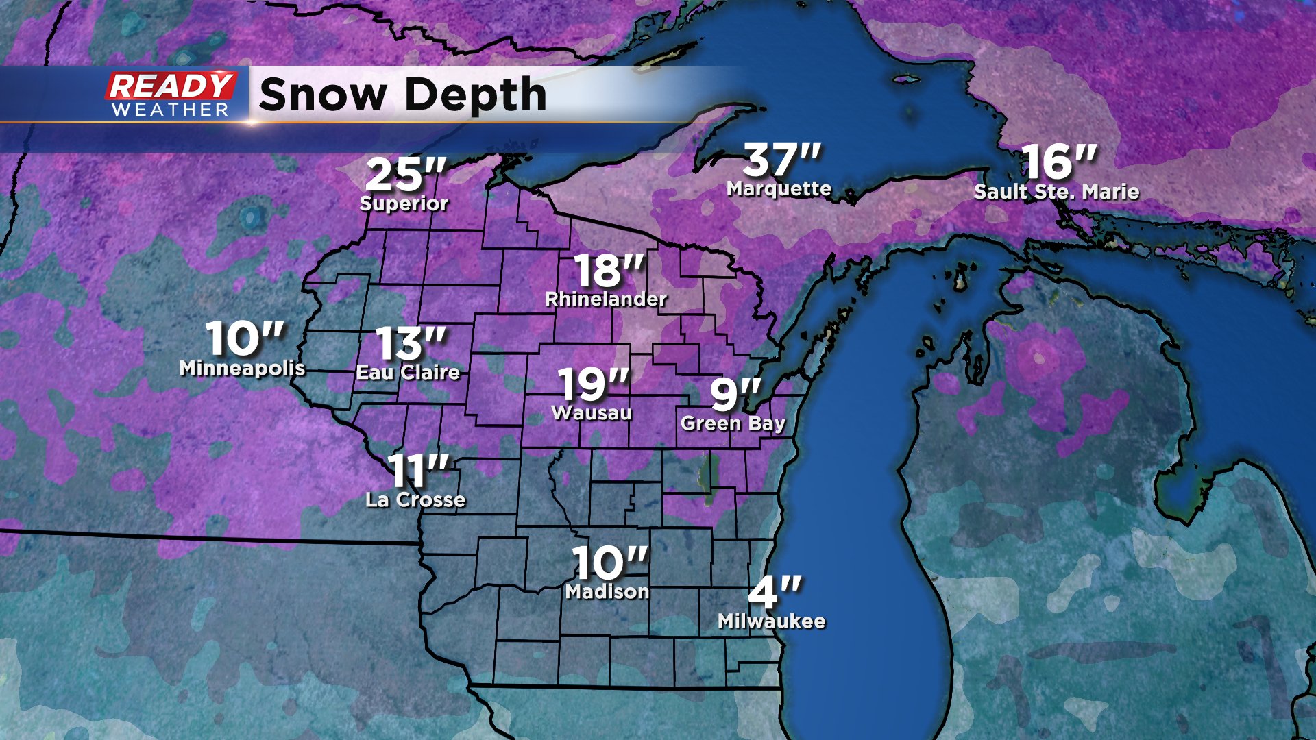
Since our Sunday snow it's been all about the sunshine the past 24 hours. All of Monday's sun led to a good amount of melting and more of that melting and compacting is expected Tuesday with highs around freezing under a mostly sunny sky. Right now Milwaukee sits at a snow depth of 4" with much more across the rest of the state.
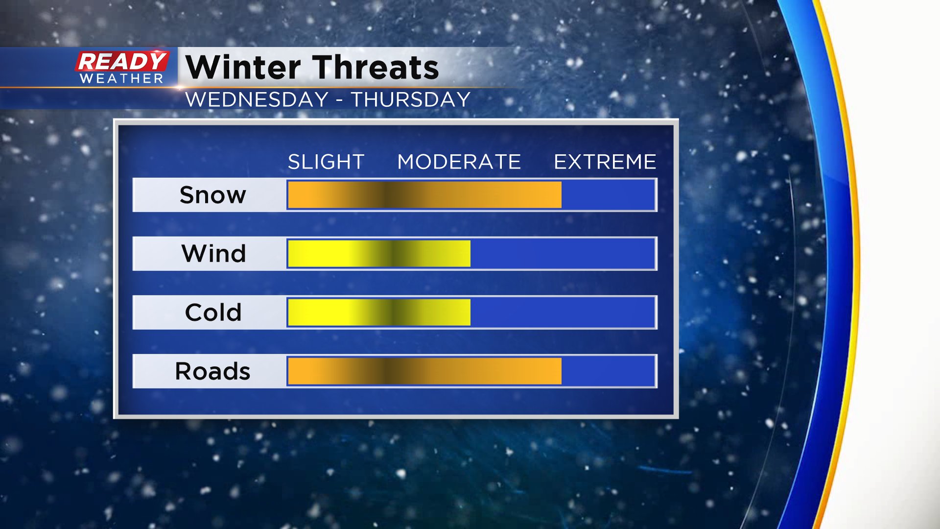
Wednesday morning we wake up to some sunshine with clouds increasing in the afternoon. The cloud cover will then give way to some snow showers Wednesday evening after 5 p.m. Light to moderate snow is looking likely for Wednesday night into Thursday morning perhaps lingering into Thursday afternoon.

Right now it doesn't look like too wide of a range in snow totals with 2-5" for all of southeast Wisconsin. The bulk of that snow will fall Wednesday night and Thursday morning.

The Thursday morning commute will likely be impacted by the snow with potentially some minor impacts to the Wednesday evening and Thursday evening commutes as the snow starts and stops. The wind will become breezy on Thursday so blowing snow may be possible. Unlike our other snow storms this winter, cold air will have an impact. A strong cold front is partly responsible for the snow and will cool temperatures down from near 40° on Wednesday falling most of Thursday and bottoming out around 0° Friday morning.
Download the CBS 58 Ready Weather app to track the snow as it falls.