Next round of rain rolls in Wednesday evening through Thursday


Wednesday morning and afternoon look to be nice and dry with some sunshine coming through but also increasing clouds. Going into the rain chance Wednesday night November is doing ok on rainfall for the month with 0.95" of rain so far this November which is just slightly above average. Last year was also right around average by this point of the month.

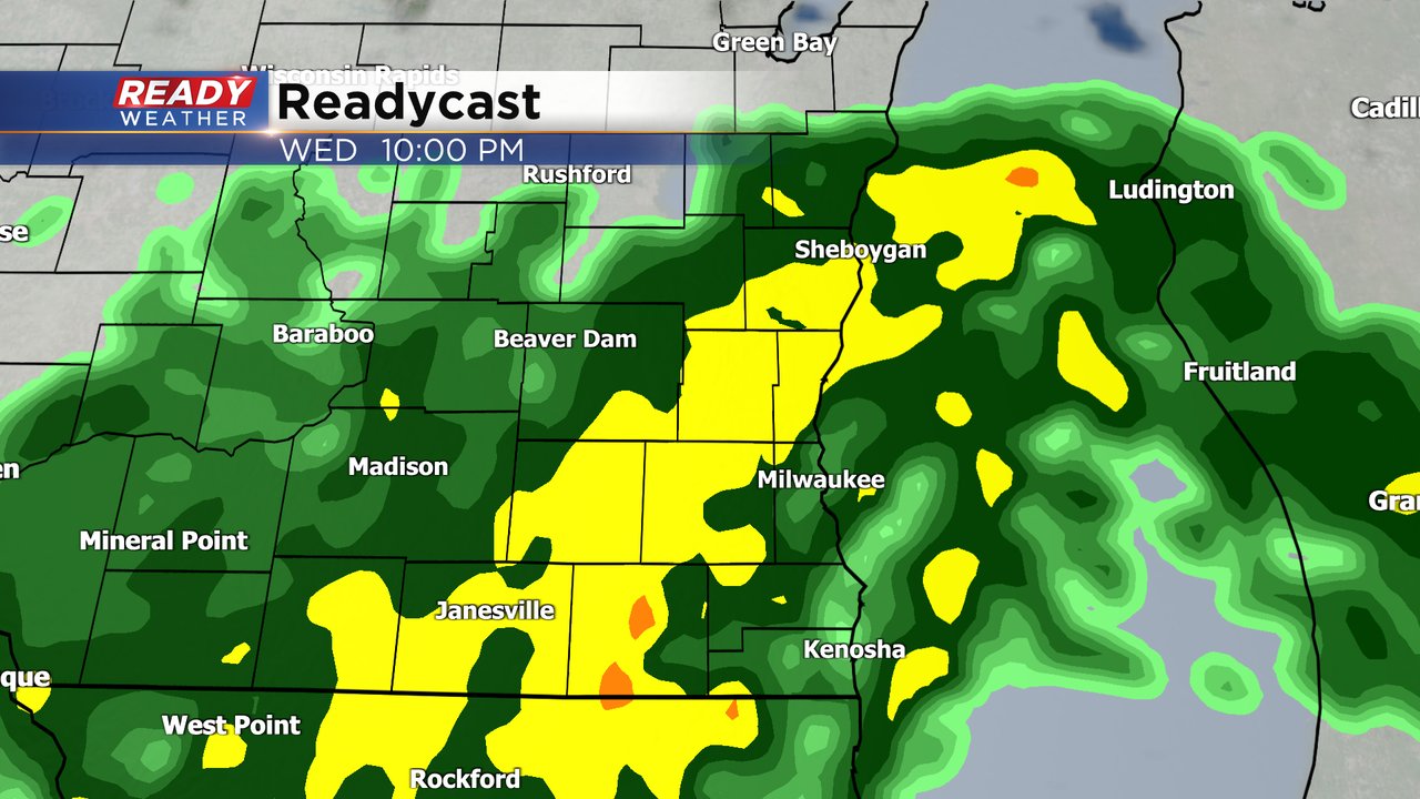
The rain chance Wednesday evening starts after 6 PM with everyone seeing steady, and at times moderate to heavy rain, by 10 PM. That rain lasts until Thursday morning with scattered showers lingering the rest of the morning hours and even a bit into the afternoon in some locations.
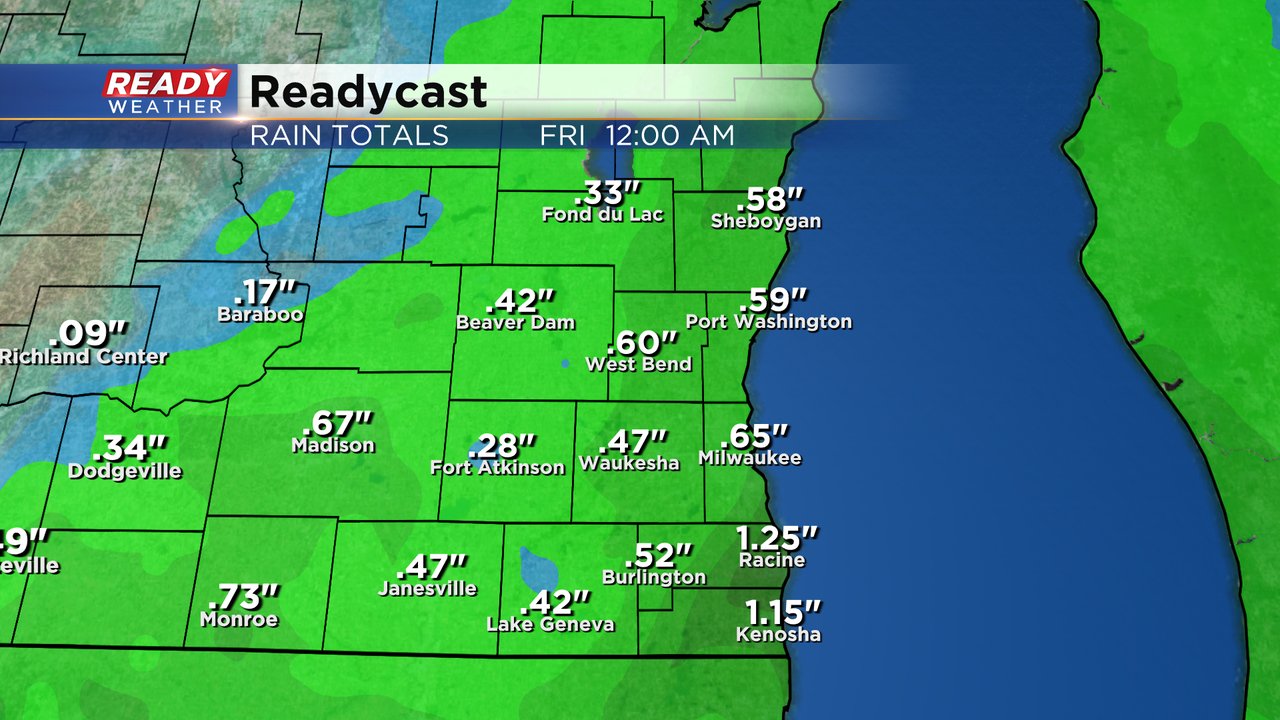
Rain totals continue to increase for Wednesday night into Thursday morning with most of southeast Wisconsin getting at least a quarter inch of rain to a full inch. Some communities, especially in SE Counties could get over an inch with steady rain in those spots.
Download the CBS 58 Ready Weather app to track the next round of rain.