8:30 PM Update: Storms about to exit


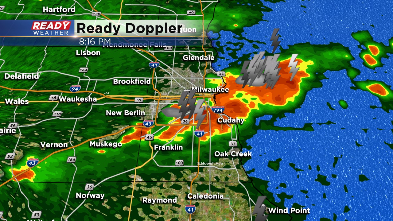
8:30 PM Update:
The last of the storms are rolling through the metro and should be out within the next 15 minutes. Strong winds have created power outages. Some of the wind gusts were estimated around 50 mph just below severe limits.
WE Energies is also reporting over 5700 customers with power outages.
_____________________________________________________________________________________________________________
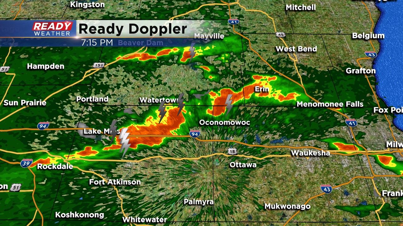
7:30 PM Update:
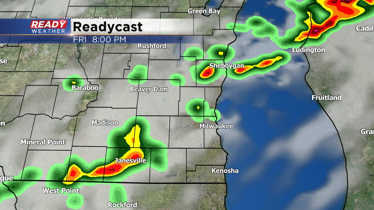
This is the last of the storms head of the front. Still a chance for small hail and gusty winds as they move through. The severe thunderstorm watch has been cancelled to our west.
The storms should be clear of the area by 9 pm.
____________________________________________________________________________________________________________
6:30 PM Update:
Leftover instability has fueled some showers and storms this early evening across southeastern Wisconsin. There have been some reports of small hail and very heavy rainfall; however, no organized severe weather has occurred.
We do expect the isolated storm activity to come to an end by 8 pm as the front starts to move through.
_____________________________________________________________________________________________________________
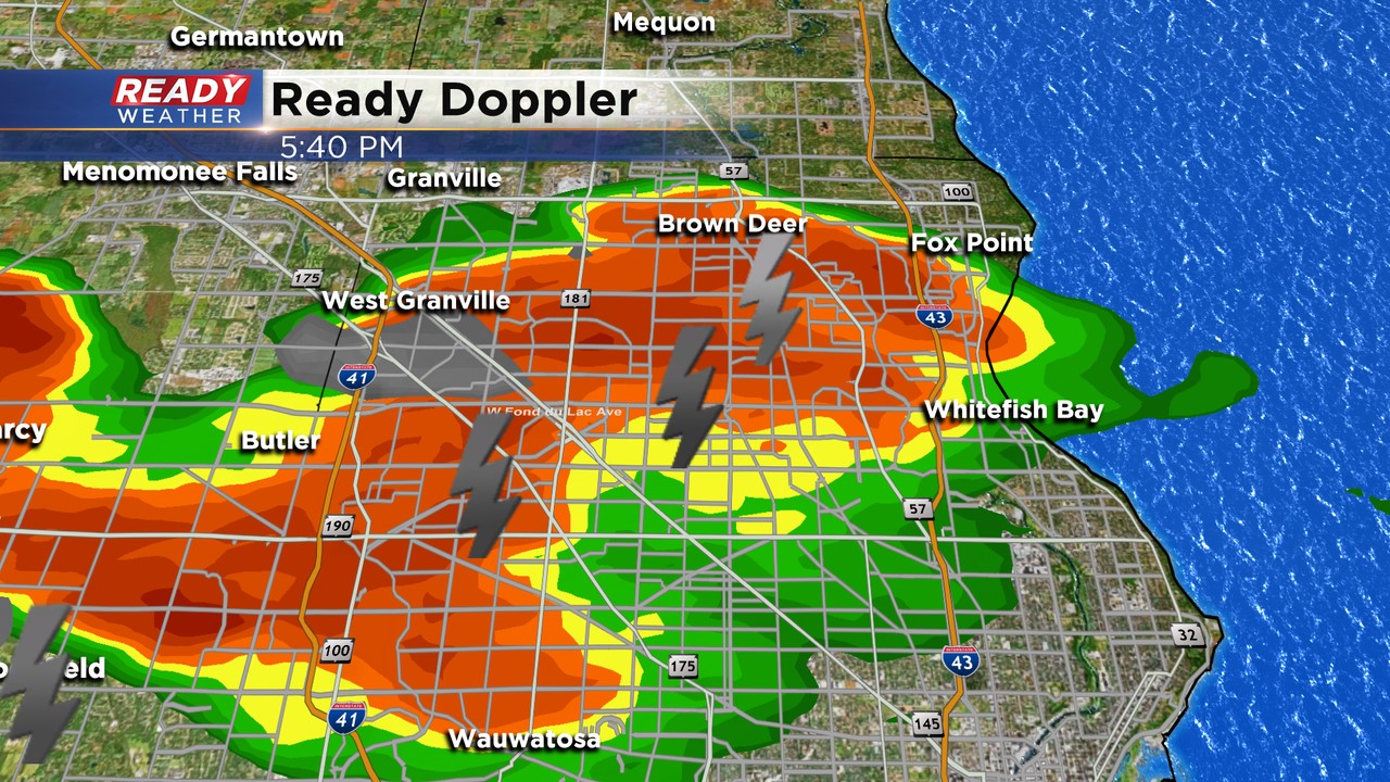
5:30 PM Update:
A strong cell has popped up this evening with lightning and a chance for small hail. This is tracking east just north of 94. There remains a chance for an isolated shower or storm this evening through 8 pm; otherwise, quiet and breezy overnight.
_____________________________________________________________________________________________________________
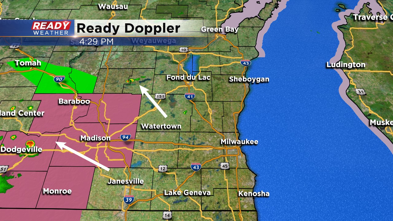
4:30 PM Update:
Not seeing great signs for organized severe weather or thunderstorm coverage across the area this evening. There are some cells trying to pop west of Fond du Lac right now.
Models do indicate a broken line of showers and some storms this evening. The overall strength is still in question. Any severe weather would be extremely isolated.
______________________________________________________________________________________________________________
All is quiet across southeast Wisconsin right now, but storms are beginning to pop to our west where a Severe Thunderstorm Watch is in place through 9 pm.
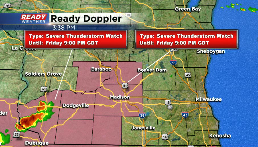
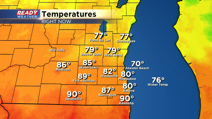
Although southeast Wisconsin is not included in the Watch, we could still have a few strong to severe storms work through the area before midnight. The sunshine we've had the last few hours has helped temperatures and dew points recover somewhat, but the best chance for any strong to severe storms still looks to be south of I-94 where there weren't any storms earlier today.
All of southeast Wisconsin remains under a Level 2 of 5, Slight Risk, for severe storms through this evening.

----------------------------------------------------------------------------------------
Updated: 1:30 pm August 28, 2020:
The line of storms has moved out over Lake Michigan early this afternoon. The line remained below severe limits, but did produce 30-40 mph wind gusts and a nice soaking rain along and north of I-94.
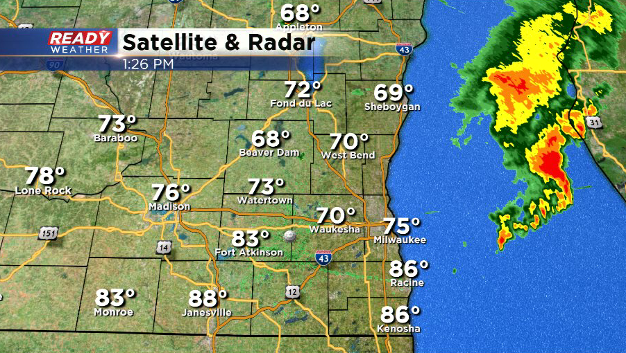
This line has lowered our chance for severe storms later this afternoon, especially north of I-94. The latest severe weather outlook has all of SE Wisconsin under a level 2 of 5, Slight Risk, for severe storms, which is a downgrade from the level 3 of 5 Enhanced Risk that was in place earlier today.
Due to the midday storms, the best chance for any additional storms/severe weather would be along and south of I-94 where there hasn't been any storms today. Latest models trends have also backed off on how many storms may pop late this afternoon and early this evening with the front, but scattered storms are still possible, and if they pop there's a good chance they'd go severe. Continue to check back for updates through the afternoon.
-------------------------------------------------------------------------------------
Updated: 11:00 am August 28, 2020:
A line of storms is moving into the northern portions of the area and will continue to track eastward through the area through midday. This line of storms will likely stay north of I-94. A few could be strong with gusty winds or hail.
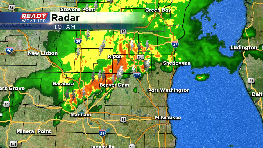
We'll have to wait and see how quickly this line moves through and if we're able to see some sunshine this afternoon ahead of the actual cold front. If we can see more sunshine and destabilize again, scattered strong to severe storms would be likely late this afternoon into the evening, with the best chance along and south of I-94. Check back for updates this afternoon
------------------------------------------------------------------------------------
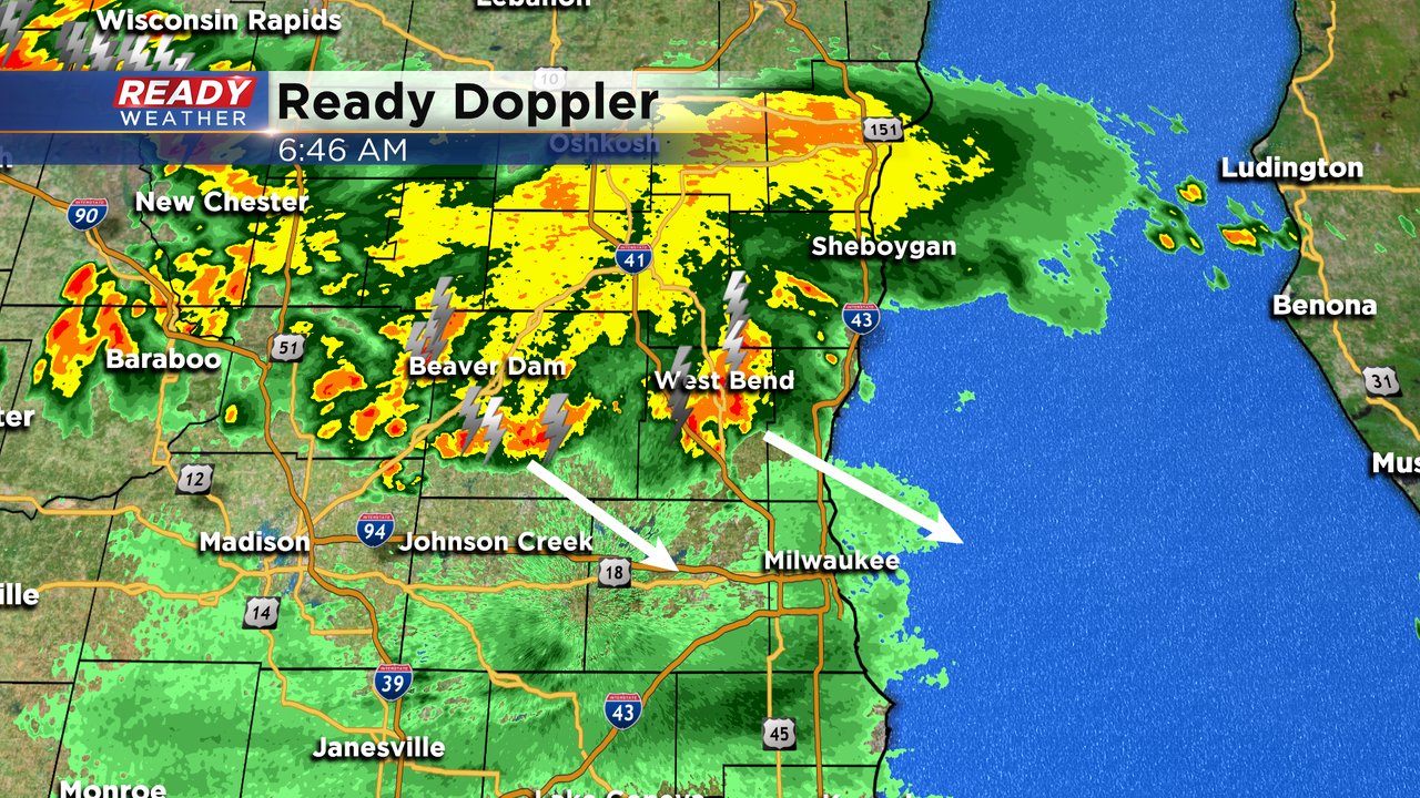
Updated: 9:18 a.m. August 28, 2020
The first round of storms has pretty much wrapped up in our northern counties with just some light rain lingering. The second round has moved through western Wisconsin and is heading east and expected to arrive in southeast Wisconsin by late morning or around lunchtime. A few stronger storms are possible with that second round or some isolated severe weather storms. The third round is still on track to arrive during the late afternoon and evening and has the best potential for severe storms.
------
Posted: 6:34 a.m. August 28, 2020
Most of the thunderstorms on Thursday stayed in our northern counties where the front stalled. Those areas got some heavy rain Thursday and have the best chance to see more on Friday. A flash flood watch has been issued for Fond du Lac, Sheboygan, Dodge, Washington and Ozaukee Counties until 7 p.m.

Our chance for storms on Friday will come in three rounds. The first is currently moving through our northern counties and areas of Central Wisconsin. As of 6:30 a.m. none of these storms are severe but there are strong storms with the possibility of very heavy rain, small hail and gusty wind.
The second round is currently a cluster of storms that's racing across Minnesota into western Wisconsin. As this cluster moves east a majority of the weather models keep it just north of us into the Green Bay area. Our local northern counties once again have a better chance to see these storms which would arrive around lunch time. However, the cluster is starting to trail a line of storms and if that continues the rest of southeast Wisconsin could also see rain and storms that could be strong to isolated severe.

The third round of storms will arrive during the afternoon and evening and is our best chance for severe weather. These storms will form along a cold front expected to move across our local area from 4 p.m. to 10 p.m.
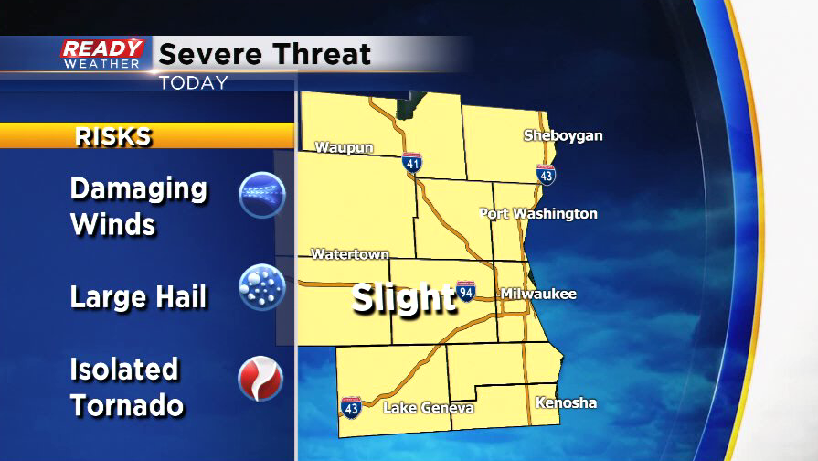
An enhanced risk, level three of the five severe levels, has been issued for most of southeast Wisconsin and the rest of our area is in the slight risk. Wind, hail and heavy rain will be our main threats but there is a low tornado risk. Make sure you have a way to get warnings and make sure your volume is turned up on your phone to get the tornado warning alerts.

Any heavy rain will be heavily dependent on where thunderstorms end up and who sees multiple rounds of the storms. In general, 0.50-1.50" of rain is possible with some seeing 2" to 3" of rain where thunderstorms go over the same area and others that stay away from the storms not getting much at all.

Download the CBS 58 Ready Weather app to track the storms and get alerts for watches and warnings.