More Storms Firing Tonight...Strong to Severe Possible...Early Evening Update
Most of our area was hammered with very heavy rainfall this morning. The morning convection has left several boundaries and excessive humidity for more storms to form this evening. Temperatures did spike into the 80s with some late afternoon sun, so there's plenty of available energy to fuel more storms.
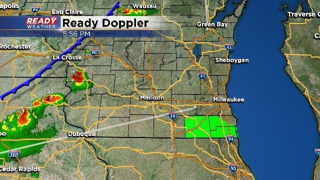
More storms have erupted across western Wisconsin ahead of a cold front. Those storms will likely go severe very quickly with all of the heat and humidity they encounter. Those storms will continue to move southeast this evening across southeastern Wisconsin. The timing looks to be from 8 PM till Midnight.
Storms that fire across our area will have the chance to produce damaging winds and hail. There is a slight chance for rotating storms that could produce an isolated tornado.
No watches have been issued in our area, but i would expect some sort of watch later tonight. There is a severe thunderstorm wtch to our north until 11 PM. We will continue to update you right here.
