


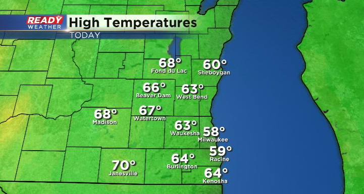
It was a well deserved day of sunshine and seasonal temps (for most) across southeast Wisconsin today! Highs topped out in the mid to upper 60s for most except for spots right along the lakeshore.
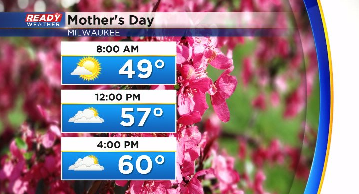
Temps will be a couple degrees cooler on Mother's Day thanks to more cloud cover, but highs still make it to either side of 60 degrees.
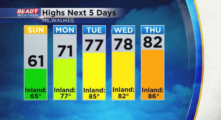
We'll get our first extended taste of summer throughout next week with highs in the 70s lakeside and 80s inland for most of the work week!
You may even notice some humidity next week, especially on Tuesday and Thursday as dew points climb into the 60s.
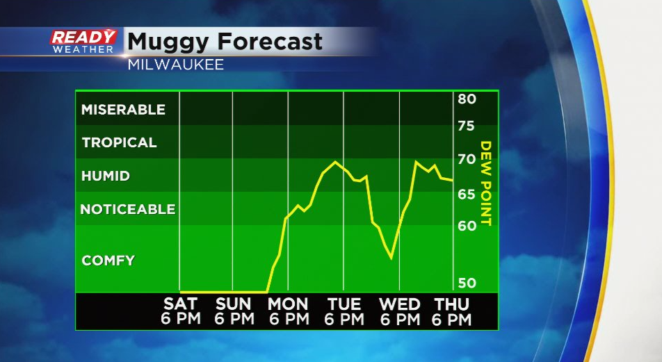
This may trigger a few isolated storms Tuesday and Thursday, but neither day will be a washout. The chance of storms later Tuesday may push a front south of the area on Wednesday, briefly cooling us down/giving us a break from the higher dew points, before that front lifts back northward to end the work week. In the short term, you'll notice the wind a bit more heading into the start of the new week.
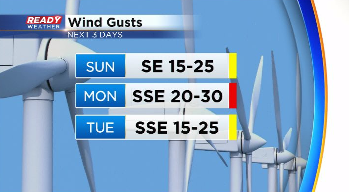
Winds gusts between 20-25 mph both Sunday and Tuesday afternoons, but Monday will be the rea blustery day with gusts over 30 mph possible. Download the CBS 58 Ready Weather App to see the full 7 day forecast.