Mild start to the week, but extended cool down looms for mid April
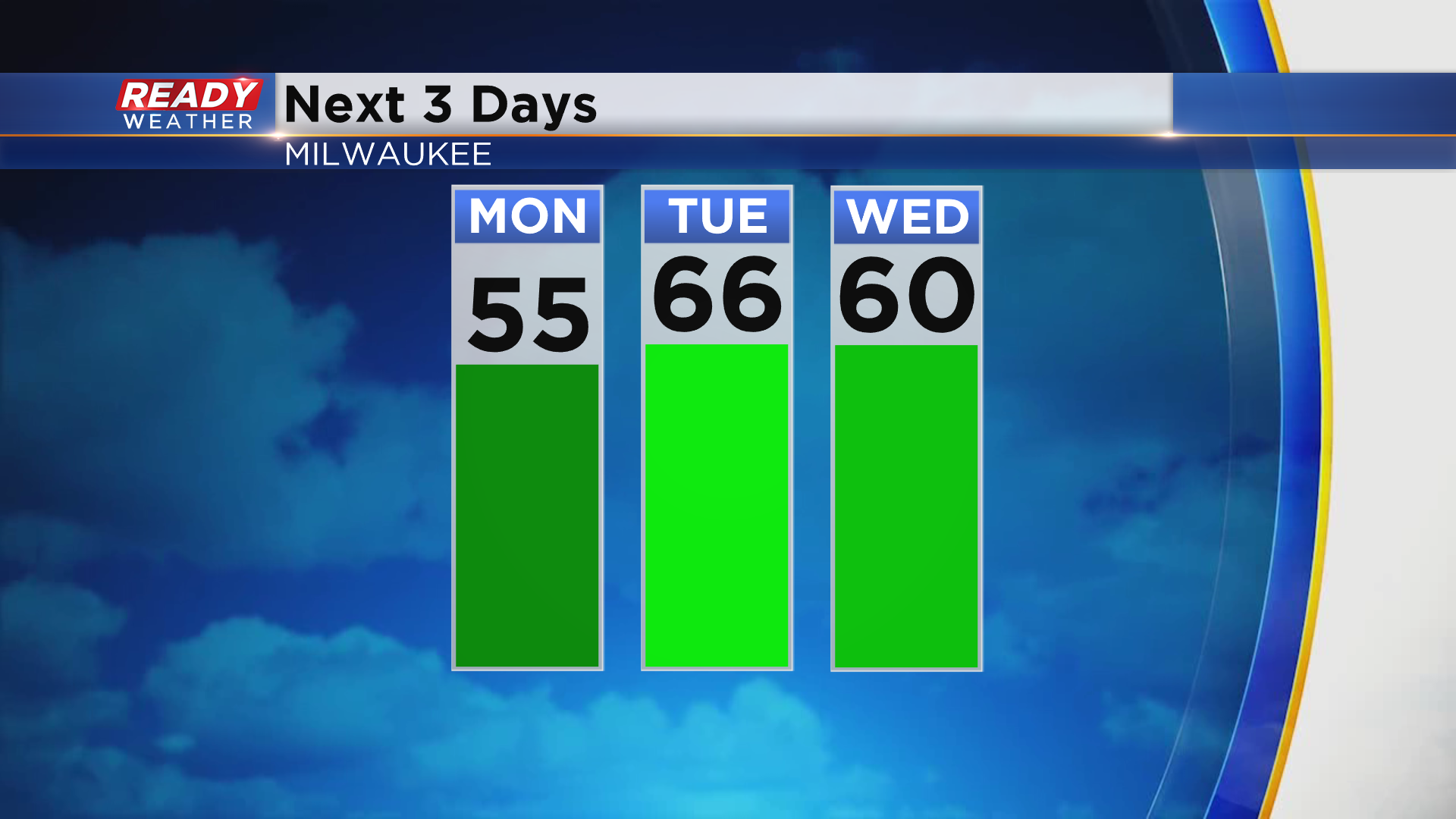
After the clouds cleared out this morning, abundant sunshine helped temps warm into the mid to upper 40s lakeside and 50s inland. We'll all see some warmth over the next few days, with our warmest weather arriving on Tuesday with highs in the mid to upper 60s!
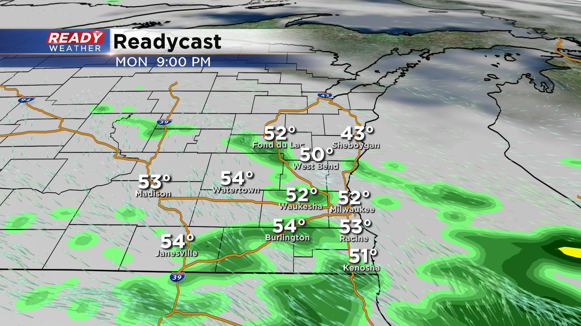
Unfortunately we won't be as sunny as we were this weekend. Clouds move back in late tonight with a chance for a few scattered showers and isolated storms late Monday afternoon and evening as a warm front lifts closer to the area.
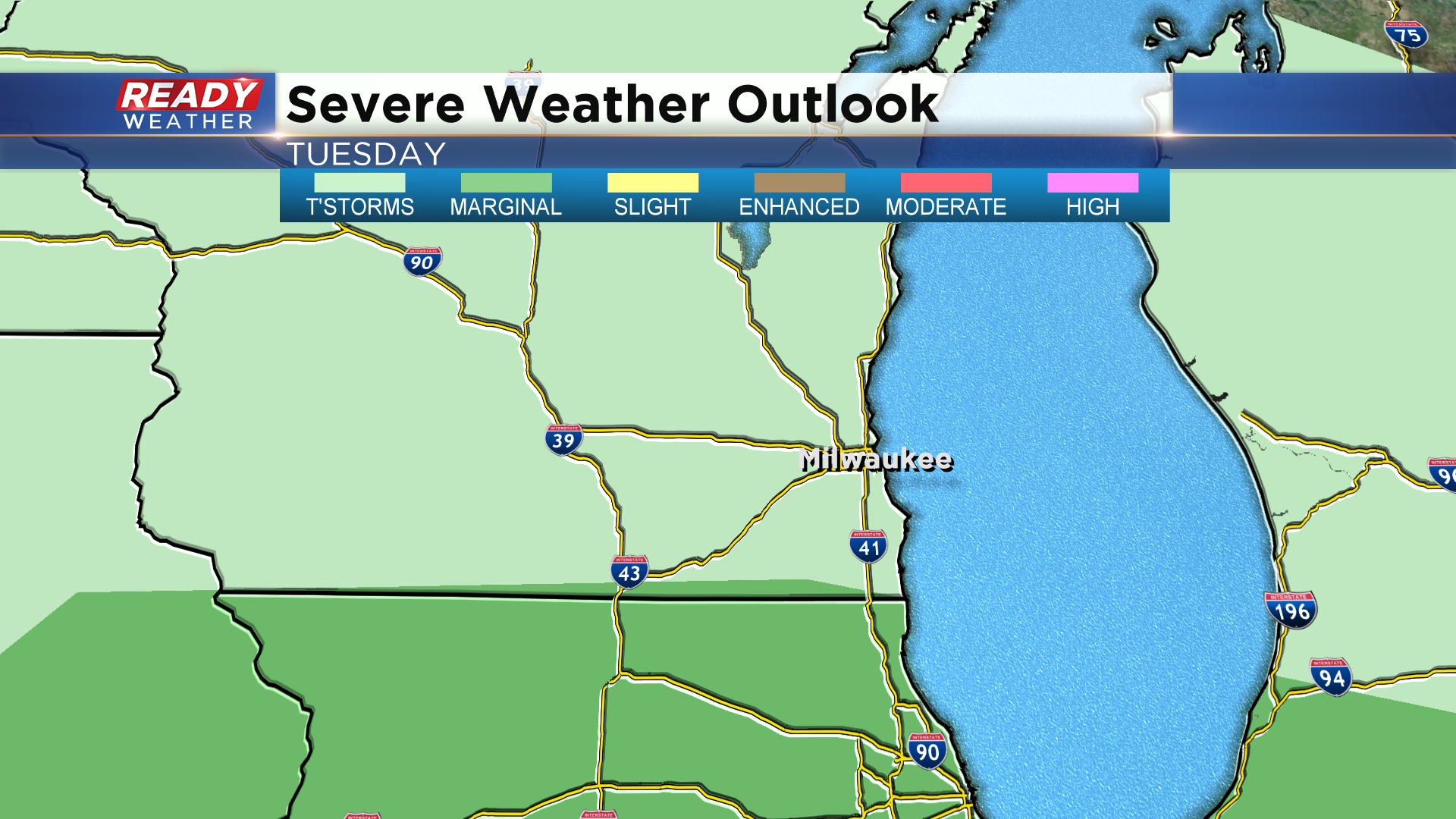
The warm front will be north of the area Tuesday, and we'll be dry for a good majority of the day until a weak cold front slides through late afternoon/early evening. An isolated shower or storm may develop, but there's going to be a pretty strong "cap" on the atmosphere in SE Wisconsin so the better chance for storms will be to our south. That's where there's a Marginal Risk for strong to severe storms. If a storm is able to develop in SE Wisconsin, it could become strong and produce hail.
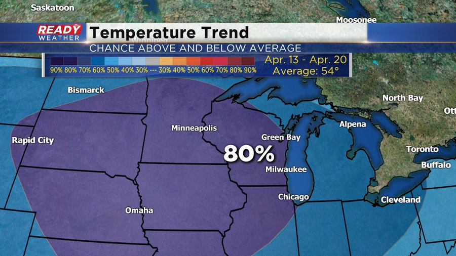
A much stronger cold front will move through late in the afternoon Wednesday and bring a better chance for rain. Behind this front, temperatures fall back into the mid 40s for highs through Easter Weekend. It looks like this cool down could last a while too. The latest temperature outlook from the Climate Prediction Center for April 13 - 20 has a high chance for below normal temps. Normal highs that time of year are in the mid 50s.
Take advantage of the warmth over the next few days!
