


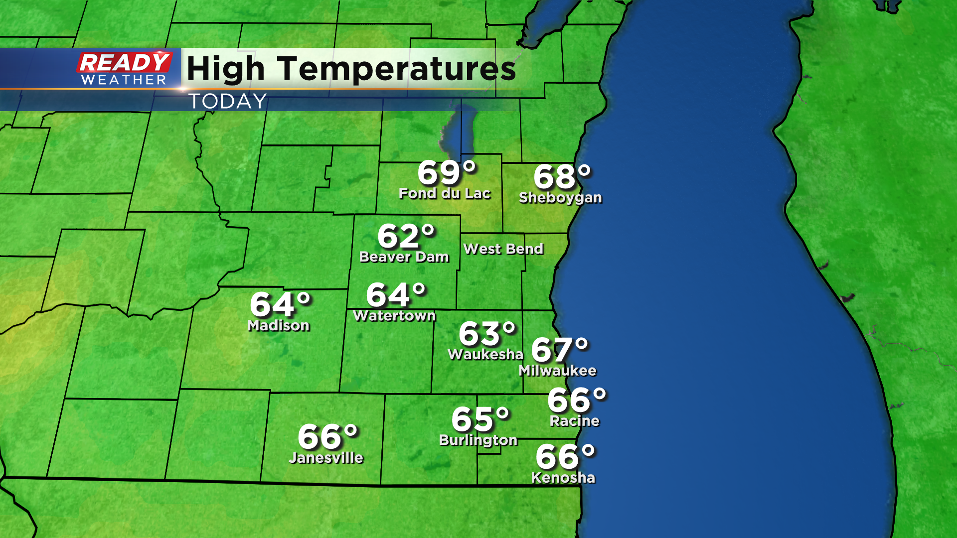
It was another fantastic late fall day across southeast Wisconsin with mostly sunny skies and highs topping out in the mid to upper 60s!
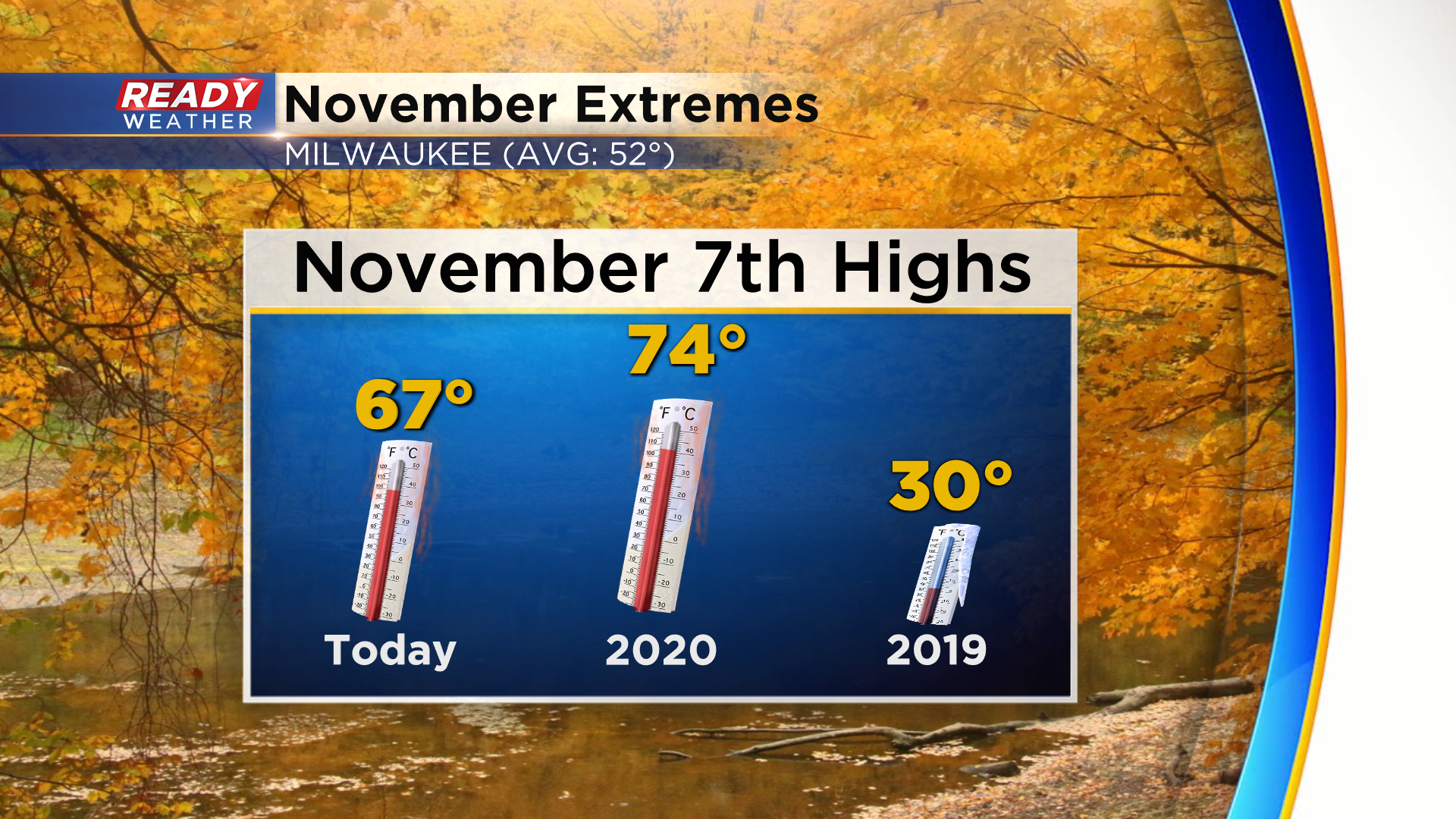
We didn't break the record high of 74 degrees that was set on this date last year, but it was still 15° above normal! Contrast that with two years ago today when we had 2" of snow on the ground and barely warmed to 30°.
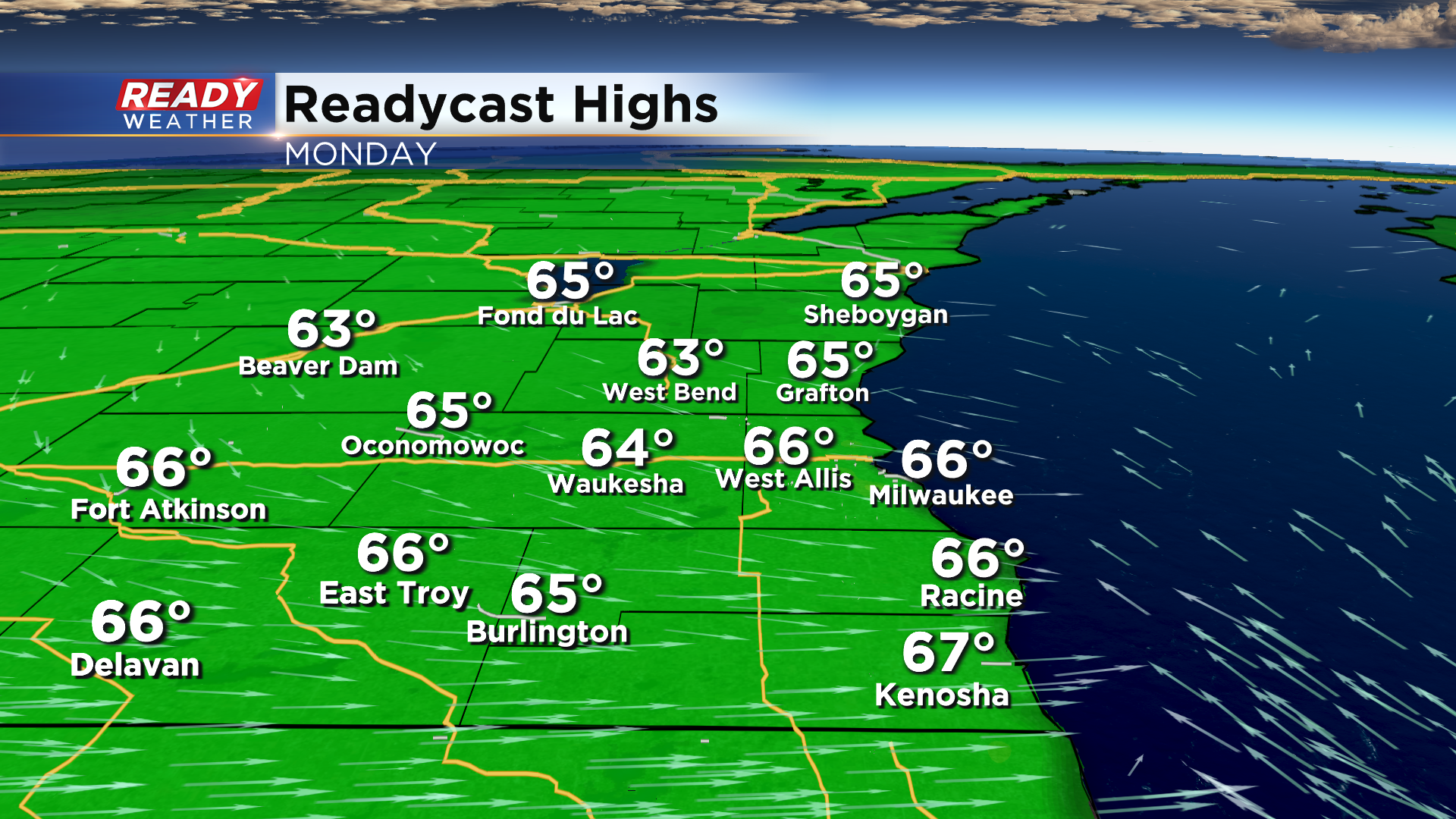
Another 10/10 day is expected on Monday with mostly sunny skies and highs similar to today in the mid 60s.
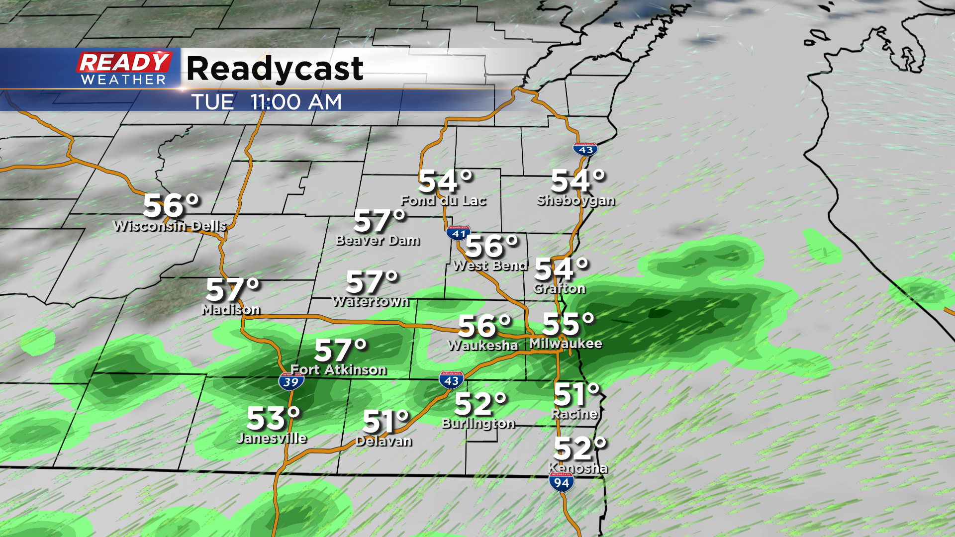
Clouds will start to roll in late tomorrow afternoon and thicken up heading into Tuesday as a weak disturbance tracks through the state. This could trigger a few spotty showers during the day Tuesday, but not a washout.
A better chance of widespread rain arrives later Wednesday into Thursday as a stronger low pressure system develops.
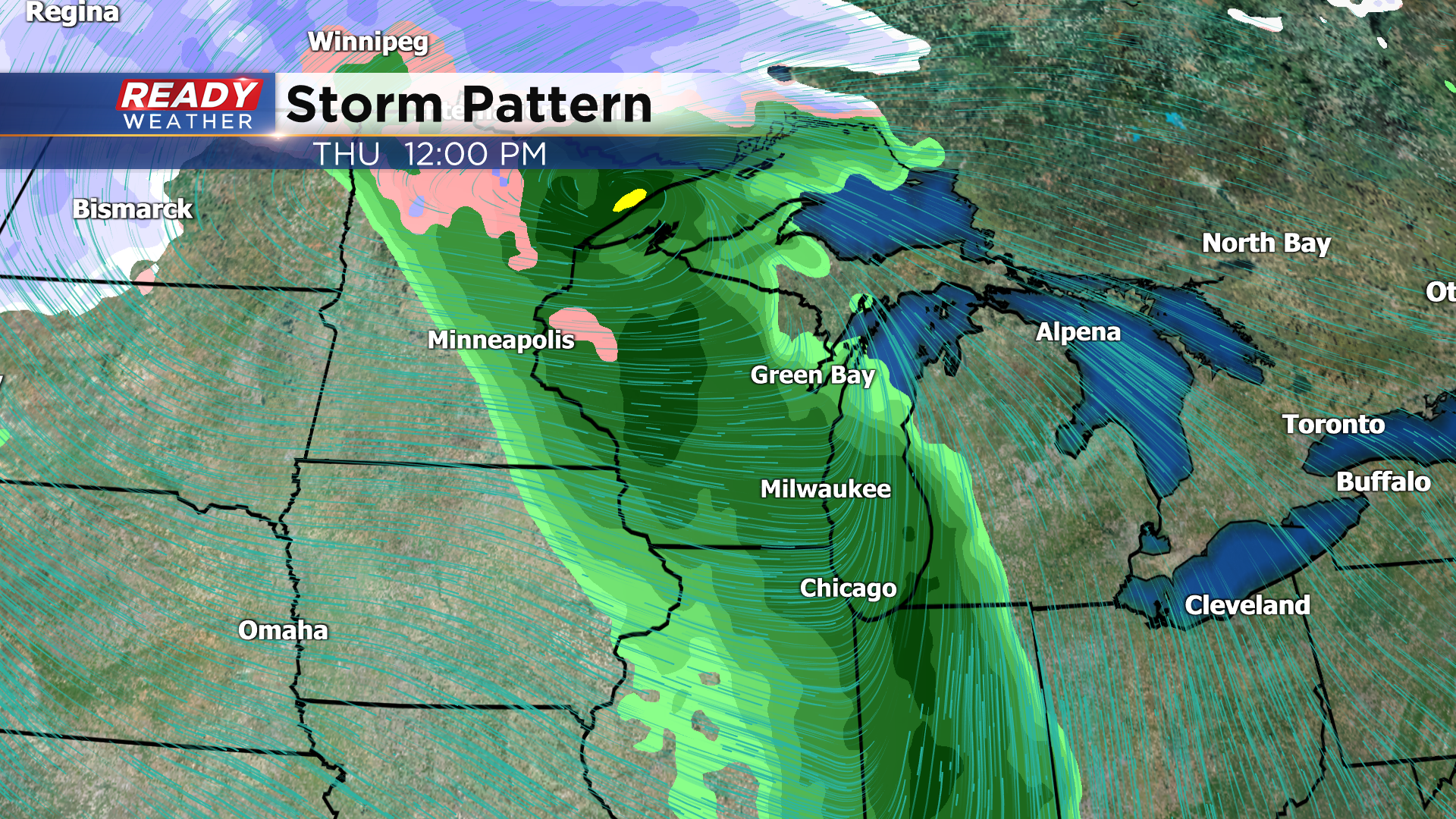
Temps will be in the 50s during the middle of the week, but will drop into the 40s for highs by Friday behind this system.
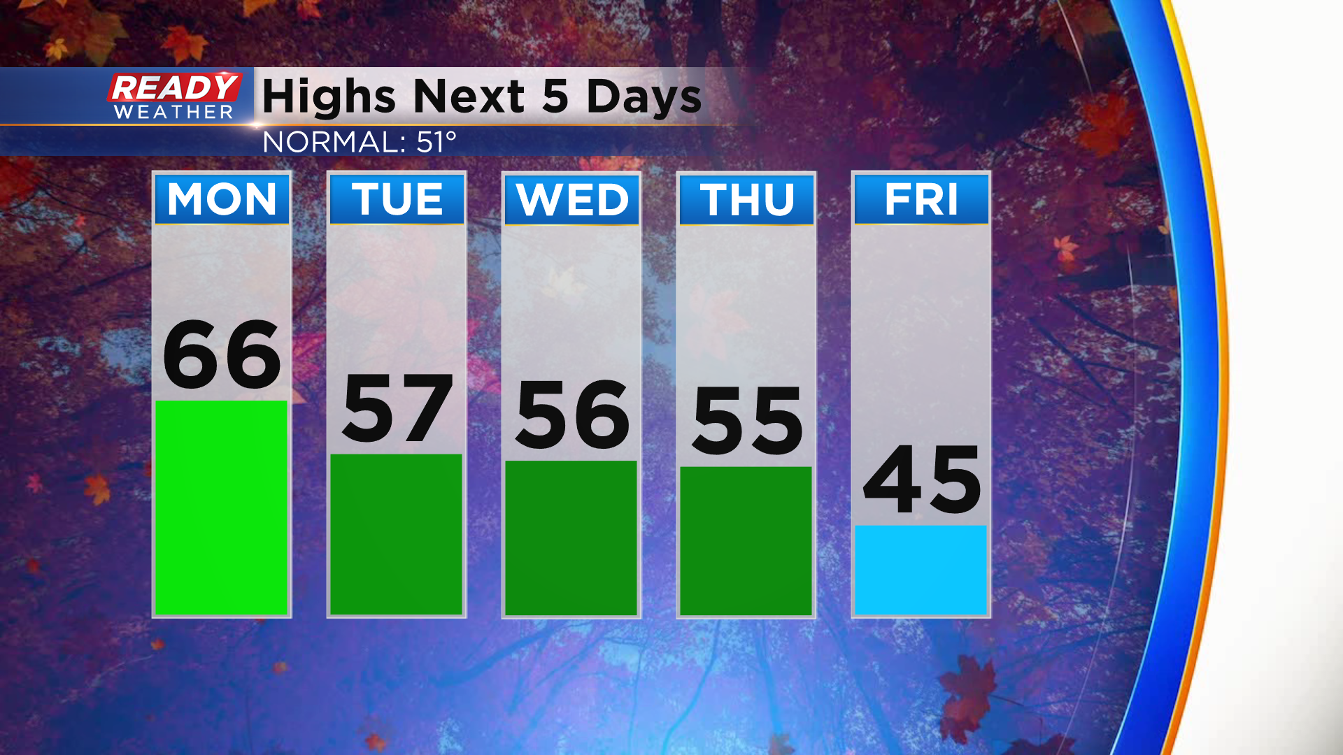
A few wrap around showers are possible on Friday, and depending on how cold the airmass is, we may have a few snowflakes or graupel mix in. There is a lot of uncertainty with the strength and track of this low, so stay tuned for updates!