Light snow lingers tonight and then heavy snow and ice Wednesday into Thursday. Winter storm and ice storm warnings issued.


9:00 PM Update:
Light snow is possible this evening across the area. Most areas will receive a quick dusting to 0.5" of snow. Northern counties could see between 1" to 2" of snow.
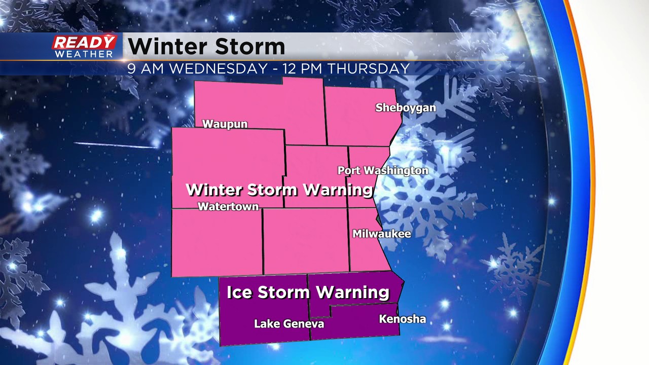
The NWS has issued an ice storm warning for Kenosha, Racine, and Walworth counties on Wednesday. All of the other counties have been upgraded to a winter storm warning. The greatest chance for accumulating ice will be along the border of IL/WI. The further north most of the precipitation turns into sleet and snow.
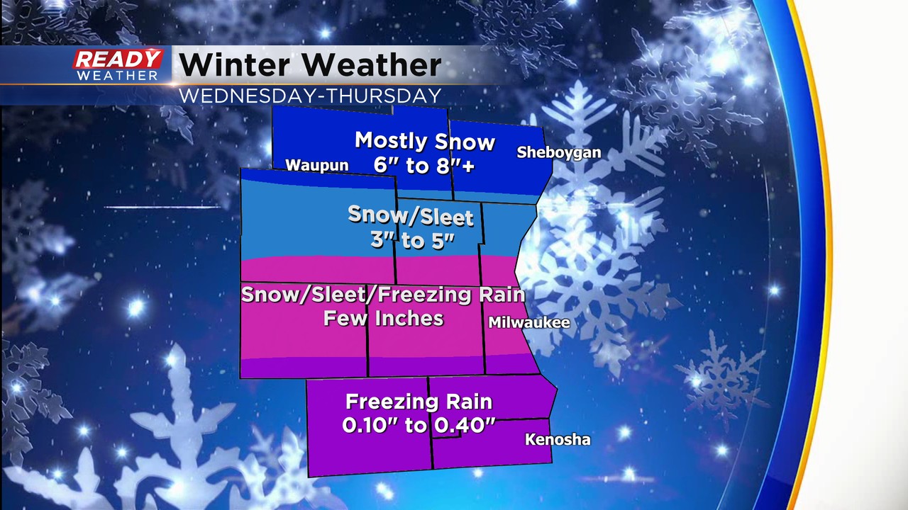
Here's the breakdown of the precipitation and the types. Northern areas will experience several inches of snow and sleet. The greatest chance for over 6" is across Sheboygan and Fond du Lac counties. The central part of the viewing area will have a true mix of sleet, snow, and freezing rain. A few inches of sleet and snow are possible across the metro.
Where it gets tricky is our southern counties. More freezing rain is forecast there. With higher winds on Wednesday, any icing could create some isolated power outages.
Roads will be very problematic for the evening commute. Use caution getting around Wednesday. The majority of the mix will wrap-up early Thursday morning.
______________________________________________________________________________________________________________
The calm before the storm. Thankfully weather will be good for waiting in line to vote or for paczki on this Tuesday. You might start to see a little light snow around the time the polls close with light snow likely, especially in northern counties, from Tuesday evening through early Wednesday morning. Up to 2" of snow is likely in northern counties with only a dusting or a few tenths of an inch in southern counties.

We may get a brief lull in the precpitation early Wednesday before a good slug of moisture rolls in from mid-morning on Wednesday through the rest of the day. Northern counties will see mostly snow but central and southern counties will see a good wintry mix of mostly sleet with some snow and freezing rain mixing in.

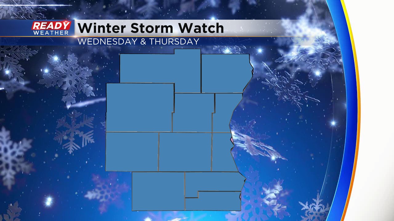
A winter storm watch has been issued for all of southeast Wisconsin for Wednesday and Thursday for the potential for heavy snow in northern counties and heavy ice in southern counties. This watch will likely be upgraded to an advisory or warning Tuesday afternoon.
Significant snow is expected Wednesday and Thursday in our northern counties with over 8" possible in parts of Sheboygan and Fond du Lac Counties, 4-8" is possible for Dodge, Washington and Ozaukee Counties with less than 4" everywhere else. Notice how narrow the bands of snow are. Any shifts of the storm track to the north or south with drastically change the expected snow totals in your hometown.
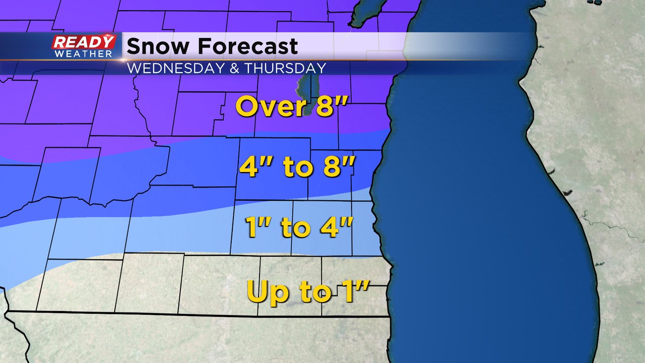
When it comes to ice northern counties don't see much, if any, but southern counties could see as much as a quarter inch or more. The area of all rain really looks to stay to our south in northern Illinois.

Download the CBS 58 Ready Weather app to track the light snow Tuesday evening and see changes to the forecast for the snow and ice on Wednesday and Thursday.