Winter weather advisory issued: Light snow and freezing drizzle likely overnight


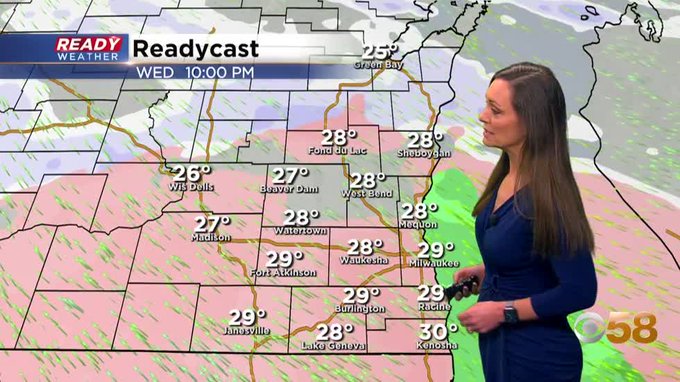
Updated 10:00pm Wednesday February 5th
A winter weather advisory has been issued for all of the counties in purple. These areas will have the best chance for light freezing drizzle and ice accumulation.

Not many changes to the ongoing forecast. We should start to see a mix of some light snow and freezing drizzle around10 pm. The greatest impacts will be after midnight into early Thursday morning.

Northern counties will see an inch or less of snow, while a southern areas could receive a few hundredths of an inch of freezing drizzle.
Untreated roads along with elevated surfaces are the most susceptible. Use caution travelling overnight.
______________________________________________________________________________________________________________
On going forecast is intact. Here's a look at the latest radar imagery. The light snow band inching up from southern spots to the I-94 corridor is not reaching the surface on any of our area sky cams.

After a dry but cloudy start to the day Wednesday we will see precipitation chances increase for the afternoon and evening. The precipitation likely starts out as light snow with a dusting or a few tenths of an inch possible.
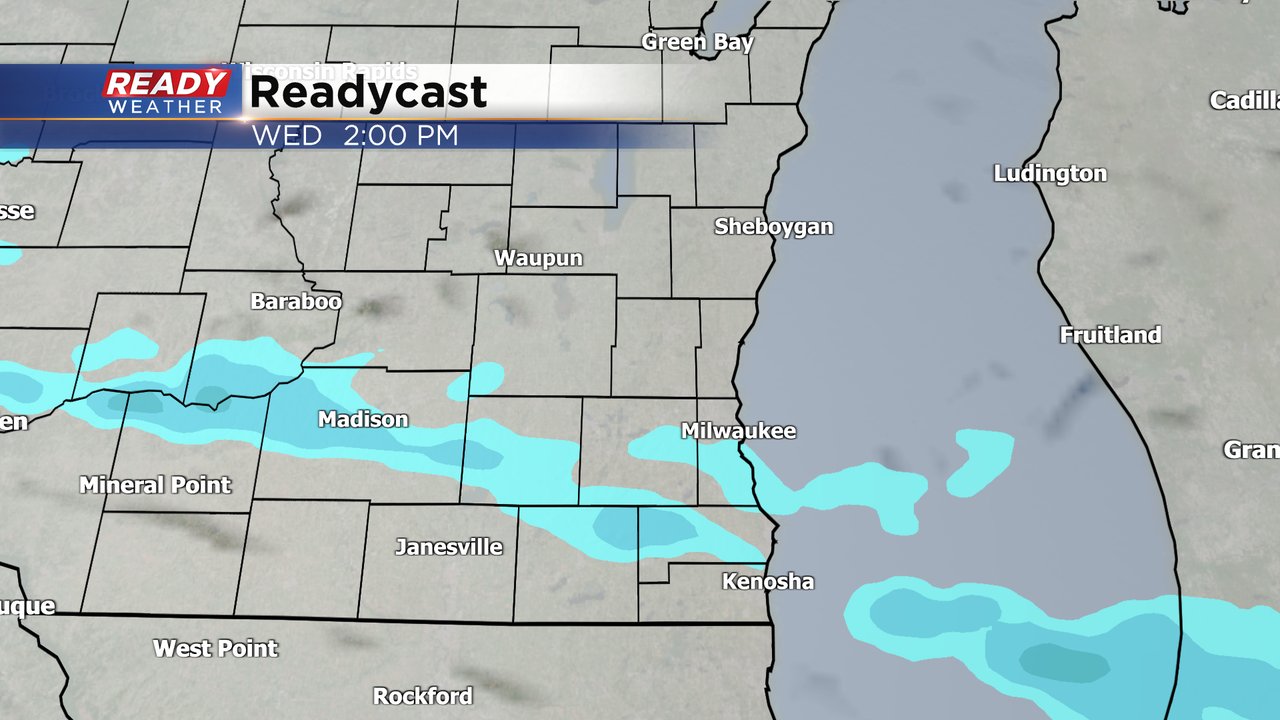
After the Wednesday evening commute some wintry mix with freezing drizzle and sleet will be possible through early Thursday morning.

Northern counties like Fond du Lac and Sheboygan likely stay all snow throughout this event and snow totals might be a bit higher in those locations around 1". The rest of southeast Wisconsin will likely see under an inch of snowfall.
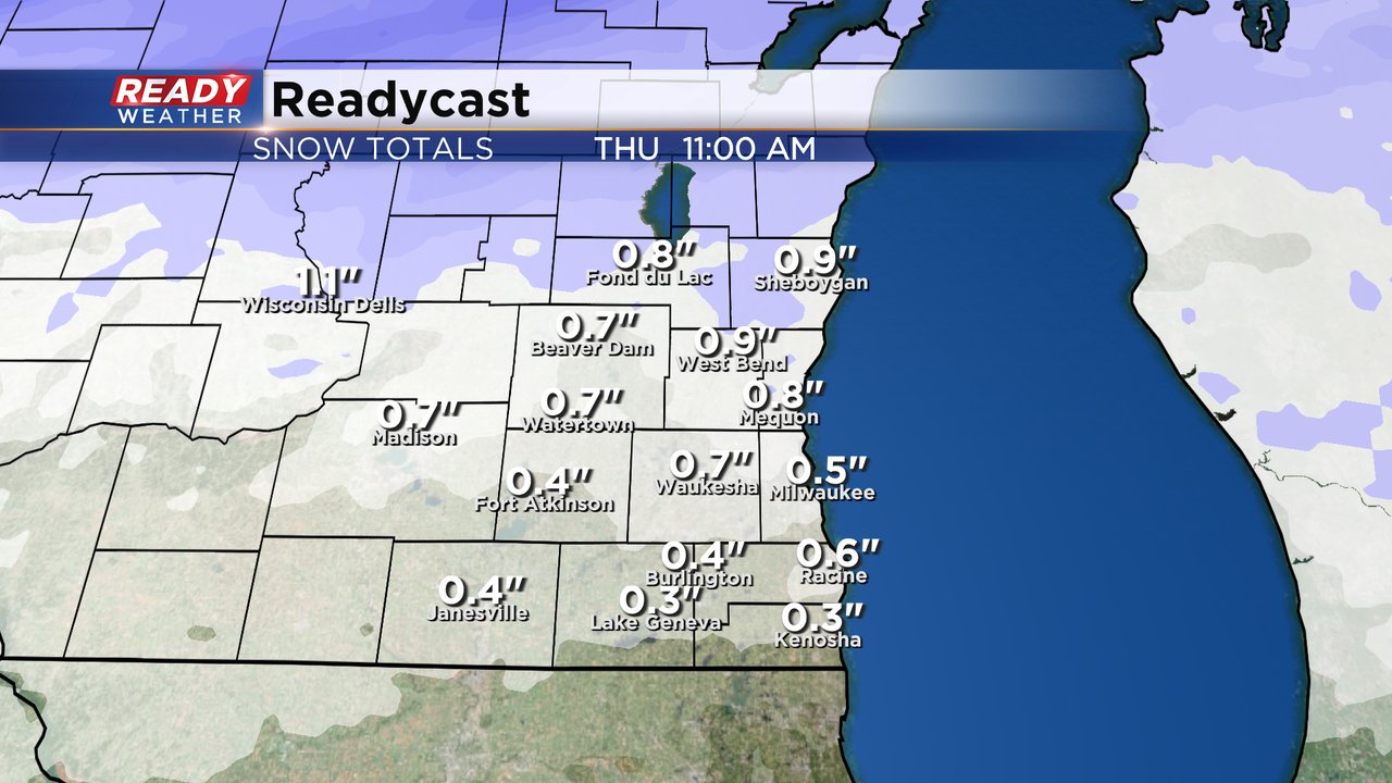
Any freezing drizzle that develops could drop a glaze of ice on roads but ice totals look to be well under a tenth of an inch. With temperatures in the upper 20s salt will be very effective at treating the ice so treated roadways should be in ok shape but sidewalks and driveways could be a bit slippery early Thursday morning.

With overall light precipitation, no major impacts are expected with this round of wintry precipitation so no winter weather advisory has been issued at this time. Some freezing drizzle and sleet could have moderate impacts on roads. The snow should be light enough where it won't be much of an issue. Cold air is not an issue with this storm system but the wind could be a bit breezy at times.

Download the CBS 58 Ready Weather app to track the precipitation with the Ready Weather app.