Late evening update: Storms have weakened below severe limits.


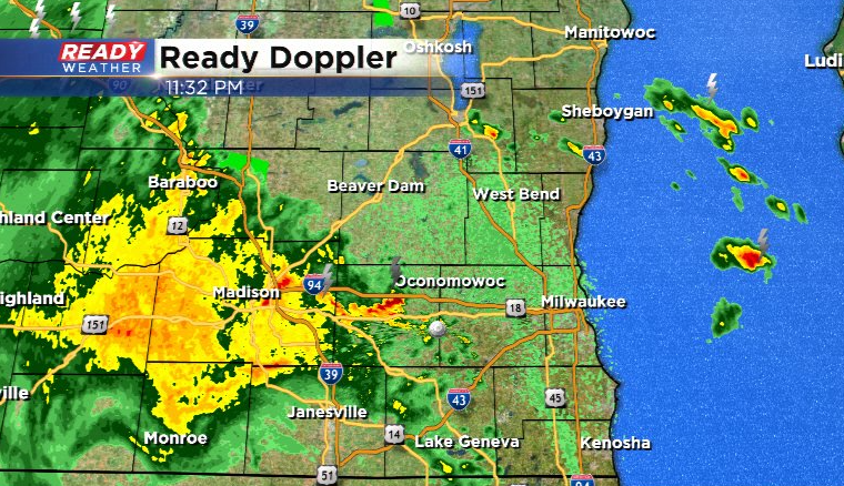
Updated: Saturday, April 15th 11:35pm:
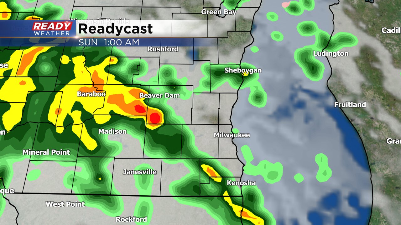
The gust front raced ahead of the line of storms, which has caused them to fall apart. The gust front itself is approaching Milwaukee with 30 mph wind gusts expected with it. Additional showers and isolated storms will continue tonight, but most, if not all, should remain below severe limits
-------------------------------------------------------------------
Updated: Saturday, April 15th 10:20pm:
A Severe Thunderstorm Warning has been issued for western Walworth county until 11pm. 60 mph winds are the main threat with the leading edge of this line of storms that recently produced a 54 mph gust in Rockford. It's tracking to the north at 40 mph.
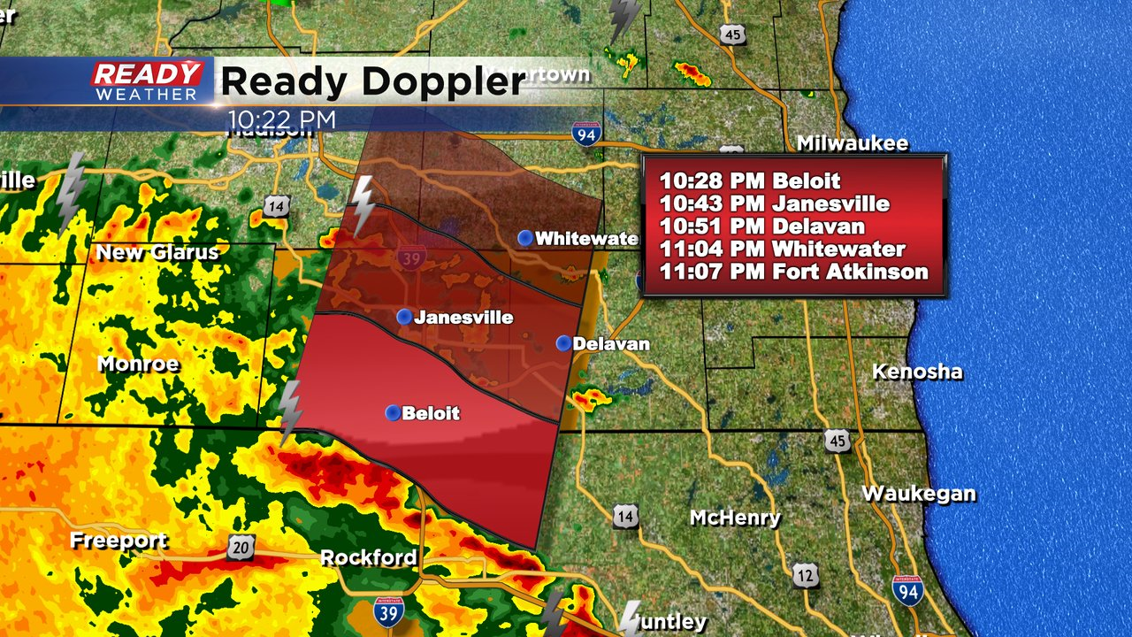
Most storms overnight will remain below severe limits, but may produce gusty winds and hail.
---------------------------
Updated: Saturday, April 15th 3:30pm:
Scattered thunderstorms have developed as expected this afternoon. These storms are mainly sub-severe with lightning, downpours, and pea to penny sized hail, but a couple of cells in Dodge county have dropped nickel to quarter sized hail which prompted a brief severe thunderstorm warning.
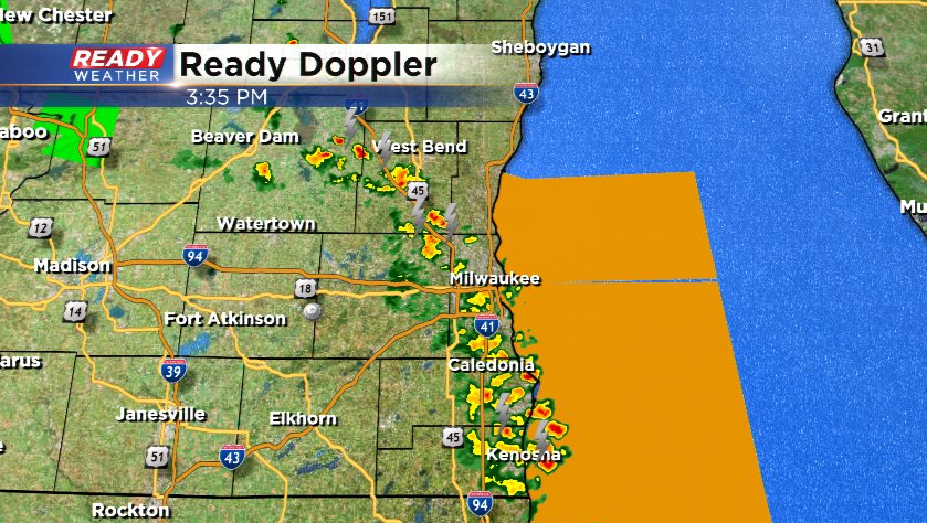
These are all lifting NE at 25 mph. We should have a good amount of dry time into the evening once these exit the area, but more rain moves in tonight.
----------------------------------------------
Our warm, dry, sunny stretch of weather is coming to an end. We've now had nine straight days in a row without any sort of precipitation which is the longest dry streak since the end of September and beginning of October. A few thunderstorms could change that Saturday afternoon and evening. The chance during the day looks fairly isolated.
The better chance for showers and storms rolls in late Saturday evening through Saturday night and into most of Sunday. Scattered showers and a few thunderstorms will be likely with some heavy rain at times. Temperatures will also drop pretty quickly Sunday afternoon and evening.
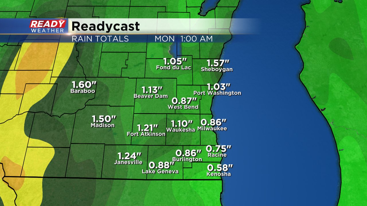
A good soaking rain is expected for most of southeast Wisconsin from Saturday afternoon through Sunday evening. Anywhere from 0.50-1.50" of rain is expected.
Any storms that do form Saturday afternoon and evening could be on the stronger side. The lingering warmer temps with highs in the upper 70s will add enough fuel to thunderstorms to bring in a gusty wind and small hail threat. Tornadoes are not expected. All of southeast Wisconsin has now been placed in the Level 1 Marginal risk for an isolated stronger storm.
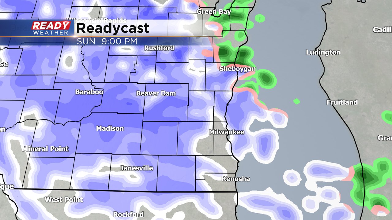
By Sunday evening temperatures will have dropped enough where the rain showers switch to snow. That snow will likely continue most of Sunday night into Monday morning. Lingering snow showers are possible the rest of Monday as well. Since a lot of that snow will fall during the overnight hours we will likely see some accumulation. Most of the accumulating snow will happen on grass but roads could be a bit slushy Sunday night and a few inches of snow is not out the question.
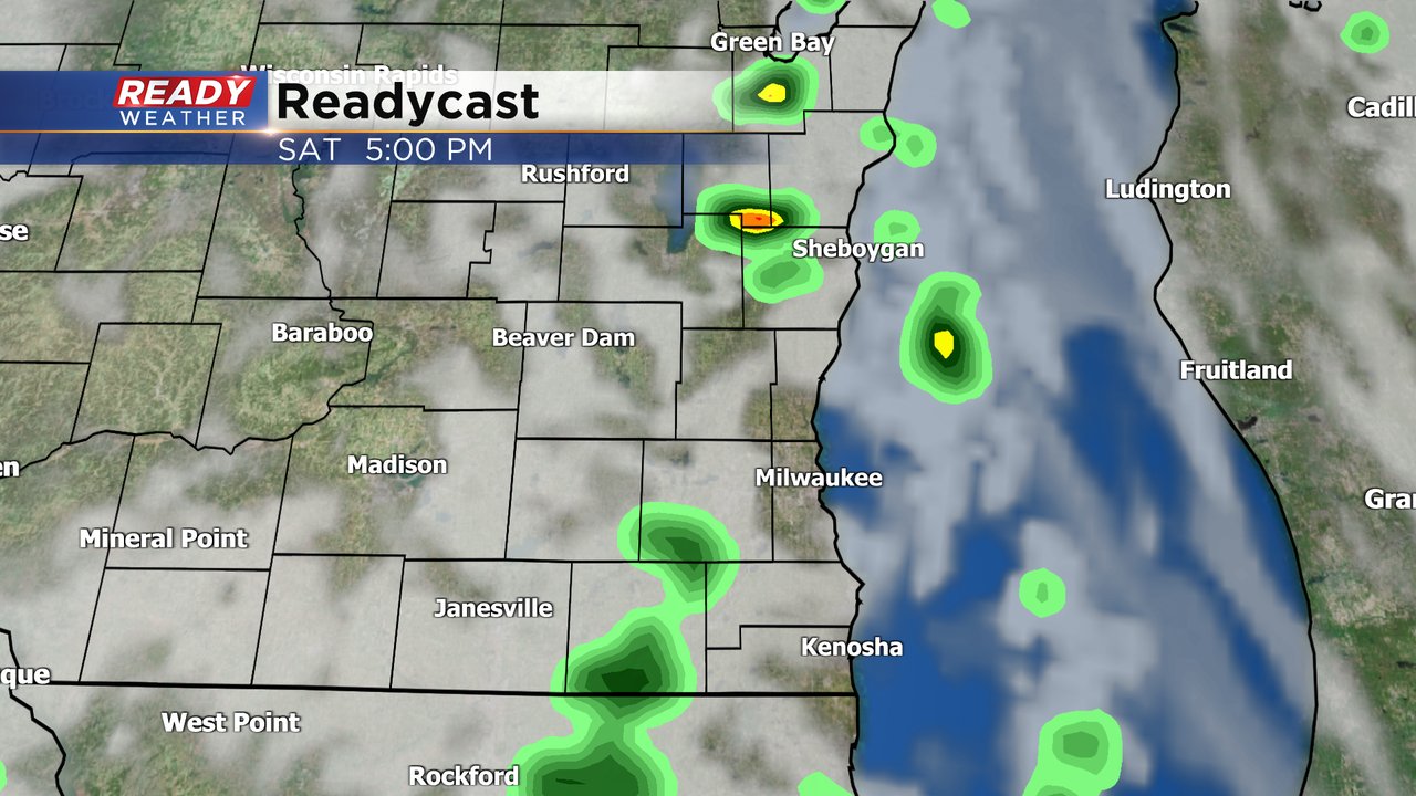
Download the CBS 58 Ready Weather app to track any thunderstorms that pop Saturday and look ahead to the accumulating snow Sunday night.