Early evening update: Isolated strong storms possible Tuesday evening


5:30 PM Update: Tuesday, June 27th
We continue to watch the potential for some strong storms later this evening across southeastern Wisconsin. Temperatures spiked into the middle to upper 80s this afternoon with some humidity.
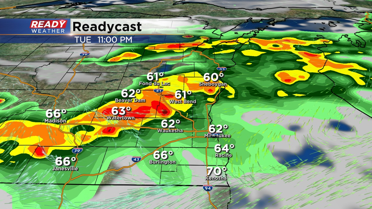
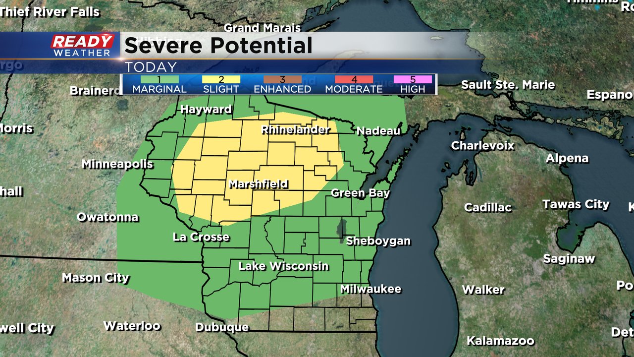
There is a severe thunderstorm watch for central Wisconsin until 8 pm. We are expecting that line of storms to move into our area between 8 pm and Midnight; however, we expect those storms to gradually weaken as they move southeast. Small hail and gusty winds will accompany the stronger storms this evening.
______________________________________________________________________________________________________________
It's been a dry couple of weeks across southeast Wisconsin. Besides a few scattered showers and storms here and there most have stayed dry. Milwaukee has only picked up 0.01" of rain over the last 12 days. The last time we had a soaking rain was on June 15th when 0.71" of rain fell. As of Tuesday we are running about 1.50" below-average on precipitation for the entire year.

After a sunny start on Tuesday we will see the clouds increase during the afternoon. An isolated shower is possible this afternoon but the better chance for rain will arrive later this evening mostly after dinner time with scattered showers and storms.
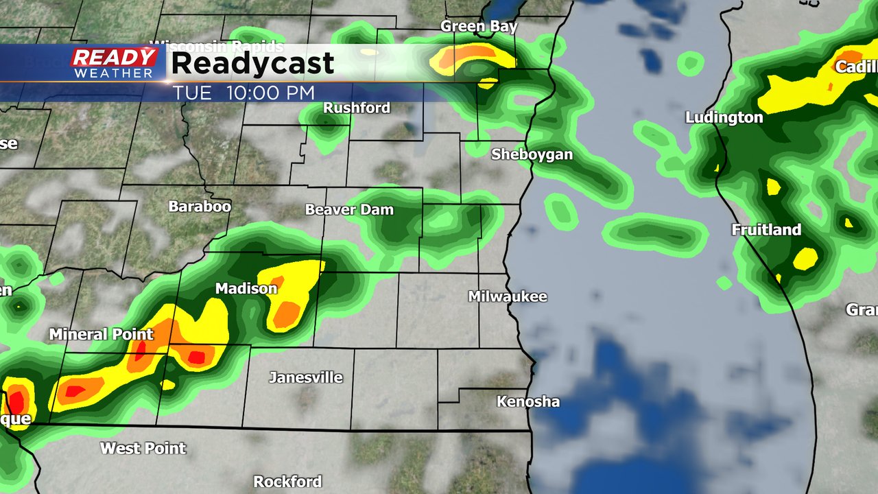
The storms are not expected to be super heavy and some may only see a brief passing shower. There is an isolated chance for a stronger thunderstorm. That chance is better in our northern counties who are under the Level 1 Marginal Risk. The better chance for severe weather is in northern Wisconsin where the Level 2 Slight Risk is in place.
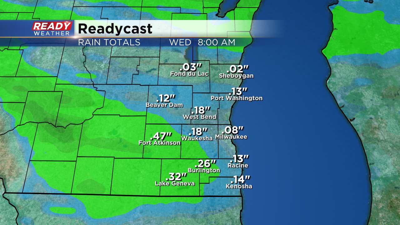
Those that see thunderstorms could get up to a half inch of rain but most won't see much with with 0.10-0.20" for most. Not even enough to stop you from watering the lawn.
Download the CBS 58 Ready Weather app to track any storms and showers as they roll in.