


We are going to continue to stay mostly dry for another 36 hours in most locations across southeast Wisconsin. We can't rule out a ten percent chance for a passing shower in Racine/Kenosha Counties Tuesday night and an isolated shower or storm Wednesday morning but the next best chance for rain and storms is Wednesday evening.
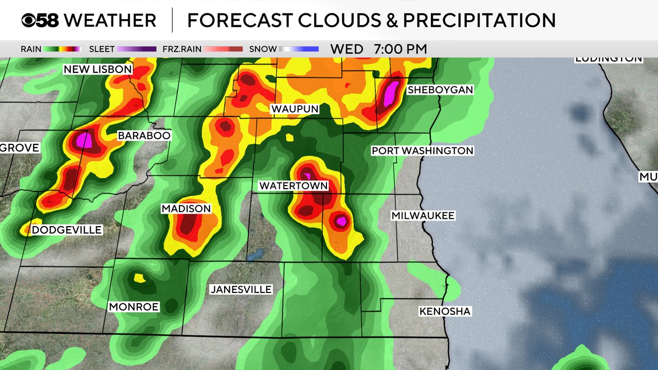
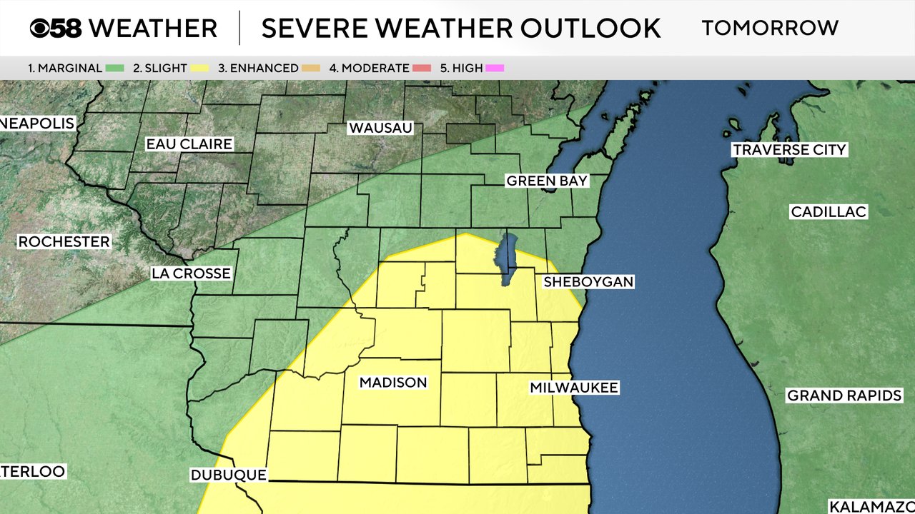
Some of the storms that form on Wednesday could be strong to severe. Warm and very high humidity levels will give storms some extra energy to deal with. A Level 2 Slight Risk has already been issued for nearly all of southeast Wisconsin for Wednesday. Damaging wind and an isolated tornado are the main threats.
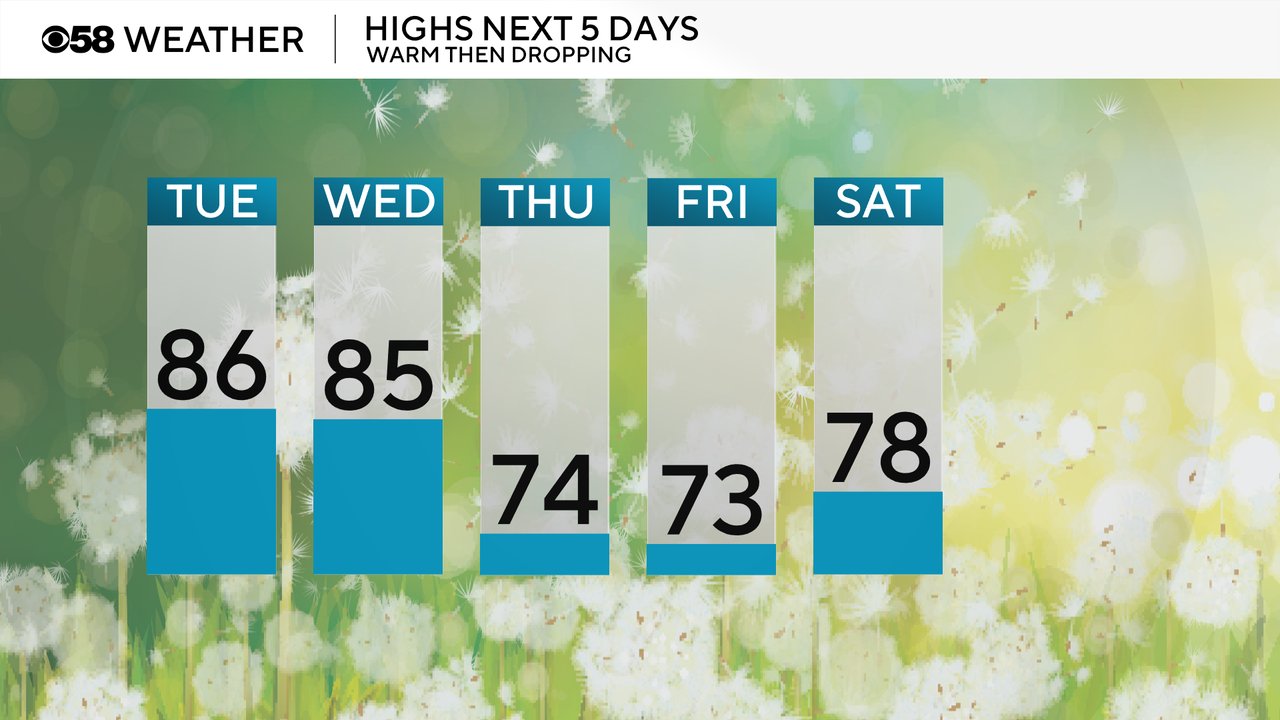
Before we get to the next storm chance we will see temperatures and humidity levels increase. Highs on Tuesday and Wednesday will reach the middle 80s - not the hottest of the year but a bit above average.
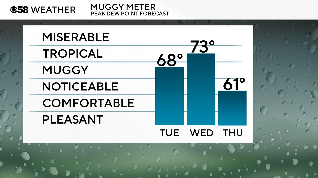
Dew points Tuesday will rise into the upper 60s with very muggy conditions returning. Even more humidity is on the way for Wednesday with dew points reaching into the 70s which could be the most humid day of the season so far.
Download the CBS 58 Weather app to track the heat and humidity with the hour-by-hour forecast and track the next chance for storms with the interactive radar.