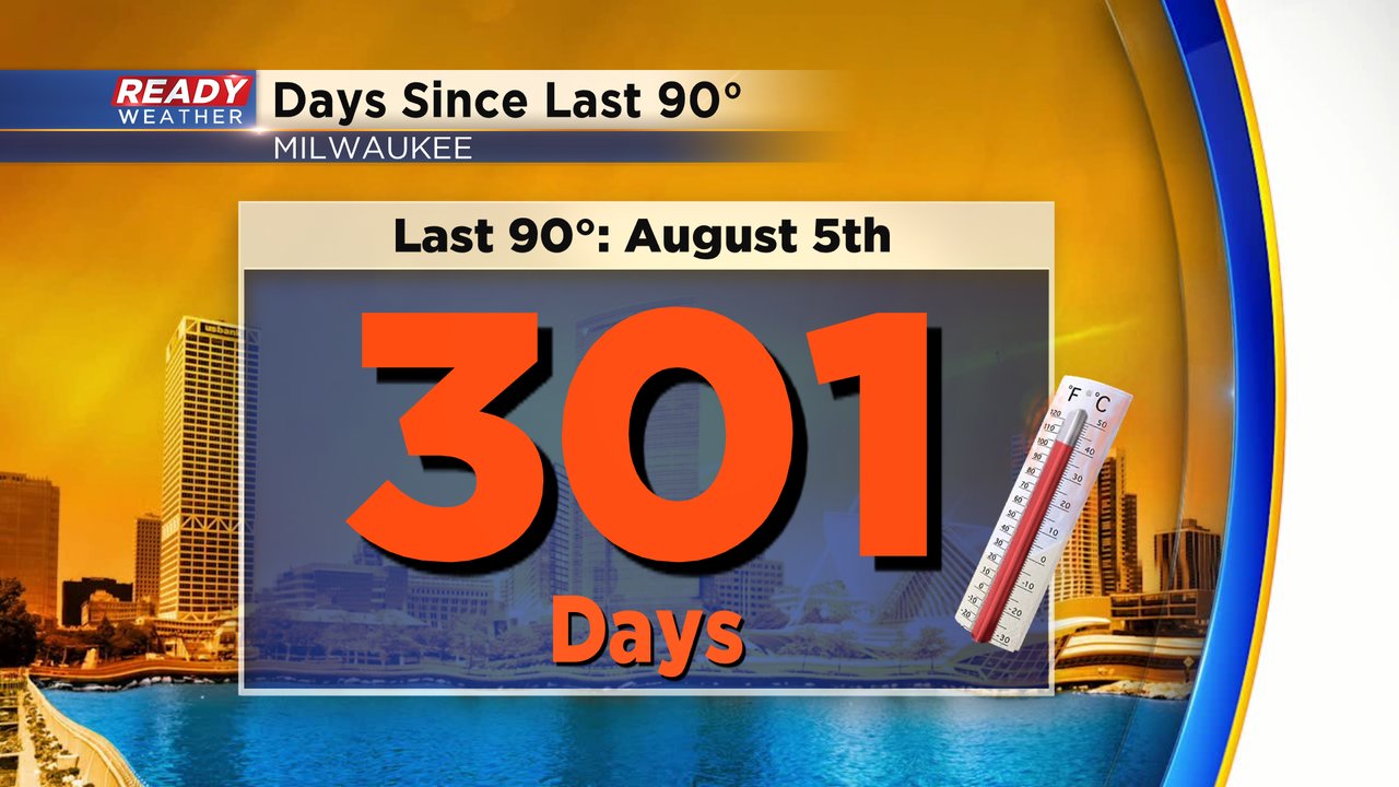
We wait for it every year.... summer heat! You either love or loath it, but we can all agree that the hot season is fairly short up in these parts. While we don't suffer the entire summer with sweltering heat, we can certainly get our fair share. But it's been a while... let's jog the memory a bit on our last ninety degree day in the city:
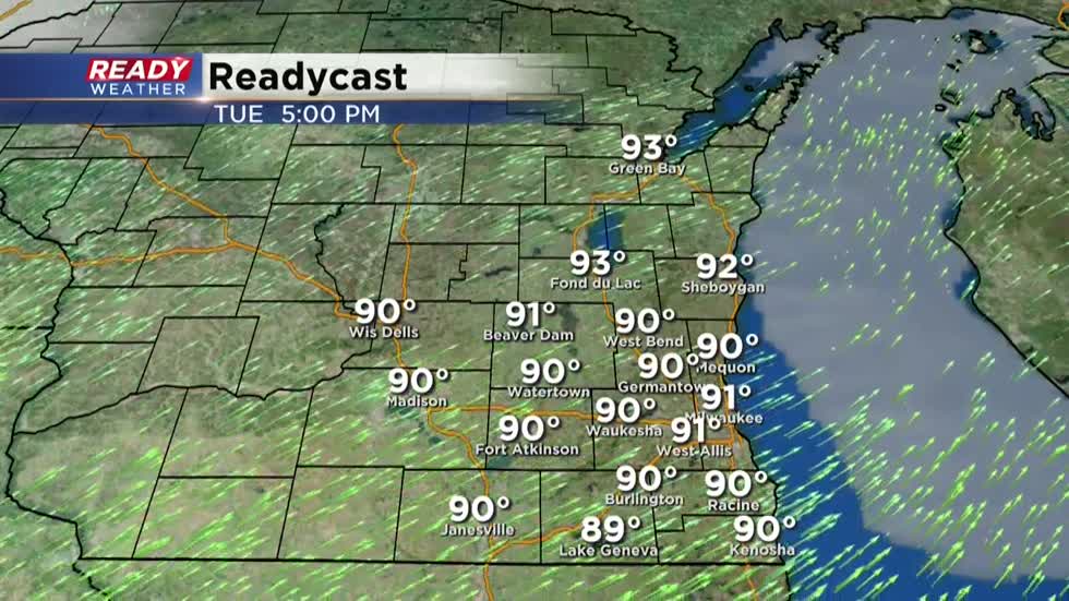
And our long wait for more 90s may end tomorrow. Currently, a warm front is tracking across the area. By Tuesday, the heat is firmly entrenched across southeast WI. Take a look at the expected highs:
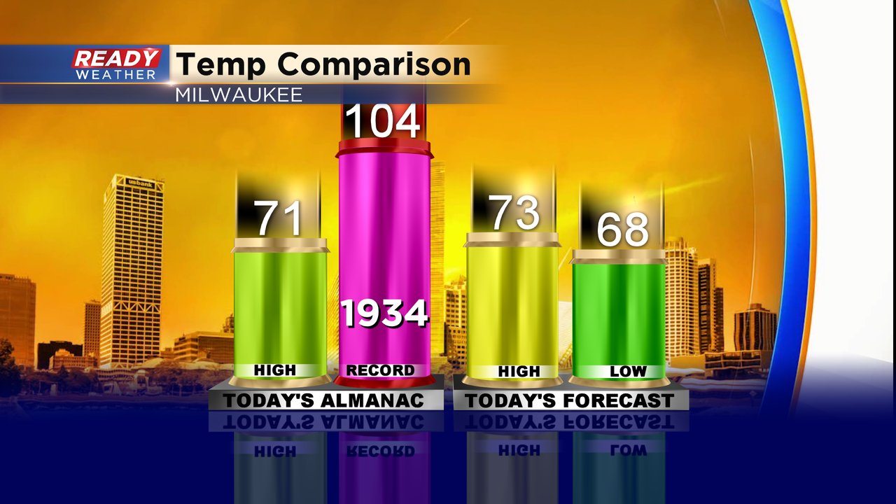
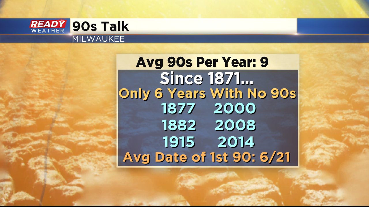
While this first potential 90 of the year is coming just a bit ahead of schedule (Average first 90 is June 21st when looking at Milwaukee's entire record book) June has started even hotter in the past. Today marks not only the start to Meteorological Summer (June-July-August) but also our first triple-digit high temp record!
As you can see we'll be closer to the average of 71 on today's date. Tuesday, however, we'll be on record watch! Tomorrow's high temperature record sits right at 90, from 1944. We could break records highs tomorrow as well as start the 90s tally for the season.
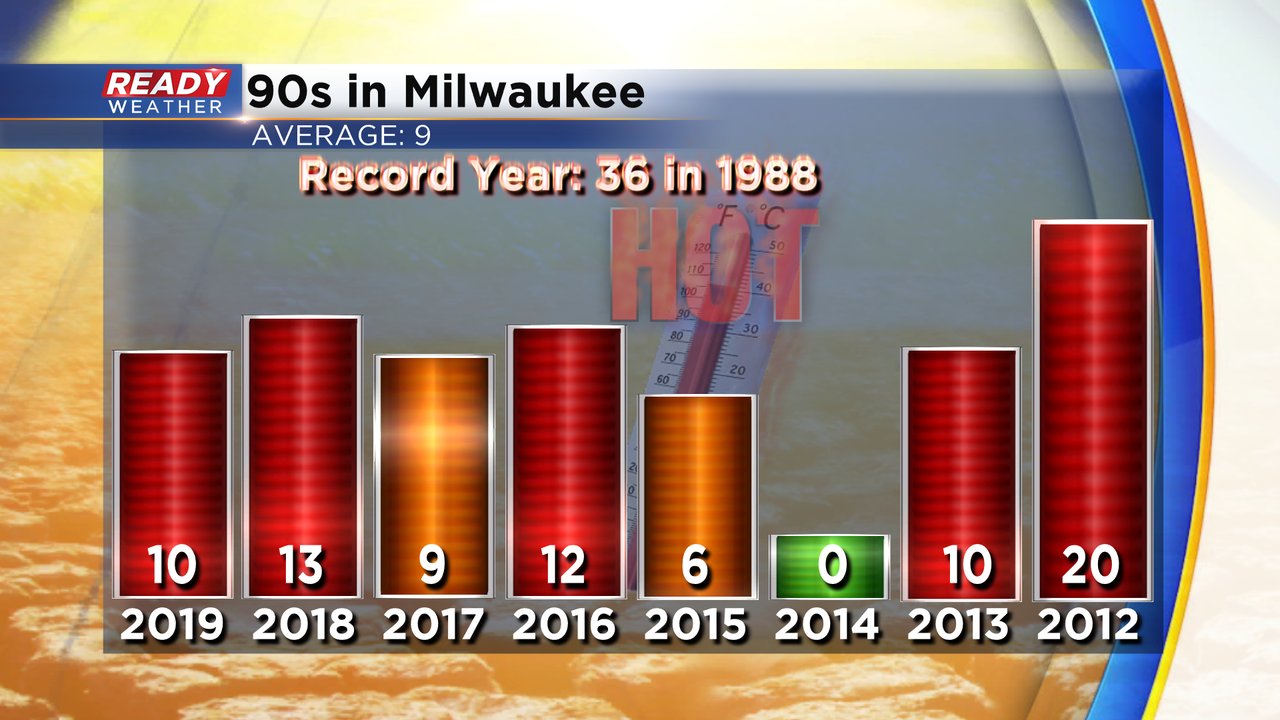
The average amount of 90s per season in Milwaukee is nine. Most years recently were near that mark. Notice 2014 had no 90s at all! Something like that happens only every once in a while.
So as we track the 90s tomorrow, keep in mind it was also be very humid making it feel well into the 90s by the afternoon. Stay hydrated, take breaks and find some shade if outdoors for a while. As we head into the night, the heat and humidity will spark storms, some could be strong. Keep it tuned here to our Ready Weather blogs, as we keep you updated on the forecast!
I'm meteorologist Rebecca Schuld