Heavy Rain and Flash Flooding Possible
Update as of Noon on Friday...
Several of our computer models are coming together with their outputs. Unfortunately, a lot of them are saying the same thing. 1-3"+ of heavy rain across the area, especially overnight into Saturday morning.
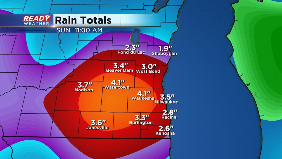
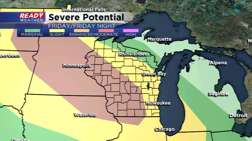
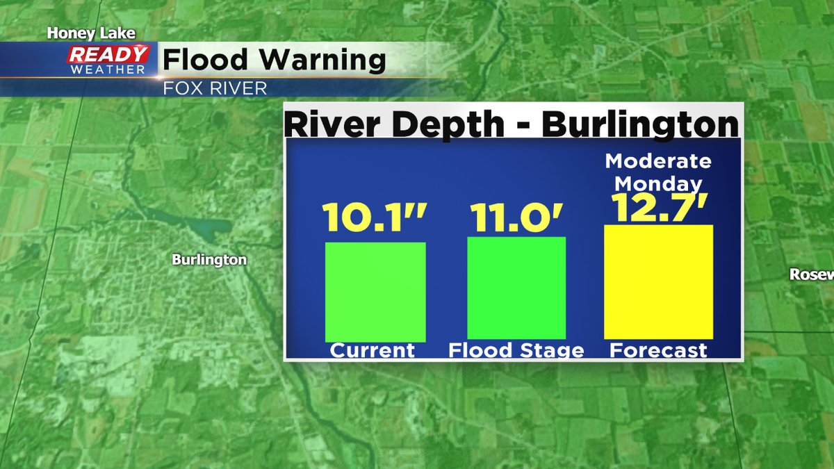
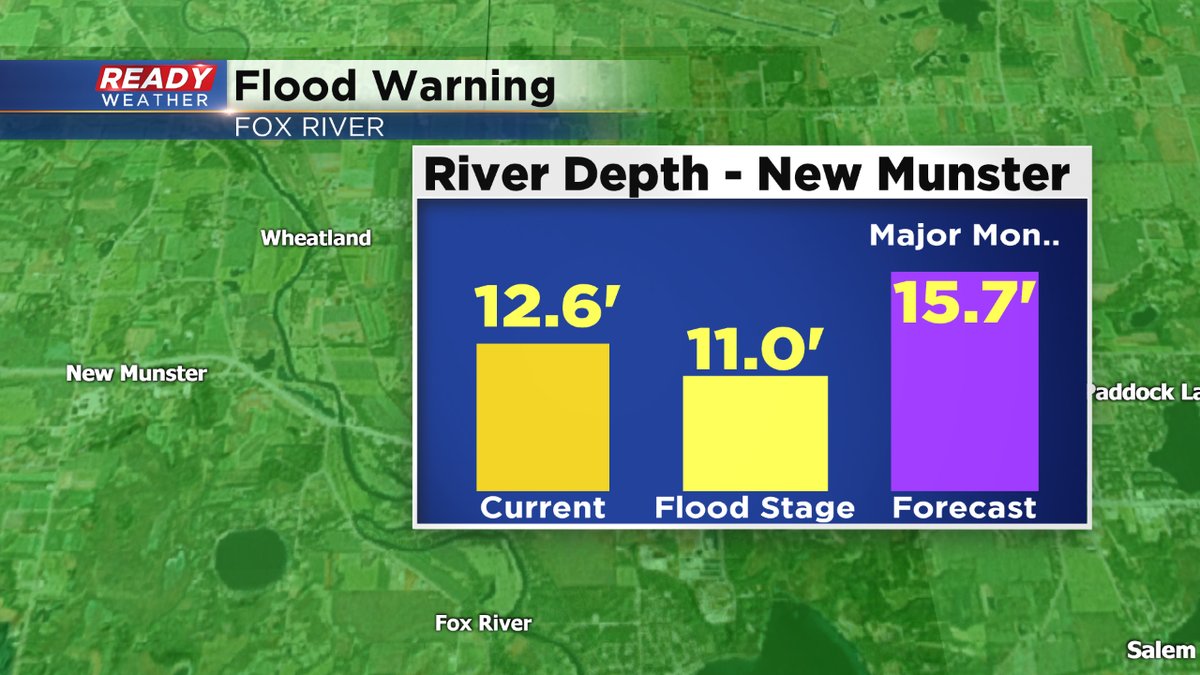
The risk of severe weather is there as well, including large hail, damaging wind, and frequent lightning. The "enhanced" risk of severe weather now covers Kenosha, western Racine, and Walworth Counties. Most everyone is under a "slight" risk. With the heavy rain on the rain, all eyes are on the Fox River. In Burlington, moderate flooding is expected by Monday, and major flooding could happen in New Munster in Kenosha County. Of course the entire CBS58 Ready Weather team is watching the situation carefully.
Please keep a careful eye on the water levels this weekend. And if necessary, move to higher ground. Also, make sure you have the free CBS58 weather app loaded on your phone. It's free and very useful when it comes to severe weather.
Flash Flood Watch is now in effect for a good chunk of the CBS58 viewing area starting later this afternoon and running until Saturday morning. An upper-level disturbance accompanied with a high amount of energy and moisture will setup the chances for strong to severe storms. The main threats will be high winds, hail, and especially, heavy rainfall.
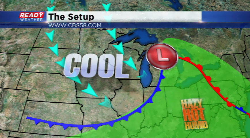
With an influx of dew points in the 70s along a warm front, and precipitable water values (measure of moisture when rung out at the surface) very high, watch for not only training storms but flash flooding with any storms later tonight. The flood-prone areas of Walworth, Racine, and Kenosha counties will have to be watched very closely. A strengthening low-level jet later this evening and tonight will initiate a cluster of thunderstorms. Many areas overnight hit by storms could see 1”-3” of rain in a very short amount of time. Once Saturday morning rolls around, the disturbance and forcing loses some steam.
Along a front on Sunday, a few storms could fire off but nothing strong or severe. A big cool down and a break from this weather pattern will take place early next week.