Showers and storms weakening. Flood advisory.
Posted: Jun 29, 2020 3:27 PM CDT | Updated: Jun 29, 2020 5:44 PM CDT


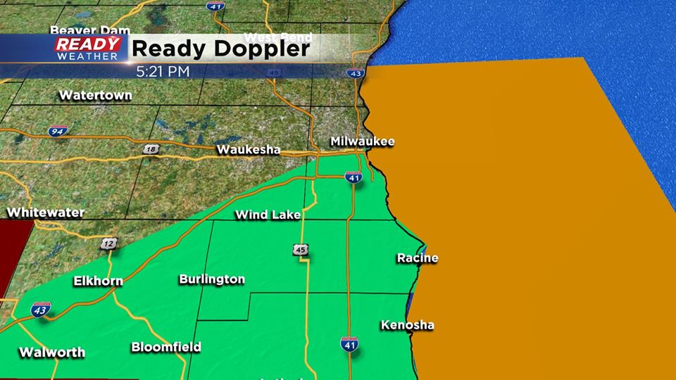
5:30 PM Update:
An aerial flood advisory has been issued until 8:15 for the counties in green. Locally heavy rain has fallen in a short amount of time creating ponding and some flooding.
Thankfully the heavy rainfall is weakening and should be out of the area within the hour. Light to moderate rain will fall apart and end after 9 pm.
______________________________________________________________________________________________________________
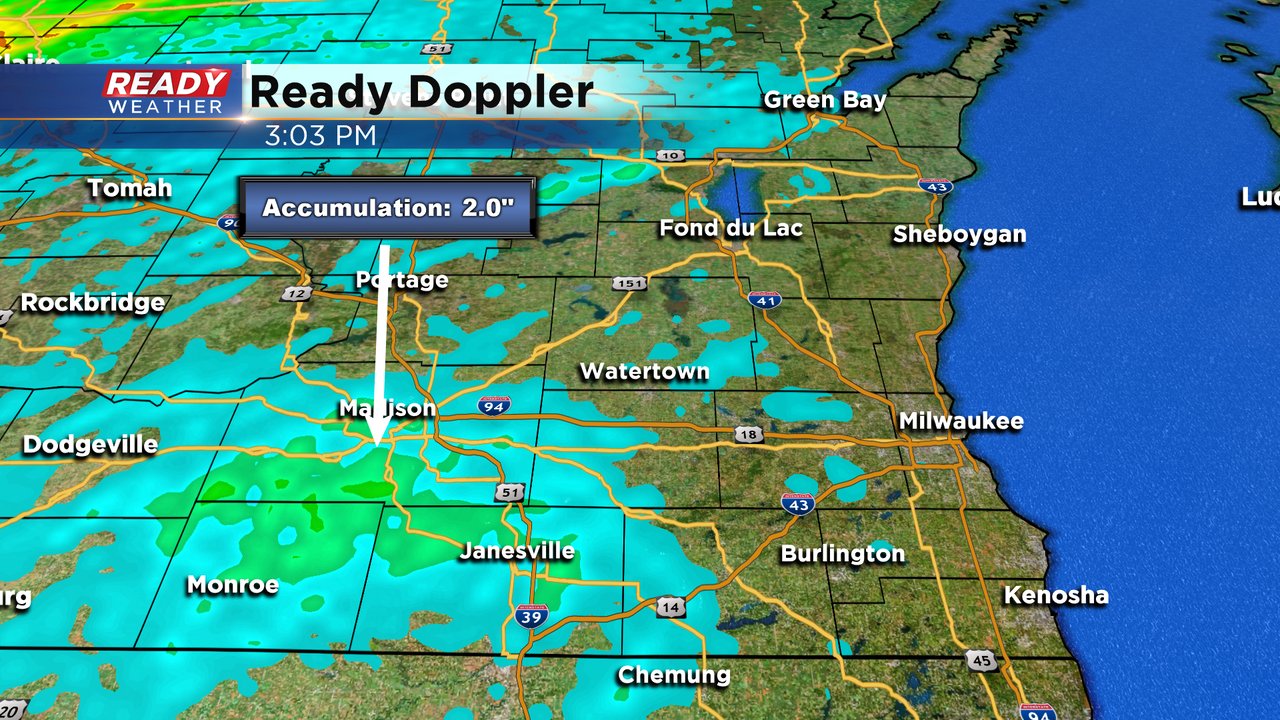
Scattered showers and storms have merged over the Madison area this afternoon providing torrential rains.

I'm meteorologist Rebecca Schuld