


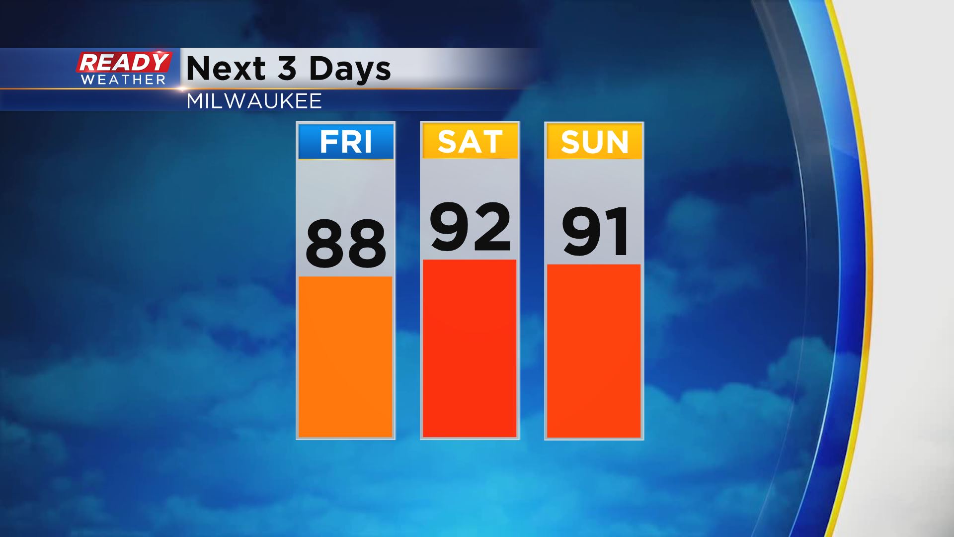
Temperatures and dew points are running 10-15 degrees warmer than this time yesterday morning, and this heat isn't going anywhere any time soon. Highs will reach the upper 80s today and low 90s both Saturday and Sunday.
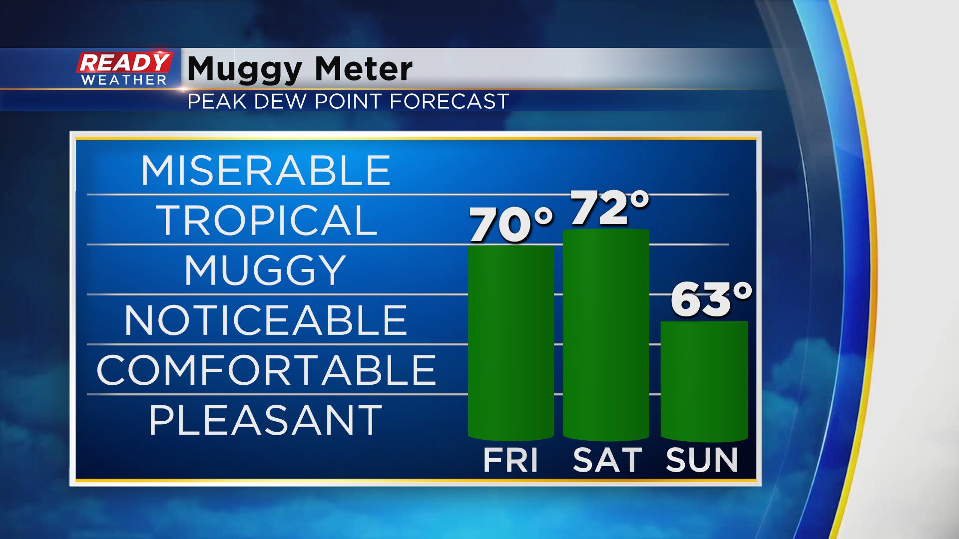
Dew points are already in the low 70s and will stay there through Saturday, however, we won't be quite as humid on Sunday thanks to a cold front that'll track through on Saturday.
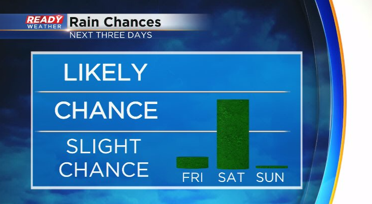
That front will bring our best chance of showers and storms this weekend, with dry weather expected on Sunday. We'll also be on the lookout for an isolated shower along the lake breeze this afternoon.
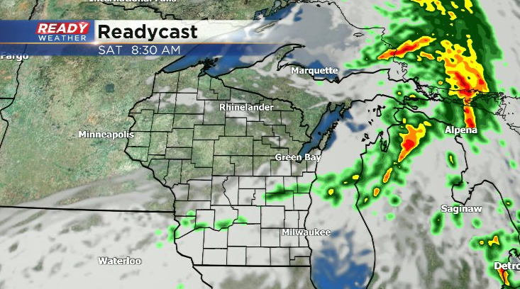
The front will push into the northern part of the state tonight with a line of thunderstorms.
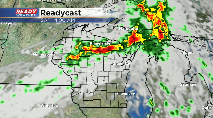
This line will primarily stay north of our area, but a few weakening showers or storms will be possible mid morning, with the best chance coming in our northern counties.
We'll be watching to see where round one of storms leaves a boundary as that boundary will be the focus for additional scattered storms late afternoon into the evening.
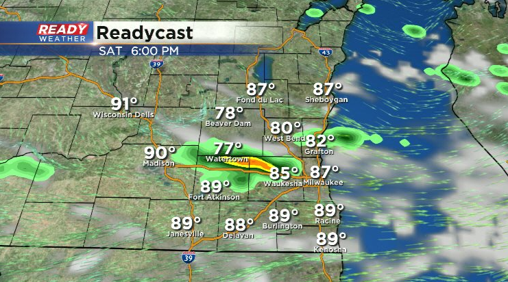
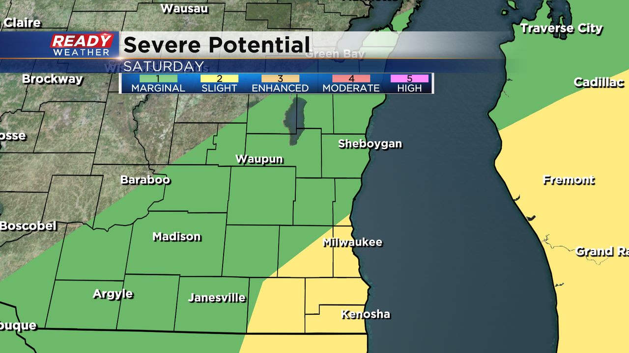
There's some uncertainty whether or not that boundary will stall across southeast Wisconsin or just to our south in Illinois. *IF* storms do fire late afternoon and evening, they will have the potential to produce damaging winds and large hail. The Milwaukee metro to the IL border is currently under a level 2 of 5, Slight Risk, for severe storms on Saturday with the rest of the area under a level 1 of 5 risk.
While we'll have a brief break from the tropical air on Sunday, the heat will continue into next week. Download the CBS 58 Ready Weather App to see the full 7 day forecast and to track any weekend storms.