Winter Weather Advisory extended until 2 am. Winter storm warning for Saturday.


Updated: 10:30 pm Friday, December 31st:
A Winter Weather Advisory has been issued for Fond du Lac, Sheboygan, Dodge, Washington, Jefferson, Waukesha, Ozaukee, and Walworth counties for the freezing drizzle and freezing rain threat. It has been extended until 2 am.
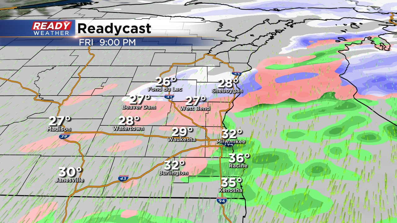
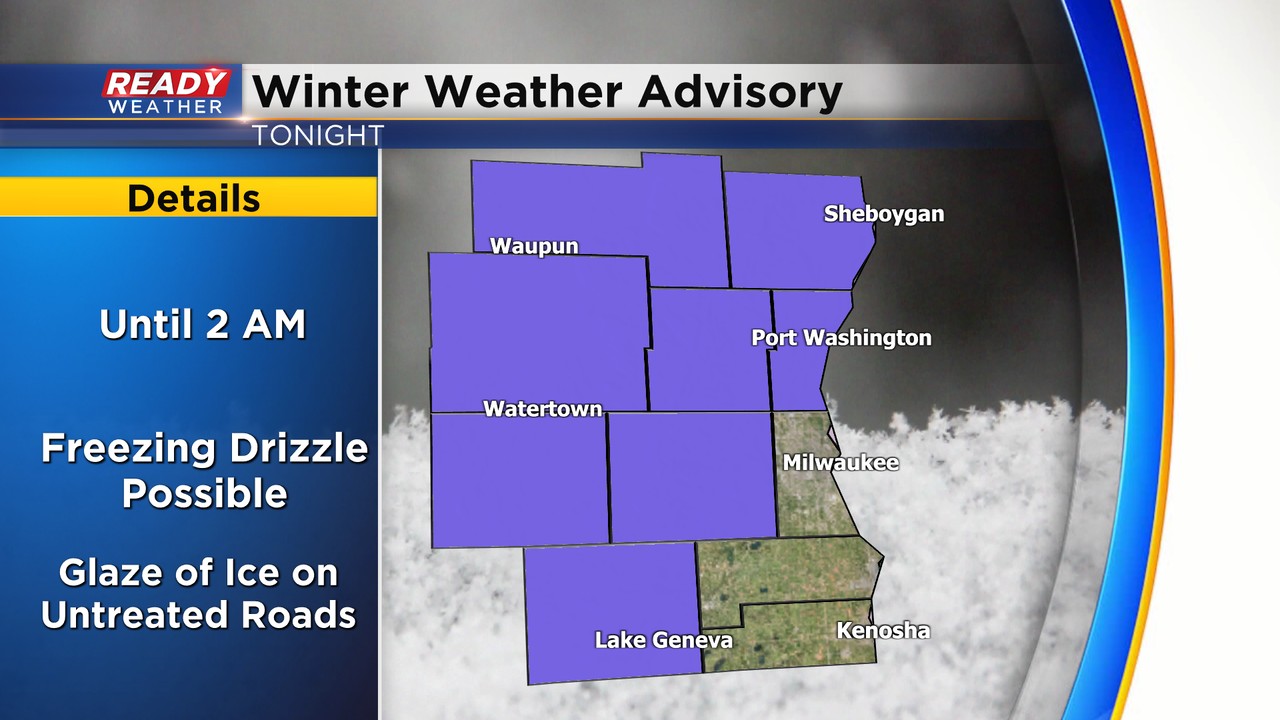
A glaze of ice is possible on elevated and untreated surfaces. Temps will likely be warm enough in Milwaukee, Ozaukee, Racine, and Kenosha for plain drizzle, so they're NOT included in the advisory.
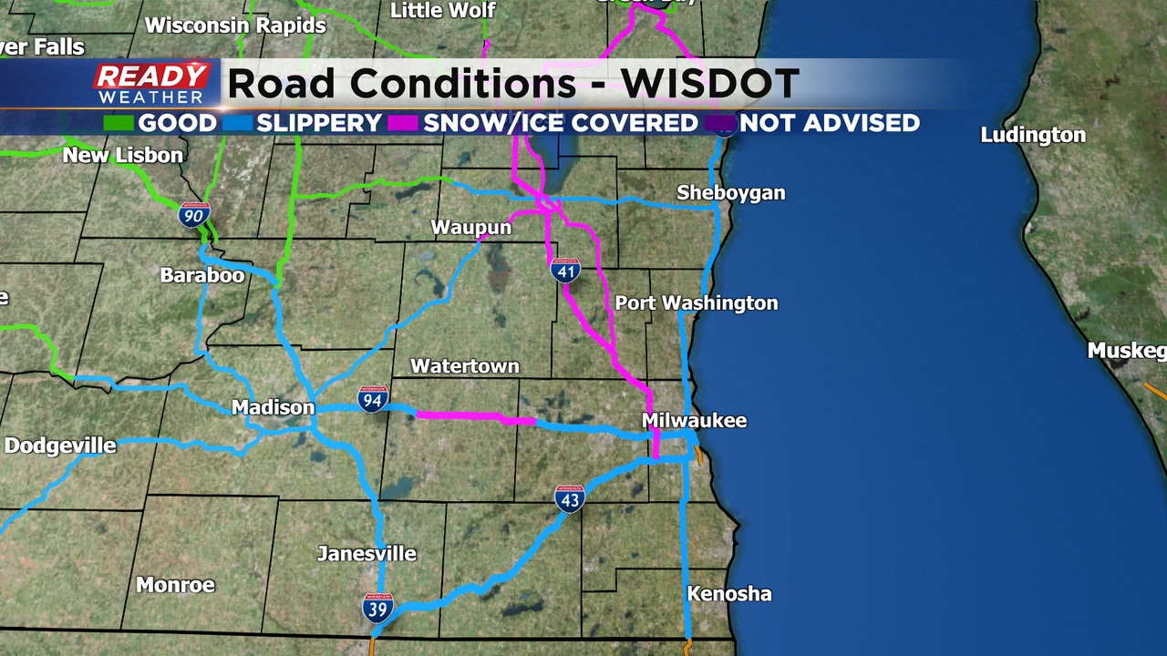
Plenty of slippery stretches being reported across the area this evening.
Be *extremely* careful when driving tonight, especially since tonight the most dangerous night of the year when it comes to drunk drivers.

The NWS has upgraded the winter storm watch to a warning for Saturday. Only 3 counties are in the warning. Those areas closest to the lake could pick up 6" to 8" of snow. Travel will be a major issue Saturday night!
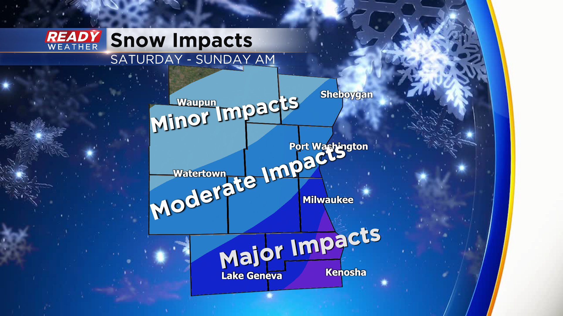
All of our other counties except Fond du Lac will be under a winter weather advisory for Saturday afternoon into Sunday morning.
------------------------------------------------------------------------------------
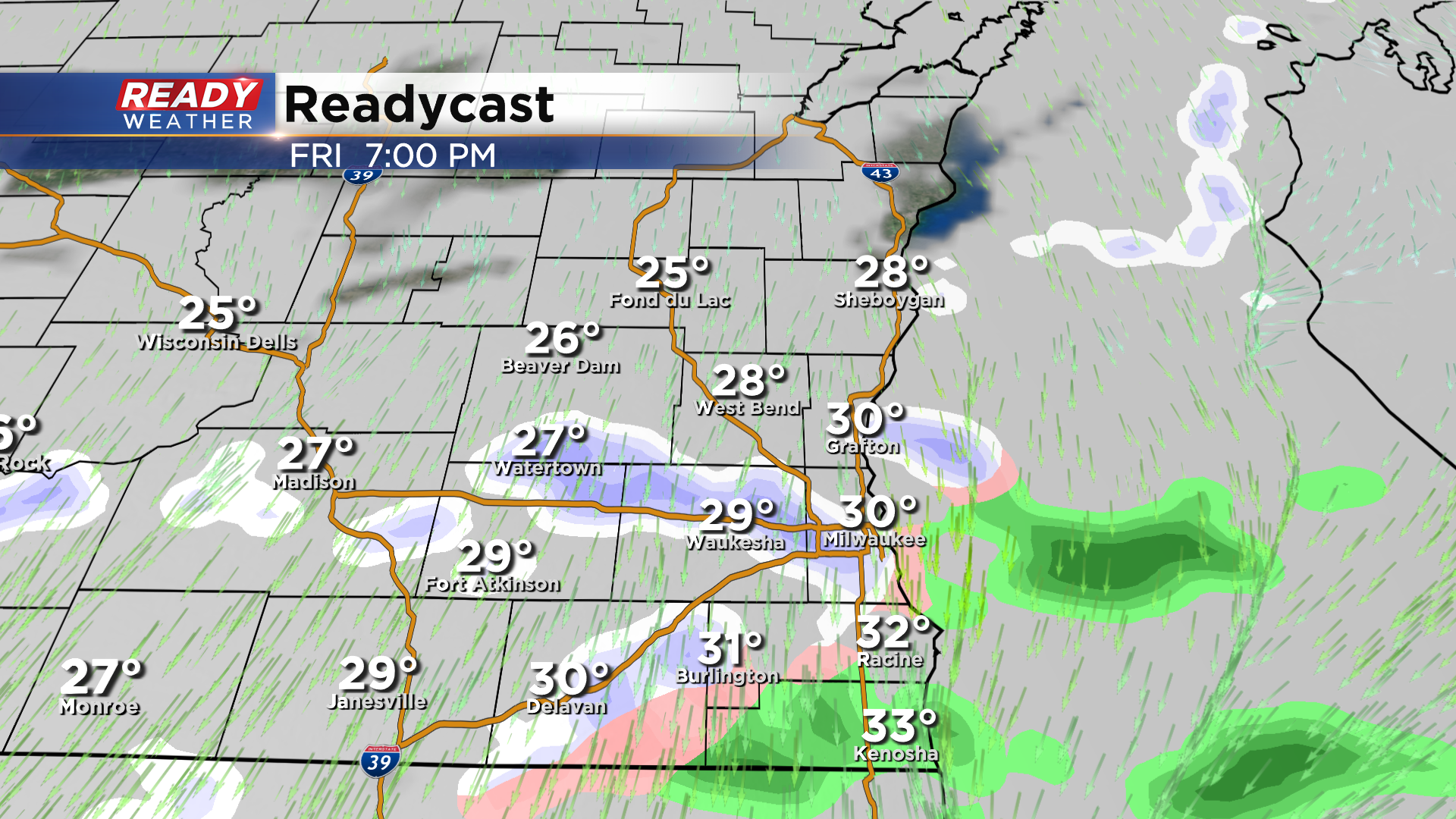
After a year with well below normal precipitation, we'll end 2021 and start 2022 on an active note. Before the accumulating snow moves in New Year's Day, we'll have to deal with a period of drizzle, freezing drizzle, and flurries late this afternoon through the evening. This could lead to slick or icy spots on roads so be careful if you're planning on heading out for New Year's Eve.
Otherwise accumulating snow is still on tap for Saturday. A Winter Storm Watch has been posted for Milwaukee, Racine, and Kenosha counties beginning at noon Saturday - 6am Sunday. These areas have the best chance at 4-8" of snow thanks to lake enhancement.

The widespread snow won't move in until Saturday afternoon, but a band of lake effect snow could set up across southern Milwaukee, Racine, and Kenosha counties Saturday morning, which could lead to slick spots while inland areas stay dry.
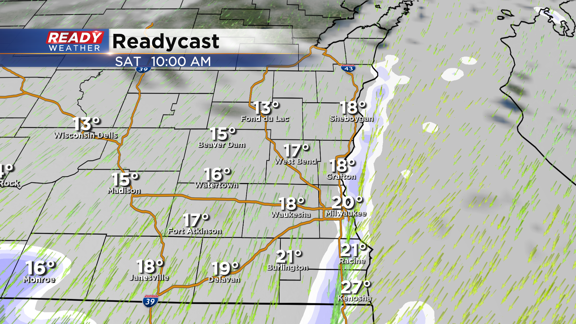
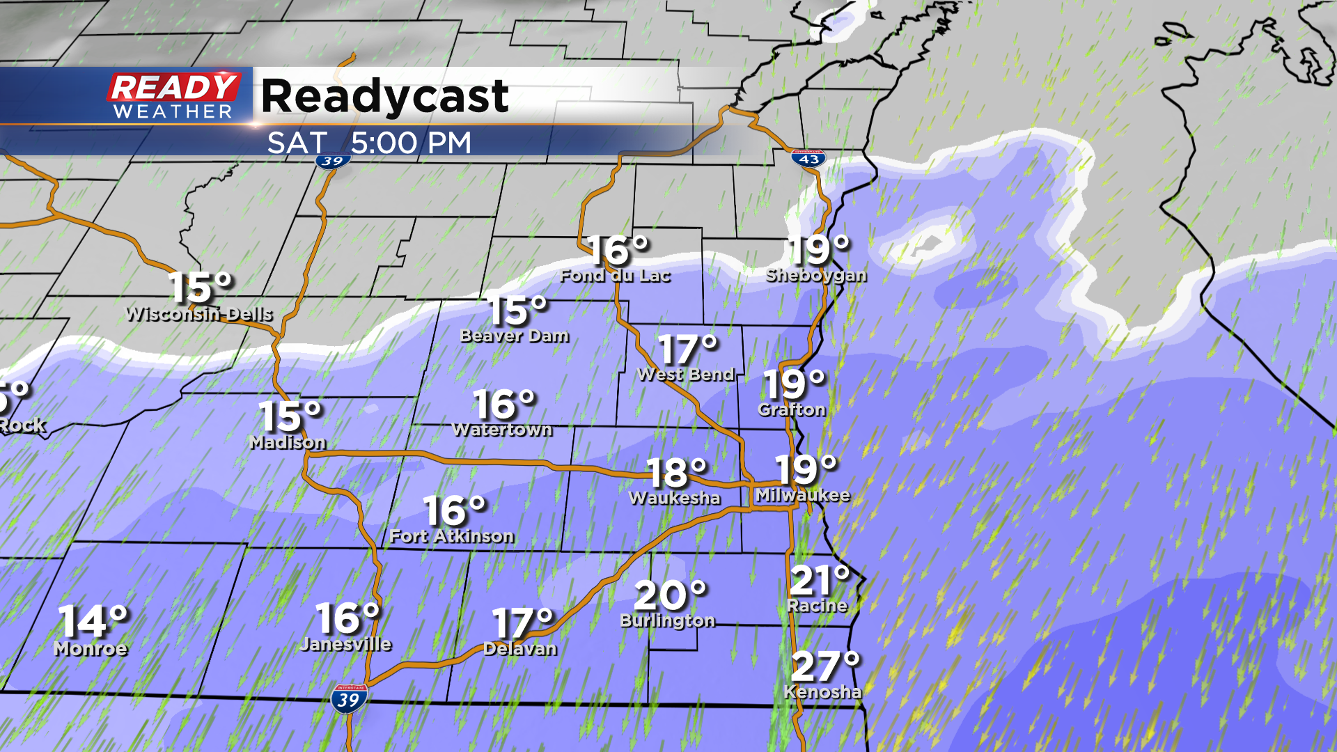
Widespread snow moves in from south to north between Noon and 3pm, becoming moderate to heavy late afternoon into mid evening, especially lakeside as lake enhancement continues.
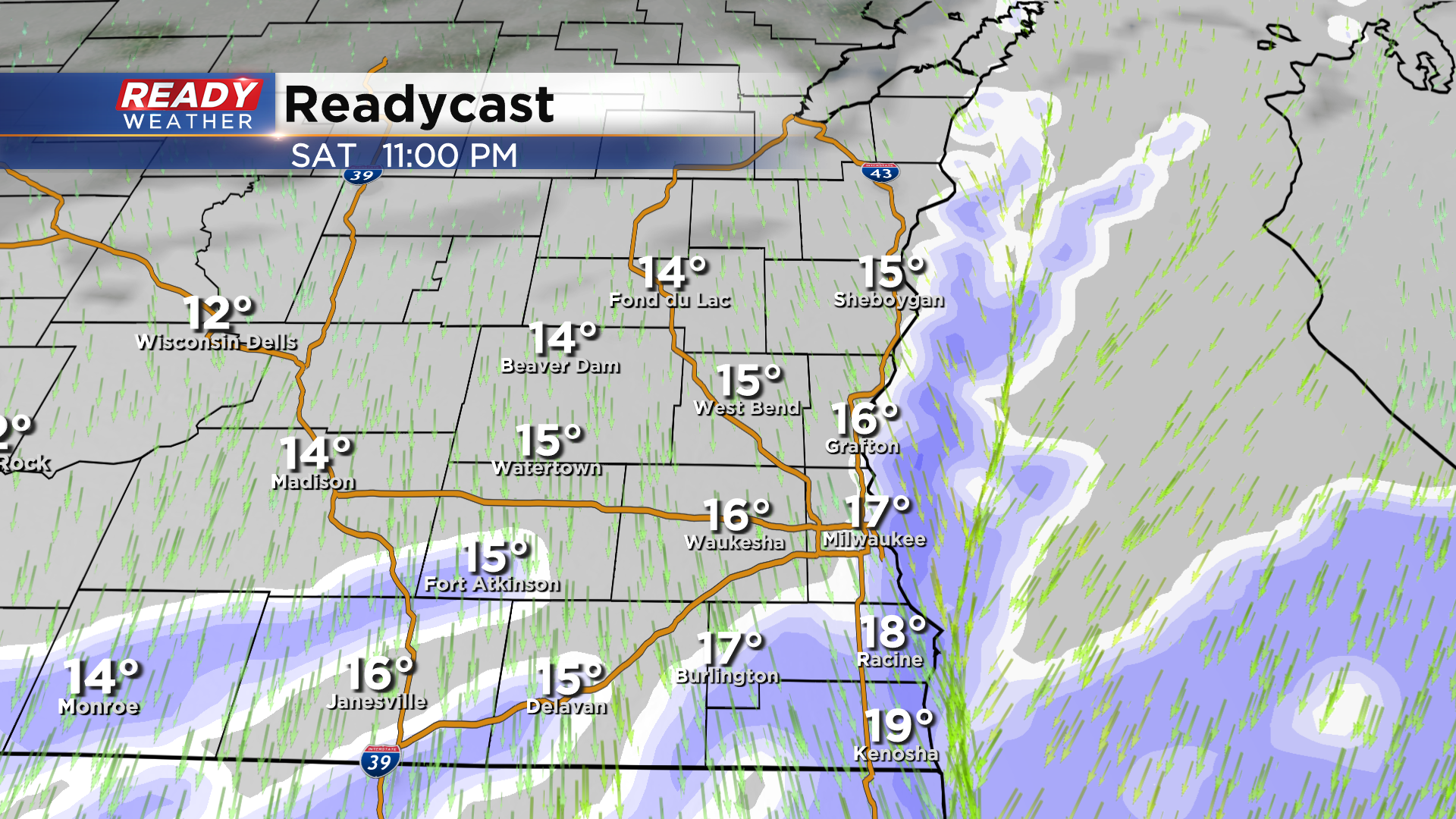
Most of the widespread snow will taper off around midnight, but lakeside areas will continue to see light snow overnight Sunday, ending around sunrise.
Between 4-8" is expected in far southeast Wisconsin with the highest totals of 6" to 8" confined to the lakeshore. There will be a sharp cutoff in snow totals to the northwest, with potentially only a dusting to an inch near Fond du Lac and Beaver Dam. Wind will also be gusting at 25-35 mph, which will lead to blowing and drifting.
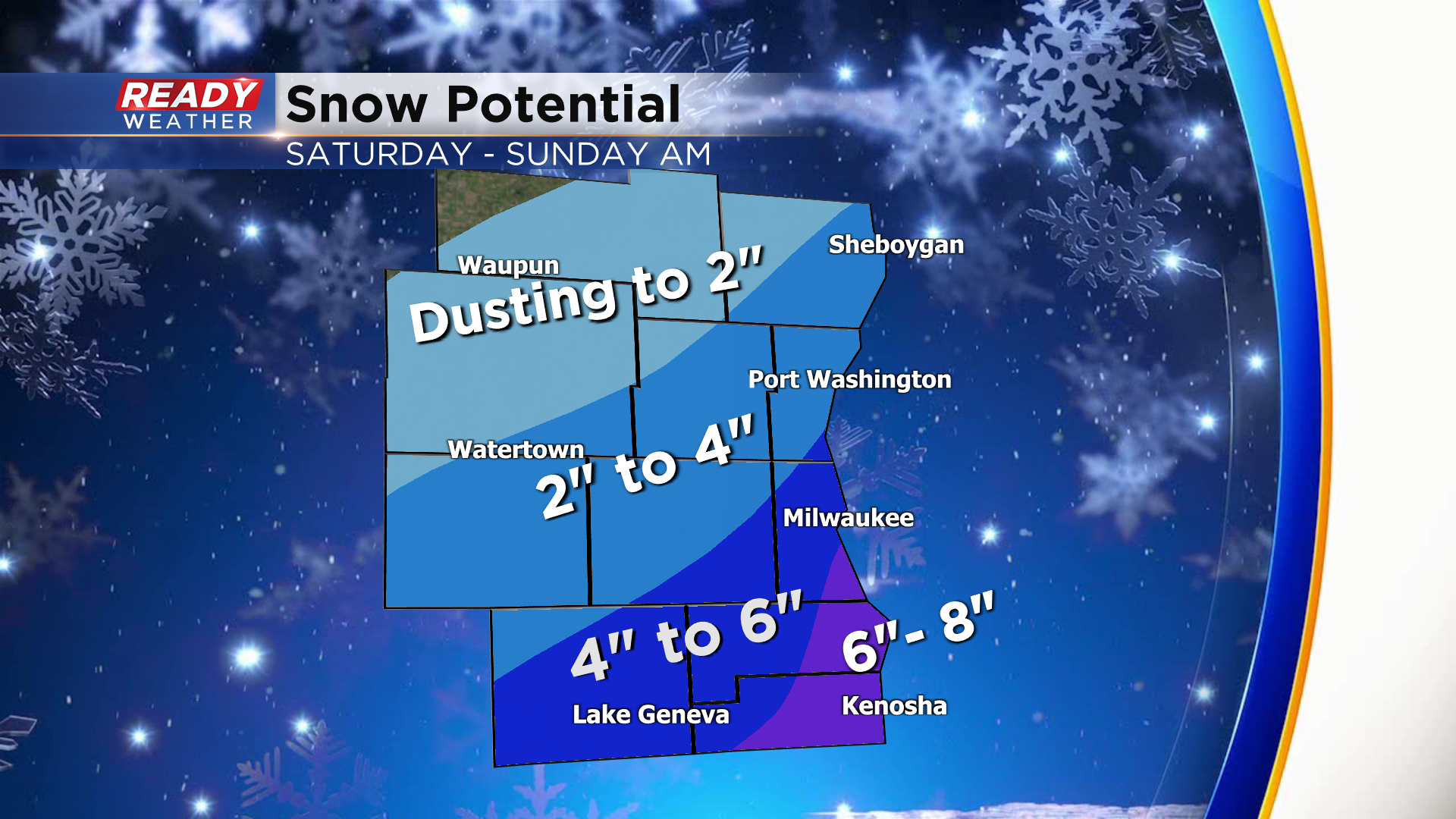
With the strongest winds and heaviest snow expected in far southeast Wisconsin, major impacts are likely in these areas Saturday afternoon and evening, but the impacts won't be as severe the farther northwest you go due to less snow and a shorter period of accumulating snow.
Snow ends by sunrise Sunday, but it'll be very cold behind this system with highs only in the teens, feeling like zero degrees. Download the CBS 58 Ready Weather App to track the incoming snow and freezing drizzle.