Forecast is full of winter weather. Take your pick.

-
1:20

A life-saving change is coming to the Ozaukee Central Fire Department
-
1:49

Whitefish Bay voters reject state’s second most expensive school...
-
2:02

’Safer Together Week’ celebrates Milwaukee first responders,...
-
1:22

Marquette Law School hosts discussion on data center energy,...
-
1:05

Community members gather to discuss Milwaukee’s affordable...
-
2:21

Traffic calming reconstruction project begins on National Avenue
-
1:40

Busias XOXO Polish Market offers traditional treats and community...
-
4:09

Tiffany’s Dessert Bar previews spring and summer plans including...
-
3:58

Choral Arts Society closing 39th season with ’Fantasia!’...
-
2:18

First of three rounds of precipitation brings wintry mix Wednesday...
-
1:56

Alicia Halvensleben projected winner in Waukesha mayoral race
-
1:29

CBS 58’s Hometown Athlete: Twins from Tosa make UW-La Crosse...

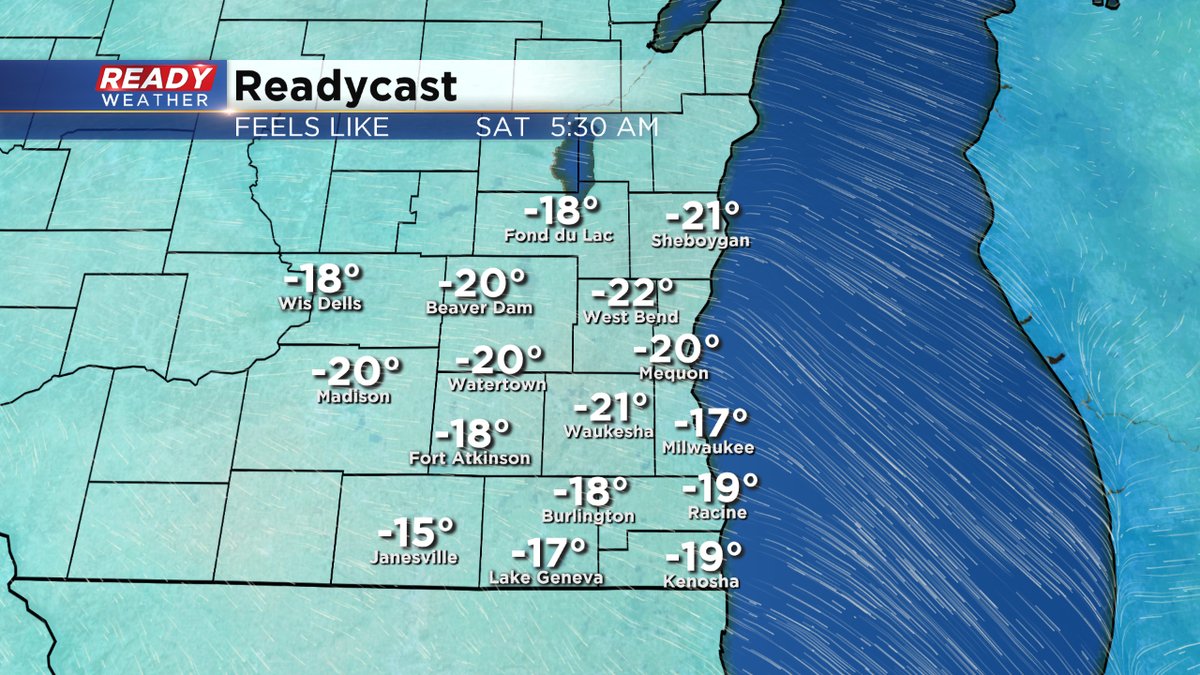
MIlwaukee (CBS 58)--Our dangerous chill in place hangs on through Friday and into the weekend. The Wind Chill Advisory is in effect until noon today. This means it will feel like -20 to -30 at times. Even during the heat of the day, it won't feel warm at all. The wind chill numbers will stay below zero. Highs today, if lucky, will be near 5. Highs this weekend will be 5-10. The "chills" stay below zero.
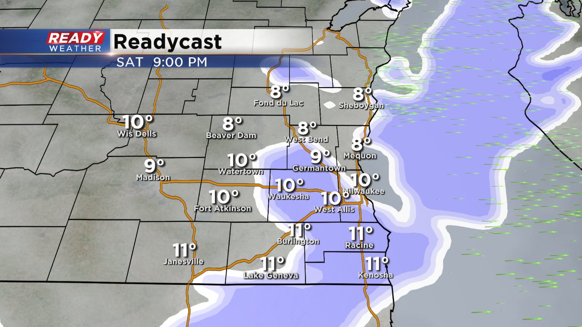
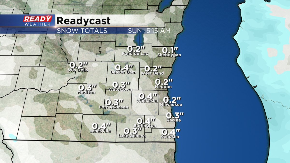
We do have the chance for some snow showers into Saturday evening. But the much bigger push will be coming Sunday night and lasting through much of Monday. We have the chance for substantial snow. Of course the entire CBS 58 Ready Weather team will keep you on top of the weather situation.
Behind the next big snow, we get dangerously cold. Again. We'll see temperatures, actual air readings, near -15.