Flash Flooding....Severe Weather Returns Tonight
A very active 24 hour period returns across southeastern Wisconsin. Strong to severe storms return to the forecast after midnight, and they could redevelop once again for Wednesday evening.
The entire area is under a flash flood watch with the potential for 1" to 3" of rain. Localized flooding could occur especially if storms train over the same spot. There is a chance for isolated spots to pick up over 3" of rain.
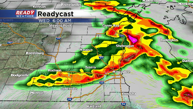
Let's talk about the first round of storms. Elevated showers and storms with small hail are expected between 2 am and 5 am. The main line of storms will push across the area during the morning commute. Those storms between 6 am and 9 am could contain strong gusty winds over 50 mph.
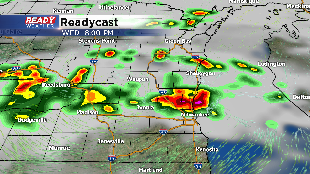
The area should see a break during the late morning into the afternoon. Hot and humid conditions will set the stage for another round of showers and storms by Wednesday evening. Those storms will fire ahead of a cold front. If we can get some sunshine, storms that form late in the day could contain large hail and damaging winds.
The severe weather threat should end by Midnight going into Thursday morning.


