Few light showers possible going into the weekend before a blast of cool air


Southeast Wisconsin has stayed pretty dry this week since a few areas of heavy rain this past Monday. A couple of light showers may be possible Friday night into Saturday morning. Rain chances look best from 11 PM Friday night through 7 AM Saturday morning. Not everyone will see the rain and any showers that do develop will be very light. Under a tenth of an inch of rain is expected for those that get the showers.

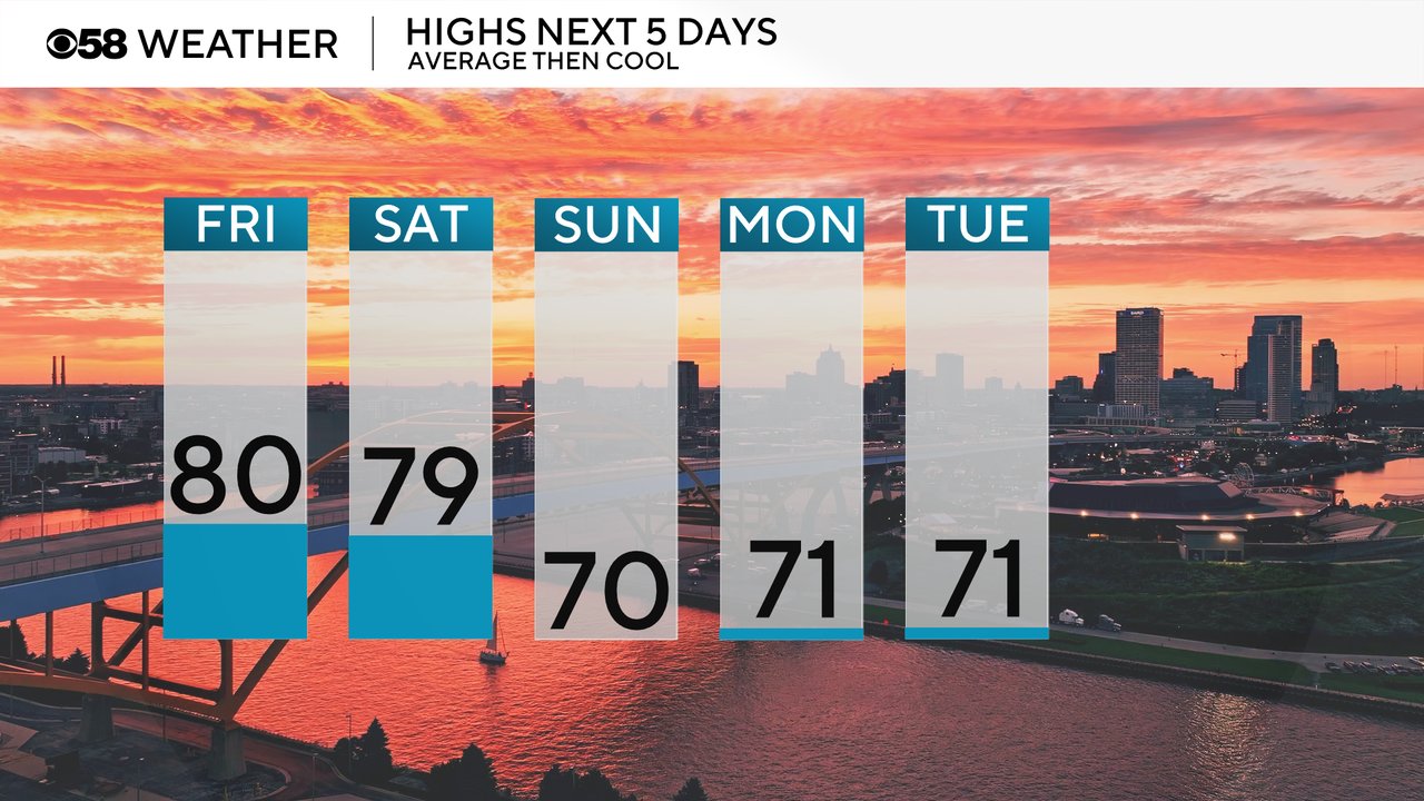
Friday and Saturday will be a bit warmer with highs around 80 then a blast of cool air arrives with highs around 70 going into the beginning of next week.
Once that cool air arrives on Sunday the temps will likely stay below average through the end of August. The current Climate Prediction Center Outlook has a 30-50% chance for below average temps through August 31st. Highs can be expected to stay in the low to middle 70s for the most part.

With some of the mild air Friday and Saturday dew points and humidity levels will stay noticeable. Saturday that mugginess is mostly in the morning and becomes pretty comfy by Saturday afternoon. Dew points will drop into the low 50s for Sunday pushing the Muggy Meter into the pleasant category for the first time in a long time.

Download the CBS 58 Weather app to track the light showers Friday night and the cool down next week.