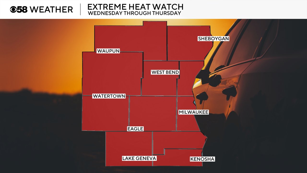
Extreme Heat Watch issued for Wednesday and Thursday for feels-like temps over 100


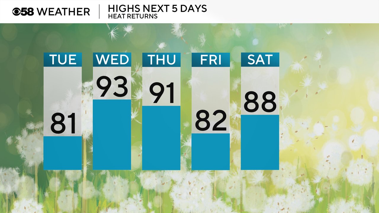
Temperatures and humidity levels will start to increase Tuesday with highs around 80 and dew points reaching the middle 60s making it pretty muggy. More heat is on the way Wednesday and Thursday with highs reaching the low 90s. It doesn't look as hot as it once did but still plenty warm around 90 at least. Friday might touch a cool back to average but then the warmth kicks right back in for the weekend and beyond with highs in the upper 80s to around 90.
Muggy meter is already showing mid 60s for dew points Tuesday making it feel fairly humid. Even more humidity is on the way Wednesday and Thursday with dew points reaching well into the 70s making it feel fairly tropical.

The combination of heat and humidity will likely push feel like temps over 100 degrees in most areas Wednesday and potentially again on Thursday.

Because of the dangerous heat, an Extreme Heat Watch has been issued from Wednesday morning through Thursday evening. Feels like temps could push over 105 in spots each of these days, but Wednesday looks like the hotter day right now. This watch will be upgraded to either a Heat Advisory or an Extreme Heat Warning later Tuesday.
One factor that could impact how warm we get both Wednesday and Thursday will be storm chances. There is now an isolated threat for a few storms Wednesday morning through midday. If the rain, and associated clouds, linger too long it could prevent temps from reaching the 90s.

Another round of storms looks more possible Thursday, especially in the afternoon and evening. Download the CBS 58 Weather app to track the heat, humidity and storms.