


9:00 PM Update:
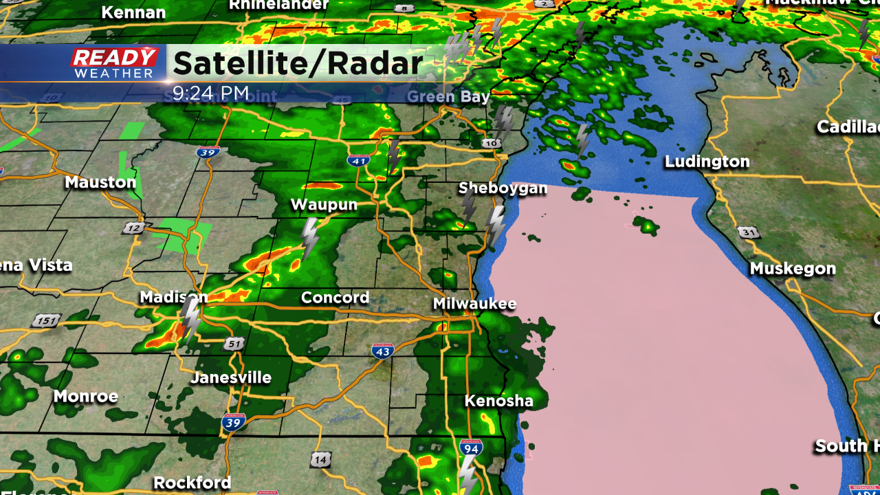
Scattered showers and storms are likely through midnight; however, the overall severe threat is low. Storms that fire to our west will weaken as they move east. The atmosphere is rather stable, so it will be tough for storms to support hail or winds.
______________________________________________________________________________________________________________
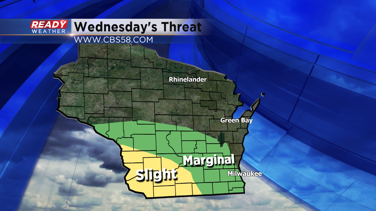
The slight risk for strong to severe storms remains to our west this evening. The best instability will stay across southwestern Wisconsin. The marginal risk is primarily for the western parts of our area. A new watch is possible for that area.
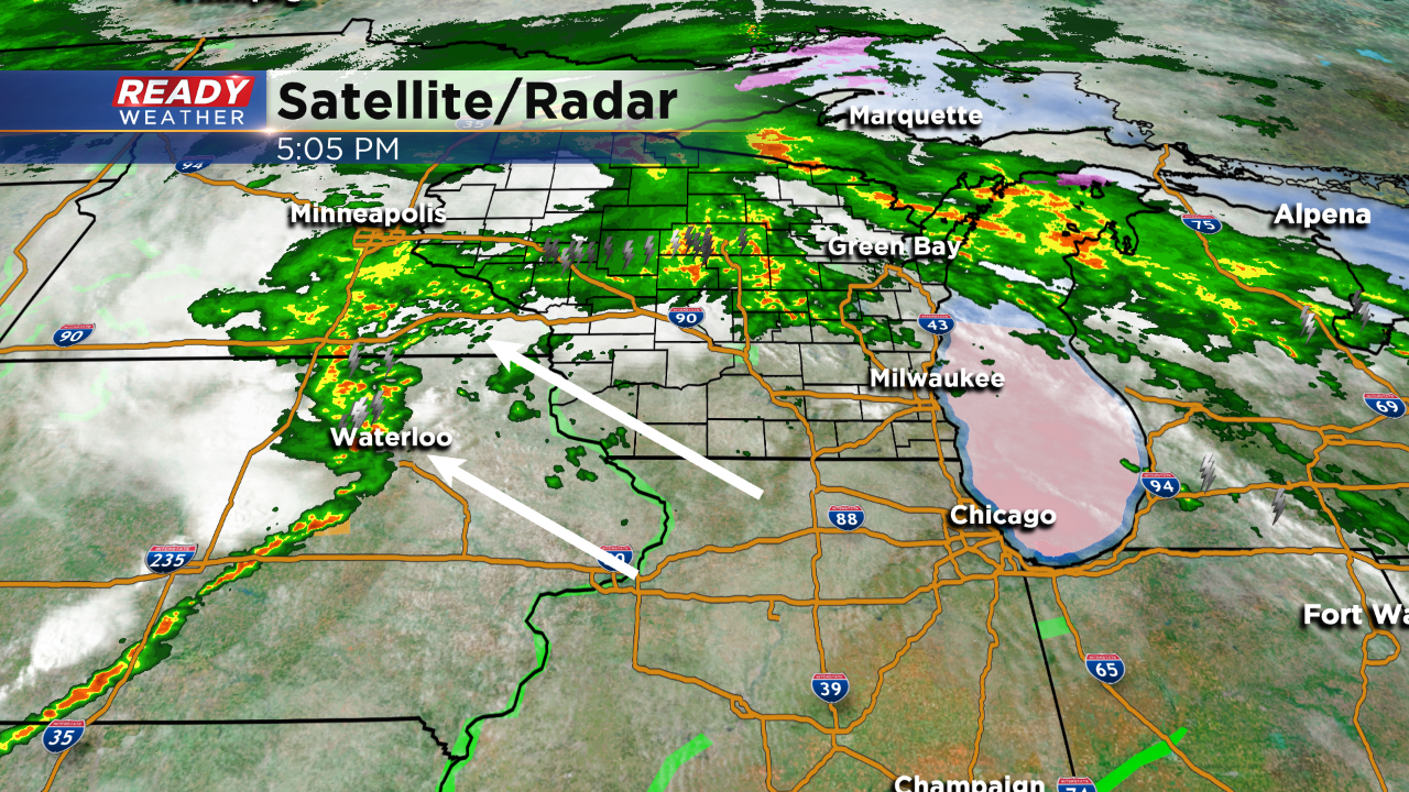
The storms right now are developing across Iowa, but they will likely weaken as they approach our viewing area. Storms that do hold together could produce small hail and gusty winds.
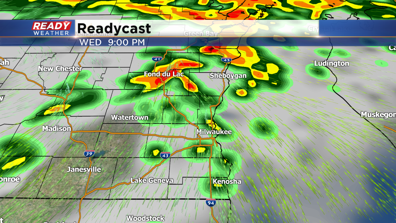
The best chance for storms to move across the area will be between 8 pm and Midnight. Small hail and gusty winds are possible as they move through.