Late PM Update: Severe weather risk expanding for Friday afternoon and evening


Updated: Thursday, March 30th 4:00pm:
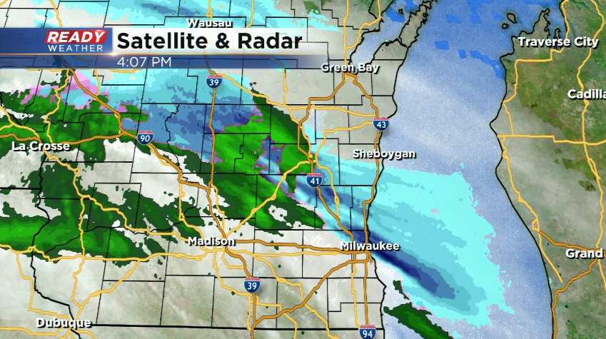
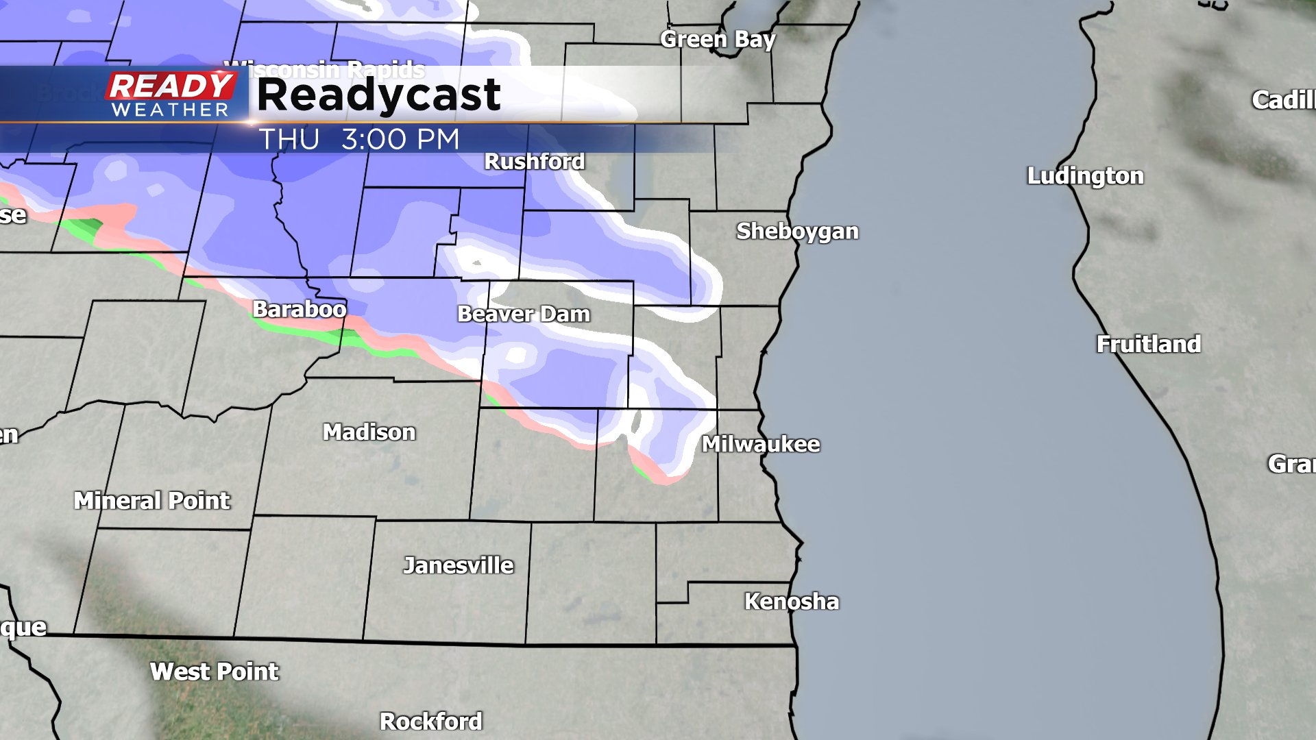
A wintry mix of rain, wet snow, and sleet is currently pushing through areas along and north of I-94. This will cause no impacts as temps are above freezing and will continue to rise.
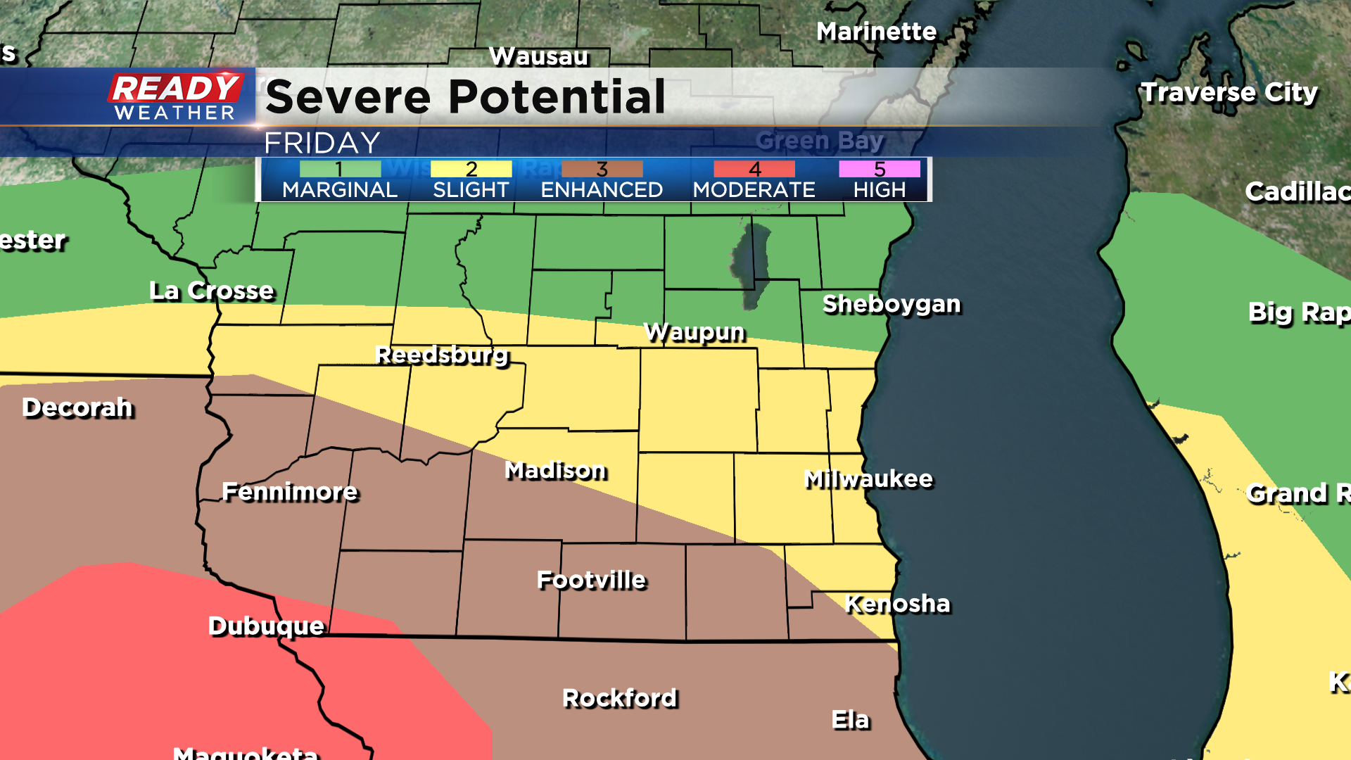
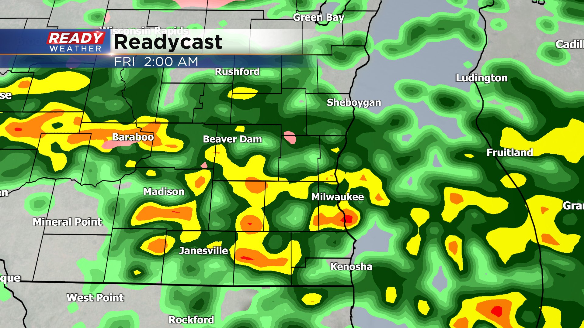
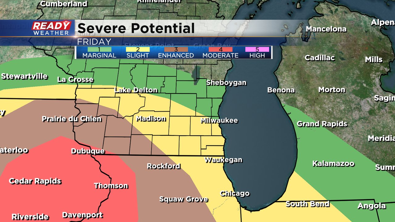
Scattered thunderstorms are still on track to push through overnight with a small hail threat in any storm that develops. The hail should remain below severe limits tonight, but the severe risk is increasing for Friday afternoon and evening. The level 3 of 5, Enhanced Risk, has been expanded from Paddock Lake to East Troy to Fort Atkinson. The level 2 of 5, Slight Risk, has also been expanded to include most of southeast Wisconsin except for far northern counties.
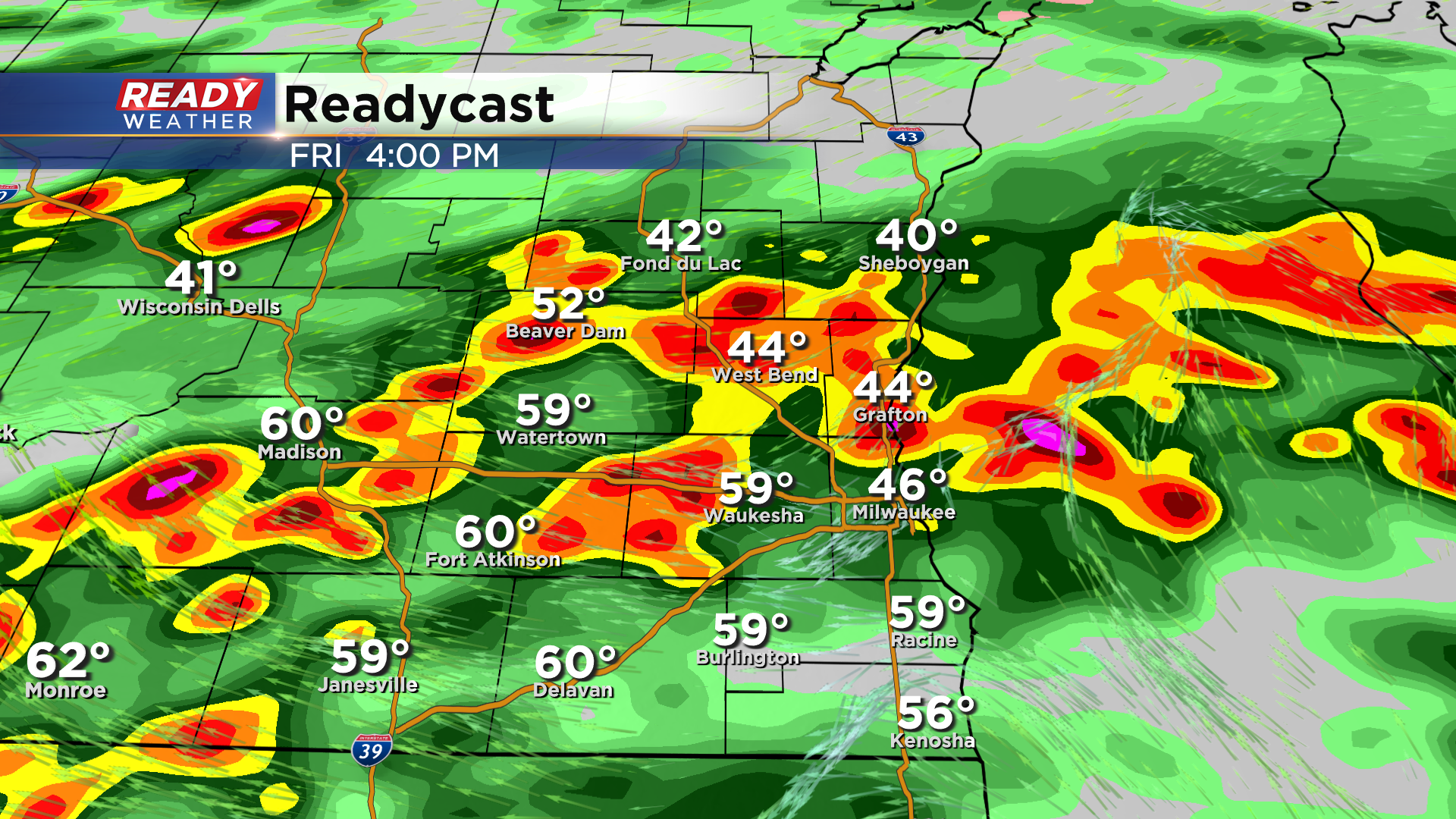
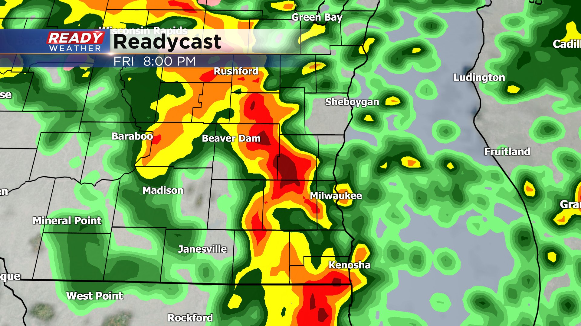
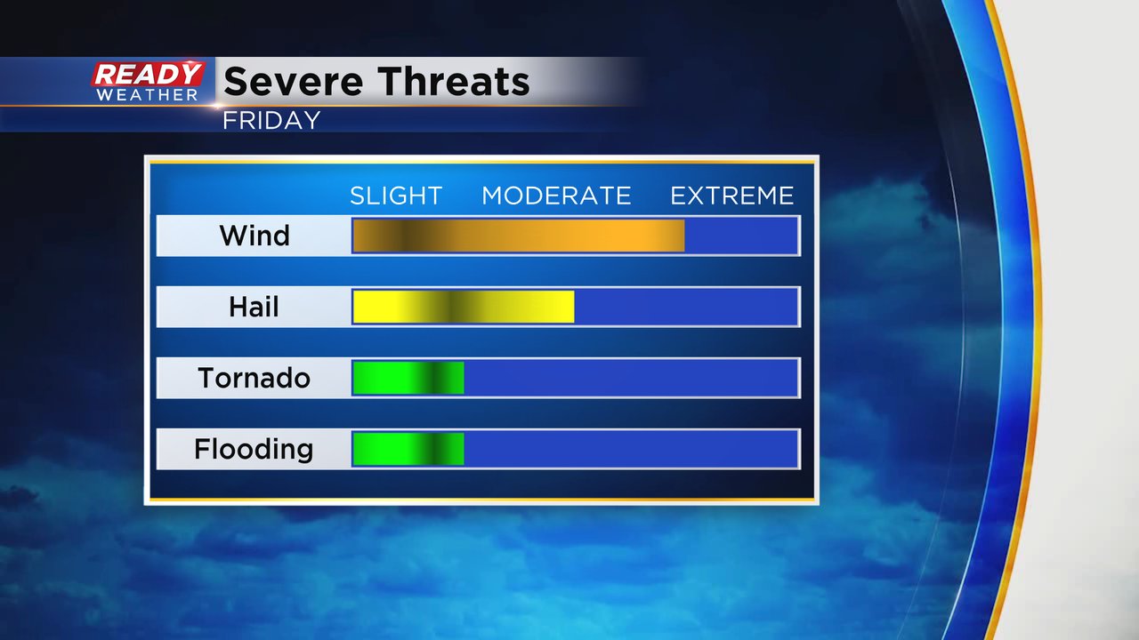
It's looking more likely that we'll have two rounds of strong to severe storms. Round one develops along and south of the warm front between 2-4pm Friday afternoon. Damaging winds and large hail are possible in these storms with isolated rotation.
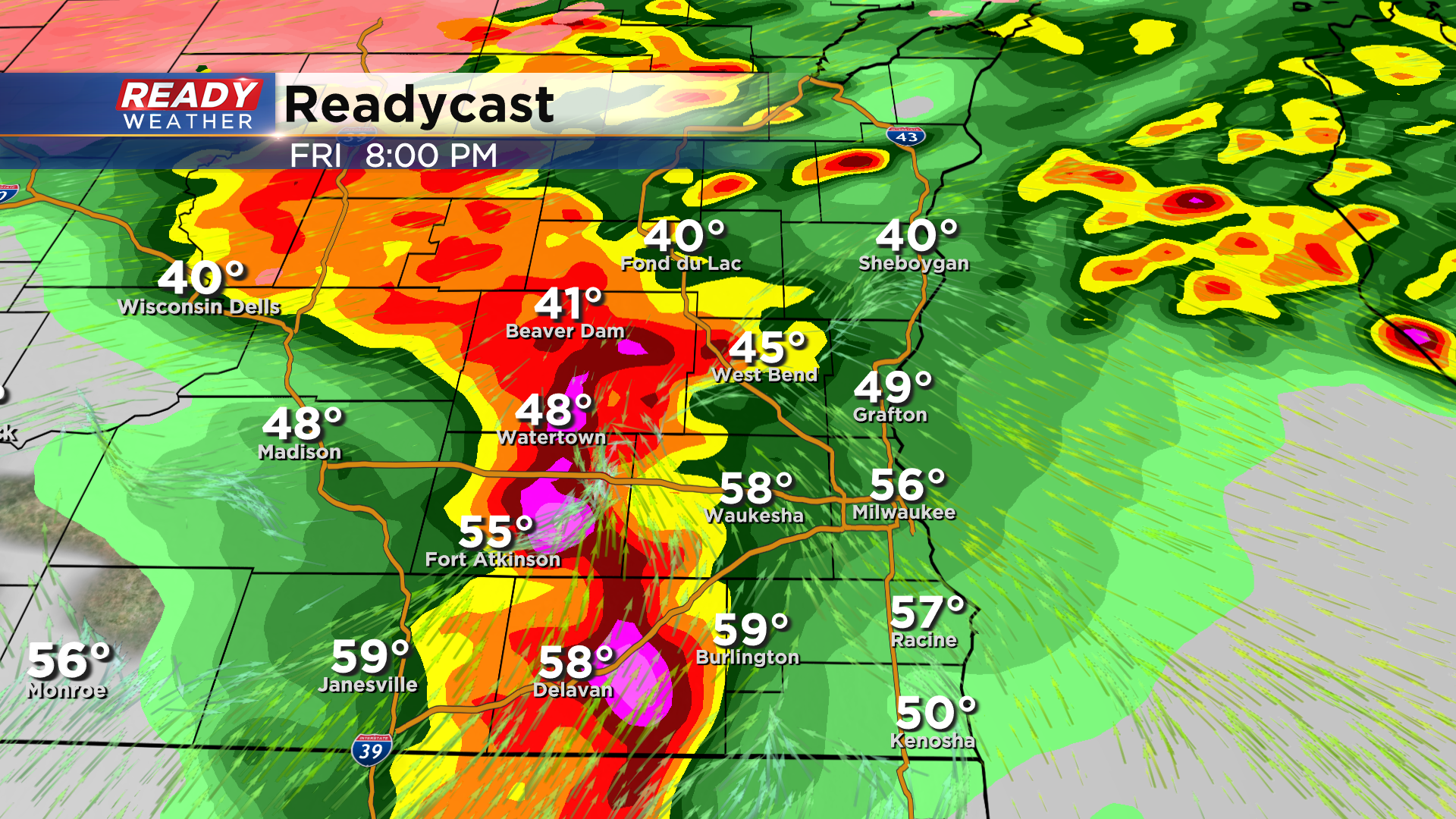
Round 2 of storms could be more intense as models are pointing at a squall line pushing through between 7-9pm. Damaging winds are likely in this line with a potential for embedded tornadoes. The best chance will be in the Enhanced Risk.
Severe storm threat ends by 10 pm. Download the CBS 58 Ready Weather App to track the latest updated and to get watches and warnings sent to your phone.
------------------------------------------------
A very dynamic storm system has its eyes set on southeast Wisconsin and most of the Midwest. After a little bit of quick sunshine Thursday morning we see the clouds increase with chances for snow and mix arriving in the afternoon. The best chance for mix and rain on Thursday will be north of I-94.
Around or a little after midnight Thursday night into Friday we see scattered showers and thunderstorms roll through southeast Wisconsin. A few of the storms could be on the stronger side with an isolated severe storm not ruled out with the chance for some hail.
We may see a few dry hours from Friday morning through around midday. There is some question whether we see a round of thunderstorms Friday afternoon. If we do they could be strong to severe. The better chance for severe storms will arrive Friday evening with a round of heavy storms rolling through.
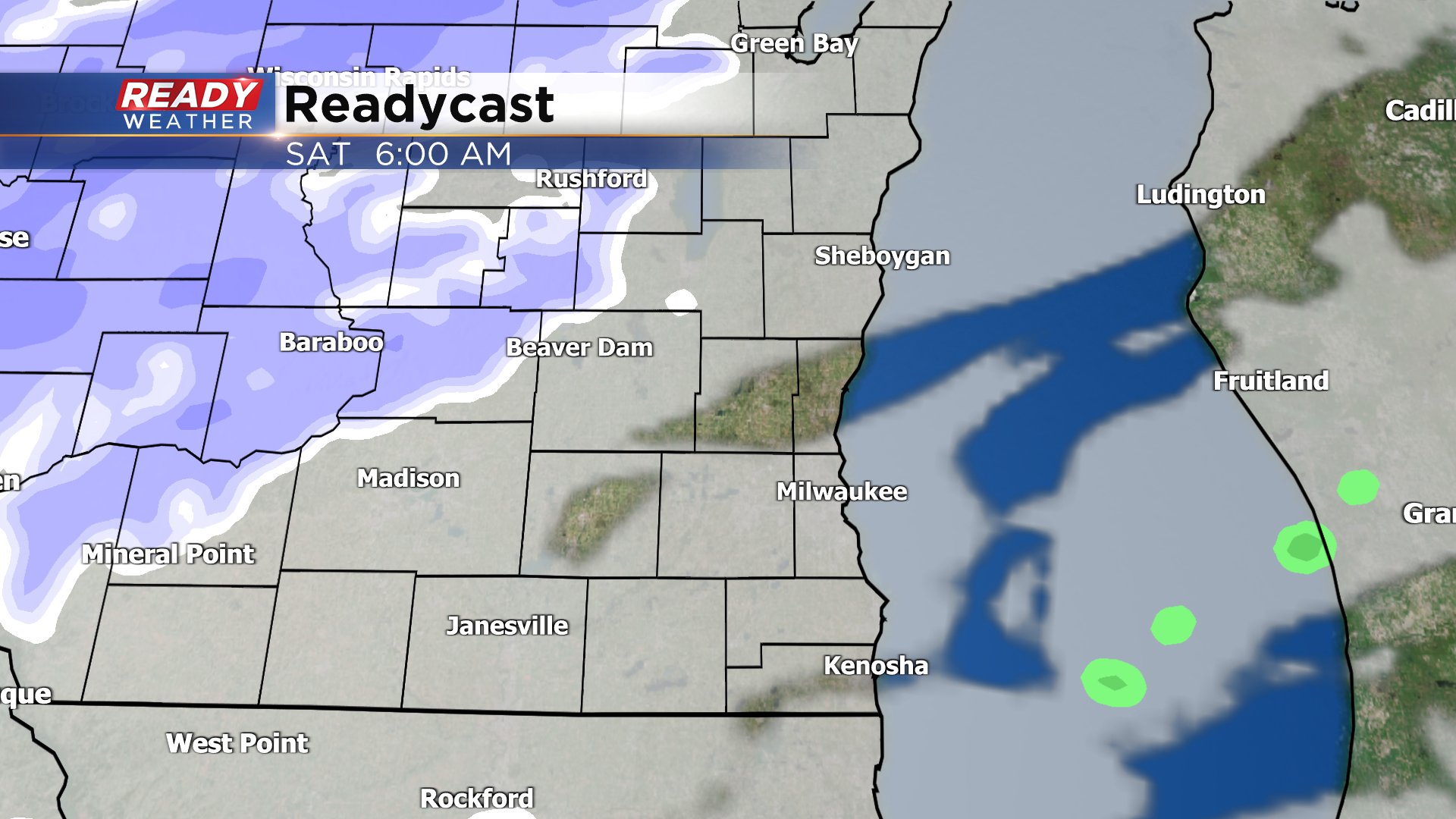
This whole storm system wraps up with a round of wet snow likely Saturday morning. Up to 1.5" of snow is a possibility before noon on Saturday.
While the severe risk on Friday looks best to our southwest where eastern Iowa and western Illinois are in the bullseye for a potential tornado outbreak, we do have the chance for severe weather locally. Areas around Milwaukee and to the west and south are under a Level 2 Slight risk for severe weather with a Level 1 Marginal risk north of there. The Level 3 Enhanced risk is not far away just to the west of Madison.
Locally, damaging wind is the main threat for any severe storms that develop. Some hail is definitely a possibility and an isolated tornado can't be ruled out.
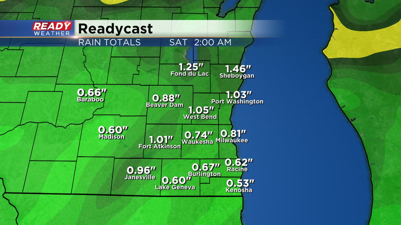
While the flooding risk is not very high, some heavy rain is expected. Rain totals for most hometowns will hover between a half to full inch with isolated areas that see strong thunderstorms getting 1.50". Expect ponding on some roadways during the heavier rains.'
Download the CBS 58 Ready Weather app to track the dynamic forecast from Thursday afternoon through Saturday morning.