Drying out with building heat and humidity to end the week
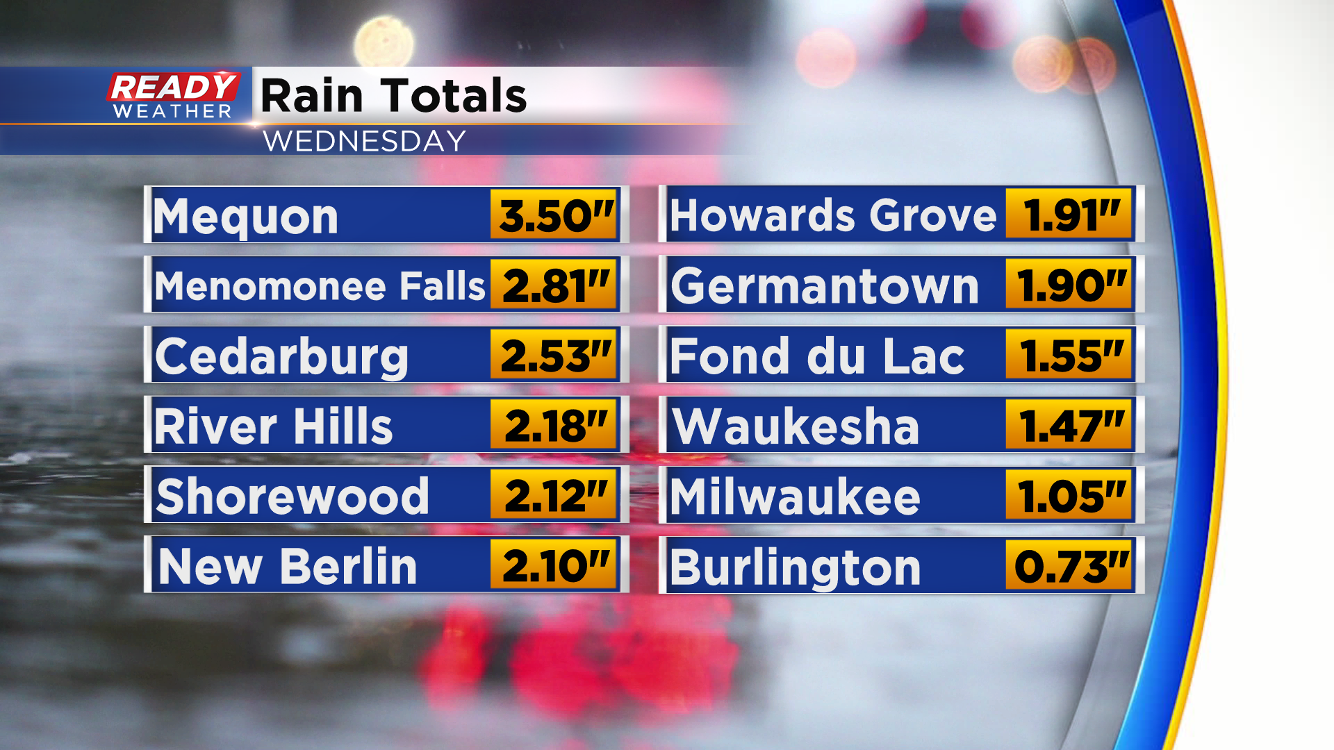
Thunderstorms produced quite a bit of soaking rain across southeastern Wisconsin yesterday, with most spots picking up a healthy .50-1” of rain. The bullseye was across parts of northern Milwaukee, southern Ozaukee, and northeastern Waukesha counties where 2-3.5” of rain fell over the span of a couple of hours.
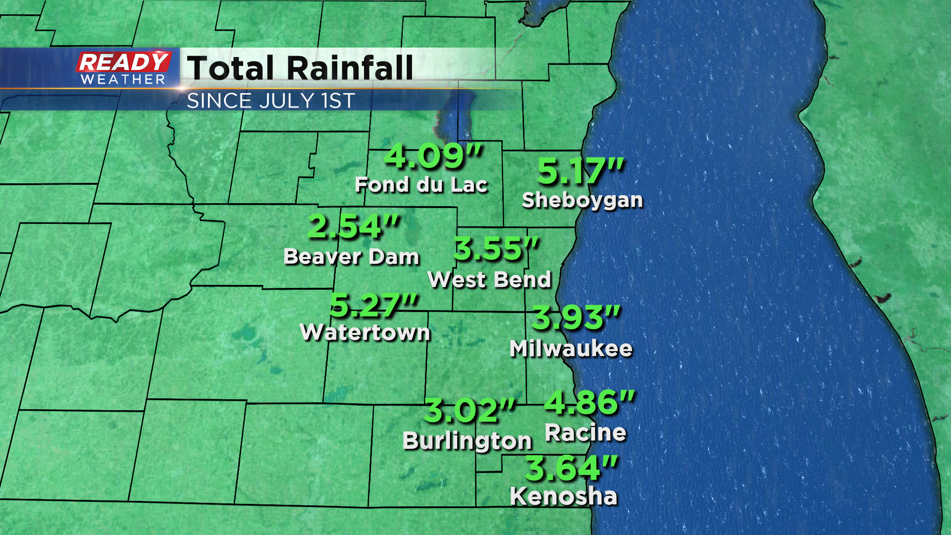
Add last night’s rain onto the heavy rain we saw last week, and a majority of southeast Wisconsin has picked up 3-5” of rain over the last week and a half.
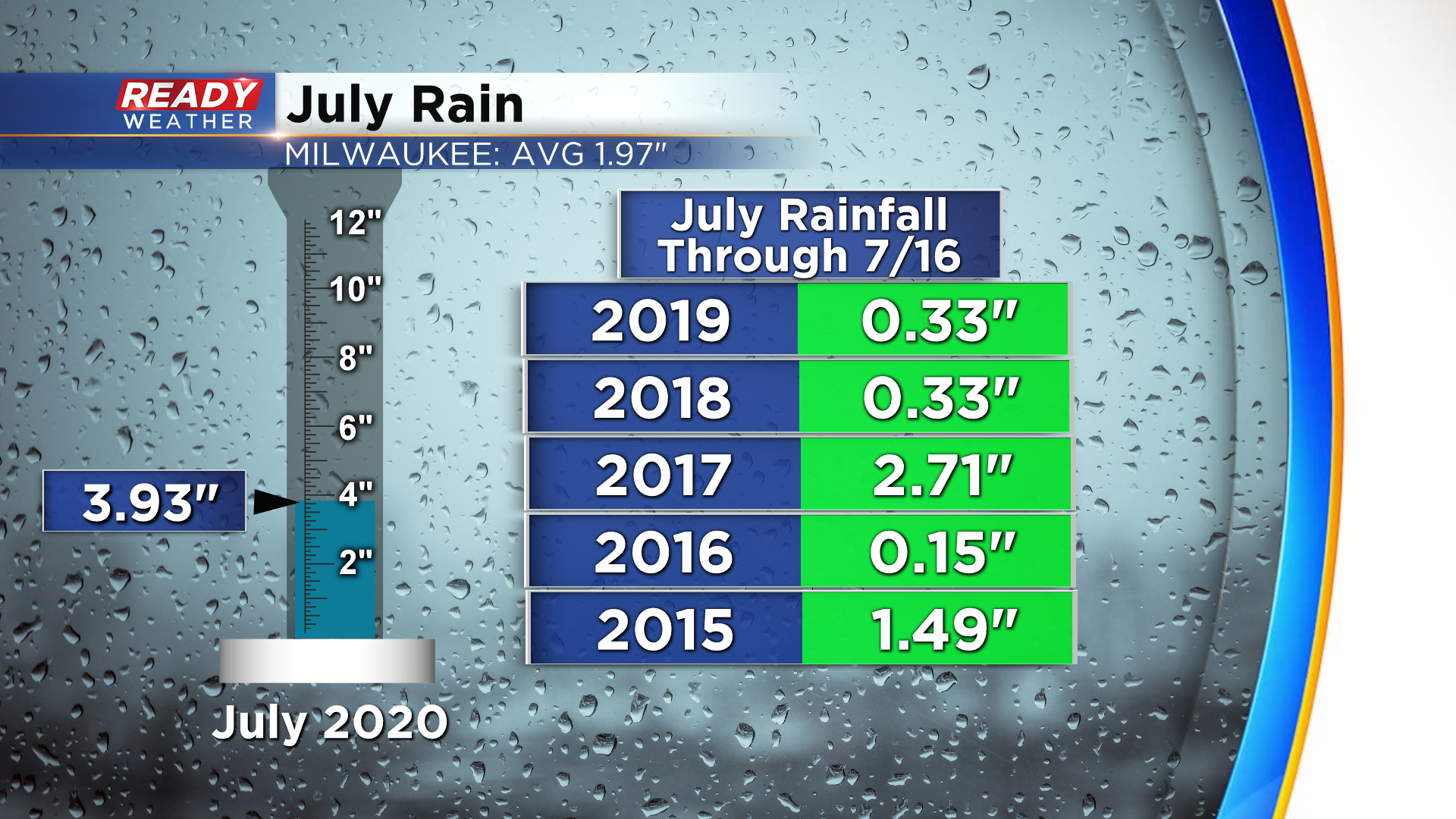
Milwaukee has had 3.93” of rain so far this month, which is more than we normally pick up for the entire month of July (3.67”). This is way more rain than we had at this point in July over the last two years. To date, this is Milwaukee's 6th wettest July on record.
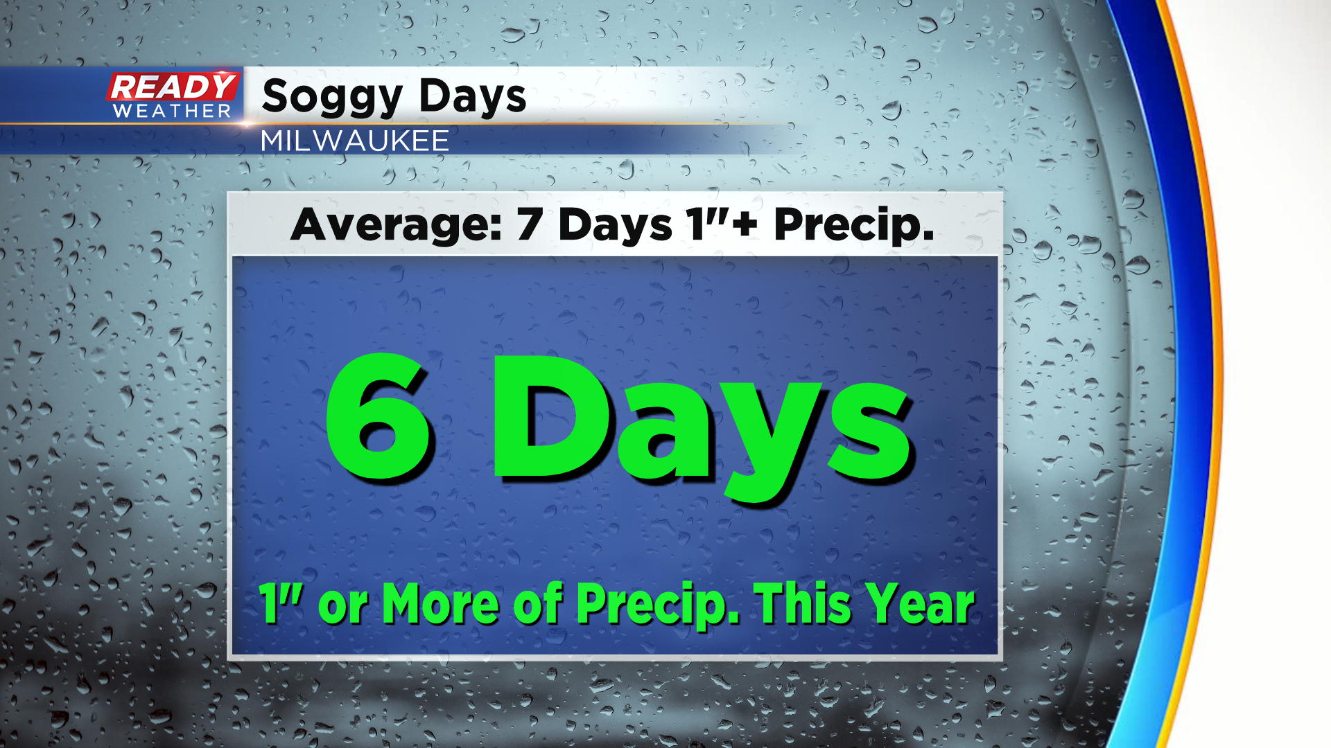
Milwaukee picked up 1.05” of rain yesterday, which marks the 6th time this year we’ve had over an inch of precipitation in one day. Overall, Milwaukee is 4.17" above normal for precipitation this year.
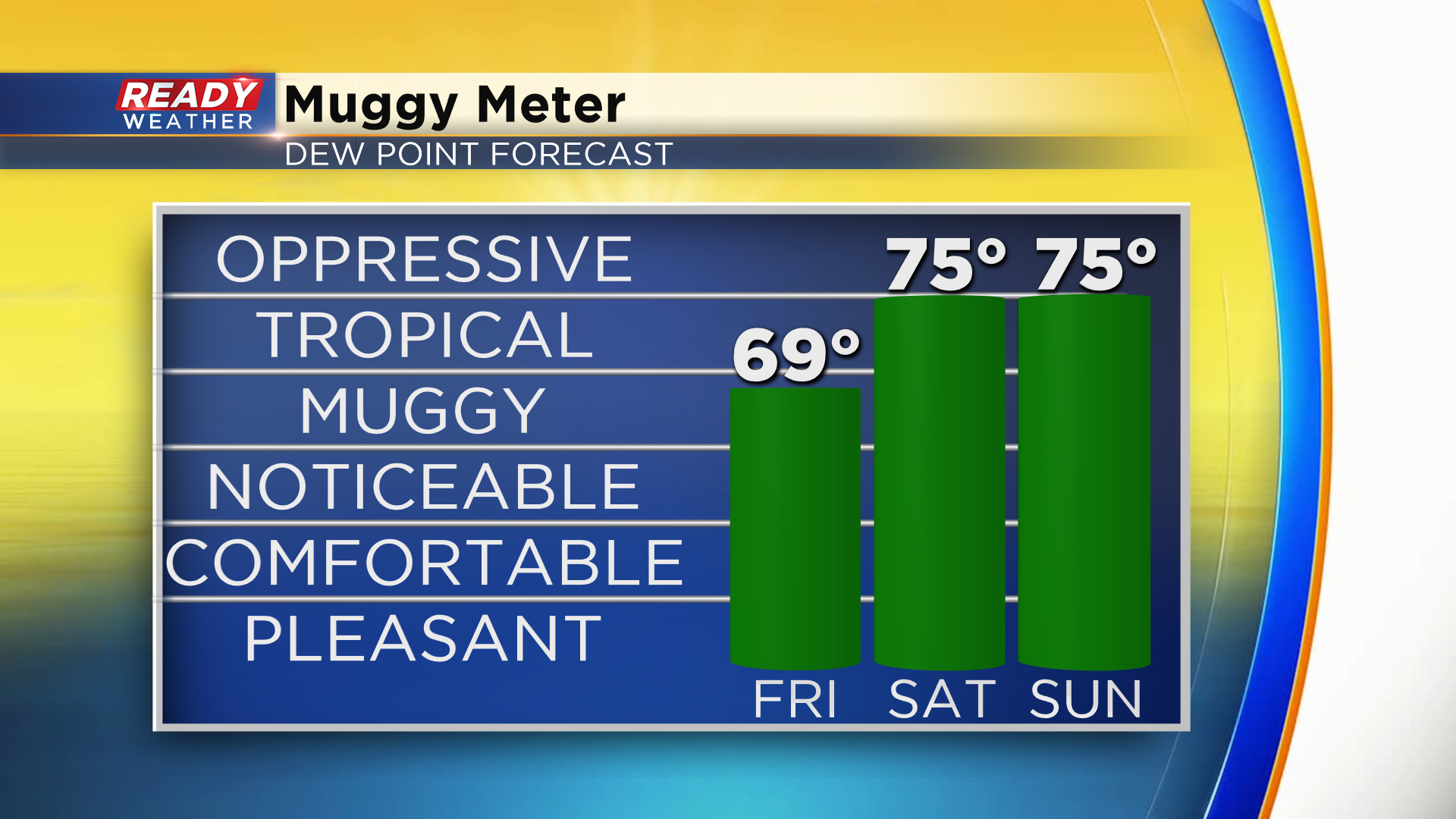
Dry weather returns to end the work week, but higher levels of humidity will be building back into the area as we head into the weekend. The northeast breeze and dew points in the mid 60s will make today the most comfortable day for the rest of the week. By Saturday, dew points will be oppressive, and combined with temperatures in the low 90s it’ll feel like 100 degrees across most of southeast Wisconsin.
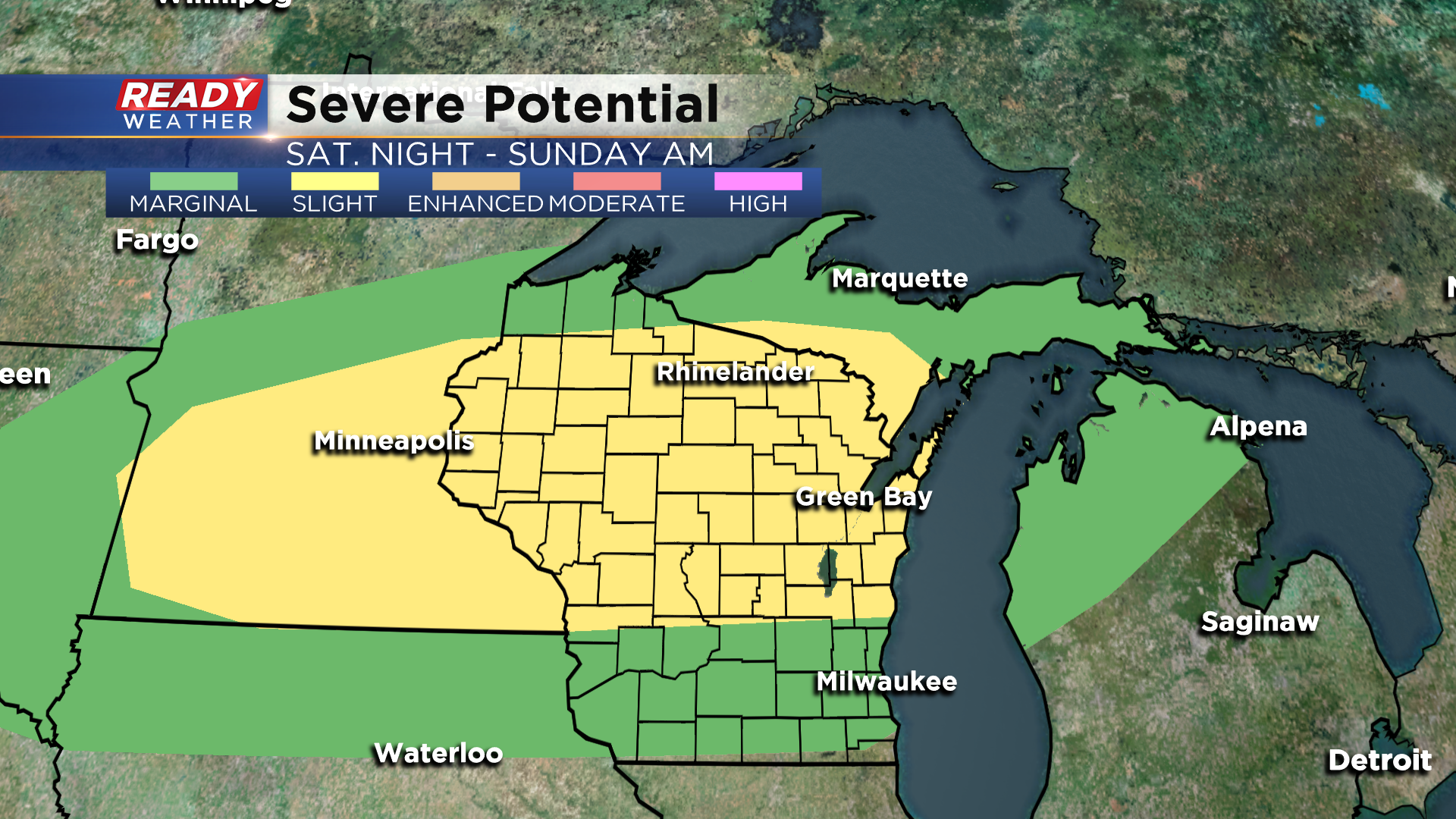
That heat and humidity could lead to a line of strong to severe storms Saturday night into early Sunday morning. Currently there's a level 2, Slight Risk, for severe storms for the northern half of the state, including Fond du Lac and Sheboygan counties.
Check back for updates over the next few days regarding the heat and severe storm chances, and download the CBS 58 Ready Weather App to see when the heat and humidity will break.
