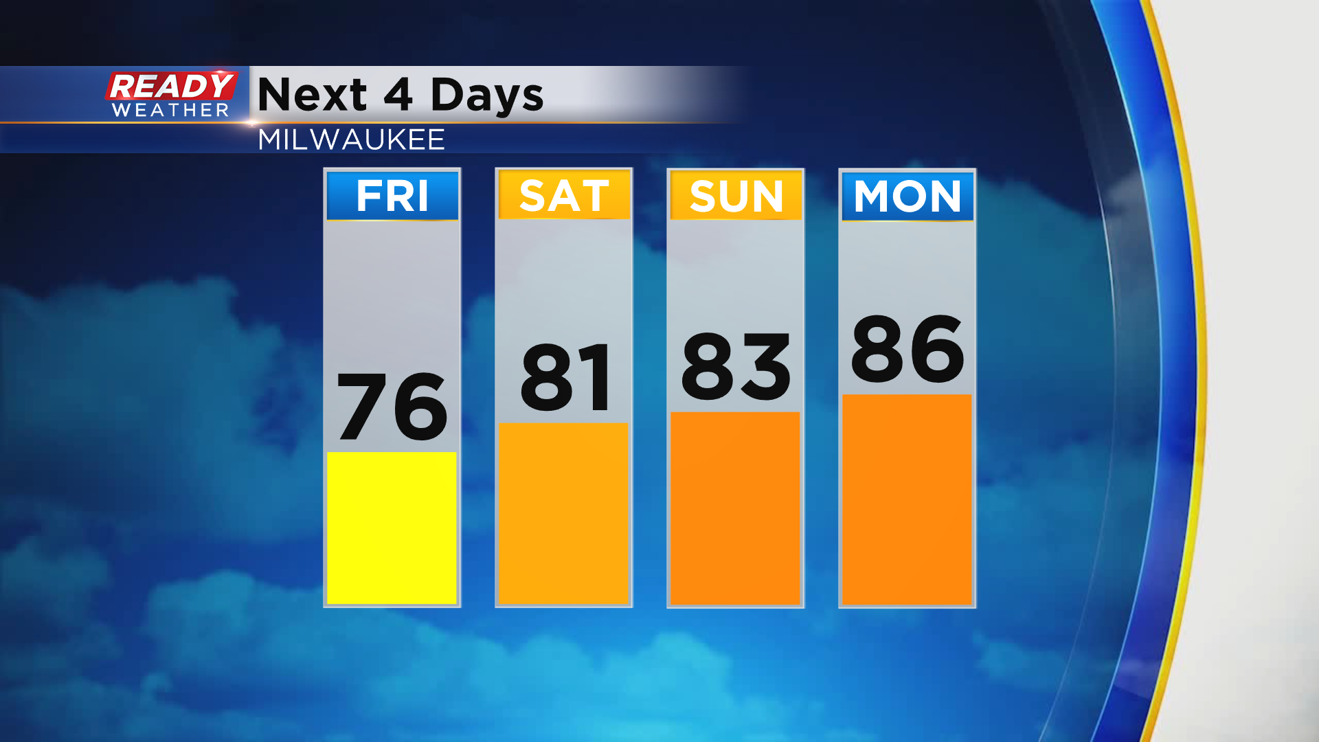
Drying out to end the week, but it won't stay that way all weekend


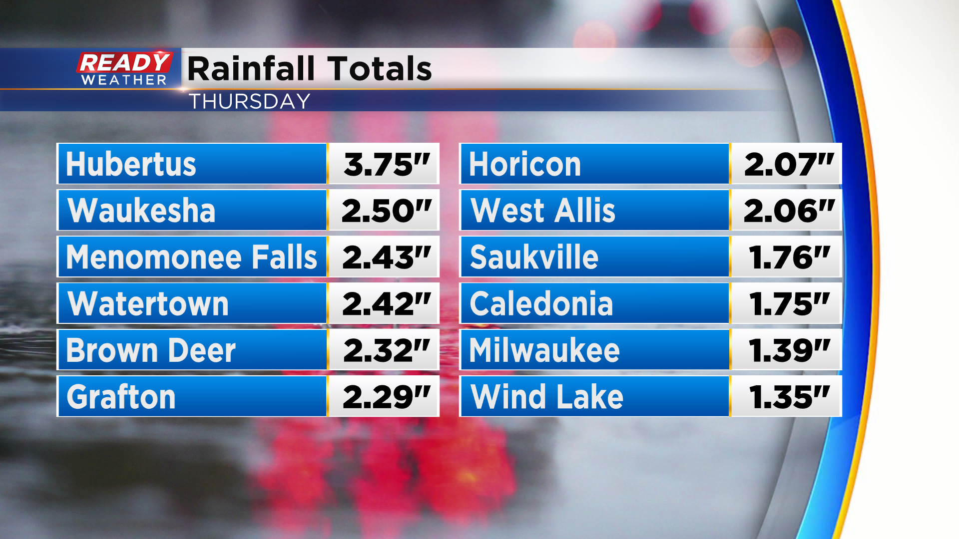
Some impressive rain fell across parts of southeast Wisconsin on Thursday with a large swath of 1.50-2.50". Hubertus was the big winner with nearly 4" of rain!
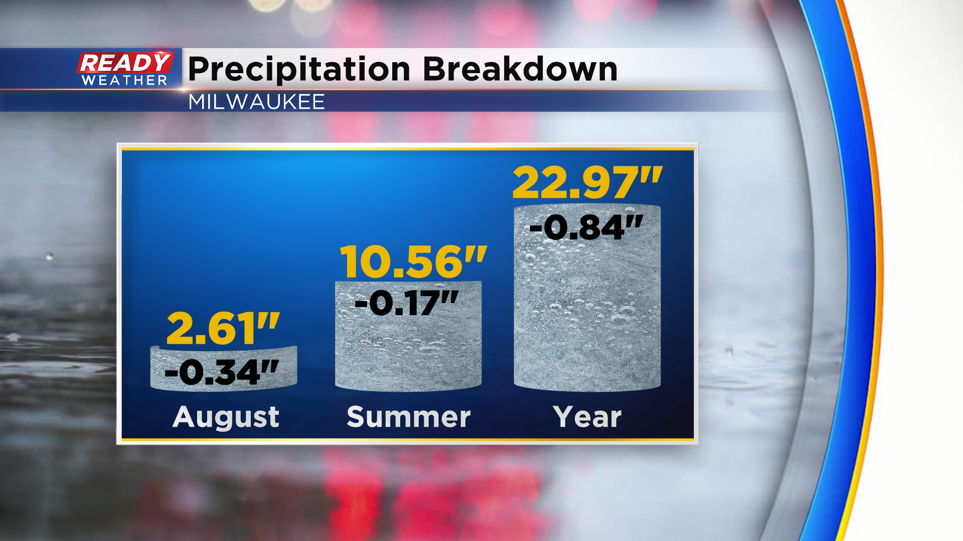
The 1.39" of rain that fell in Milwaukee basically eliminated our rainfall deficit for the month and the summer. It was also our second wettest day of 2022.
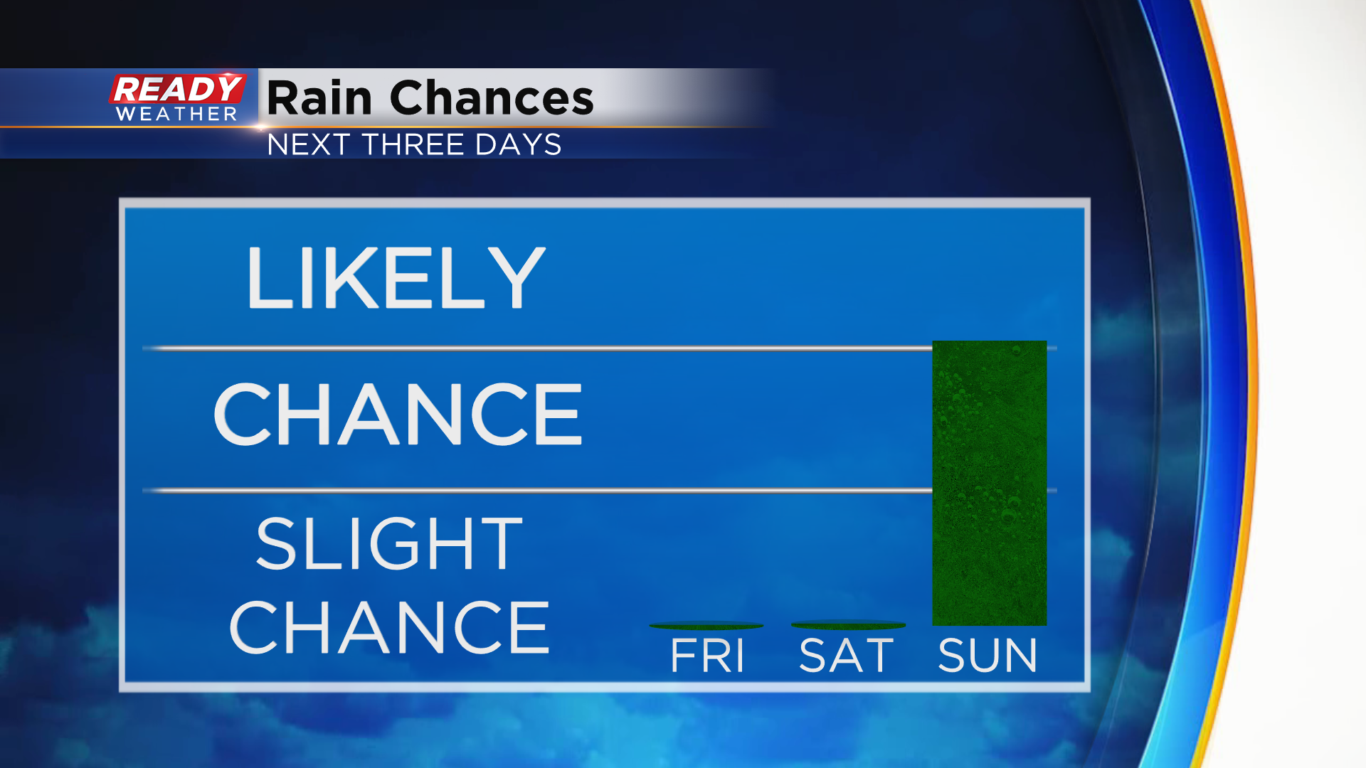
High pressure building into the Upper Midwest will clear skies out today and keep us dry through Saturday, but scattered storm chances return on Sunday.
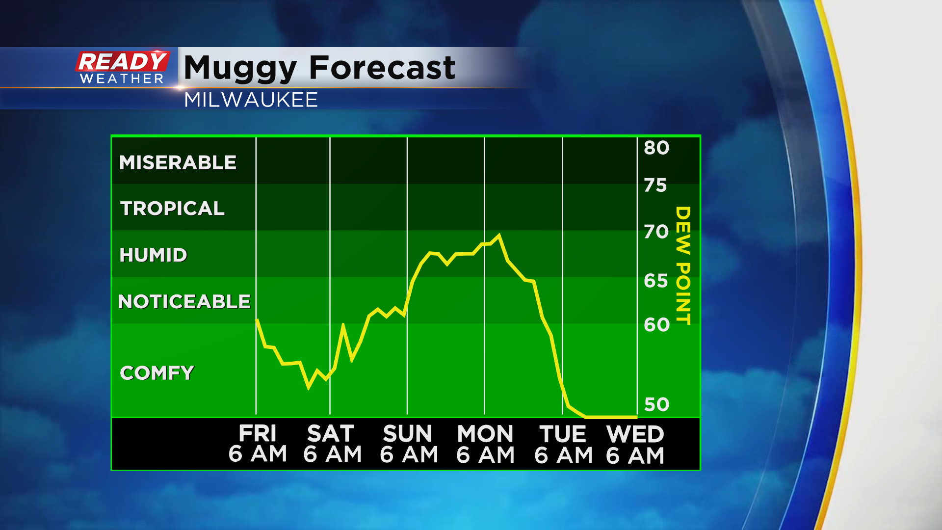
That's when the humidity will return as well with dew points rising back into the upper 60s. It'll stay humid into Monday, leading to a chance for more storms as the cold front moves through later in the day.
If you're a fan of the cooler weather, enjoy today because temps will rise back into the low to mid 80s through the weekend into the start of next week.
Download the CBS 58 Ready Weather App to see the full forecast.