Dense fog Wednesday morning, then wet snow Thursday into Friday


A dense fog advisory has been issued for all of southeast Wisconsin Wednesday morning. Visibility is down to only a few hundred feet in some locations. With continued clouds above the fog and a very light wind we likely see the fog linger through at least late morning if not beyond. The advisory lasts until 10 AM.

Thursday will start dry but by the afternoon and evening we will see some rain roll into the area. Some snow can also mix in Thursday evening as cold air starts to roll in. Thursday night that mix will continue to switch over to all snow and by the Friday morning commute we see moderate mix or snow falling. Roads for the most part will be slushy but could be snow covered at times.
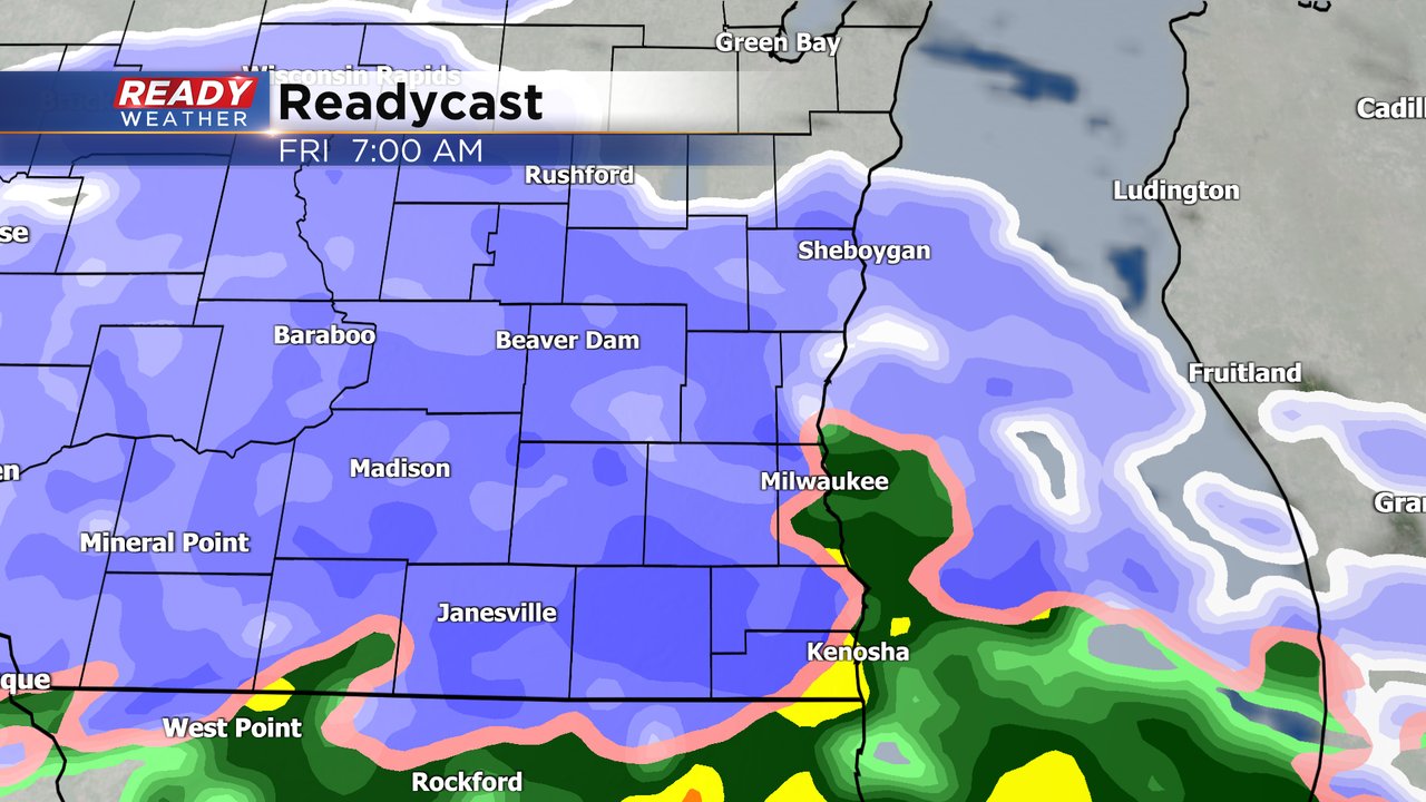
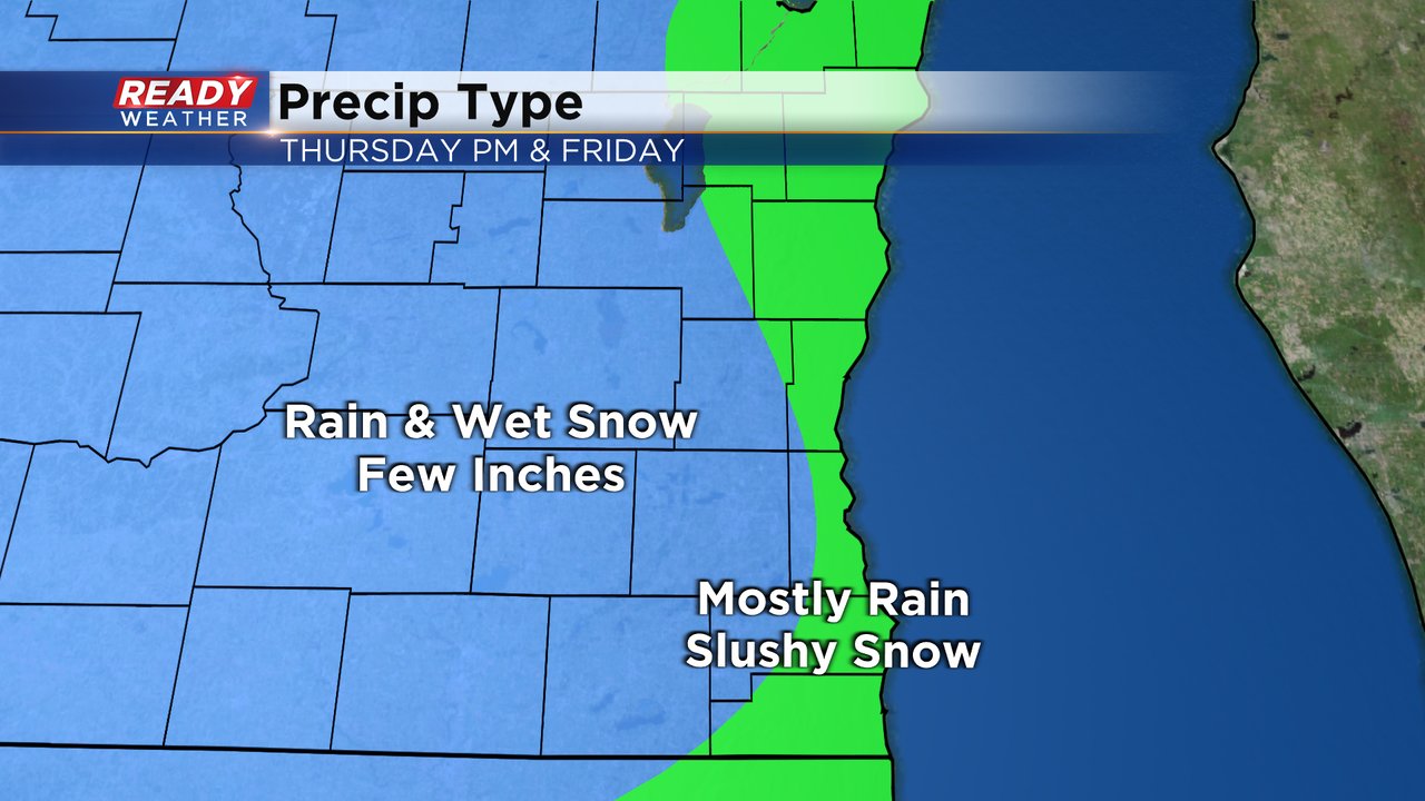
With warm temps and an east wind I think it will be hard for lakeside communities to switch over completely to snow. From Sheboygan through Milwaukee to Kenosha we likely see more of a mix during the entire event but some slush is likely as well. Inland counties have the best chance to see a few inches of snow. This will be a heavy, wet, slushy, messy snow.
Download the CBS 58 Ready Weather app to track the fog and the round of mix and snow.