Cooler and less humid air moves in after tonight's small storm chance


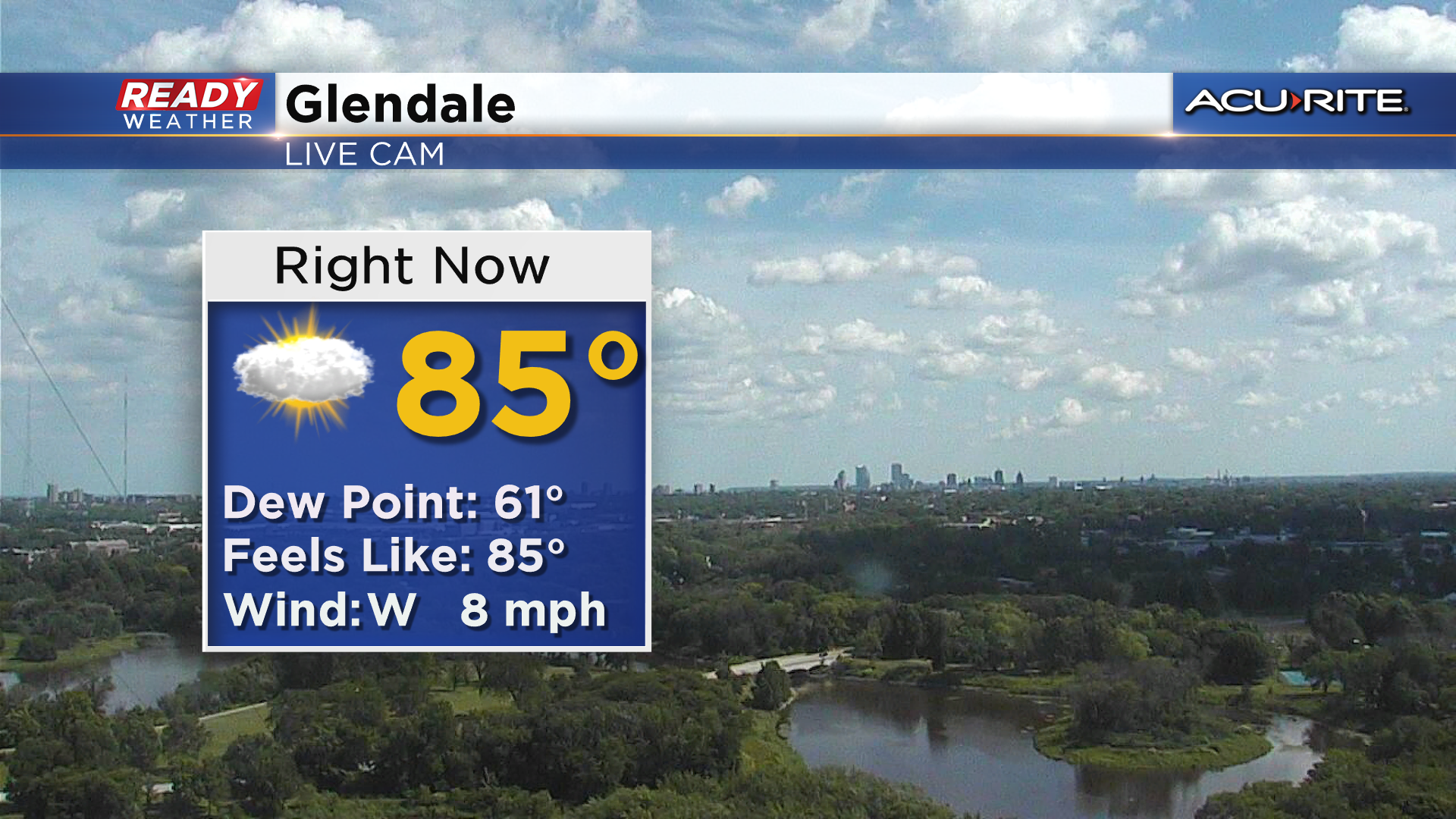
It's been a fantastic day across the area with sunny to partly cloudy skies, a nice breeze, and a bit more comfortable levels of humidity as dew points have dropped into the low to mid 60s.
As we head into the evening, our attention is on the severe storms ongoing in southern Minnesota and northern Iowa.
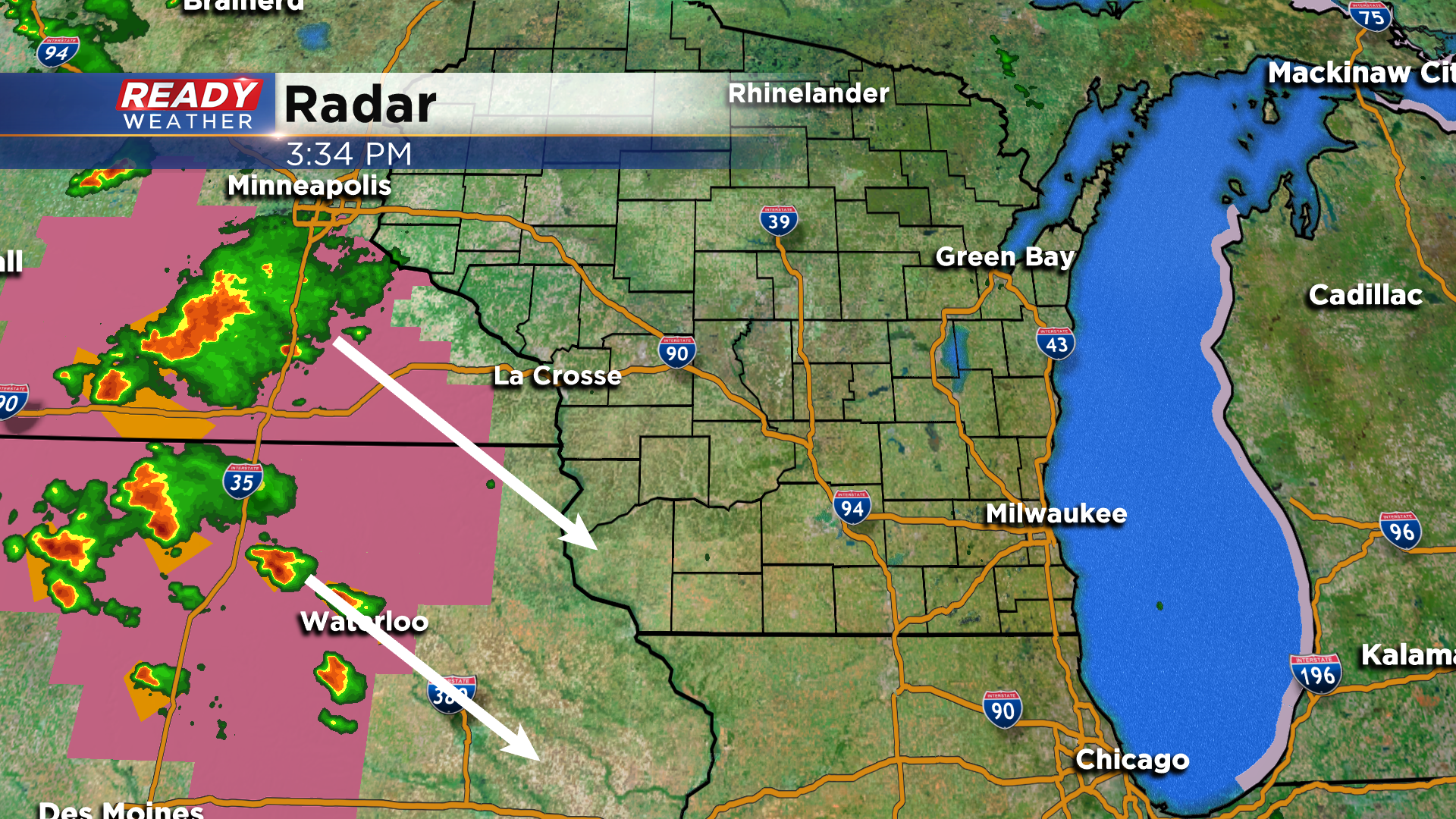
These clusters of storms will primarily track southeast into northern Illinois and miss most, if not all, of southeast Wisconsin. The best chance for any stronger storms will be west of a line from Lake Geneva to Fort Atkinson after 8 pm, but that's only a 30% chance.
While the severe weather will likely stay out of southeast Wisconsin, a couple of isolated showers or storms may also pop up before 1 am as the cold front slides through the area.
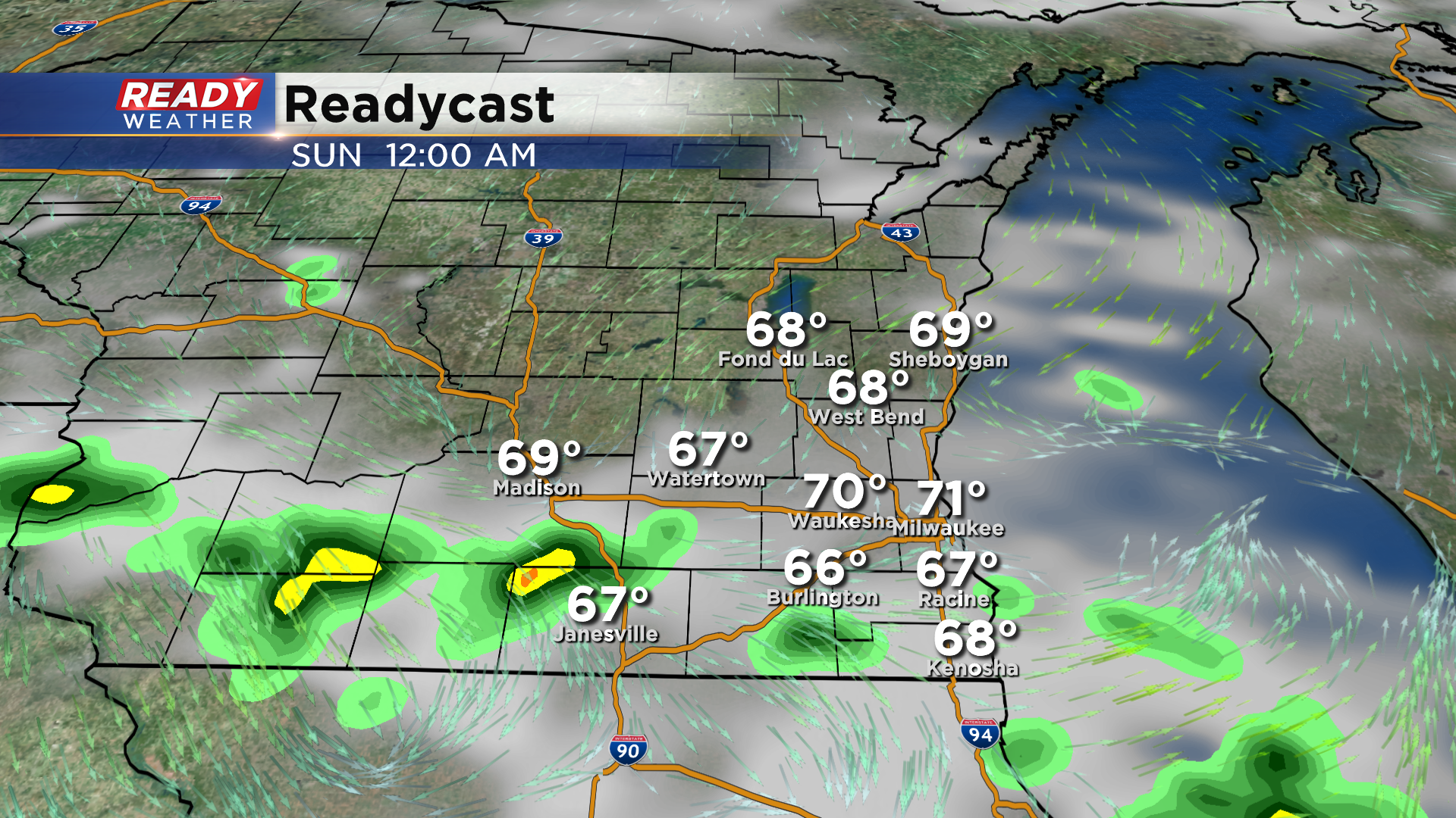
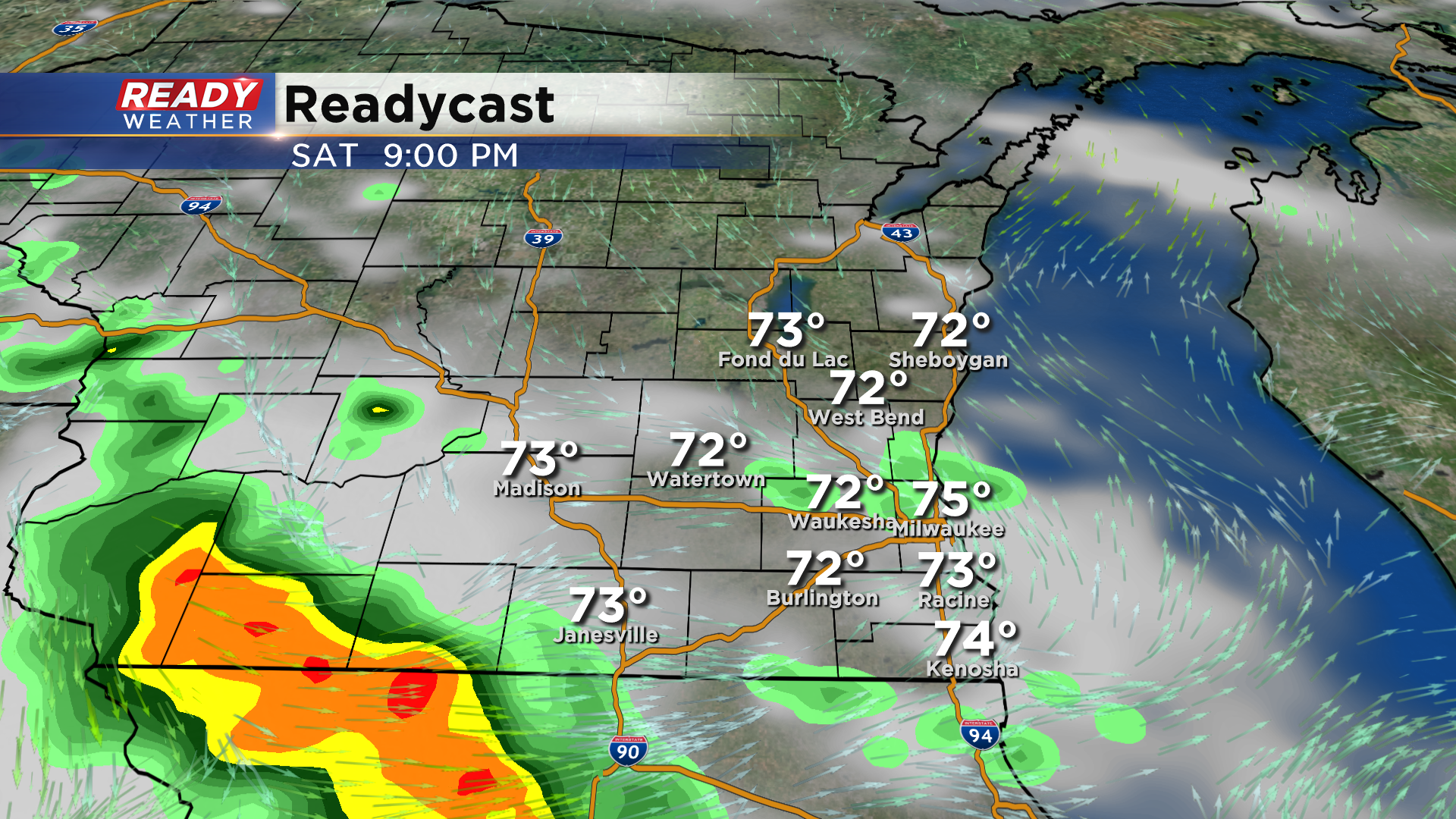
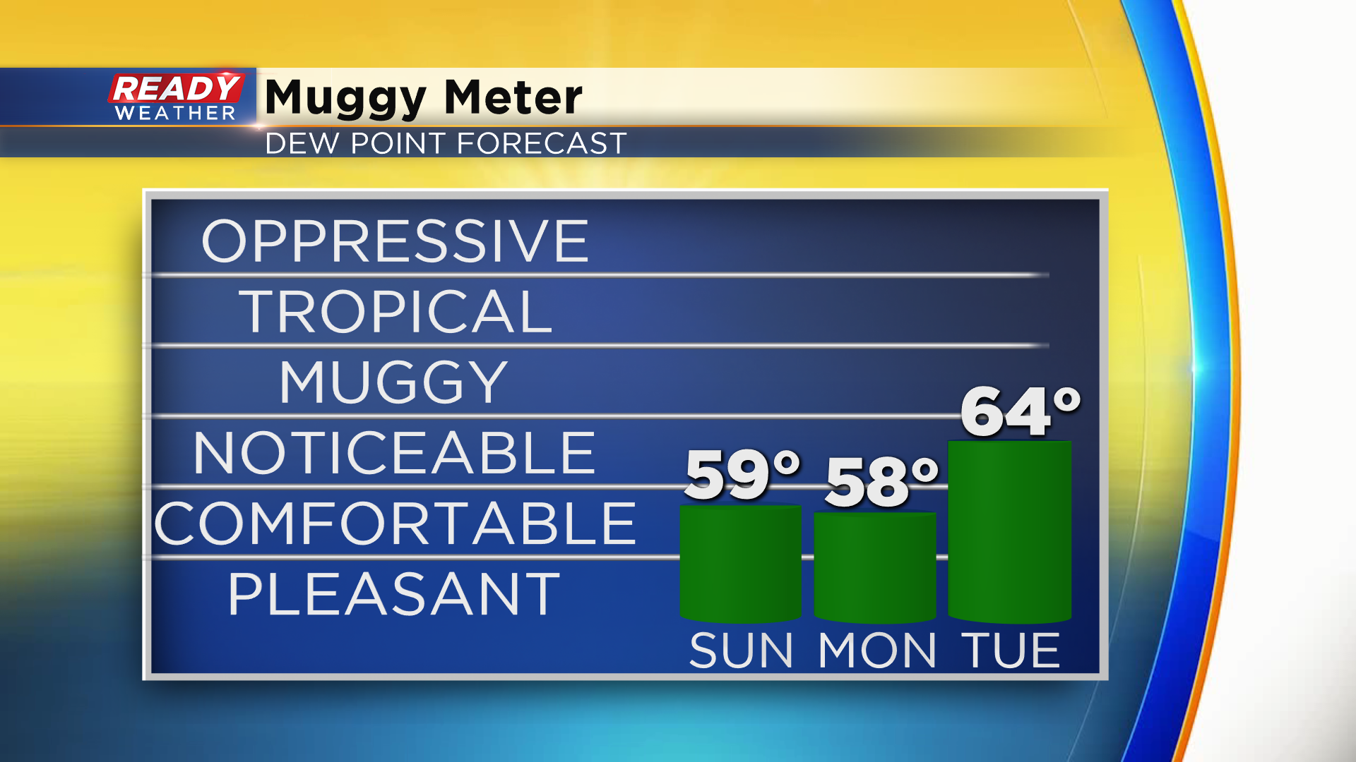
That cold front will usher in cooler and less humid air for Sunday and Monday with dew points dropping into the upper 50s. You'll notice the humidity return on Tuesday, but right now it doesn't look as bad as last week.
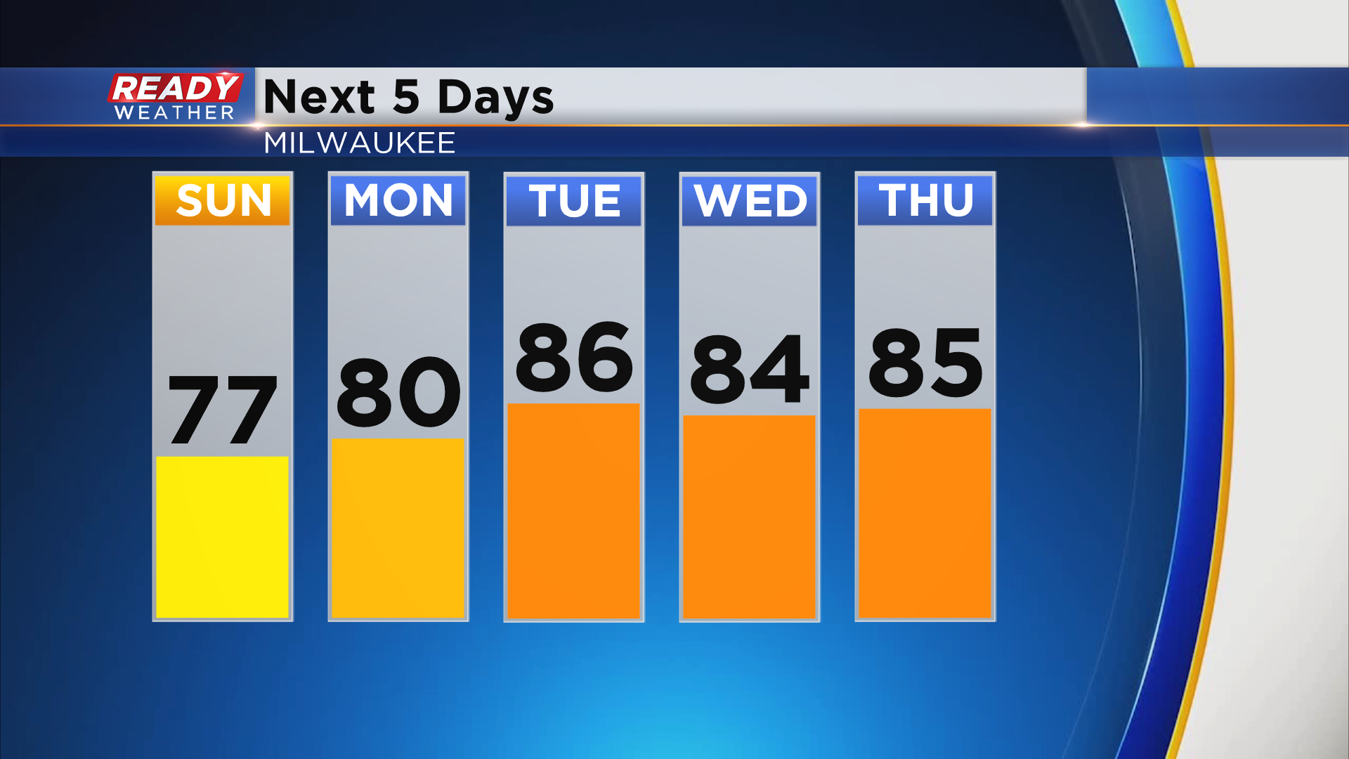
Today marked our 15th day in a row with highs in the 80s. We'll likely see that streak end tomorrow as highs will only climb into the mid to upper 70s. Mid 80s return by the middle of next week.
Download the CBS 58 Ready Weather App to see if that warming trend will continue into next weekend.