Comfy start to the week with low storm chances before the heat returns


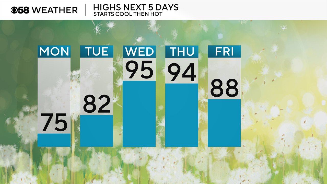
The comfy air returned to southeast Wisconsin on Sunday after a warm and sticky Saturday. Monday will continue the comfy trend with highs reaching into the 70s and low humidity. Highs return back to average on Tuesday in the low 80s but check out that heat for the middle of the week with highs hanging out in the mid 90s Wednesday and Thursday. Temps stay warm for the weekend in the upper 80s.
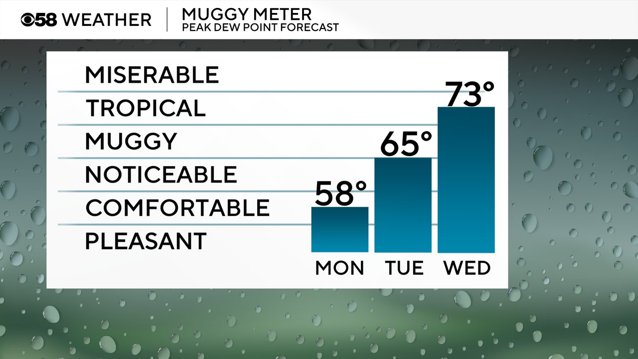
Humidity levels start comfy on Monday but the mugginess starts to return Tuesday with dew points in the 60s. The bigger humidity arrives with dew points in the 70s for the middle of the week. The combination of heat and humidity will push feel like temps well over 100 both Wednesday Thursday. Heat alerts will likely be issued with an Extreme Heat Watch potentially issued as early as this afternoon.
In terms of rain and storm chances, it's one of those weeks where every day has at least a 10-20% chance for rain. Monday looks primarily dry but Tuesday has a slight chance for some showers and storms. Late Tuesday evening looks best for any rain, if it happens at all, into Wednesday morning, but even then the chance is pretty low. Most of Wednesday looks dry after the early morning hours.

Better chances for rain arrive Thursday and Friday. Download the CBS 58 Weather app to track the rain, heat and humidity.