


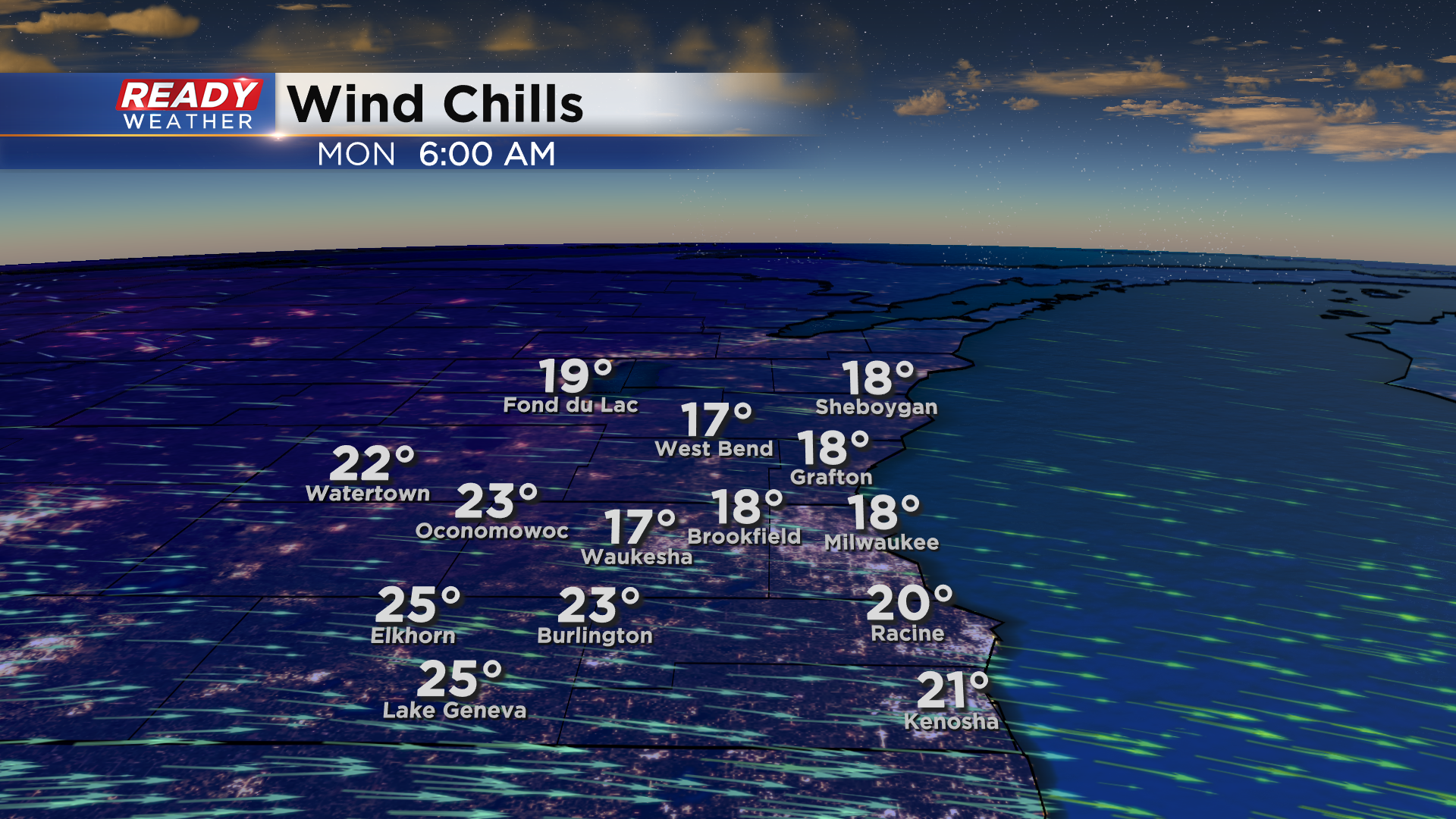
The snow has ended across southeast Wisconsin and a few breaks have developed in the cloud cover this evening. A few more breaks are expected overnight, allowing temps to drop into the mid to upper 20s area-wide by sunrise Monday morning. Factor in the wind and it'll feel more like the teens as you head out the door to work and school.
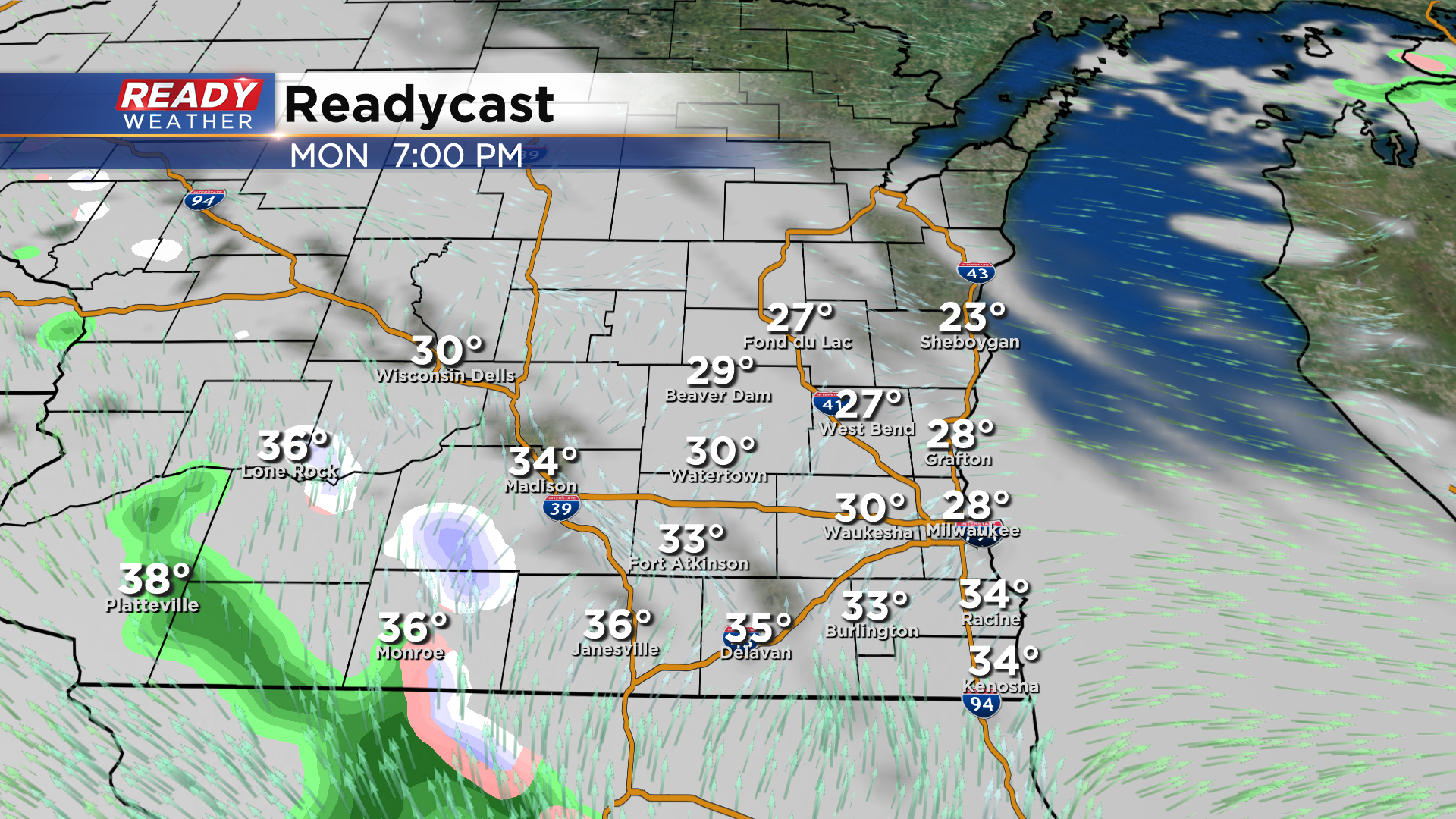
After some morning sunshine, clouds will thicken up throughout the day ahead of a weak disturbance that looks to drop from Minnesota into northern Illinois. A majority, if not all, of the rain and snow showers will miss us to the southwest, but we can't rule out a few flurries in Walworth or Jefferson counties late afternoon into the early evening.
Temperatures will start to warm on Tuesday behind this disturbance, reaching the low 50s during the day the mid 50s in the evening. Temps start the day Wednesday in the 50s, but a cold front will drop temps into the 40s by the afternoon.
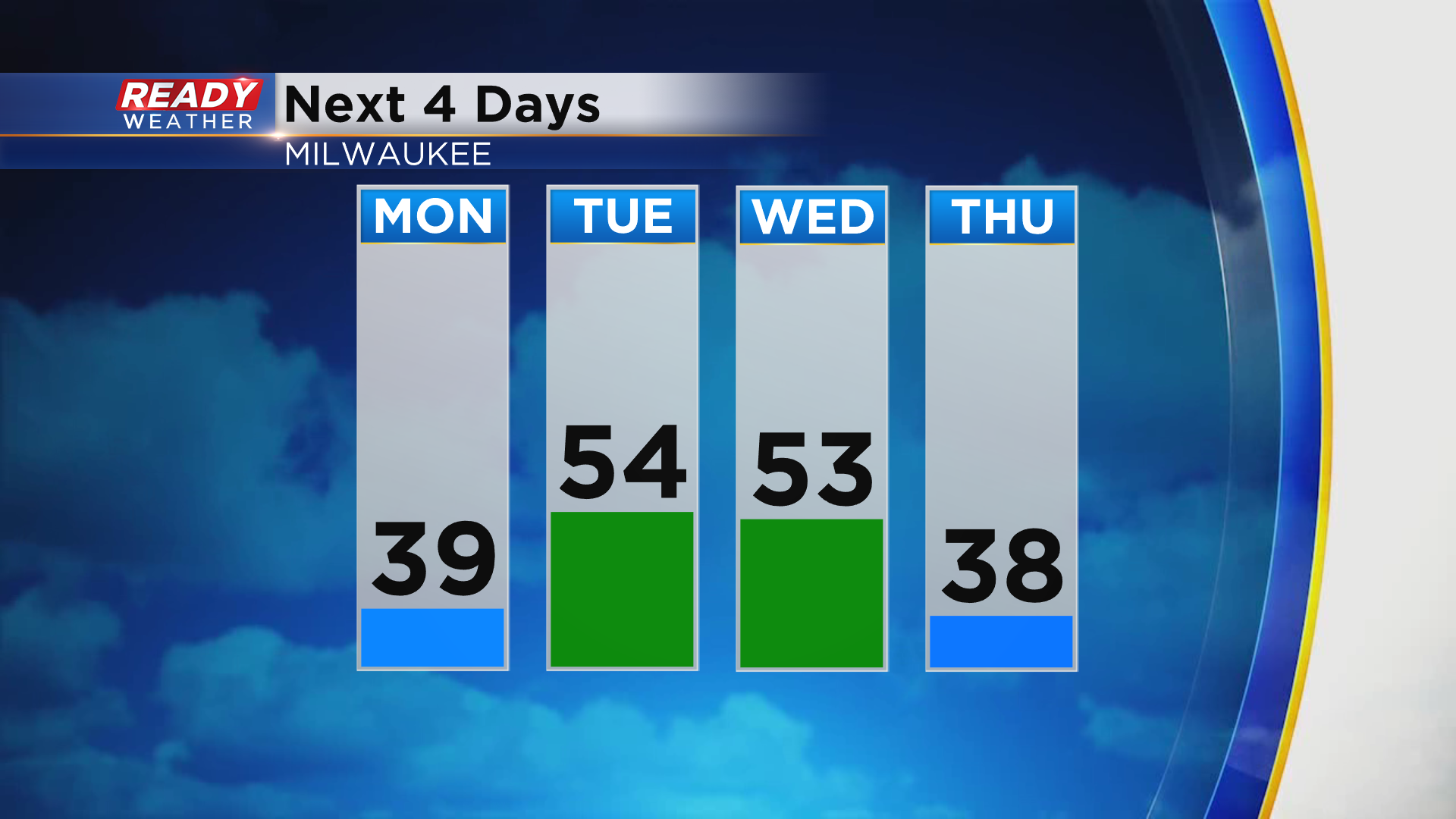
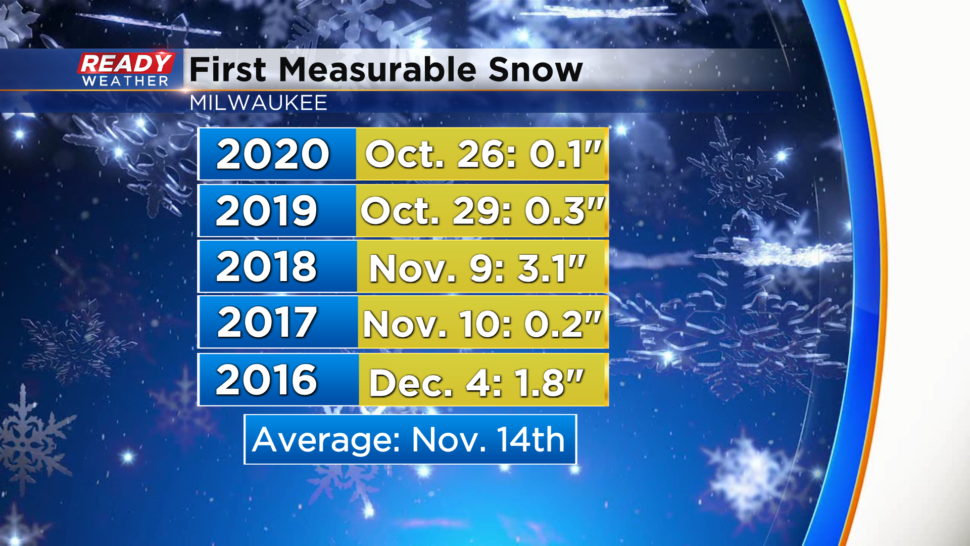
That front will likely bring some light showers through southeast Wisconsin on Wednesday, but temps will be too warm for snow. Milwaukee is still waiting for it's first measurable snow, but we're not running late on that yet. Today was the average date of our first measurable snowfall.
Download the CBS 58 Ready Weather App to see if temps rebound heading into next weekend.