Cold front brings flurry chance and sub-zero wind chills


Monday was about as average a day as they come this time of year. The high hit 32° which is exactly the average high and as of 8 a.m. the low Tuesday morning hit 19° which is also average. Tuesday will also see highs hovering around freezing but then a cold front pushes in bringing us a brief blast of cold air for Wednesday.

Highs on Wednesday will struggle to get out of the teens but the cold is short-lived. By Thursday we are back above-average and low 40s return for the weekend and last through most of next week.
As Tuesday evening's cold front passes it could spark a few flurries. No real accumulation is expected but don't be surprised if you see a few flakes from around 5-8 p.m. Not everyone will see it but an isolated dusting isn't out of the question for those that do.

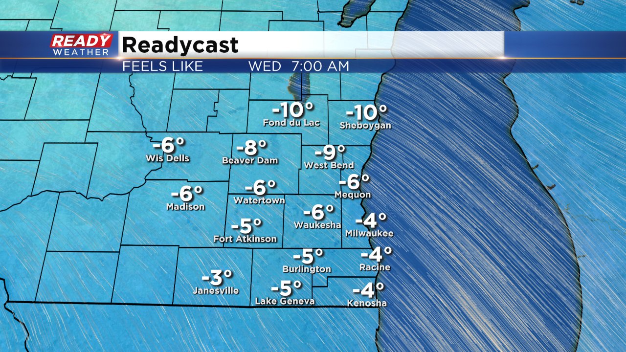
Low temps Wednesday morning will be in the single digits in many spots, potentially the coldest of the season. With a breezy wind out of the northwest wind chills Wednesday morning will be in the single digits below-zero.
Overall mild air returns for the week of Christmas with little to no chance for rain or snow. Download the CBS 58 Ready Weather app to see the full 10-day forecast.