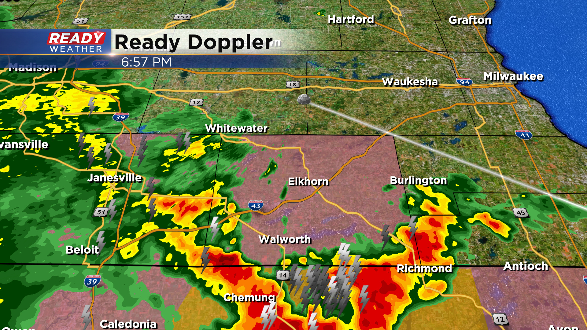
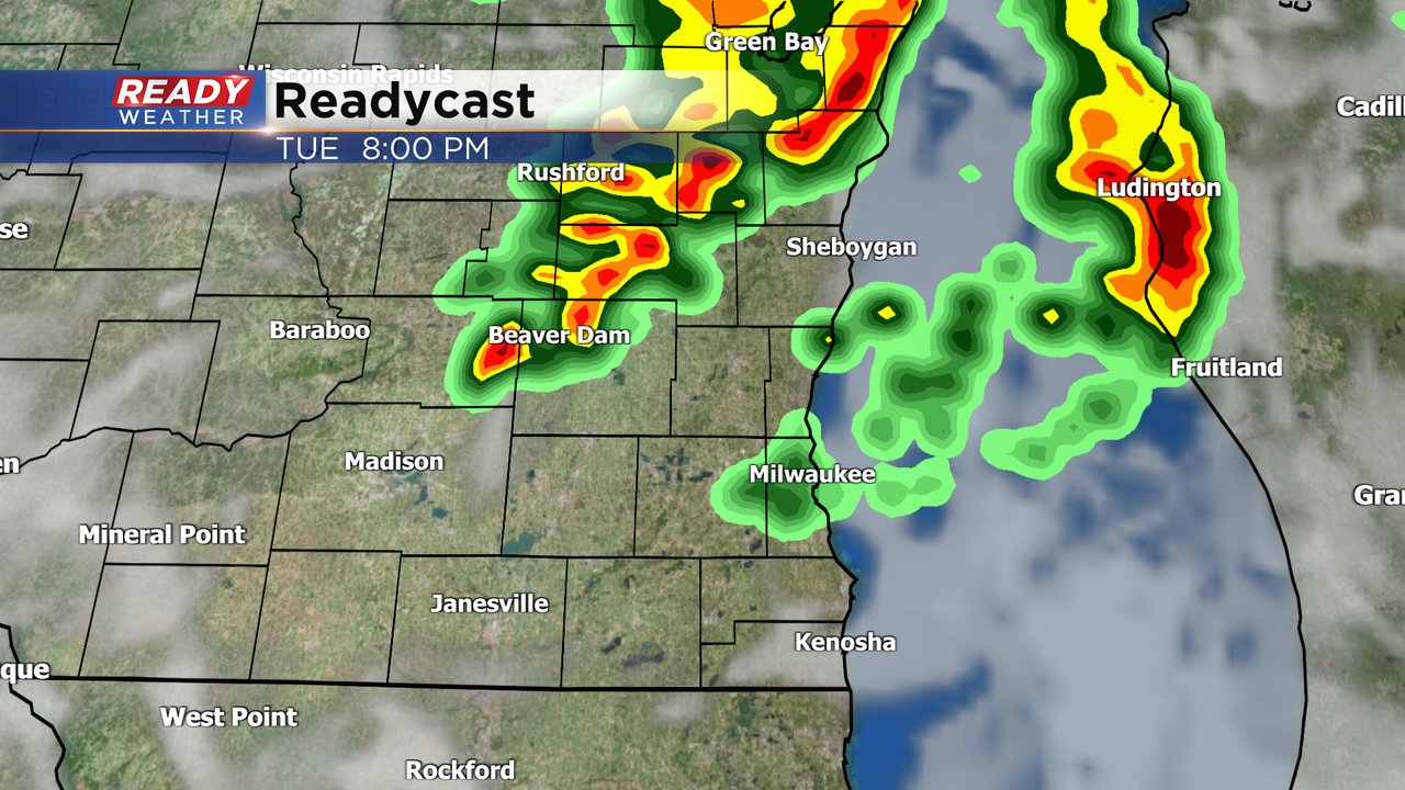
7:00 PM Update: Storms are slowly moving away from the area


Updated 7:00 pm August 24, 2021
Storms are slowly sinking south and over the border into Illinois. At this time Walworth county is still in the watch.
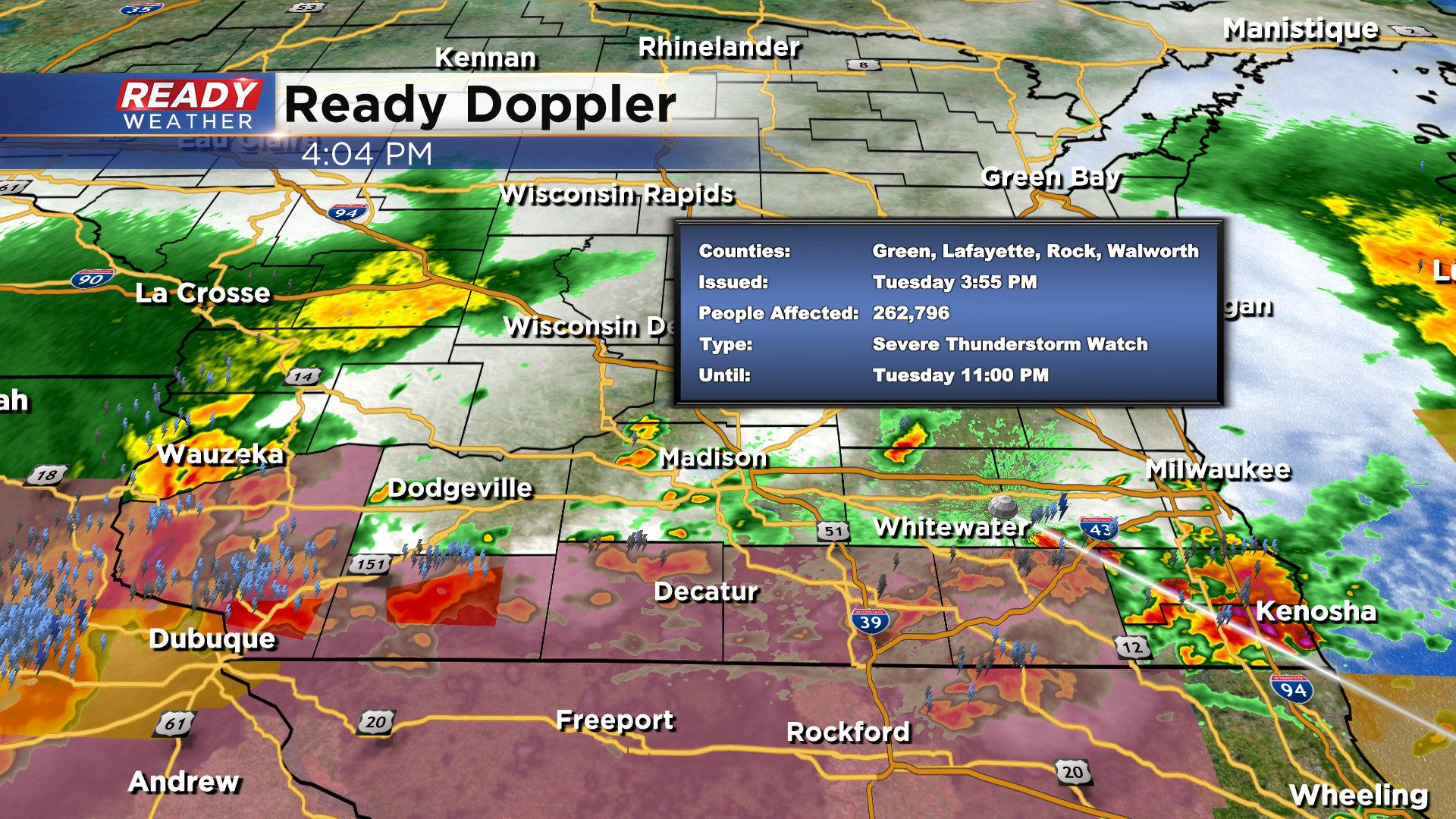
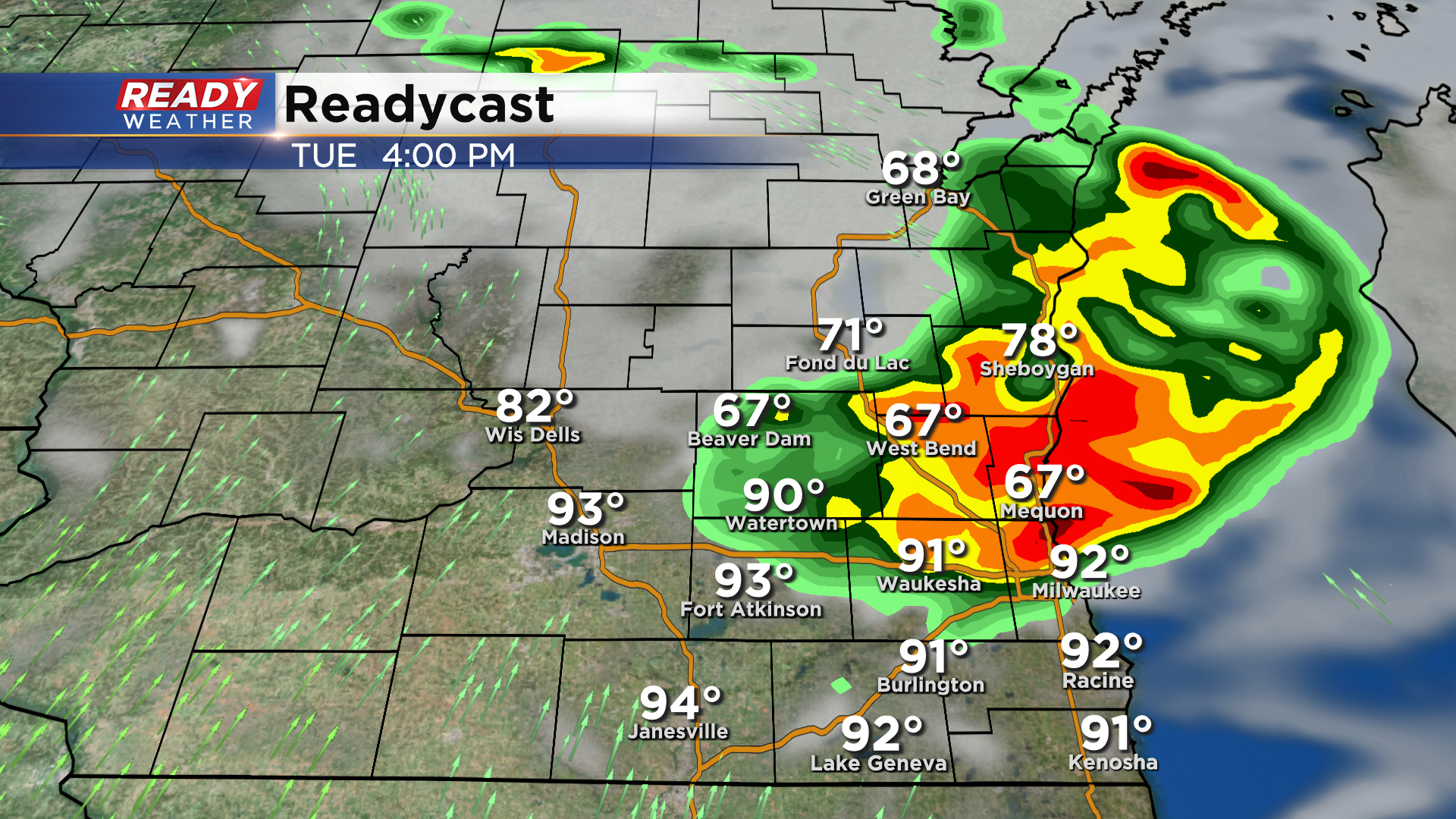
Updated 4:00 pm August 24, 2021
We have clusters of storms riding the southern tier counties of WI that border IL late this afternoon. Some storms are severe and we've even had rotation within some of the cells. There is now a Severe Thunderstorm Watch until 11pm and it includes Walworth county in our viewing area.
Updated 3:30 pm August 24, 2021
Some gusty storms moved through the metro area over the last hour, dropping the temperatures and causing some heavy rain to fall. Some spots have seen between 1 and 2 inches. Wind gusts at more than 45 mph have been clocked. Now, the storm threat has shifted south of I-94 as we venture into the evening. Stay tuned to CBS58 for all the latest weather information on air and online.
______________________________________________________________________________________________________________
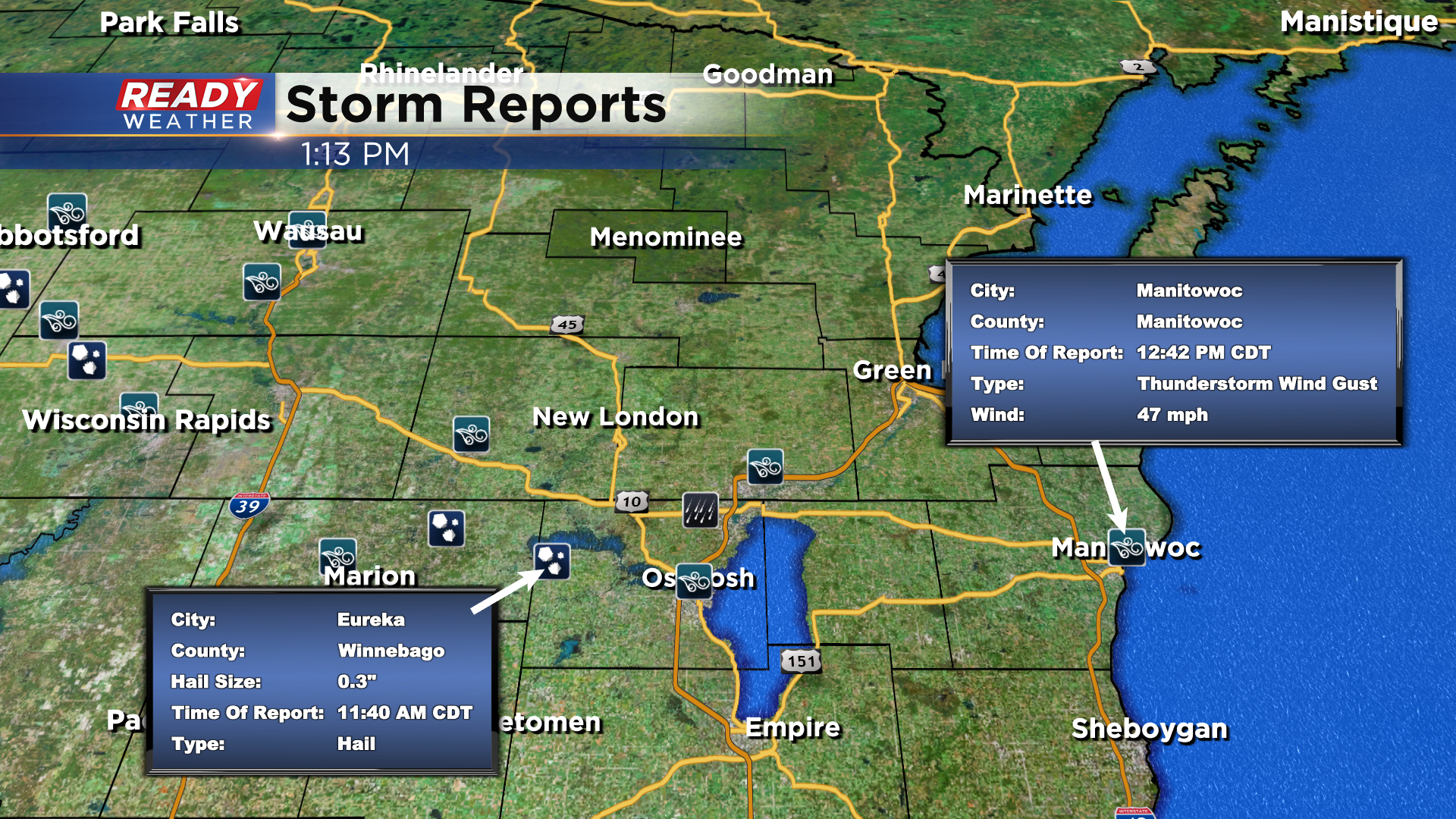
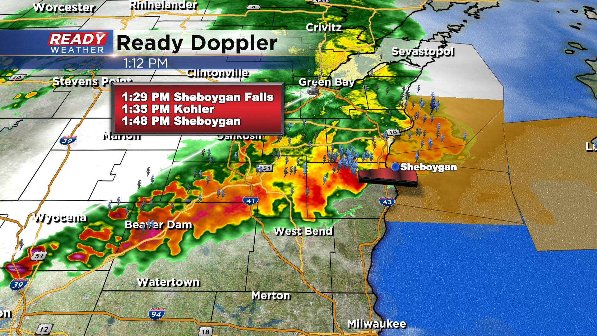
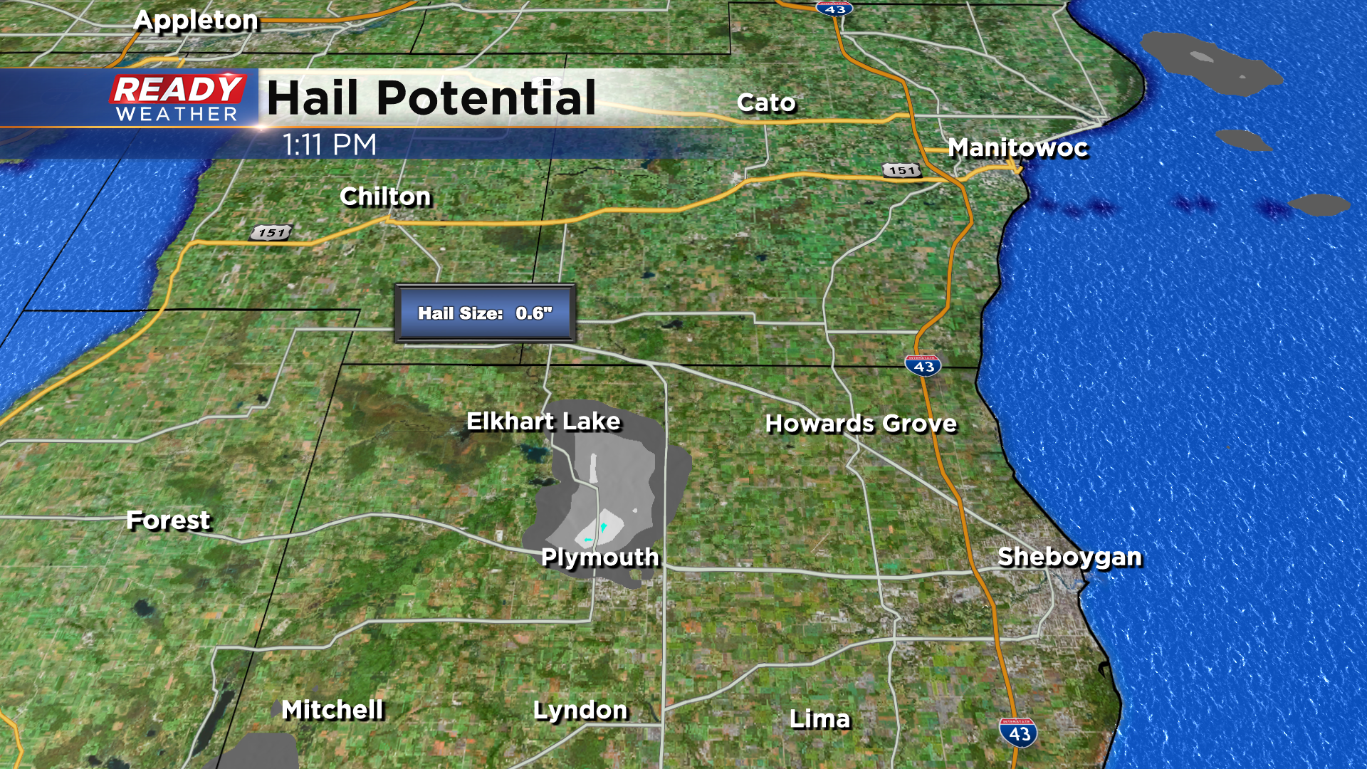
Updated: 1:15 p.m. August 24, 2021
We continue to monitor strong to severe storms across the state. As of now, all warned storms have been just north of our viewing area. Those same storms are sliding through our northern counties of Fond du Lac and currently Sheboygan county. Here's what storms have been producing so far:
Updated: 9:54 a.m. August 24, 2021
We're continuing to watch storms in the northern half of Wisconsin. As of 10 a.m. none of the storms are severe but the do have a history of sporadic wind gusts around 50-60 mph. Most of the storms are moving due east which will take them mostly north of our viewing area but parts of Fond du Lac and Sheboygan Counties could see a few storms.

The better chance for more widespread storms will be on the backside of the lines we're currently seeing as storms redevelop there and move southeast. If those storms do form, they likely won't arrive here until after 4 PM through about 10 PM.
A few weather models are also starting to keep us dry for most of the day which is also a possibility. Download the CBS 58 Ready Weather app to track any changes to the forecast and any rain that forms.
------
Posted: 7:34 a.m. August 24, 2021
High temperatures on Monday ranged anywhere from 80 to 90*. We had a few light showers in the morning then we stayed fairly dry for the afternoon and evening. Tuesday's storm chance looks a little better especially for the afternoon and evening. All morning long we have been watching a cluster of storms around the Twin Cities into Eau Claire. These storms have seen wind gusts between 50-60 mph and are expected to hit our area later this afternoon and this evening. Timing is a little uncertain so it's best to keep the umbrella handy most of the day.
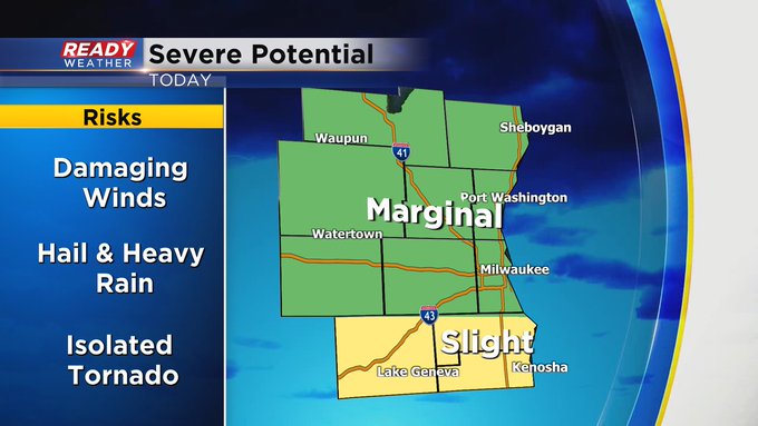
The chance for a stronger storm or two is starting to increase with most of southeast Wisconsin now upgraded to a slight risk for severe weather. Damaging wind will be the main threat, but some hail, heavy downpours and isolated tornadoes will also be possible.

The humidity increased throughout the day on Monday and dew points for most of Tuesday will stay in the low to middle 70s so expect some nasty and miserable humidity. The high humidity will last through Wednesday. On Thursday it drops a little, but still very sticky. Don't expect the humidity to really go anywhere until next week.
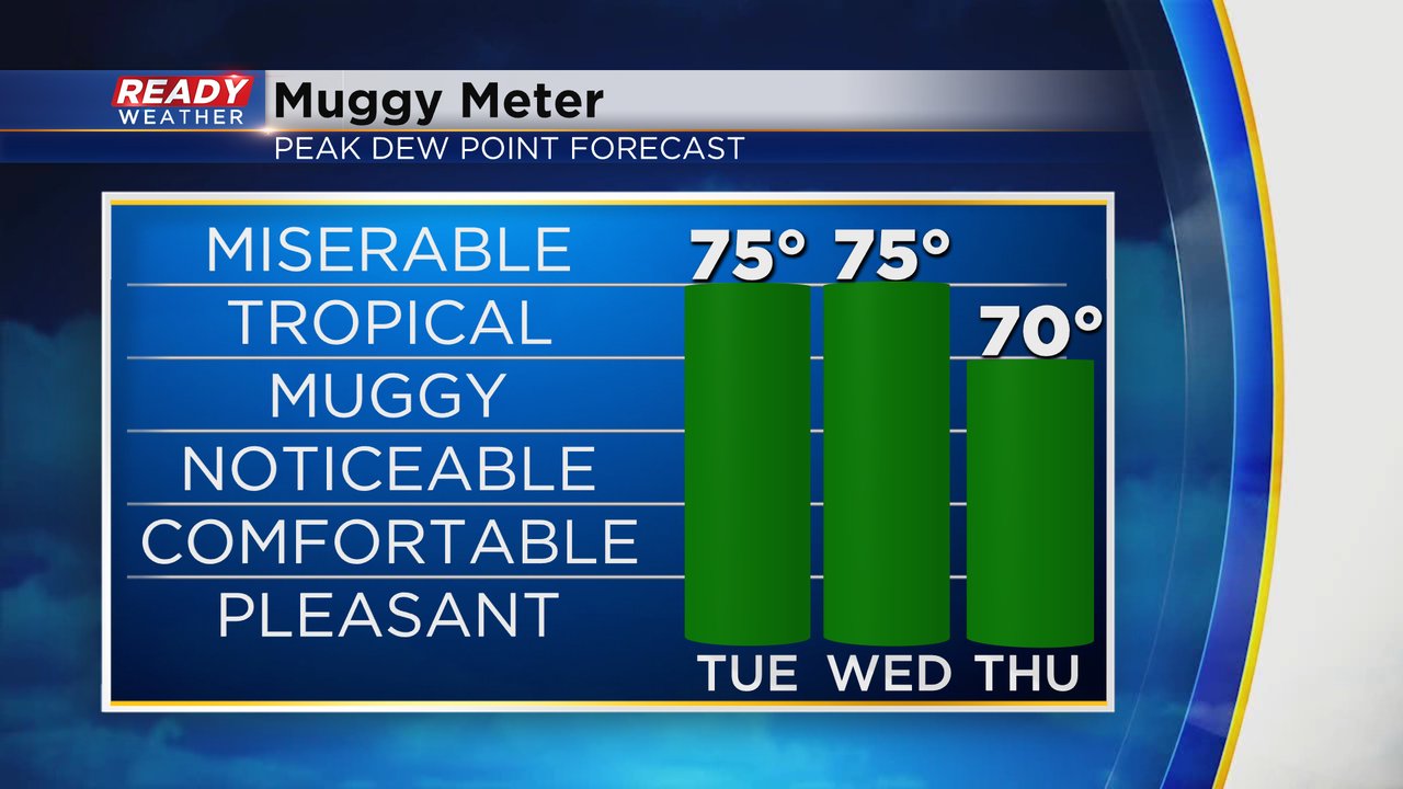
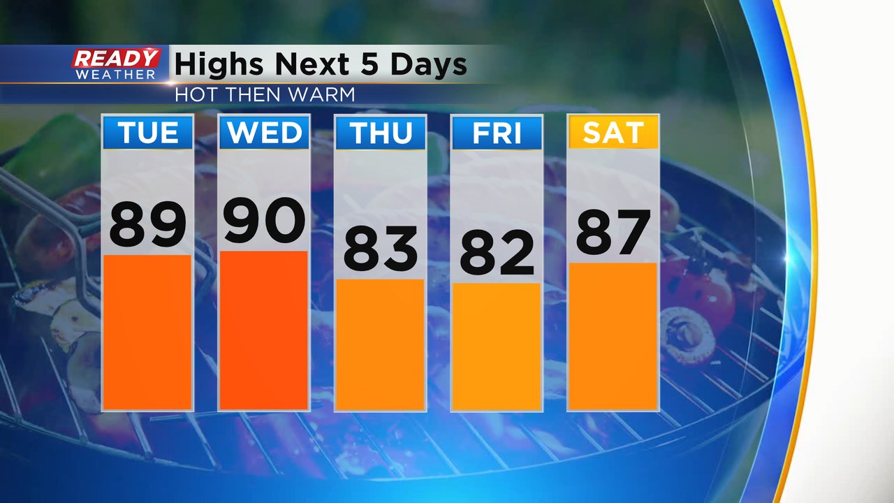
Tuesday and Wednesday are expected to be the warmest days of the week with highs around 90*. Thursday and Friday will drop slightly into the low 80s but the middle to upper 80s return for the weekend.
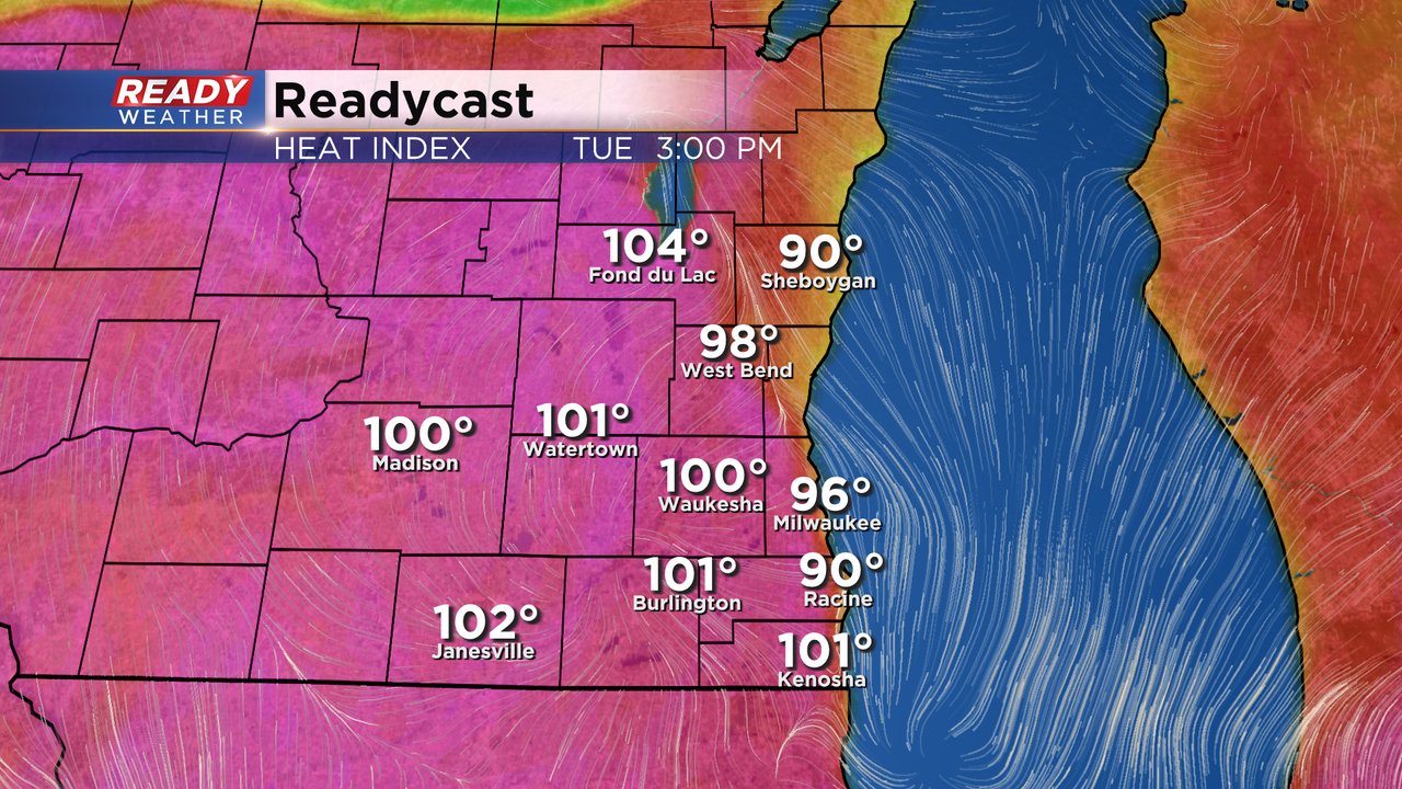
Feels like temps will become a story again with heat indices on Tuesday close to the middle and upper 90s. A few 100* heat index marks may also be reached. Wednesday will see similar heat and humidity. The one wildcard with the heat will be the storms and clouds. With scattered storm chances any rain or thick clouds that do form could keep our temps from getting too hot.
Download the CBS 58 Ready Weather app to track the storms.