


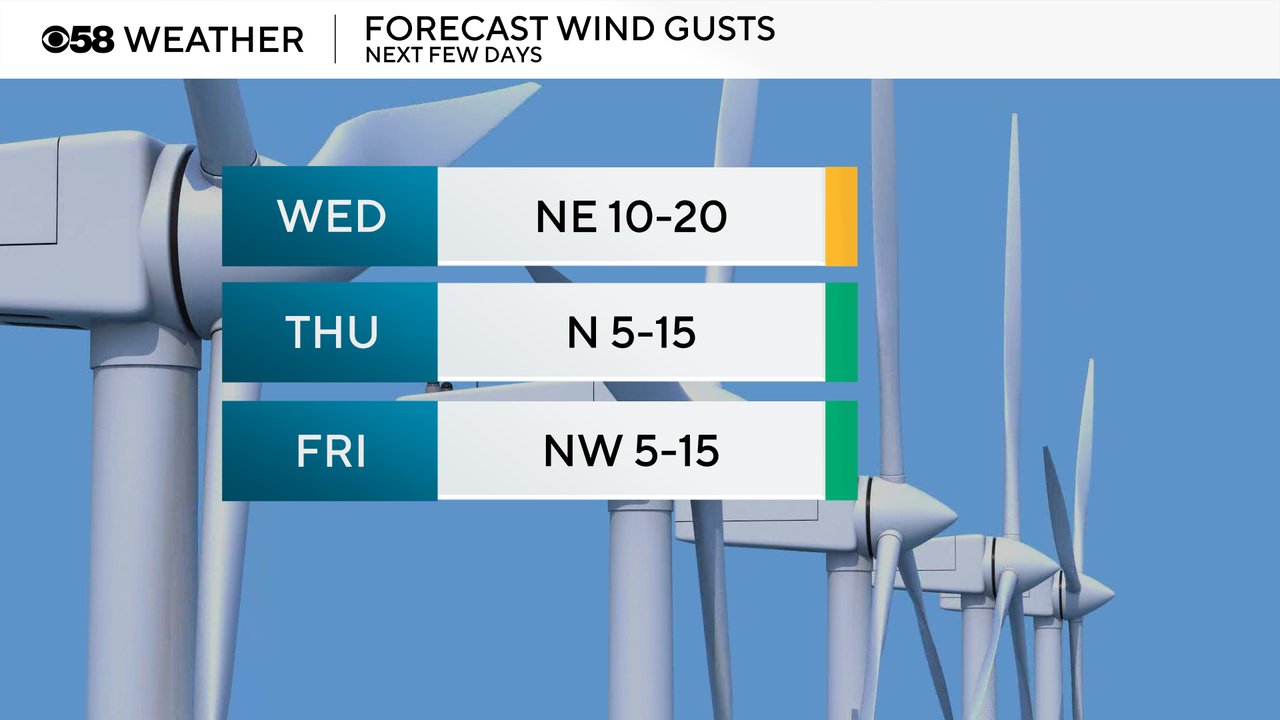
The mostly quiet forecast continues for this week. The stiff breeze that has persisted since this past weekend will remain with gusts out of the NE Wednesday to 20 mph, or even higher in some locations. But the lighter wind returns Wednesday night and stays with us for the rest of the work week.
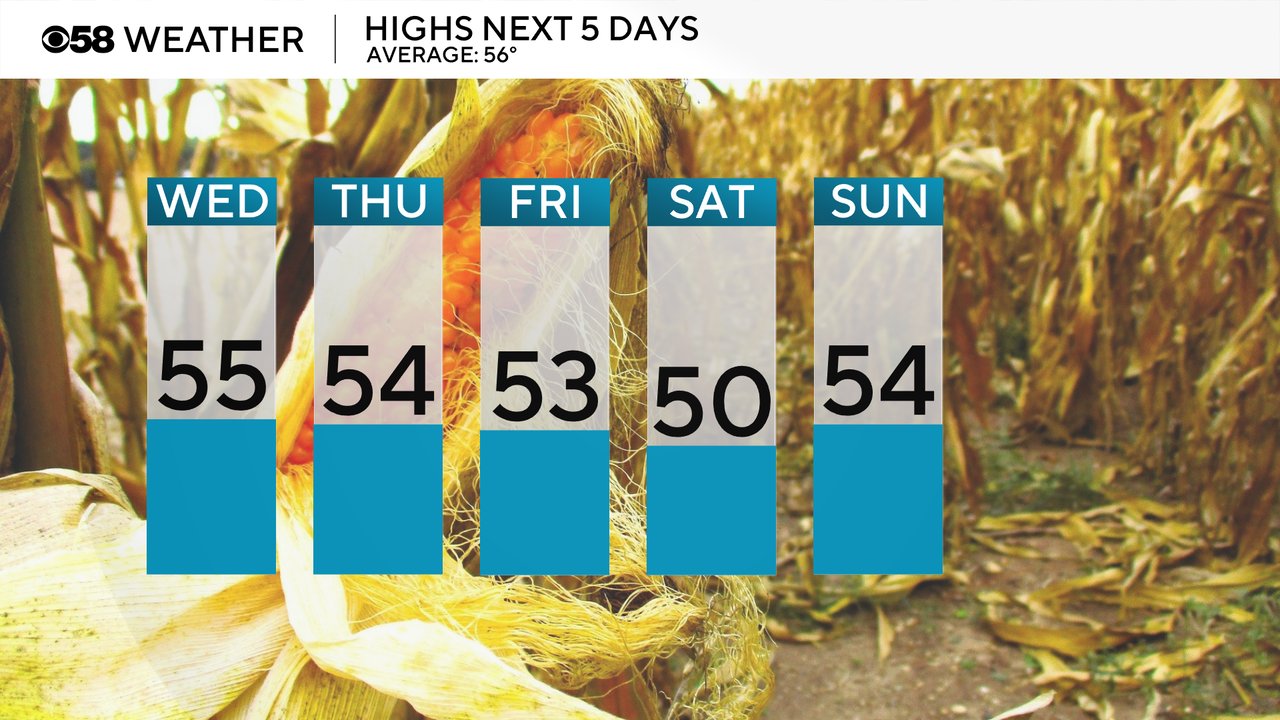
High temperatures will stay fairly steady and just below the average high of 56 degrees. Saturday looks like the coolest day around 50 with more clouds then right back into the mid 50s for next week.
The overnight lows do look a little cooler with more of the northerly wind. Some patchy frost is possible inland Thursday and Friday mornings with lows in the upper 30s. Saturday has a better chance for a widespread frost inland and Sunday could see a freeze. Lakeside stays a bit warmer and mostly away from frost concerns with lows around 40.

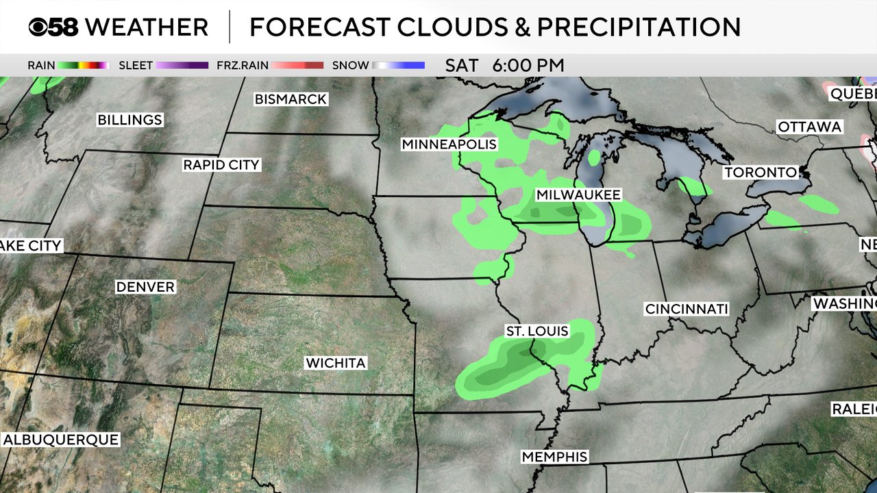
A large storm system will continue to stay to our west and south Wednesday keeping us dry. A few clouds may roll in Tuesday that could bring a 10% chance for a shower. Friday has a similar chance. Saturday might be our next chance for some rain, but even then it looks pretty light and not all of the weather models have it, so only a slight chance right now.
Download the CBS 58 Weather app to track the temps, wind and rain chances.