August currently in Top 20 warmest on record but cool down will likely change that


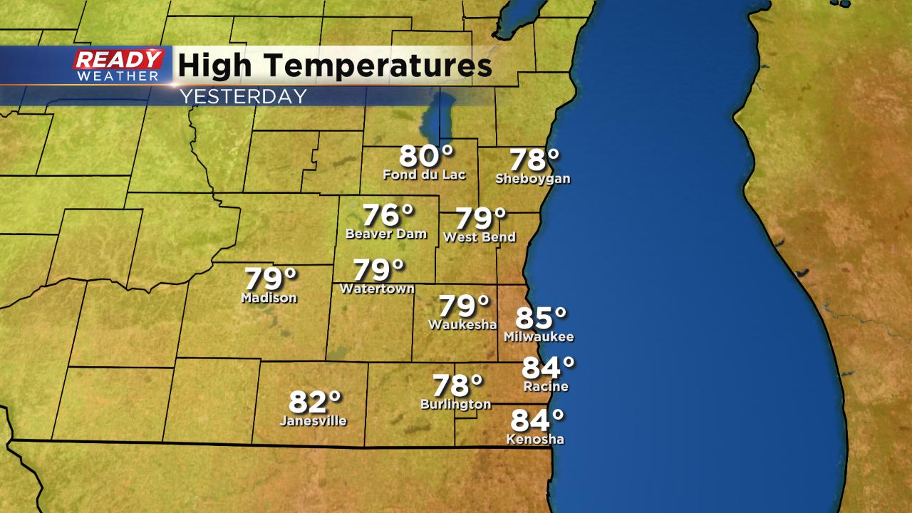
Wednesday was expected to be our last warm day before a cool down and it certainly delivered. Highs reached the middle 80s lakeside with plenty of upper 70s inland. It was the 4th warmest day of the month on Milwaukee.
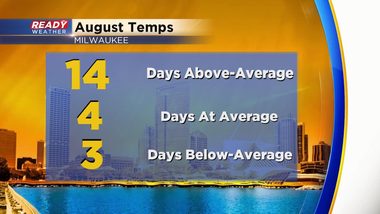
Wednesday was the 14th day with above-average highs in Milwaukee which doubles the amount of days we've had at or below-average.
Although we haven't had too much extreme warmth, it's been warm enough to go down as the 19th warmest August on record if it ended today. The hottest temp was 90° on August 5th and the coldest was August 1st when the low hit 55°. The average temperature is just over 73° but that will likely go down.

Temperatures over the next four days are expected to stay below-average with highs in the low to middle 70s. We do see a slight surge of warmth to start the following work week with highs getting back to 80°, briefly.

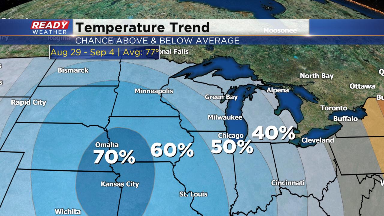
The temperature trend for the last few days of August and first days of September including Labor Day show a 50% chance for below-average temps. It's looking cool but not cold by any means. Low to middle 70s look more likely than the average upper 70s.
Download the CBS 58 Ready Weather App to see if there's any more warmth in our future on the 10-day.