Evening Update: A Winter Weather Advisory has been issued ahead of Thursday evening's snow


Updated: Wednesday, March 8th 10:30pm:
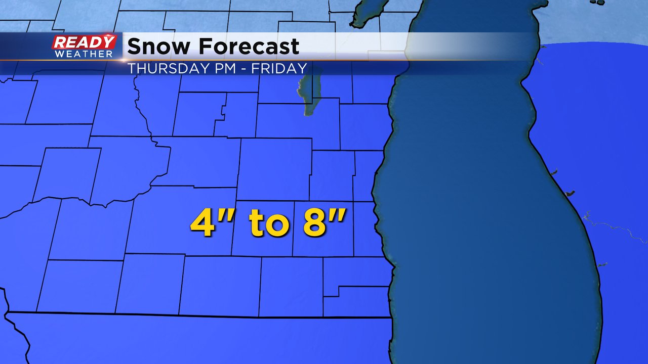
A Winter Weather Advisory has been issued for all of southeast Wisconsin beginning at 6pm Thursday and ending at Noon on Friday.
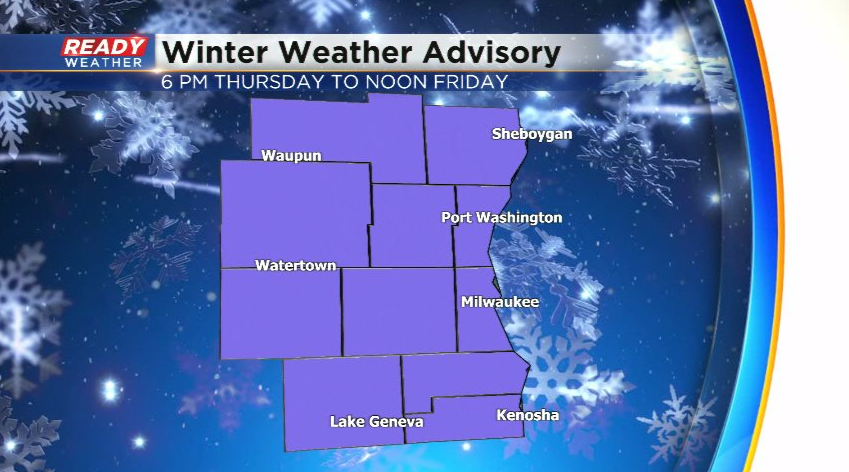
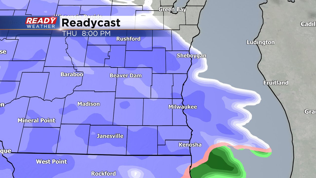
Snow will move in from west to east between 3-6pm Thursday. The heaviest and most widespread snow will fall between sunset Thursday and sunrise Friday. Lingering lake effect snow showers will be possible from time to time during the day Friday and Friday evening, with minimal additional accumulation.
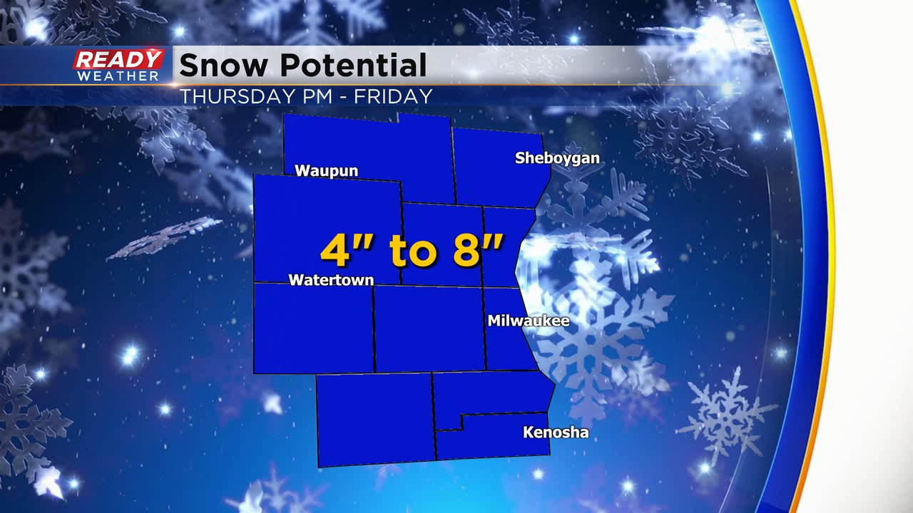
We're still expecting most of the area to pick up 4" to 8" of snow from this evening, with the best chance for higher end totals in lakeside counties due to lake enhancement.
Download the CBS 58 Ready Weather App for additional updates.
-----------------------------------------------------
Another week and another chance for snow. Basically, every week over the last month has featured at least one chance for rain or snow and this week is no different. Weather models have been very consistent with this snow so confidence that we see snow is high. The track of the storm is steady enough where mix or rain does not look too likely. A winter storm watch has been issued for all of southeast Wisconsin from Thursday afternoon through midday on Friday.

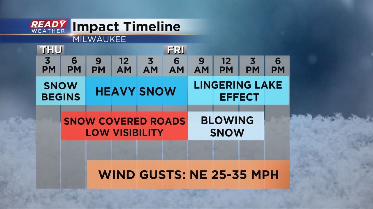
All of Wednesday, Thursday morning and Thursday early afternoon is dry. Then late afternoon through the early evening on Thursday we will see snow roll into southeast Wisconsin. As soon as the snow starts it will begin to accumulate with worsening road conditions during the Thursday evening commute.
Snow is expected to fall all night long Thursday night and most of Friday morning. This will be a heavy snow that is wet and difficult to shovel so take breaks. 4-8" of total snow is expected for all of southeast Wisconsin.
The snow will come down at a good rate most of Thursday night and Friday morning. The wind will also be fairly gusty with peak winds to 30 mph causing blowing and drifting snow. While the late Thursday evening commute could be impacted, the Friday morning commute will be the worst with very difficult driving conditions.

As we approach this next round of snow Milwaukee sits at 28.5" of total snow for the season. While that total is more than last winter, it's almost 14" below the average. Some hometowns north of Milwaukee have picked up more snow while some counties to the south have seen less. We won't make up all of that 14" deficit with this one storm but if we end up on the high end of the range we could cut down a decent chunk of it.

Download the CBS 58 Ready Weather app to track the snow and stay on top of any forecast changes.