Another round of heavy rain comes with a warm up
As if the weekend wasn't gloomy enough, more rain is expected to start the new work week. A period of rain showers with some heavy downpours is expected Sunday night into Monday. Most of the area should remain dry Monday afternoon and evening, especially after 3 p.m.
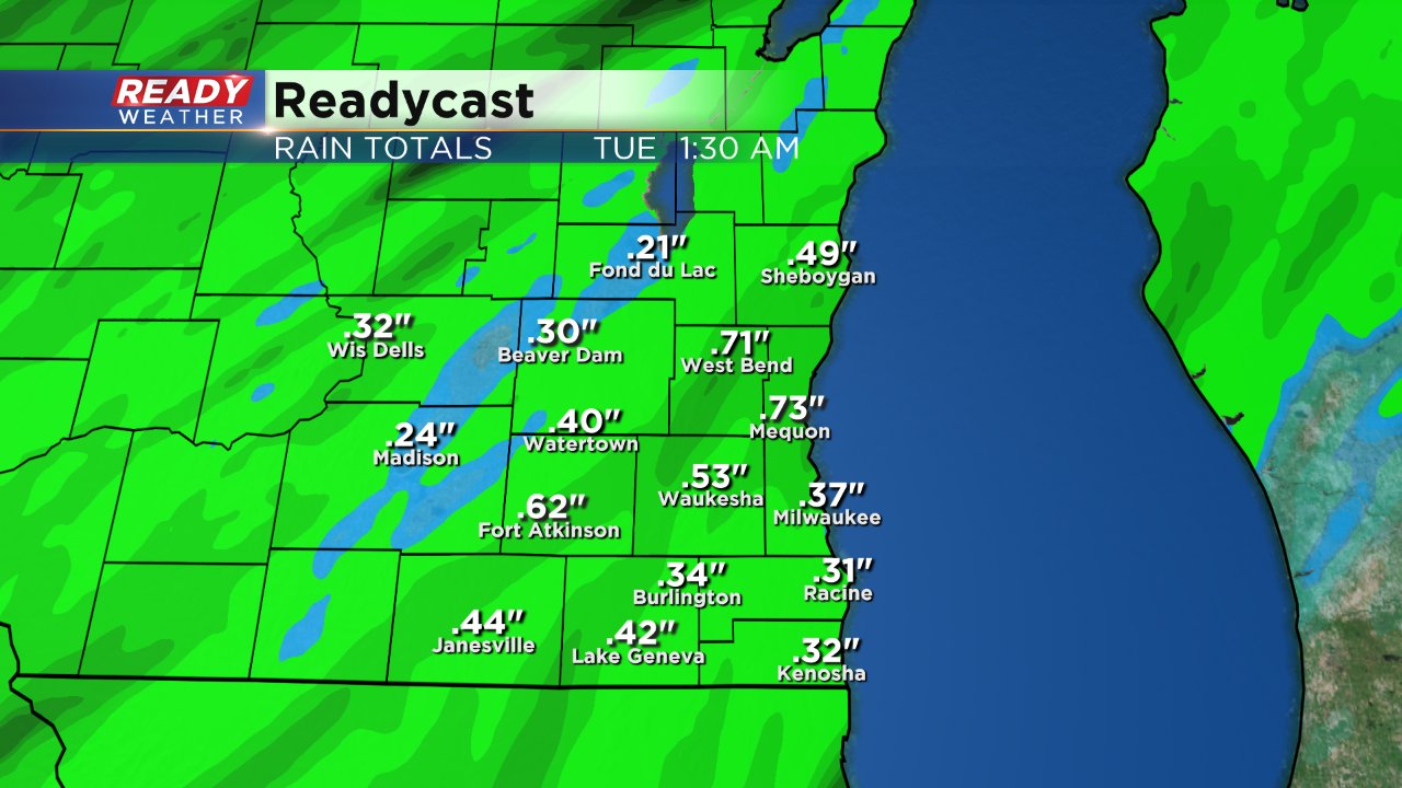
When it comes to rainfall, it won't be a super heavy rain like southern spots saw Saturday morning with 3" falling, but a good soaking is expected. Most of southeast Wisconsin can expect between a quarter to three quarters inch of rain.
Rainfall this October has been one for the record books. Through just the first week, Milwaukee has officially picked up almost 3.50" of rain. October, 2017 was a very wet month which saw over 4" of rain. The monthly average for October is 2.65" so Milwaukee has already seen more rain in a week than we typically get in its 31 days.

The record wettest October happened in 1877 when 7.15" of rain fell. If Milwaukee continues on this wet streak that record could be broken. More rain chances on Tuesday and the likelihood of heavy rain on Wednesday will get us closer to that record.
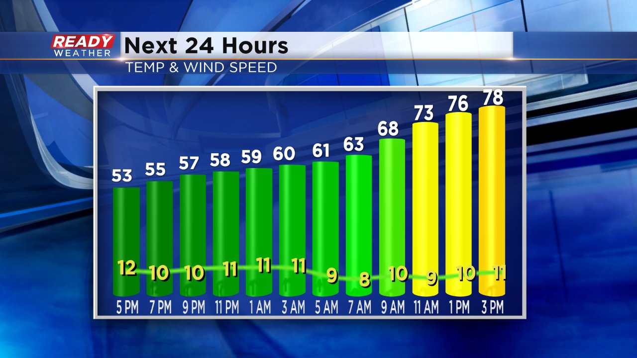
When it comes to temperatures, the next few rounds of rain will bring with it more warmth. Temperatures won't really cool Sunday night so we don't have a "low", at least not what we are used to. Temps warm all day Monday landing in the upper 70s. Highs hover around 80° Tuesday and the low 70s Tuesday before more fall-like highs in the low 50s return starting Thursday.
To track rain as it develops and see the 10-day forecast download the CBS 58 Ready Weather App.
