More heat and humidity before storms and relief arrive
After a steamy Sunday more heat is on the way Monday before a cold front arrives cooling everything down. Saturday's high temperatures were underwhelming. Thanks to Friday night storms and a lake breeze highs only reached the 80s for most. Sunday was a different story with a brisk southwest wind and lots of humidity allowing highs to reach the low 90s.
In Milwaukee the high officially hit 93° just one degree shy of the record from 1994.

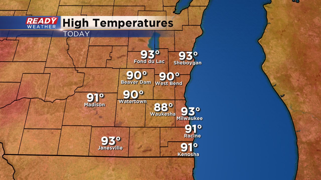
Although still hot, high temperatures Monday are not expected to hit records. Highs will reach around 90° but with dew points in the low 70s it will feel close to 100° once again.
The heat breaks Monday afternoon and evening as a cold front moves through from north to south sparking thunderstorms. Those storms are expected in the Milwaukee-Waukesha metro area around 5 p.m. and could linger south of I-94 for most of Monday night into Tuesday.
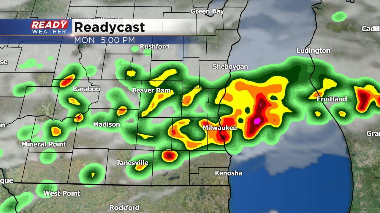
Parts of southeast Wisconsin are under a "marginal" risk for severe weather on Monday. Isolated strong storms may be possible with strong wind and hail but heavy rain will likely be the biggest threat.
A lake breeze returns the rest of the week with highs in the 70s lakeside and around 80° inland. Scattered showers and storms may be possible on multiple days.
Download the CBS 58 Ready Weather app to see what the temperature is where you live and track storms as they pop up Monday.
