After recent snow melt, white Christmas chances are decreasing with winter beginning


The warmth from the last few days really cut into our snow depth across southeast Wisconsin. A lot of the melting happened Wednesday night into Thursday morning with strong warm south winds and fog that ate up the snow then steady midday rain on Thursday cleaned up the rest of the job.
Look at the snowpack disappearing near Milwaukee's lakefront.
Your best chance at a White Christmas might be to go north where some of our northern counties still have snow on the ground and central Wisconsin has 5" or more still on the ground in some areas. More melting is likely next week with consistent warm air.

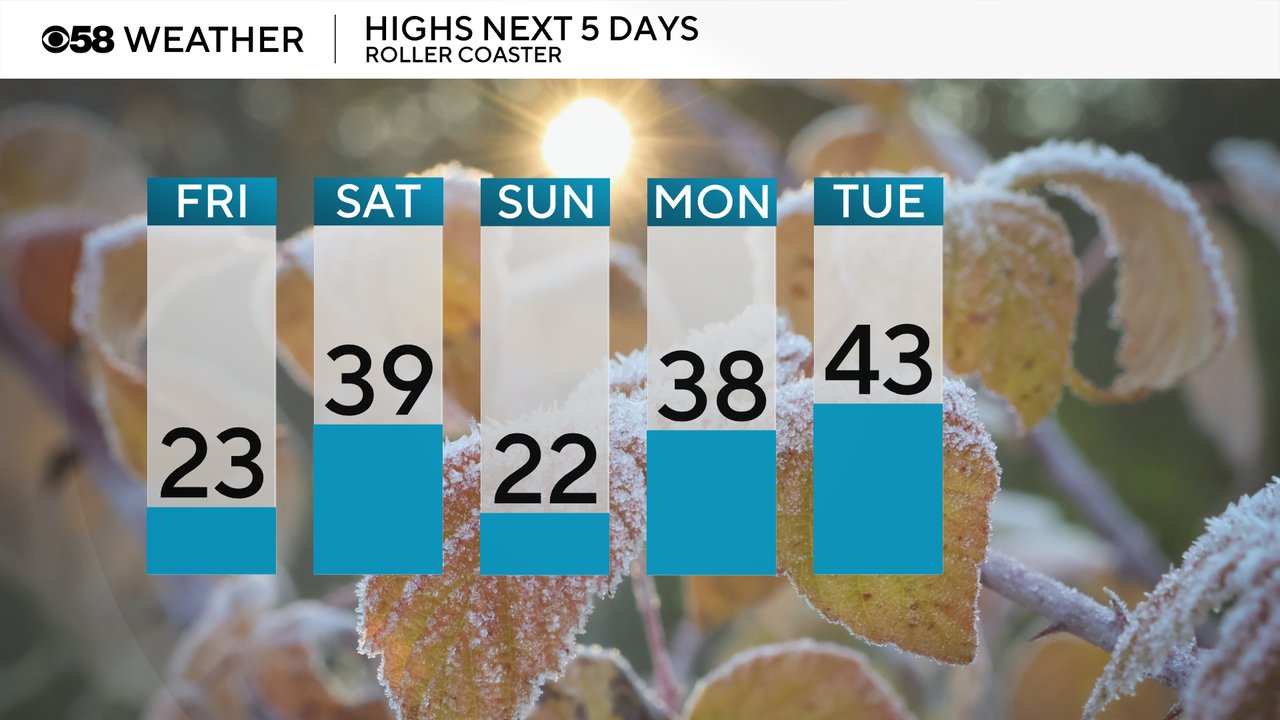
The roller coaster with the temps is now here with wind chills staying well below-zero Friday morning then warming to the low 20s for highs Friday afternoon. Saturday will see more warmth with highs in the upper 30s then Sunday cools right back down again. Monday looks to be another above average day with highs in the upper 30s and then the warmth stays with 40s on the way for the days leading up to Christmas and Christmas Day itself could hit 50!
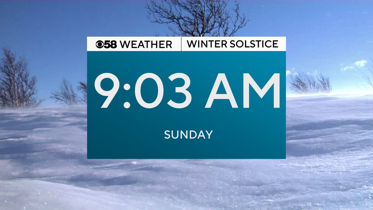
Winter officially begins this weekend with the Winter Solstice Sunday morning at 9:03 AM.
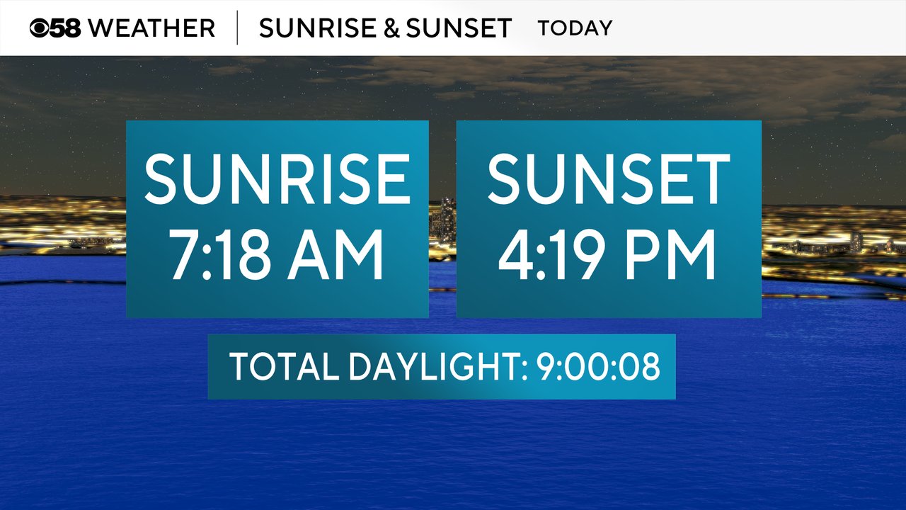
We are still losing seconds of daylight through Sunday but then by Monday the days start to get a little longer. Sunrise time on Friday was at 7:18 AM and the sunset was at 4:19 PM.
Download the CBS 58 Weather app to see if there are any chances for new snow before Christmas.