A whole bunch of seasons to get through this week

-
4:07

Schlesinger’s Saturday Showcase (6/27)...Summerfest Part II,...
-
3:10

Enjoy the tolerable temps before we get blasted with heat and...
-
1:57

Brady Street starts summer safety pilot program, neighbors maintain...
-
2:16

Brewers fans welcome Cubs to Milwaukee for first time in 2026
-
2:09

Wisconsin state officials hope federal grant can put Madison...
-
2:24

’I have several friends that are still missing’: Local man...
-
0:56

Proposed 25-story condo tower could reshape downtown Milwaukee...
-
1:15

Bicyclists young and old fill the streets of Shorewood for 22nd...
-
2:16

Masked electric scooter riders lead West Allis police on chase;...
-
2:04

Hundreds honor the Class of 2026 during Milwaukee Public Schools’...
-
2:18

Meet CBS 58’s Pet of the Week: Wanda
-
3:32

Brewers preview homestand, new fan plaza ahead of Cubs series

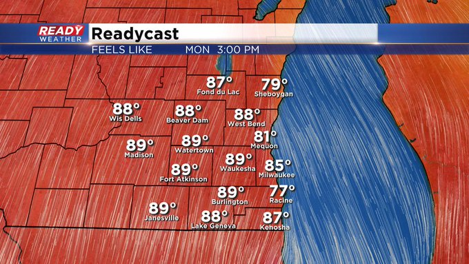
Milwaukee (CBS 58)--This will be one of those weeks with so many weather players. It's almost hard to keep up. First off, look for summertime to come back to us, big time, Monday and Tuesday as a warm front lifts north of the region. We're talking about highs well in the 80s with heat indices near 90!
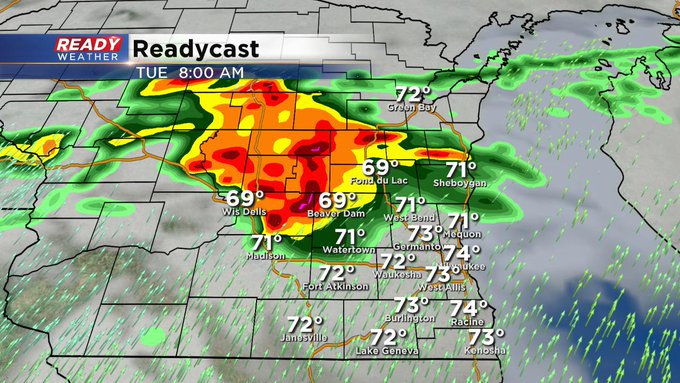
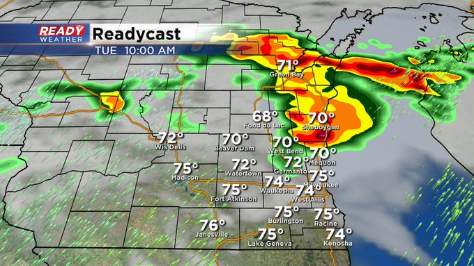
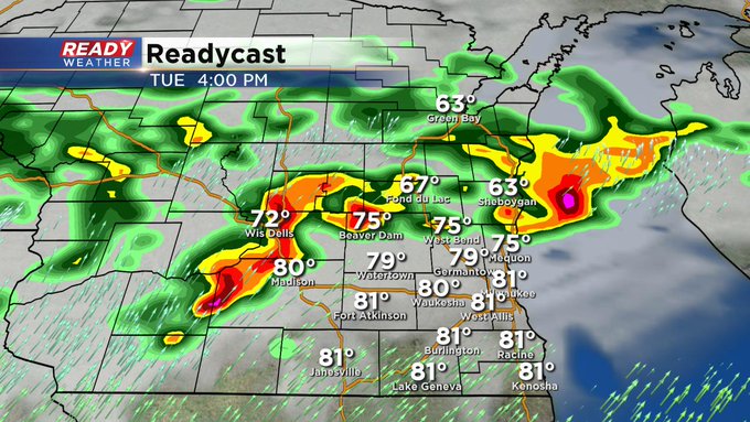
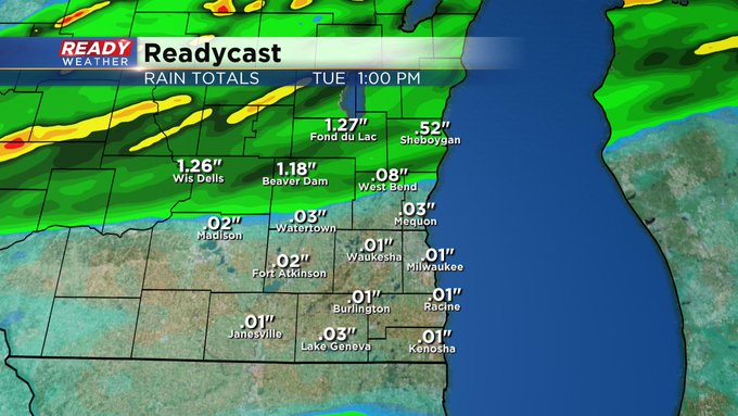
As a cold front gets closer to us on Tuesday, look for showers and storms to fire throughout the day on Tuesday into Tuesday night. The front gets hung up for about a day across the area, so showers will continue Wednesday into Thursday morning. Some of us could see several inches of rain at least.
Then, behind this system, expect some of the coolest air of the season thus far. We're talking about highs in the 50s to near 60 by Friday with lows in the 40s widespread.