
-
3:28

Milwaukee Makers Market kicks off 10th season in April with free...
-
3:57

Doggy Day returns to Deer District on April 11 to benefit local...
-
2:32

Warm Wednesday then dropping temps and a chance for showers for...
-
2:04

Kwik Trip introduces new mascot Red the Chicken, launches Midwest...
-
3:04

Putting some light on the situation with a DIY Turkish mosaic...
-
1:27

CBS 58’s Hometown Athlete: A Senior Day shot to remember
-
3:36

Milwaukee Police Department working to identify missing people...
-
2:17

KUSD School Board approves controlled entrance safety project...
-
2:19

$25K+ in damage at Church of the Gesu as parish focuses on recovery...
-
1:01

BMO collects purses, toiletries for Love Purse, benefiting local...
-
2:48

Jury finds Harry Wait guilty of 3 counts in election fraud case
-
2:15

New Marquette Law School Poll reveals voters undecided about...

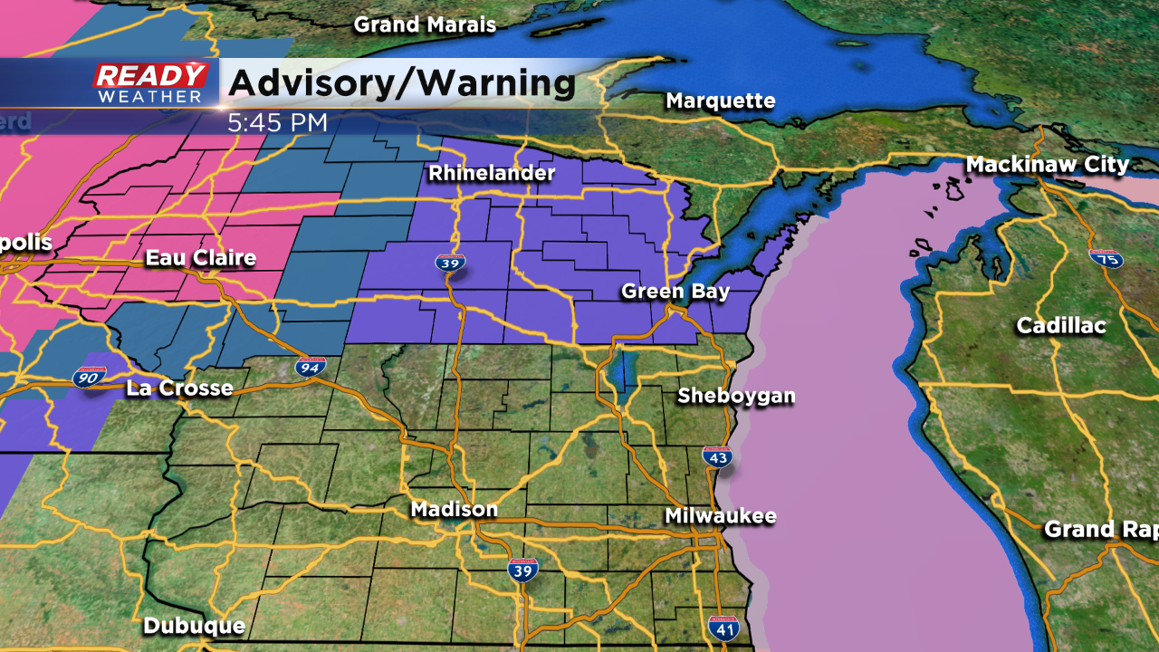
Thankfully our weekend weather maker will keep most of the accumulating snow and winter weather well to our north. If you have plans to travel across central and northern Wisconsin, please keep your eye on the changing forecast.
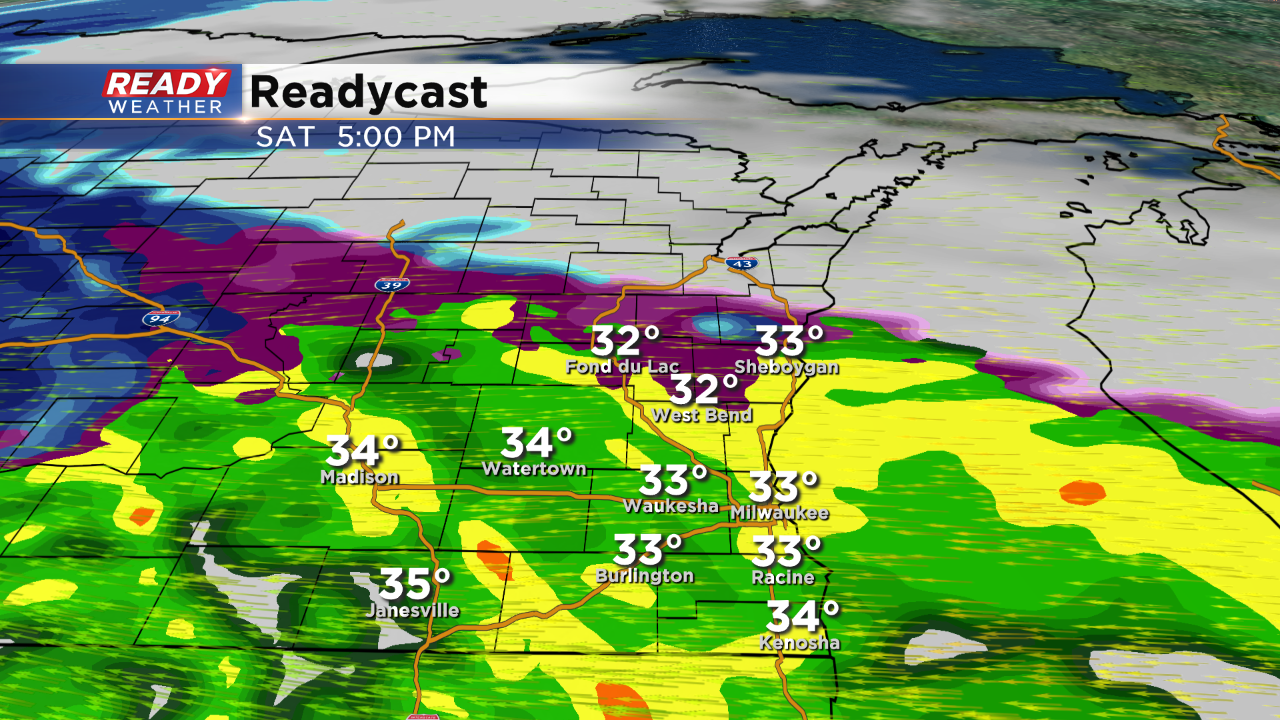
Rain is forecast to arrive between 2 pm and 5 pm across the area. Some of that rain could mix with some sleet initially; however, surface temperatures should remain above 32 to ward off freezing rain.
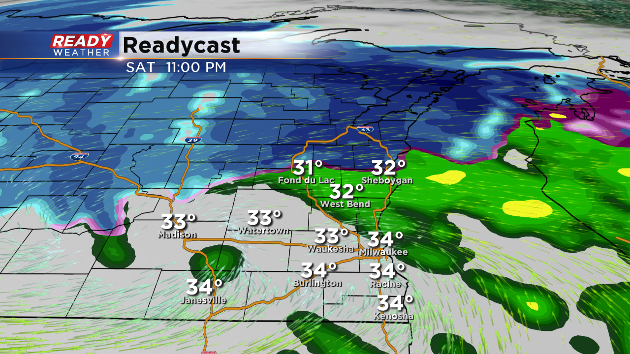
The wind will be a big factor on Saturday into Sunday. Wind gusts could approach 40 mph. Rain will likely linger through Saturday night into early Sunday morning. Rainfall totals will range between 0.50" to 1.00".
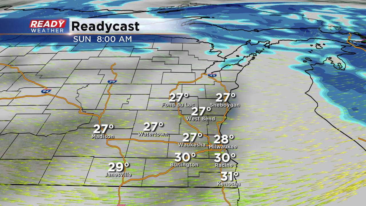
Falling temperatures and wind is expected on Sunday with some wraparound snow showers. Snow accumulation will be less than an inch.