Major winter storm coming for the weekend; winter storm watches issued
THIS BLOG IS OUT OF DATE AND WAS FORECAST FOR JANUARY 9TH AND 10TH. CLICK HERE FOR THE LATEST FORECAST.
********************************
A winter storm watch begins at 9 pm Friday for: Milwaukee, Racine, Kenosha, and Walworth counties.
A winter storm watch begins at 12:00 pm Saturday for: Waukesha, Jefferson, Ozaukee, Washington, Dodge, Fond du Lac, and Sheboygan counties.
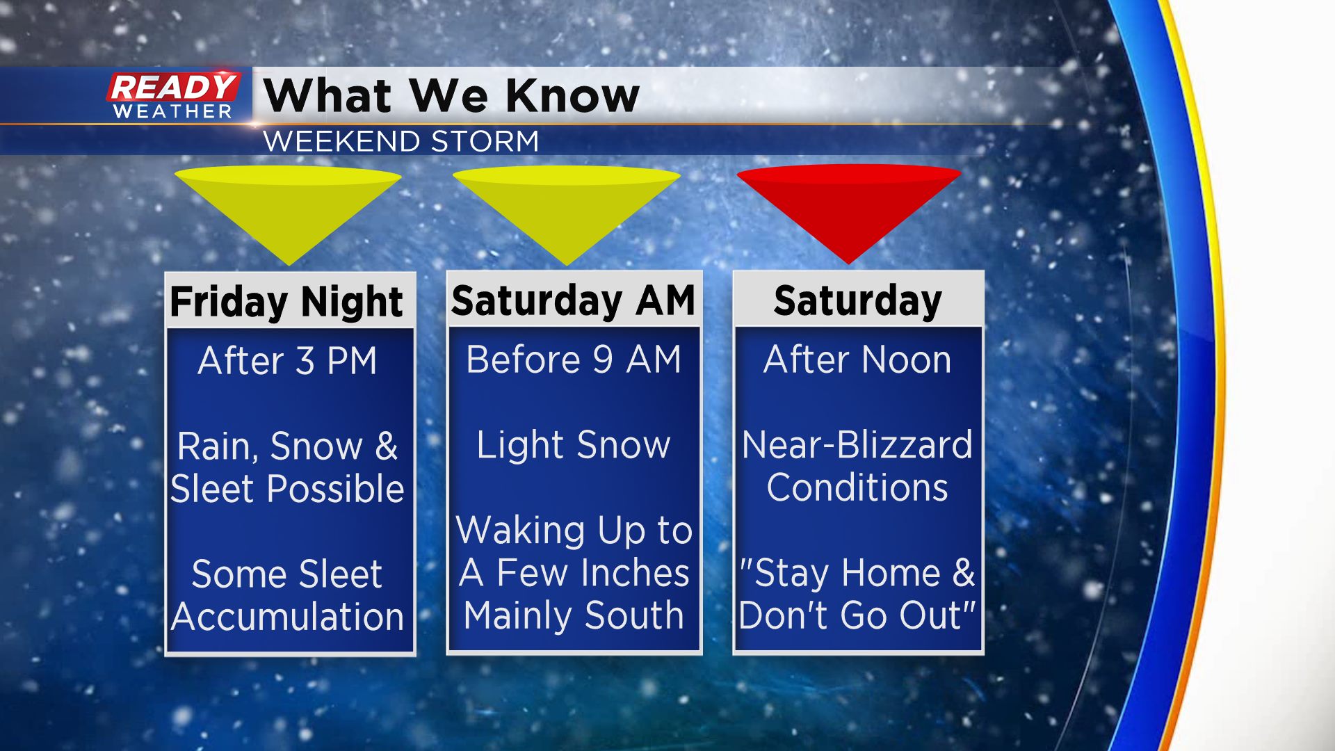
The models continue to show a significant winter storm to impact our area late Friday night into Sunday morning. This storm has the potential to produce very strong winds and blizzard conditions for Saturday evening. Travel on Saturday could be a major issue.
A mix of sleet and snow is possible Friday evening. Best chance for accumulating snow Friday into Saturday morning will be along and south of 94. That's why the watch starts earlier for those areas.
There is a chance that our southeastern counties could remain in a mix Saturday morning before turning over to all snow. You can see the totals are reflected there.
All snow is expected Saturday afternoon until 3 am Sunday morning.
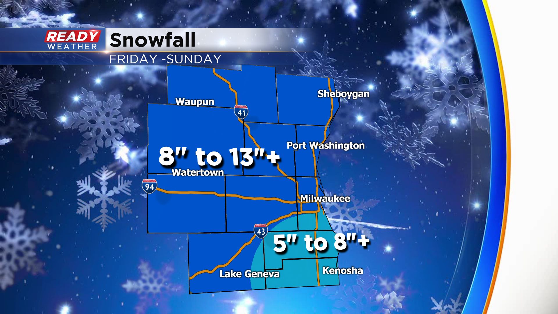
Most of the models are forecasting over 10" of snow for this event. Winds gusting over 40 mph on Saturday will create low visibility and blowing and drifting snow.
These totals will change; slight differences in temperature could lower or increase totals. We will keep you updated!
