Evening Update: Marginal risk now pulled out of the area.


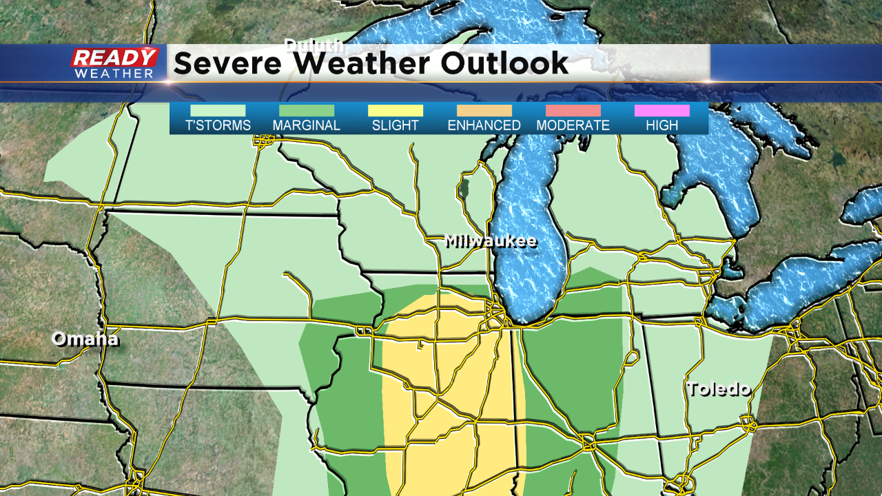
The SPC has pulled the marginal risk from southeastern Wisconsin. Limited instability has reduced the overall chance for strong to severe storms. We still expect a chance for showers and storms along with small hail, but the severe weather risk is very low.
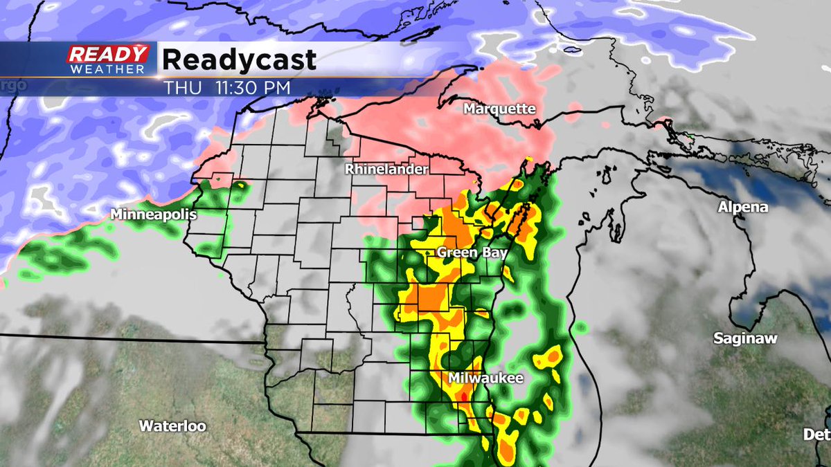
Scattered showers and storms are still forecast across southeastern Wisconsin from 8 pm till Midnight. Storms could produce a quarter of an inch to a half an inch of rain along with small hail.
2:30 PM Update:
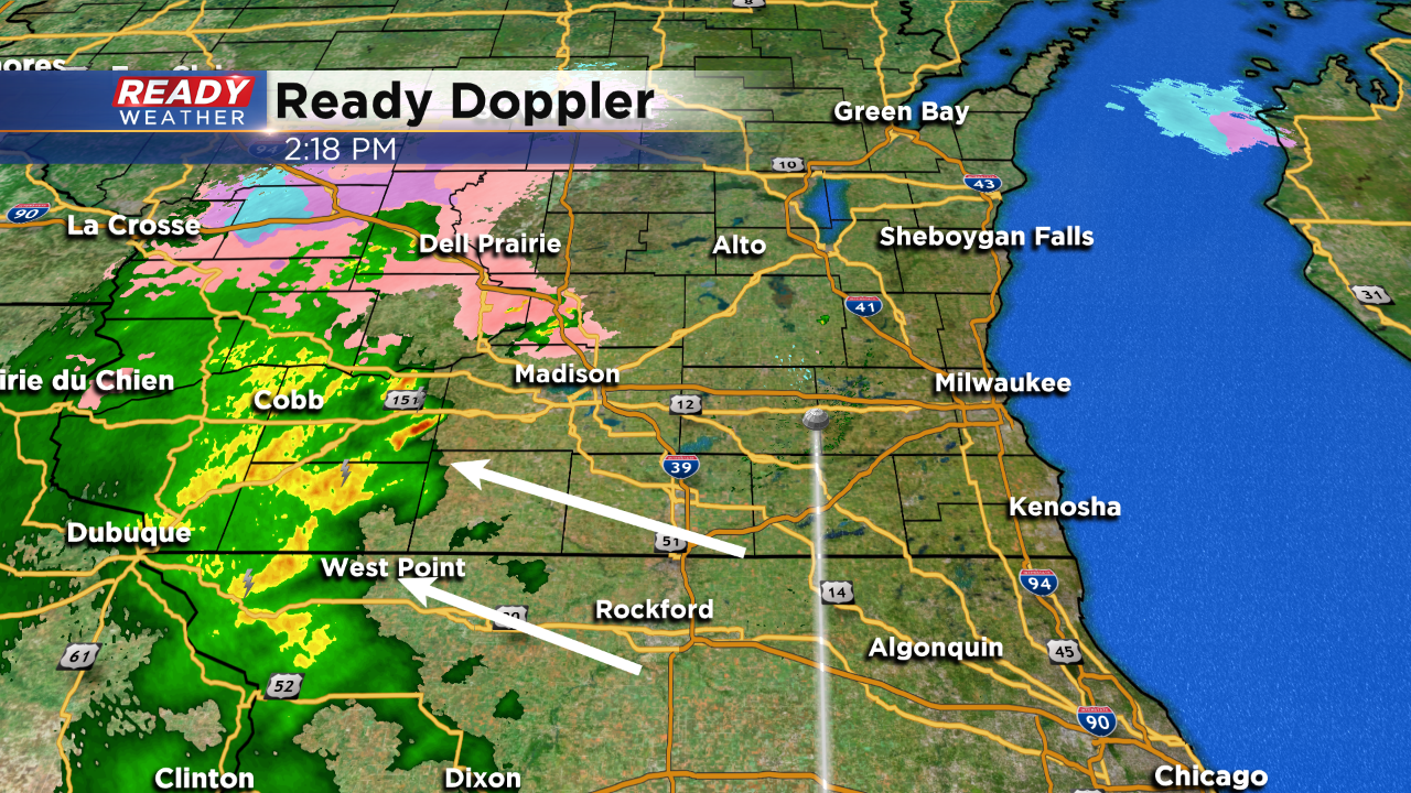
Scattered showers and even a few rumbles of thunder have developed across western Wisconsin. It's crazy to think temperatures are in the 30s with storms. Our surface temperatures are slowly warming into the upper 30s and lower 40s. We do expect more 40s by the evening. Our high of the day might not occur until close to midnight.
The best chance for storms will occur between 9 pm and Midnight across southeastern Wisconsin. Enough elevated instability will give storms the chance to produce small hail and brief gusty winds. An isolated strong to severe storms is possible; however, widespread severe weather is not expected.
Updated: 12:03 p.m. April 11, 2019
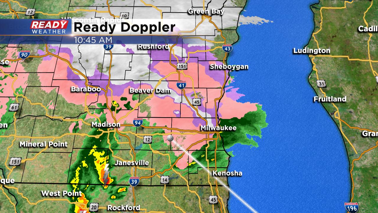
A round of light wintry mix is currently moving through southeast Wisconsin but some strong storms have been trying to push in from the south. Most of these storms are weakening as they reach Wisconsin with an atmosphere not as warm and conducive for thunderstorm development.
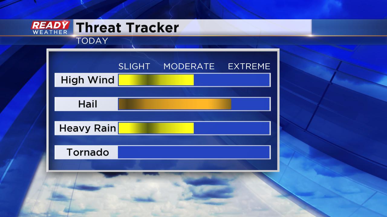
As the afternoon progresses a few more showers and storms are possible. The best chance for severe weather still looks to be between 9 p.m. and midnight Thursday night. There has been no change to the marginal risk for most of our viewing area. The main threat for any severe storm will be hail but high wind and heavy rain are also possible.
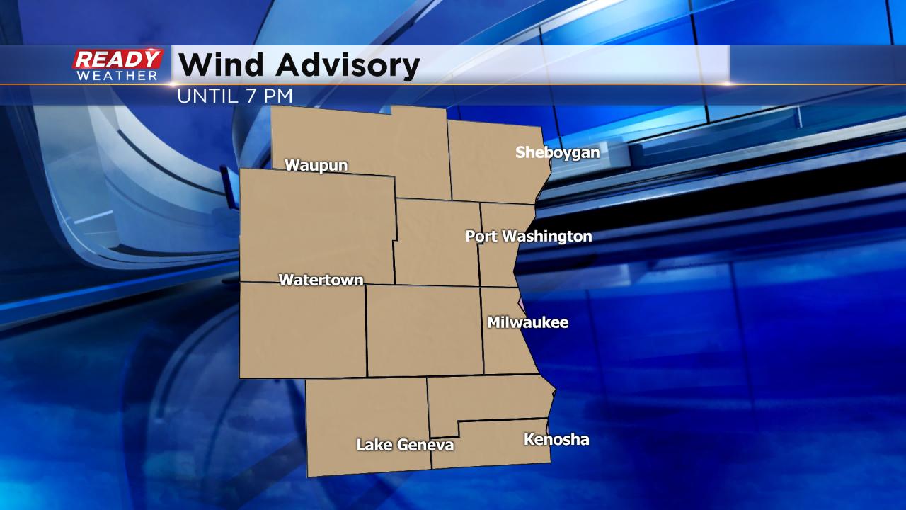
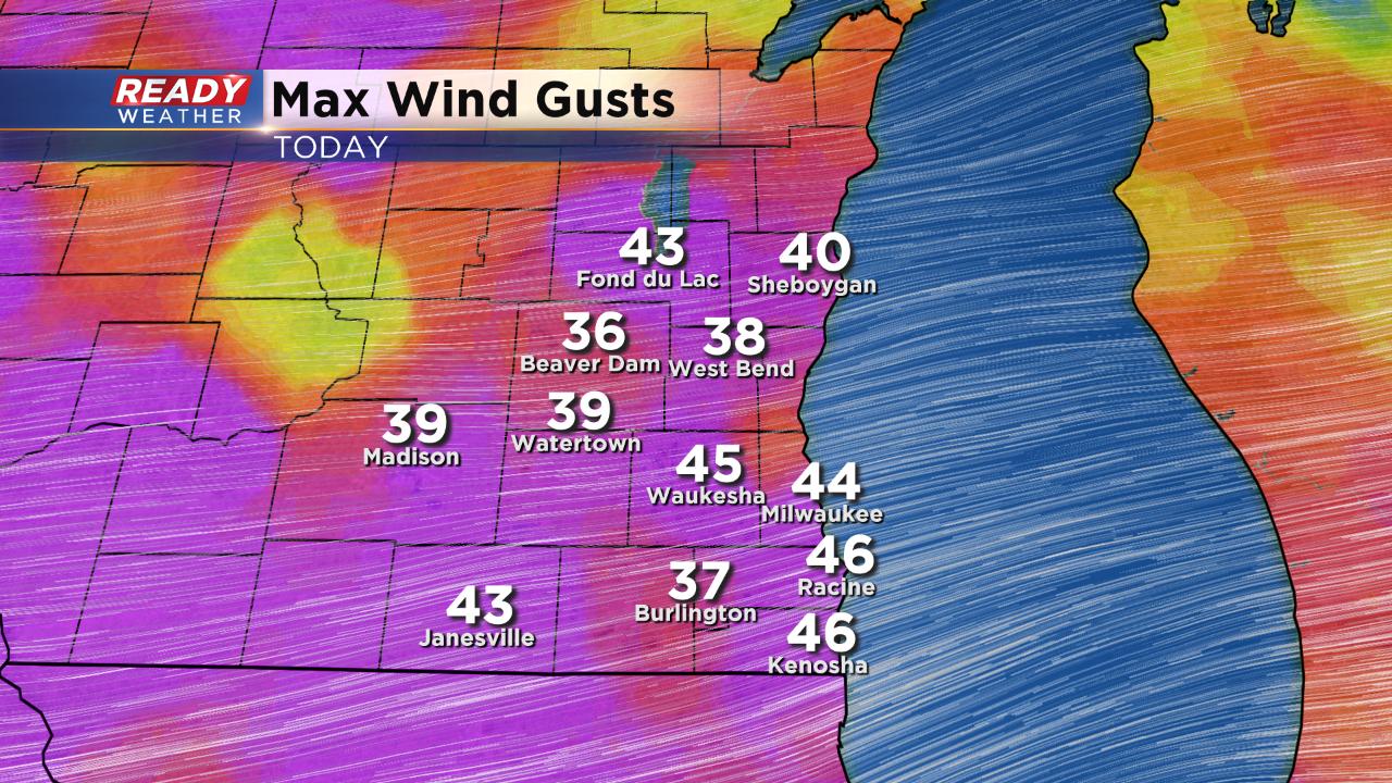
The winter weather advisory for northern counties has been cancelled early, but the wind advisory has been expanded to include all of southeast Wisconsin and extended until 7 p.m. Wind gusts up to 45 mph have been possible which many areas have already seen Thursday morning.
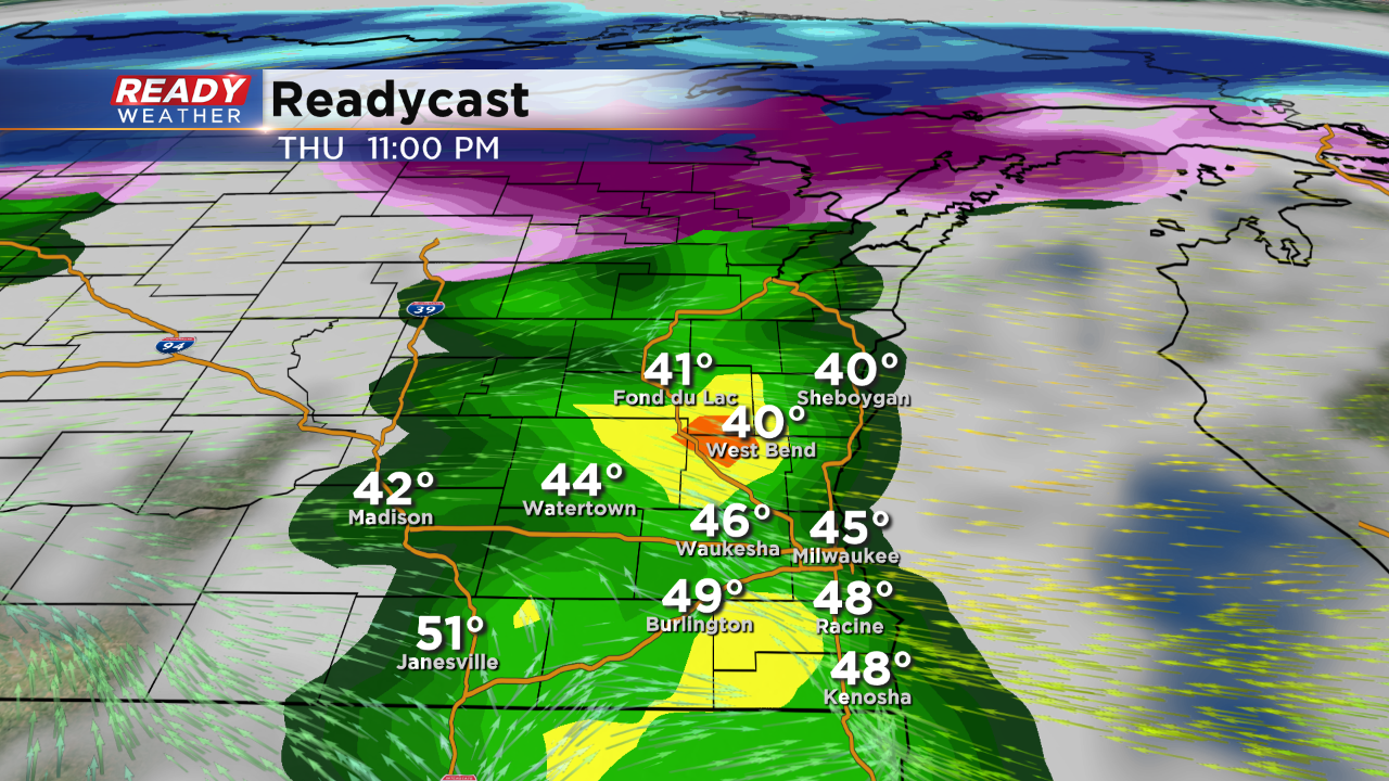
During the overnight hours the wind becomes lighter and the rain and storms stop. The wind shifts Friday out of the southwest bringing in warmer air but it picks back up with gusts to 40 mph possible.
------
Posted: 6:15 a.m. April 11, 2019
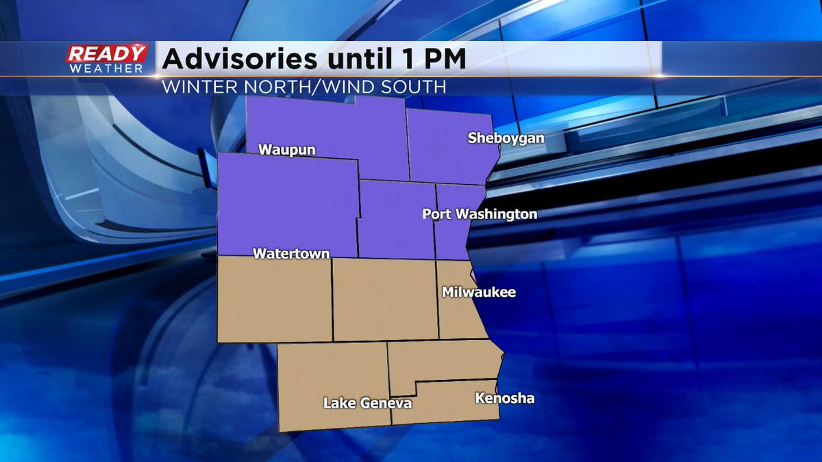
What a couple crazy of weather days, and we're not done yet. Look for wintry mix this morning, switching over to showery weather this afternoon. And then we face the risk of some stronger storms late in the day and this evening. The Winter Weather Advisory holds until 1 pm north of I-94. It's a Wind Advisory south of I-94 until the same time. Wind gusts close to 50 mph are possible. And then we could see some gusty storms by dinnertime and beyond. There is a marginal risk of severe weather for us, especially late in the day.

The weather quiets down Friday and Saturday and then we have another storm to impact us Sunday, similar to the one we're experiencing today. Rain/snow mix is quite possible. Stay tuned.