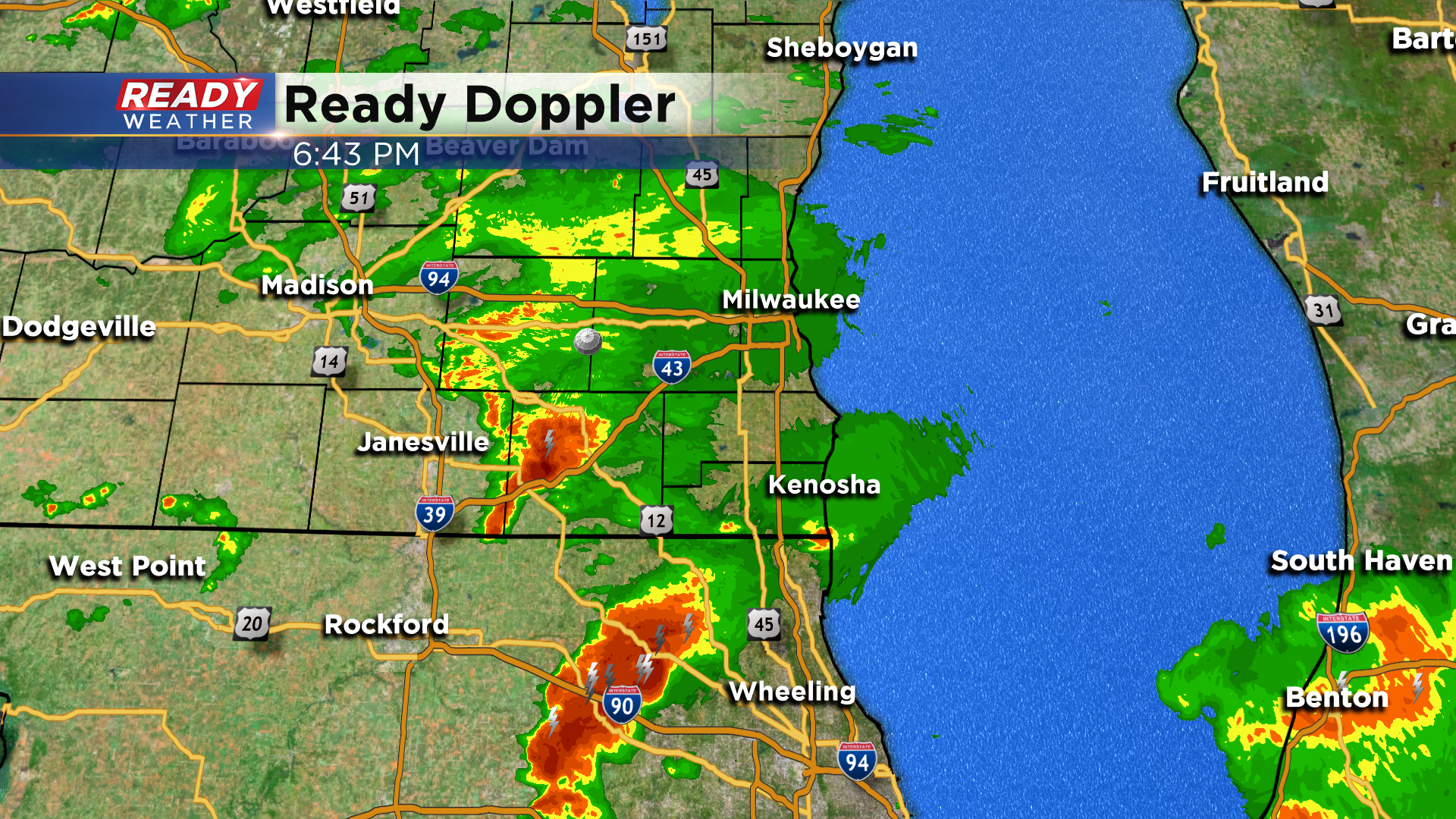
6:30 PM Update: Severe threat winding down this evening
Updated 6:30 pm Saturday May 23rd:
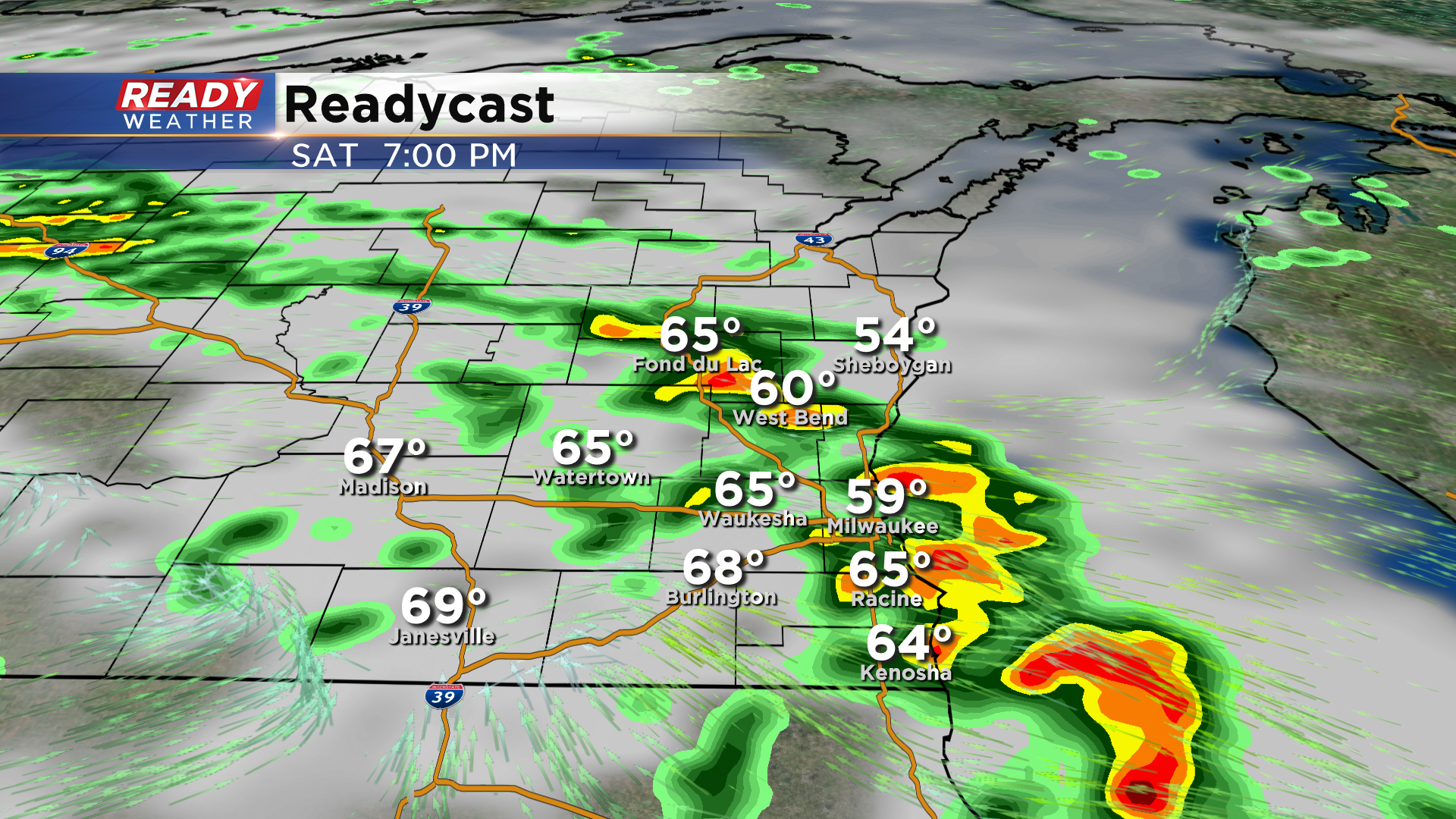
Still watching two areas of storms. The cluster in Walworth county is sub-severe and is pushing northeast into an unfavorable environment for strengthening. The storm in northern Illinois is using up most of the instability that's left, and this storm is tracking more to the east than north east. Once these storms clear the area, the severe threat will be over.
-----------------------------------------------------------------------------------------------------------------------------------------------
Update 4:00 pm Saturday May 23rd:
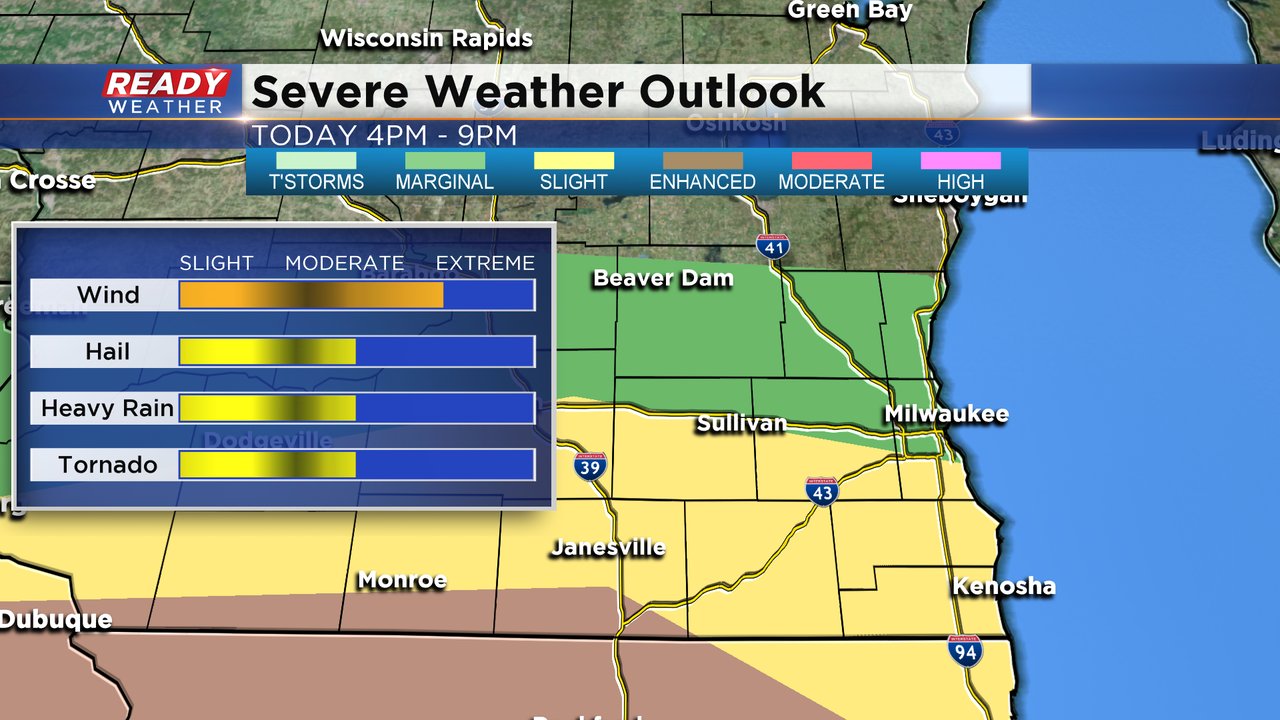
No changes in the severe weather risk for southeastern Wisconsin. We do expect scattered showers and storms to move across the area from now until 8 pm. The best chance for a strong to severe storm will be along the border of IL/WI.
Instability closer to Milwaukee is really lacking with the lake breeze. Areas near Walworth and Jefferson counties have the best chance for a weak tornado.
____________________________________________________________________________________________________________
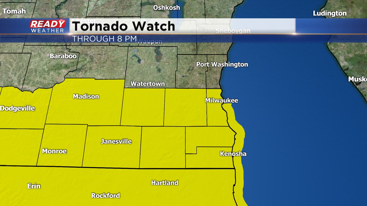
A Tornado Watch has been issued for Milwaukee, Waukesha, Racine, Kenosha, Walworth, and Jefferson counties through 8 pm this evening. The best time frame for storms still looks to be between 4-8 pm. Download the CBS 58 Ready Weather App to get warnings that are issued sent to your phone.
Update 12:00 pm Saturday May 23rd:
The level 2, Slight Risk, for severe storms has been expanded northward and now includes areas along and south of I-94. This area will have the best chance at an isolated tornado late this afternoon into early evening. Damaging winds will be the primary threat with most storms that move through the area.
---------------------------------------------------------------------------------------------------------
Dry weather with off and on filtered sunshine is expected through early afternoon, but rain and storms will start to work into the area primarily after 4 pm. A few of these storms could be strong to severe depending on how much sunshine we see over the next several hours.
A line of thunderstorms will develop and push through southwest and south central Wisconsin during the mid afternoon hours.
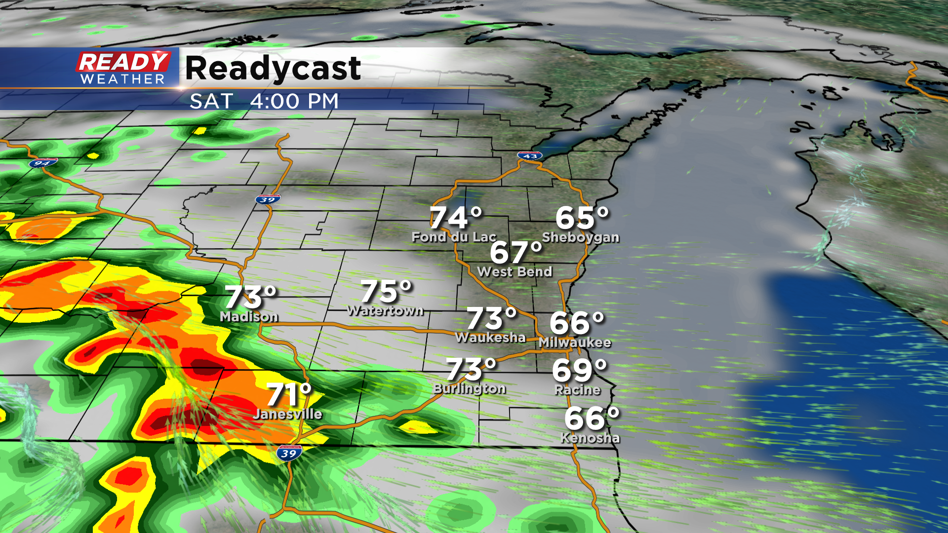
These storms will continue to track through southeast Wisconsin between 5 and 7 pm, and a few may be strong to severe.
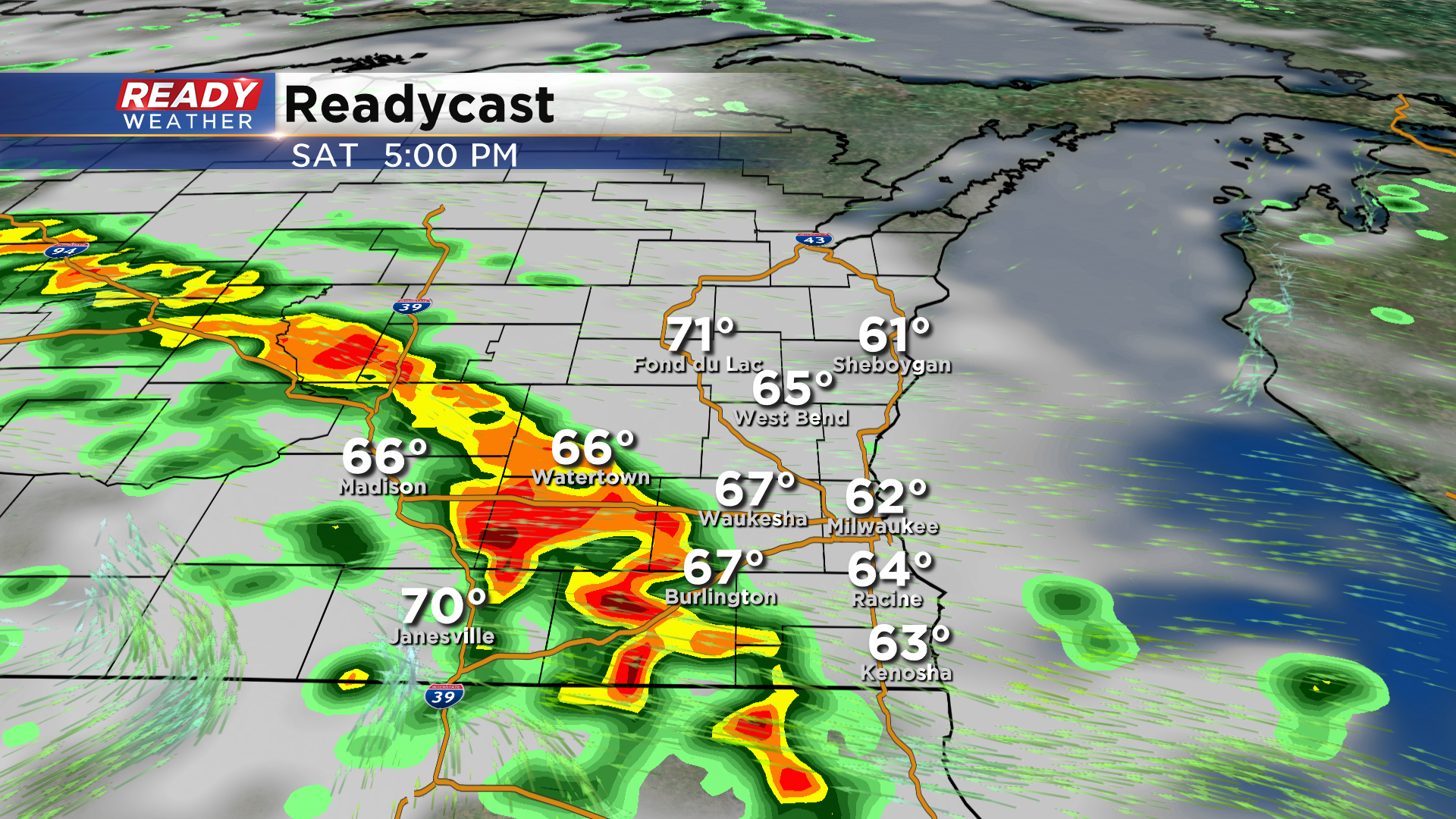
We'll have an easterly wind in place all day, which will keep the air more stable near the lake. This will cause storms to weaken as they push eastward through the area, however they could still produce small hail and gusty winds.
The best chance for strong to severe storms will be along the Wisconsin/Illinois border, including parts of Walworth and southwest Kenosha counties where a level 2, Slight Risk is in place. The rest of the area is under a level 1, Marginal Risk besides Fond du Lac and Sheboygan counties.
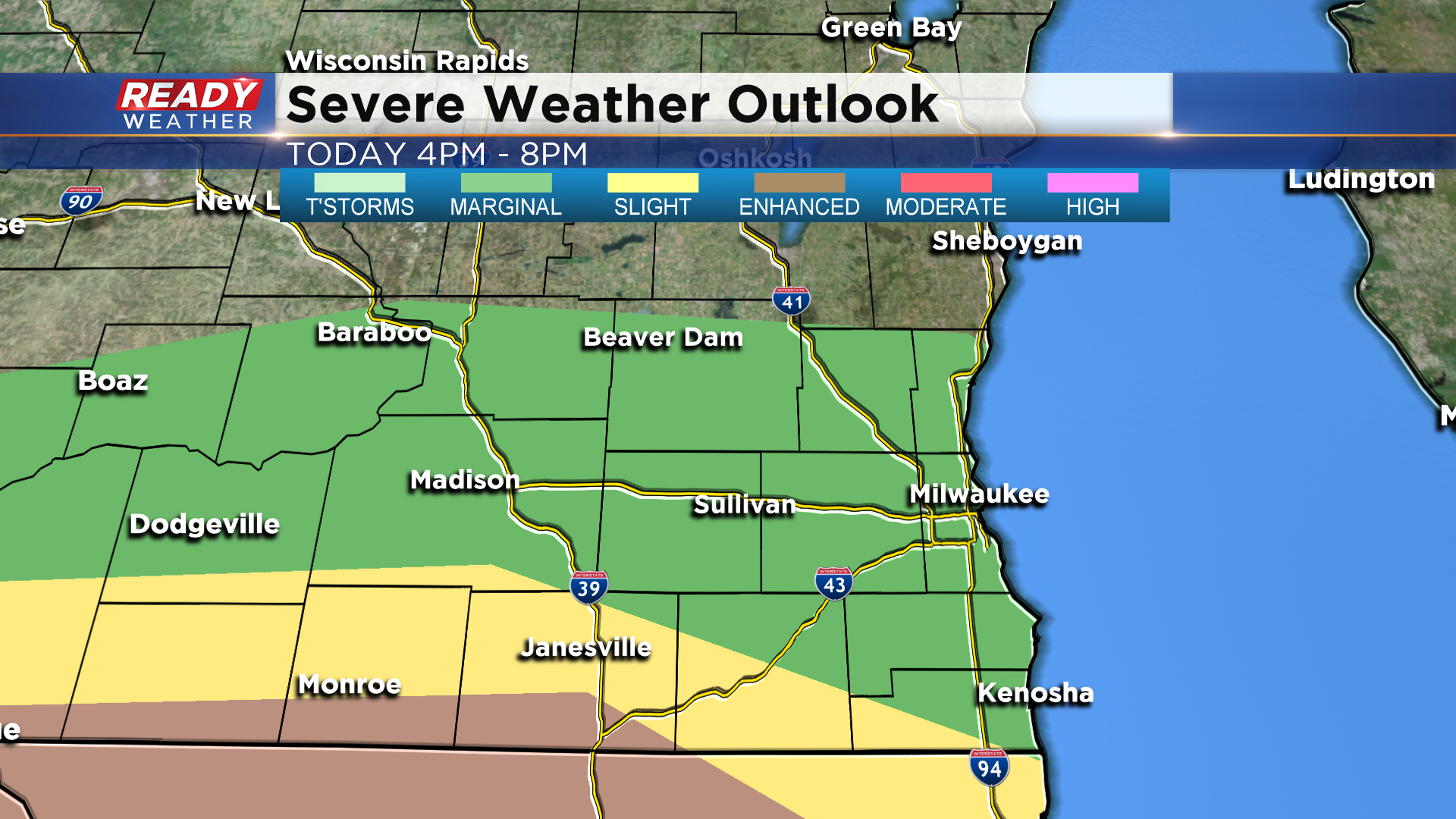
The main threats with these storms will be hail, strong winds, and locally heavy downpours. However, there is a small tornado threat along with Wisconsin/Illinois border. This tornado threat is highest in the level 3, Enhanced Risk in place from Beloit to Dubuque and across most of northern Illinois where the warm front is expected to settle.
Download the CBS 58 Ready Weather App to get watches and warning sent to your phone, and stay weather aware late this afternoon!
