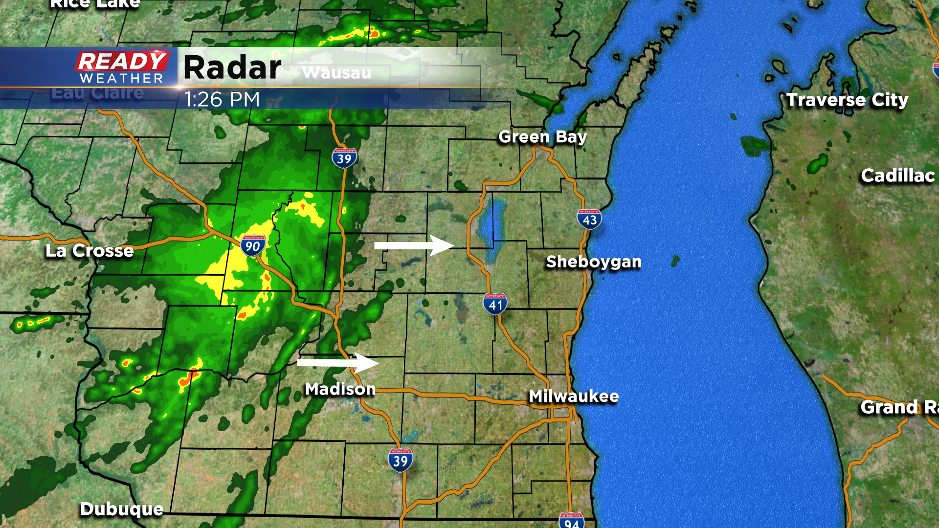
It’s been nearly two weeks since we’ve had measurable rainfall in southeast Wisconsin, but that could change for a few of us this afternoon as an area of rain is approaching from the west. There’s a good amount of dry air over us, which will cause this area of rain to weaken as it moves through southeast Wisconsin. Areas northwest of Milwaukee have the best chance at light rain, while far southeast Wisconsin may not see more than a few sprinkles.
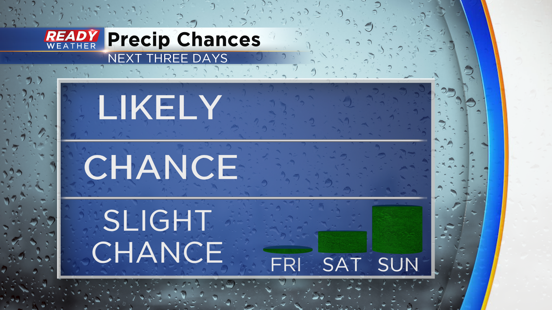
Any showers will end overnight tonight with dry weather expected through Friday. At this point, it looks like there will be plenty of dry time this weekend with only small chances for rain. Saturday has trended dry across southeast Wisconsin besides a small chance for an early morning shower or storm north of Milwaukee. There is also an isolated chance for showers Sunday afternoon and evening, but only a 30% chance. The best chance for rain and storms this weekend will be across northern Wisconsin.
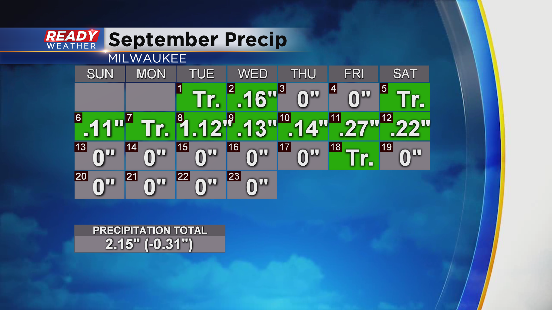
We could use a little bit of rain around southeast Wisconsin. After a soggy start to September, Milwaukee is now around a third of an inch below normal for rainfall this month due to our recent dry stretch of weather.
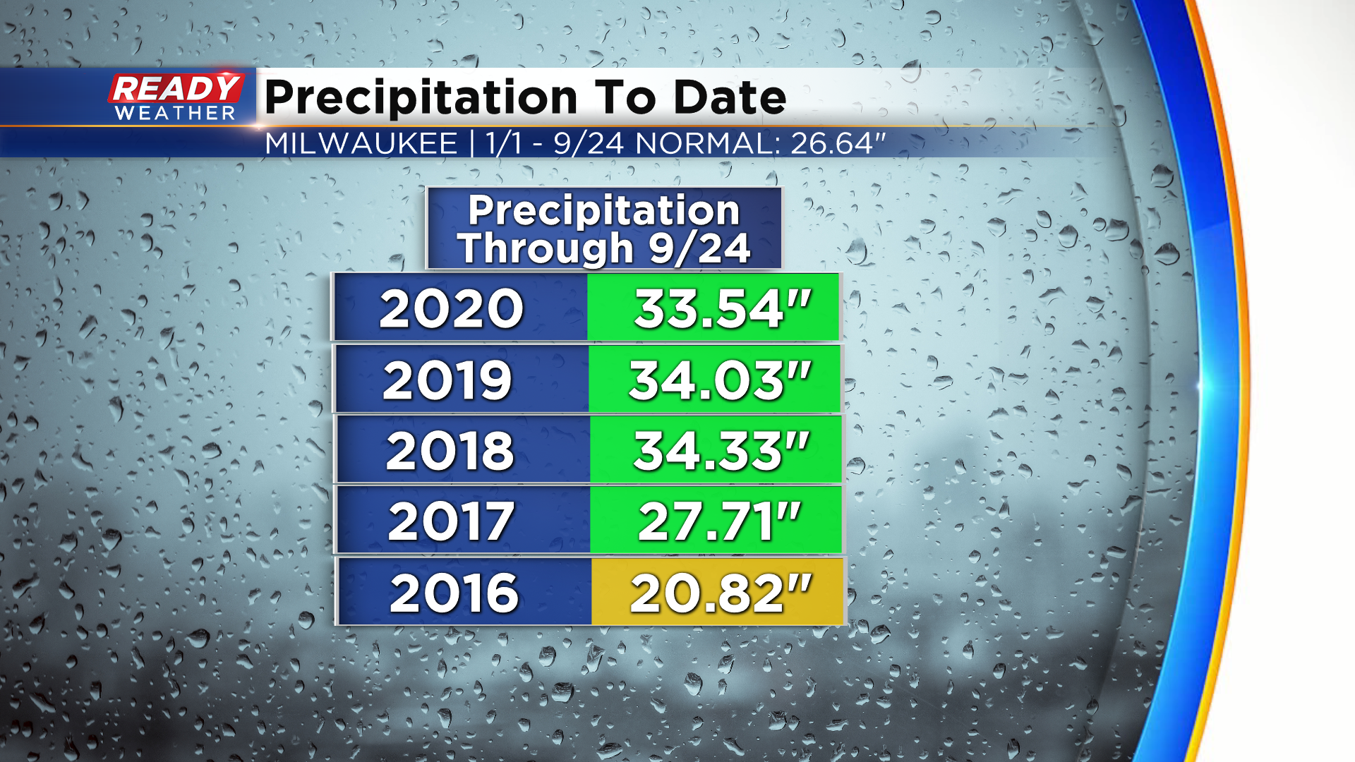
Despite the recent dry stretch, we are still well above normal on rainfall on the year. Milwaukee has picked up 33.53” of precipitation since the beginning of the year, nearly 7” above normal. This is fairly similar to where we were on this date the last two years. 2019 and 2018 ended up being the 3rd and 4th wettest years on record, so this is something we’ll continue to monitor over the next few months.
Much cooler air will stream into the region behind this weekends system. Download the CBS 58 Ready Weather App to see how chilly we'll be next week.
