


September has ended and October has begun. Temperatures seemed to cool just as soon as the calendar flipped with our first frost advisory of the season issued for the morning of October 2nd. Looking back at October we didn't have any big temperature swings and we went through longer wet and dry stretches of weather. Overall we stayed pretty close to average on both temps and rain.
When it comes to temperatures, the average September temperature ended at 63.7* which is just barely above-average. The warmest September temp was 83* on September 2nd and the coldest in Milwaukee was 42* on September 19th. What's notable about the 83 is that it's the coldest September max temperature since 1997, meaning over the past 23 years September has been warmer than 83. The 42* low temp on September 19th saw temps well into the 30s inland with many spots seeing their first frost.

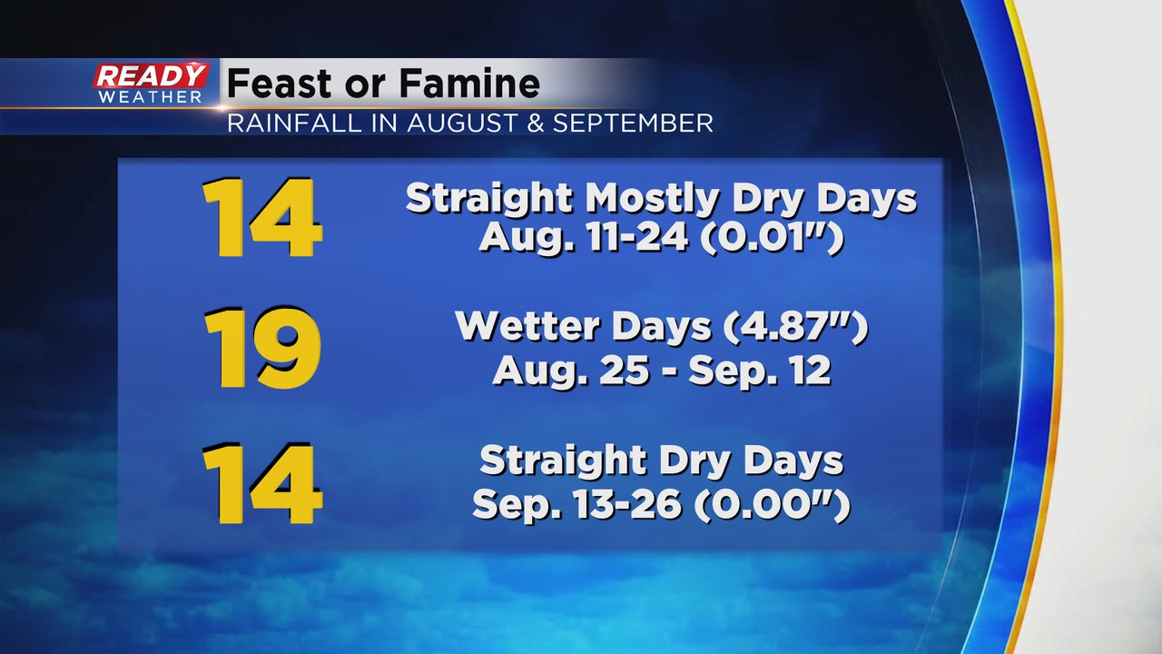
On the precipitation side of things, we started September with a wet stretch of weather that started back on August 25 and lasted until September 12. During those nearly 20 days we picked up almost 5" of rain. Then we had a two week stretch of weather that was completely dry before ending September with a few wet days.
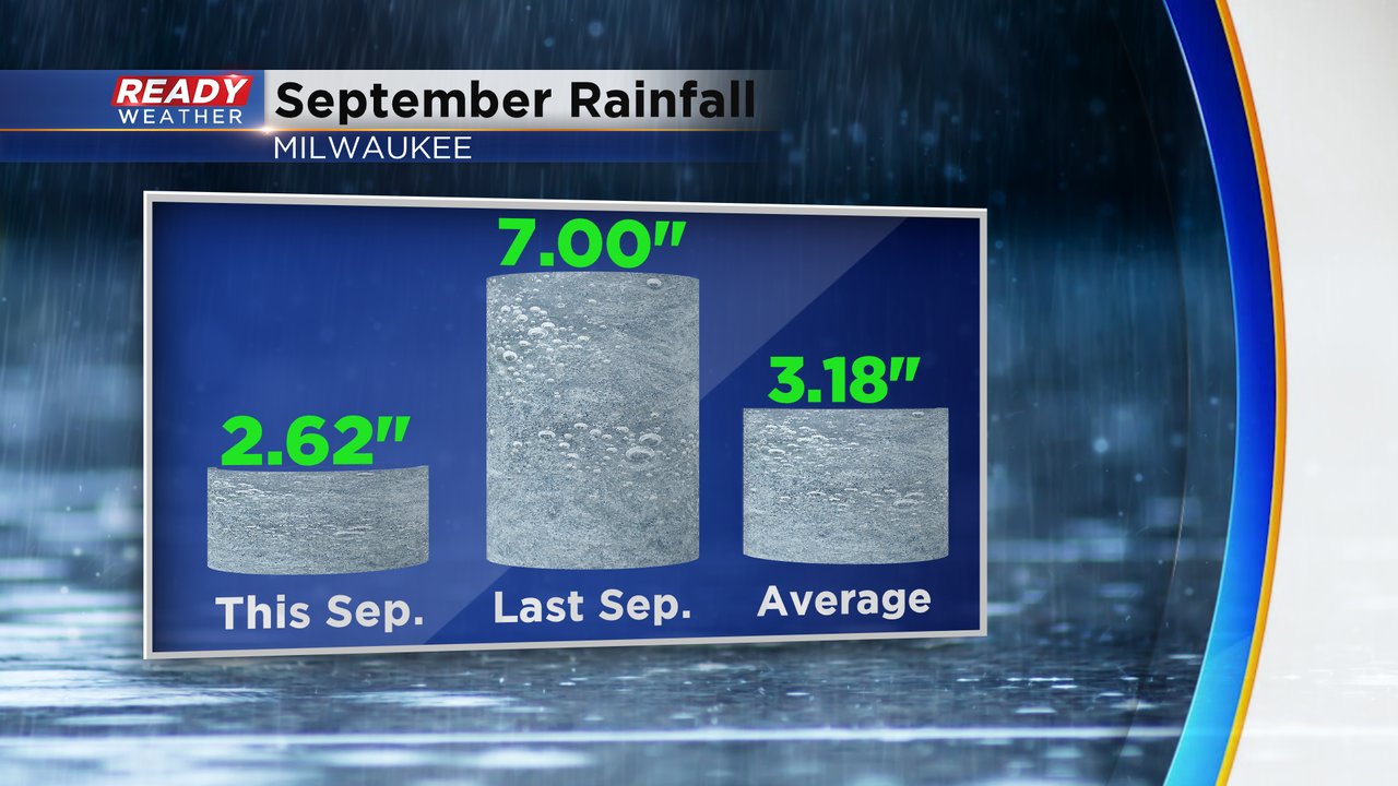
Overall September ends almost 0.60" below-average with a total monthly rainfall of 2.62".
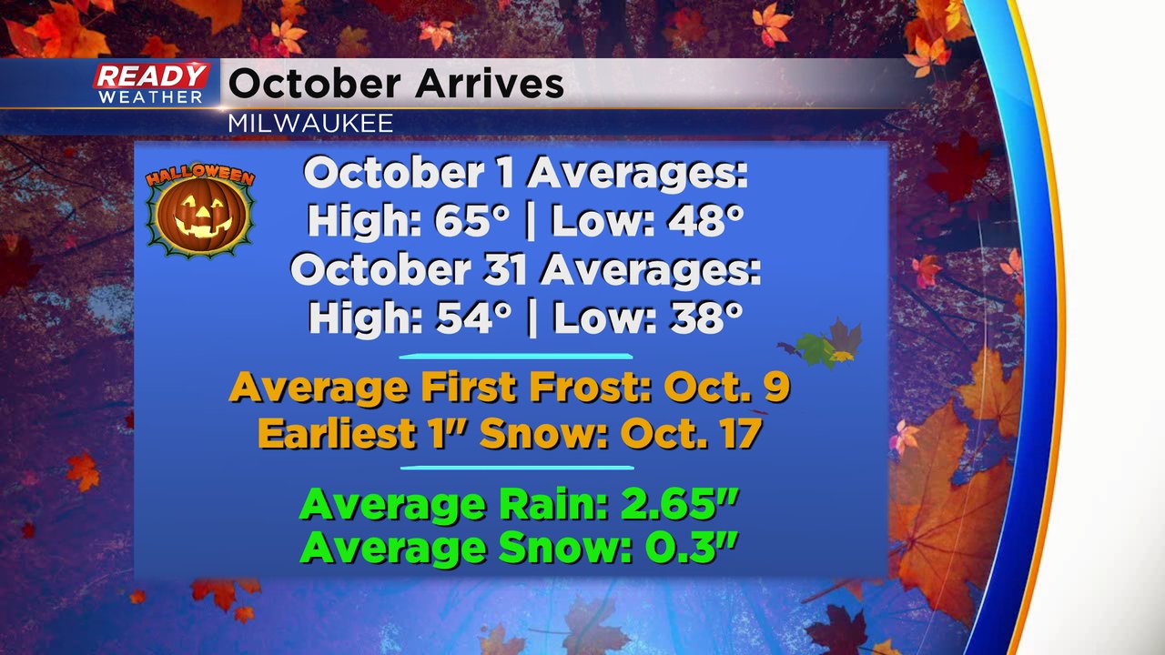
Now we are in October where the average highs and lows drop about ten degrees and by Halloween average highs are in the mid 50s and lows are in the 30s. Our average frost in Milwaukee happens October 9th, so we are seeing it a little earlier this year. We typically get our first snowflakes during October which averages 0.3" of snow and the earliest 1" snow event happened October 17th.
Download the CBS 58 Ready Weather app to see the 10-day forecast and track the cooler temps and get early warning on when snowflakes may start to fly.