Overnight Update: Lingering flurries and sprinkles overnight


Updated: 10:29 p.m. March 9, 2019
The steady precipitation is done Saturday with only lingering flurries and sprinkles remaining overnight. Most southern spots picked up a good soaking rain and northern areas got another helping of wet snow.
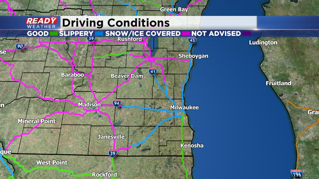
Road conditions are still reported as slipper across most of the area and snow covered around Madison and in Fond du Lac and Sheboygan Counties.
------
Updated: 8:52 p.m. March 9, 2019
The heaviest of the precipitation has already moved through southeast Wisconsin. There are still areas of rain south of I-94 and some pockets of snow north of I-94. It took a little longer than expected for the wintry mix to switch over to rain in southern spots leading to very slushy roads and a few crashes. Temperatures are currently hovering around 32° so some slick or icy spots are possible.
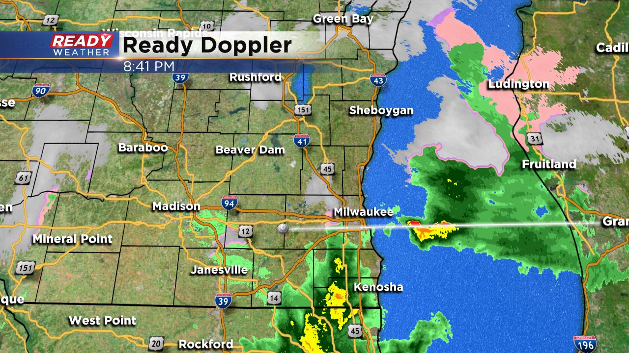
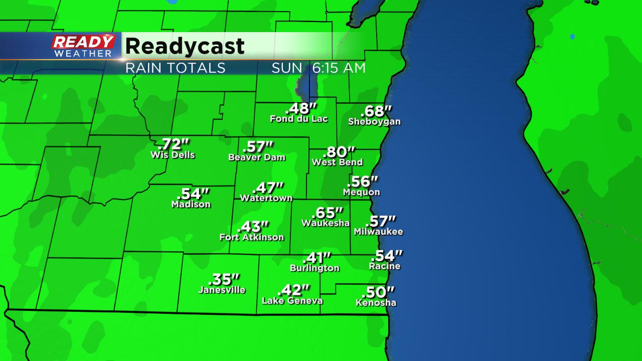
Rain totals south of I-94 have already reached three quarters of an inch in some spots with lower rain totals in northern areas where they have seen more snow.
Light precipitation will continue through around midnight before becoming just flurries and sprinkles overnight.
------
Posted: 5:40 p.m. March 9, 2019
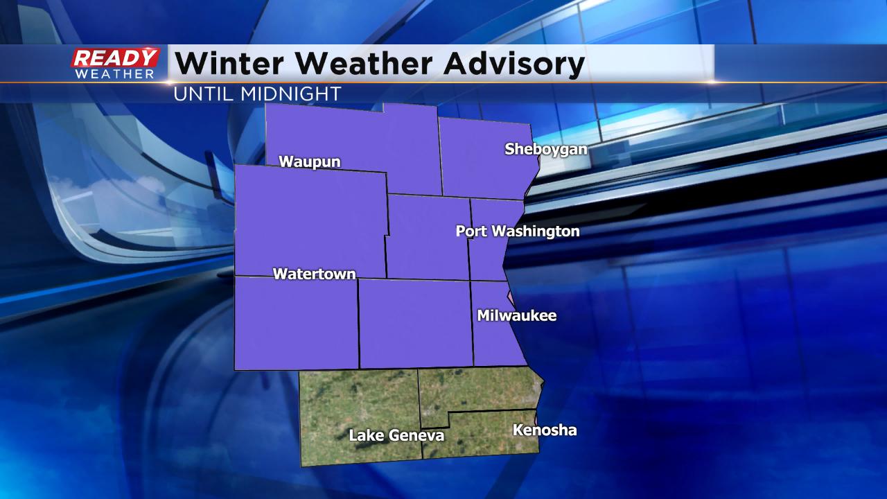
A mess of wintry mix including snow, rain, freezing rain and sleet came in quick across southeast Wisconsin Saturday afternoon. A good chunk of the area has seen freezing rain so the National Weather Service has issued a winter weather advisory for all counties except Walworth, Racine and Kenosha until midnight Saturday night.
Even though the advisory is for freezing rain, most of us pick up a good helping of rain and snow. By 8:30 p.m. the wintry mess will become more clear with mainly snow in northern spots and just rain south of I-94.
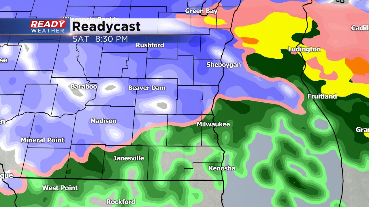
It's a good soaking rain and with snow clogging a lot of storm drains there will likely be some ponding on area roadways. A half to full inch of rain is possible by the time it ends Sunday morning.
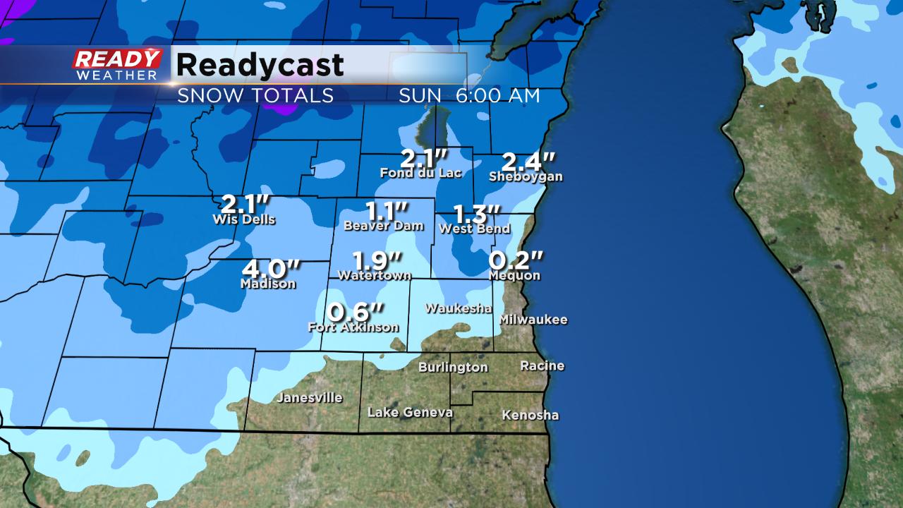
When it comes to snow in northern spots it's a heavy, wet cement like snow that accumulates to a few inches. Highest totals will be in Fond du Lac and Sheboygan Counties where up to three inches is possible.
The bulk of the rain, snow and wintry mix will be done by midnight with lingering flurries and light rain showers through daybreak Sunday.