
-
3:13

Natalie’s Everyday Heroes: Bracelets bring in bucks to help...
-
3:22

EF-2 tornado tears through Menasha, leaving widespread damage
-
2:19

Independent investigation underway for man shot and killed by...
-
1:52

Businesses react as Madison protests continue after Corey Ruiz...
-
2:10

New Packers CEO says team won’t sell naming rights to Lambeau...
-
2:00

Cedarburg family on the road to recovery after barn explosion...
-
2:46

45 p.m. update: Severe weather threat has decreased. The watch...
-
3:29

Racine Zoo rounds out summer with concerts, car show and fundraising...
-
1:20

EAA AirVenture wraps up week of aviation thrills in Oshkosh
-
0:37

19-year-old killed in Milwaukee shooting near 73rd and Beckett
-
0:59

Jordan Love hosts youth football camp ahead of Packers training...
-
1:45

Madison protesters hold State Street sit-in, renew calls for...

A fast moving system will arrive Tuesday night into Wednesday morning providing a true mix of snow, sleet, and freezing rain across southeastern Wisconsin.
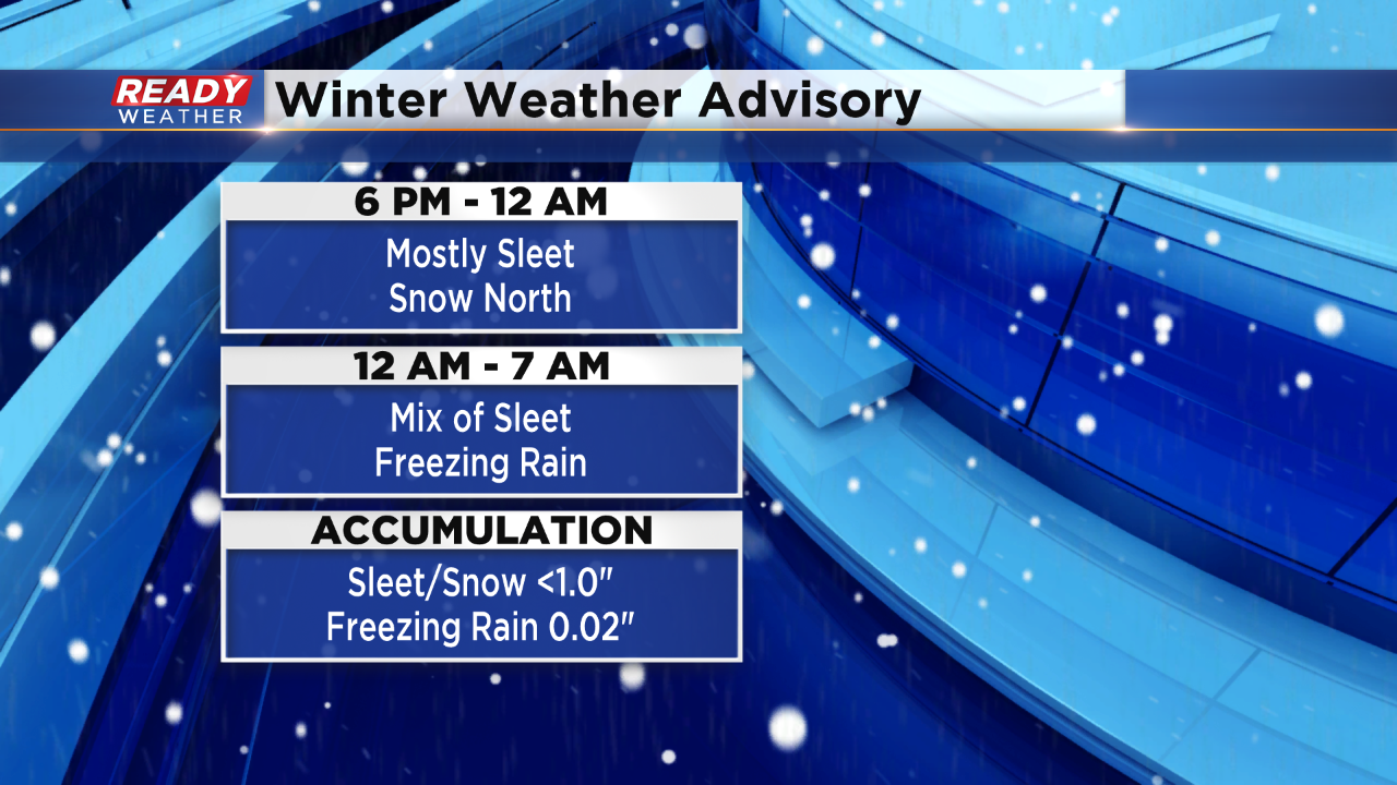
Most of Tuesday will be quiet across the area. Between 6 pm and Midnight expect a mix of snow and sleet to move across southeastern Wisconsin. The best chance for snow will occur north of I-94. As warm air starts to move into the system aloft, the snow will turn back over to sleet.
There will be a window for sleet and even freezing rain between Midnight and 7 am Wednesday.
The snow and sleet accumulation will remain below an inch with minor icing from freezing rain. While the overall totals aren't impressive, these types of winter systems will create slick roads Tuesday night into Wednesday morning.