9:30 PM Update: Lingering light snow transitions to patchy freezing drizzle overnight


Updated: 9:30 p.m. March 15, 2021
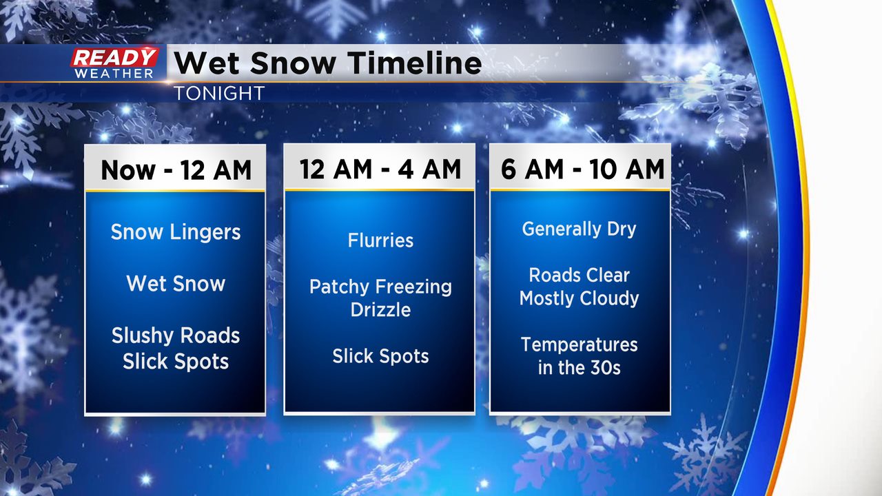
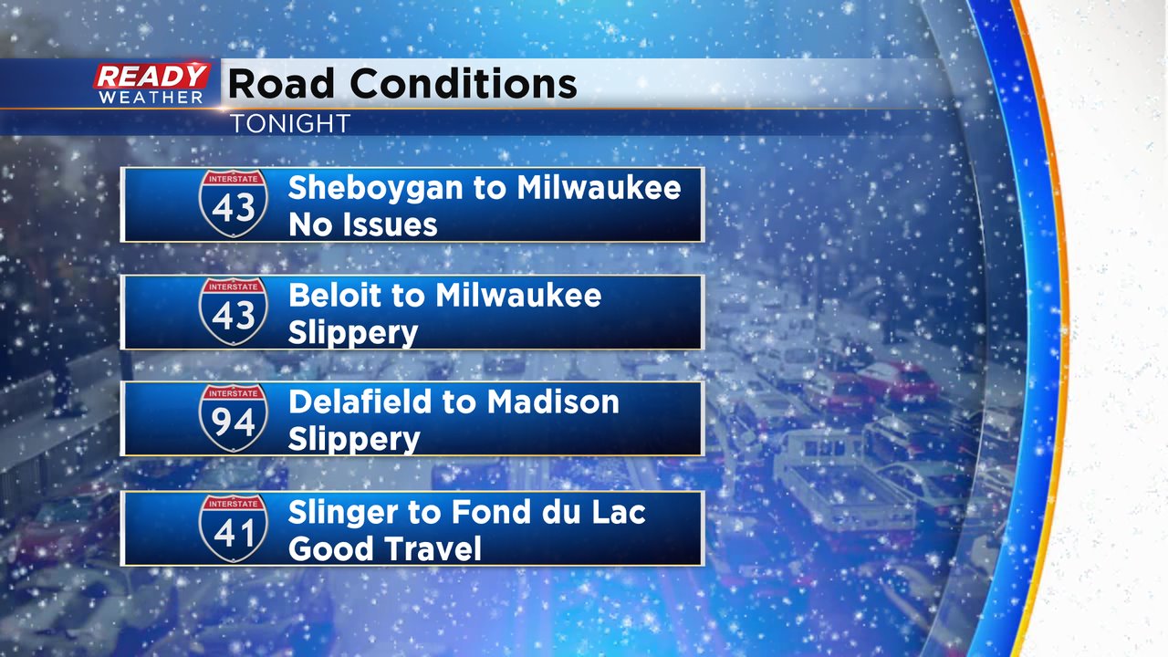
Light snow showers are likely through Midnight. Many areas have picked up 1" to 2" on grassy areas. Secondary roads are slick tonight, especially interstate ramps.
Flurries are possible overnight; however, we do expect patchy areas of freezing drizzle. After 6 am the commute should be in pretty good shape.
______________________________________________________________________________________________________________
Updated: 7:30 p.m. March 15, 2021
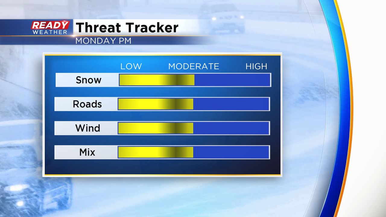
The winter weather advisory remains in effect until 1 am. Light snow continues to fall across the area; however, the intensity has gone down since the afternoon.
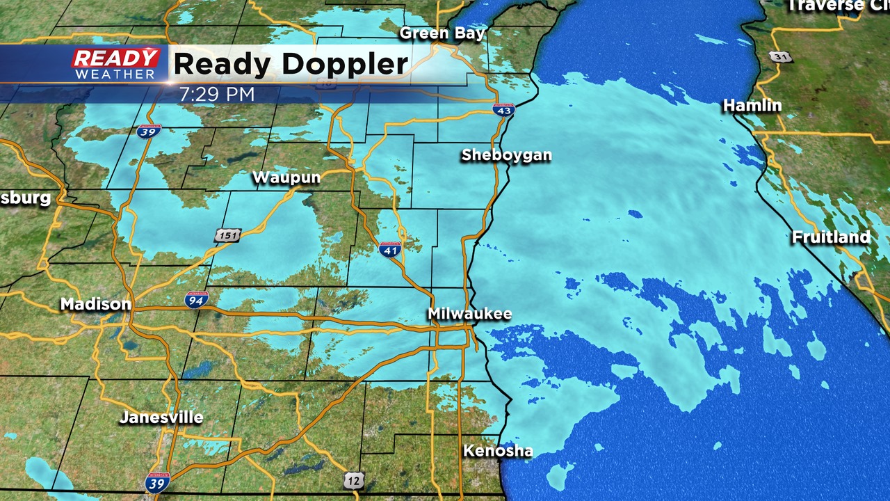
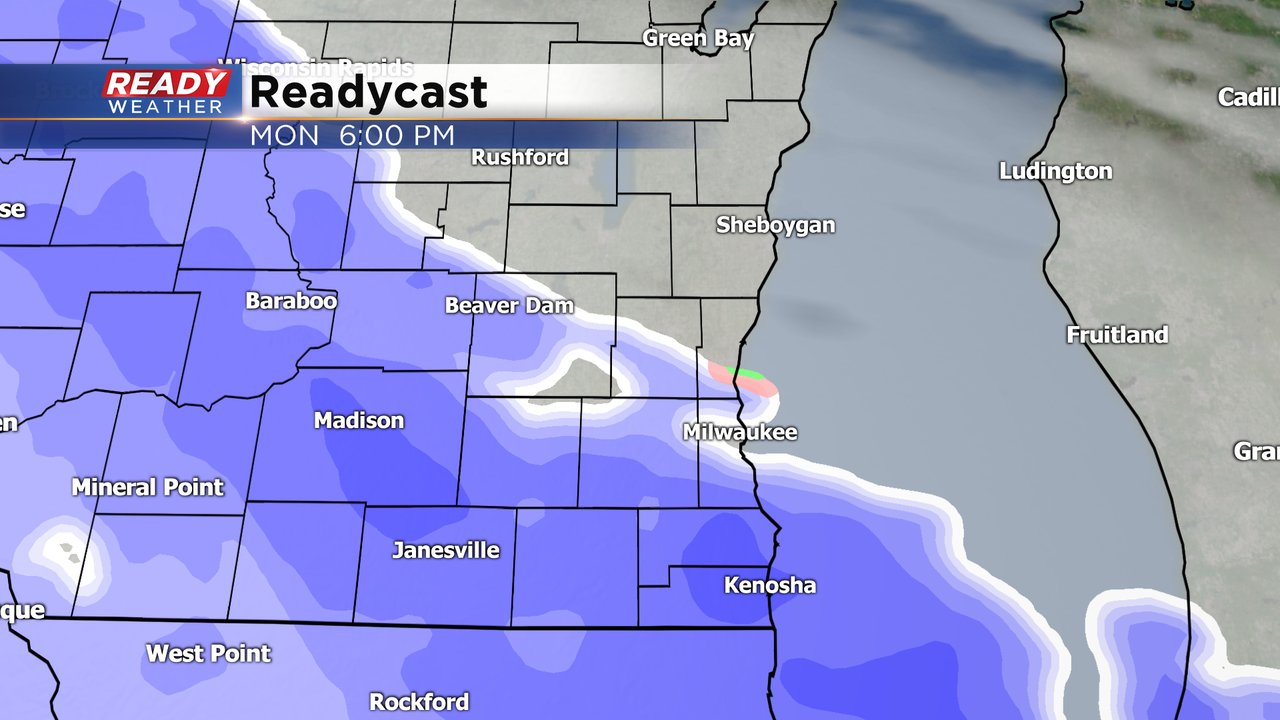
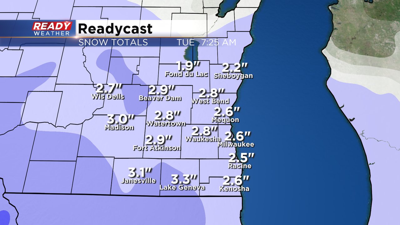
Light snow remains in the forecast through Midnight. Areas near the lakefront, especially north of Milwaukee, won't pick up on much accumulation. Most areas will receive a dusting to 1" on grassy areas.
Dry air will help to erode the snow showers and produce some patchy freezing drizzle. This doesn't appear to be widespread overnight. It could create some additional slick spots.
______________________________________________________________________________________________________________
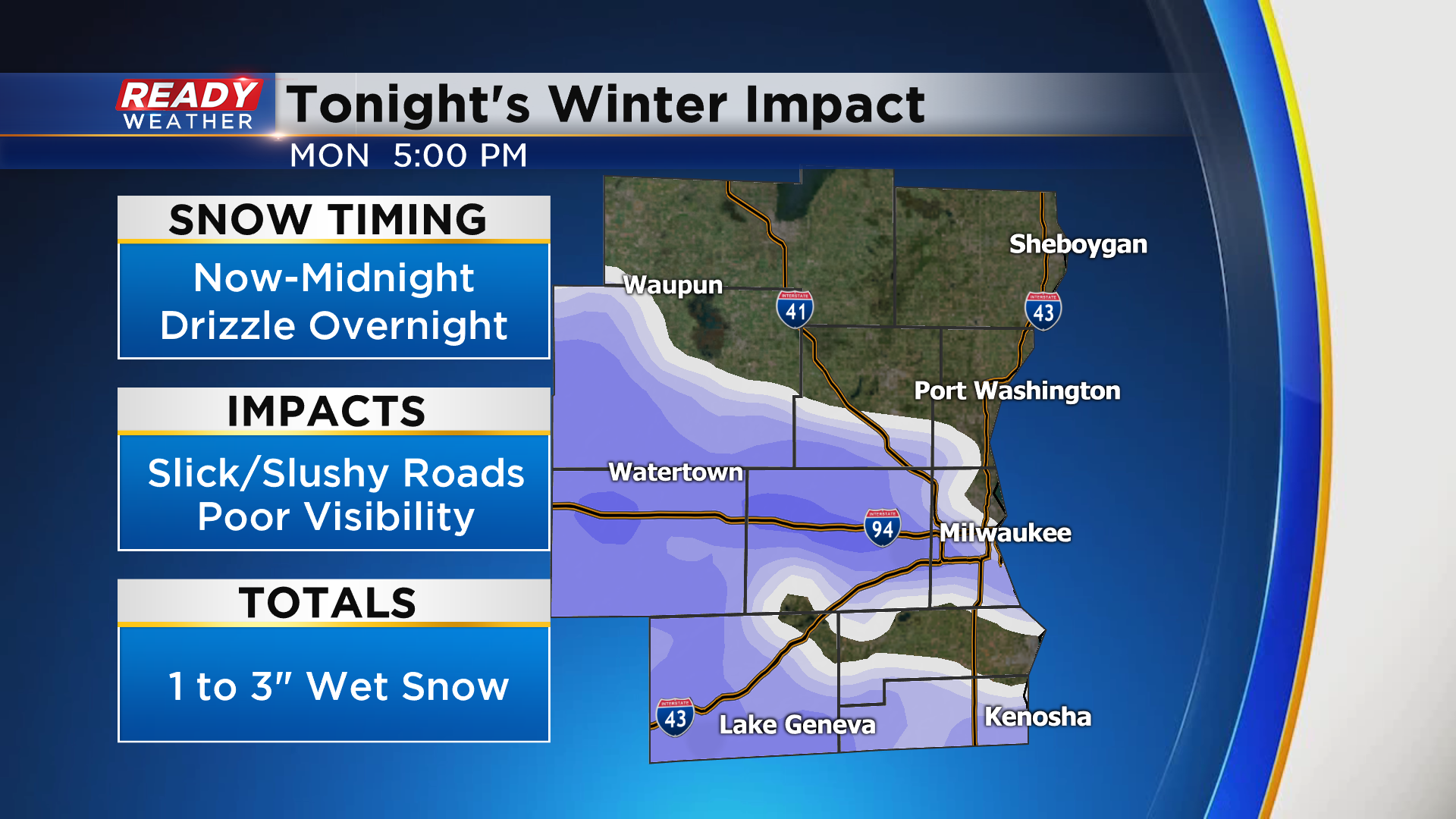
Updated: 5:30 p.m. March 15, 2021
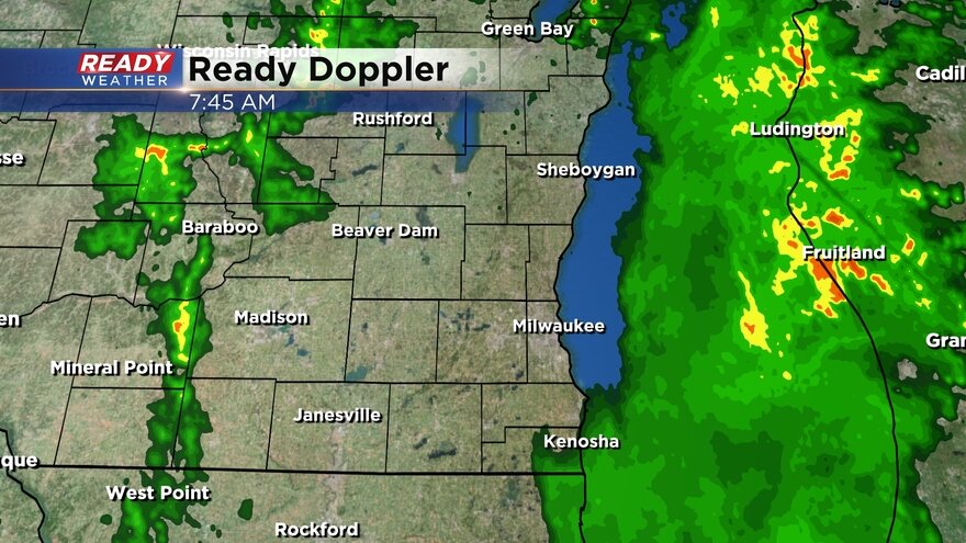
Areas west and south of Milwaukee have picked up snow and it's creating slick spots on the roads. In addition to the slick roads, low visibility is also an issue within the heavier snow band.
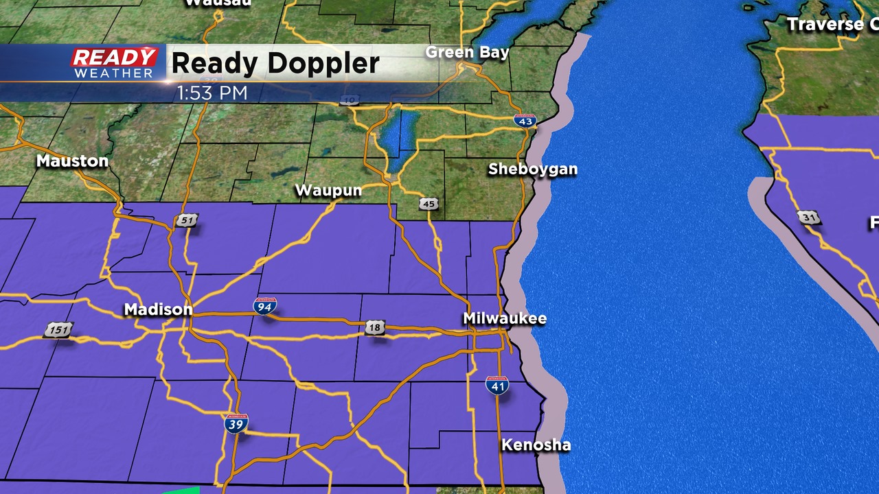
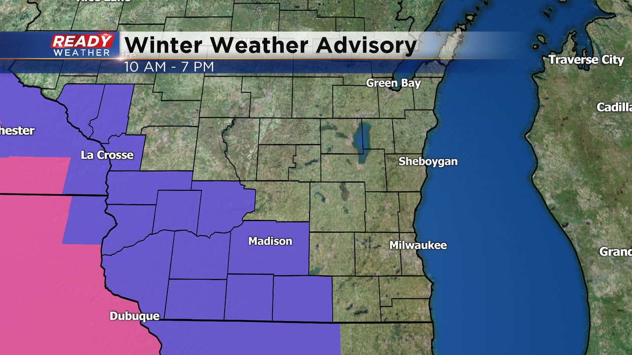
The National Weather Service has issued a winter weather advisory for the majority of the area until 1 am. Sheboygan and Fond du Lac counties are not included.
Slushy snow is expected across southeastern Wisconsin throughout the evening commute. 1" to 3" of snow is expected areawide, especially on the grass.
Roads will be slushy and slick this evening as a band of moderate snow moves from south to north. After midnight the snow will end; however, patchy areas of freezing drizzle will develop and create additional slick spots.
______________________________________________________________________________________________________________
Updated: 1:00 p.m. March 15, 2021
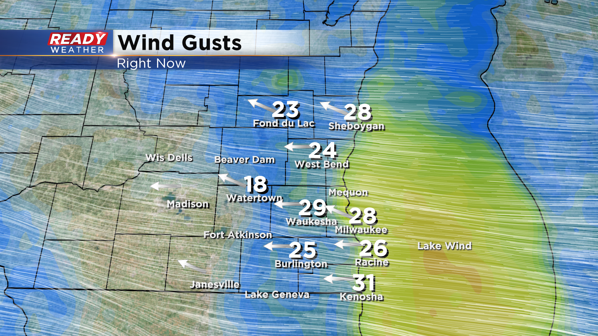
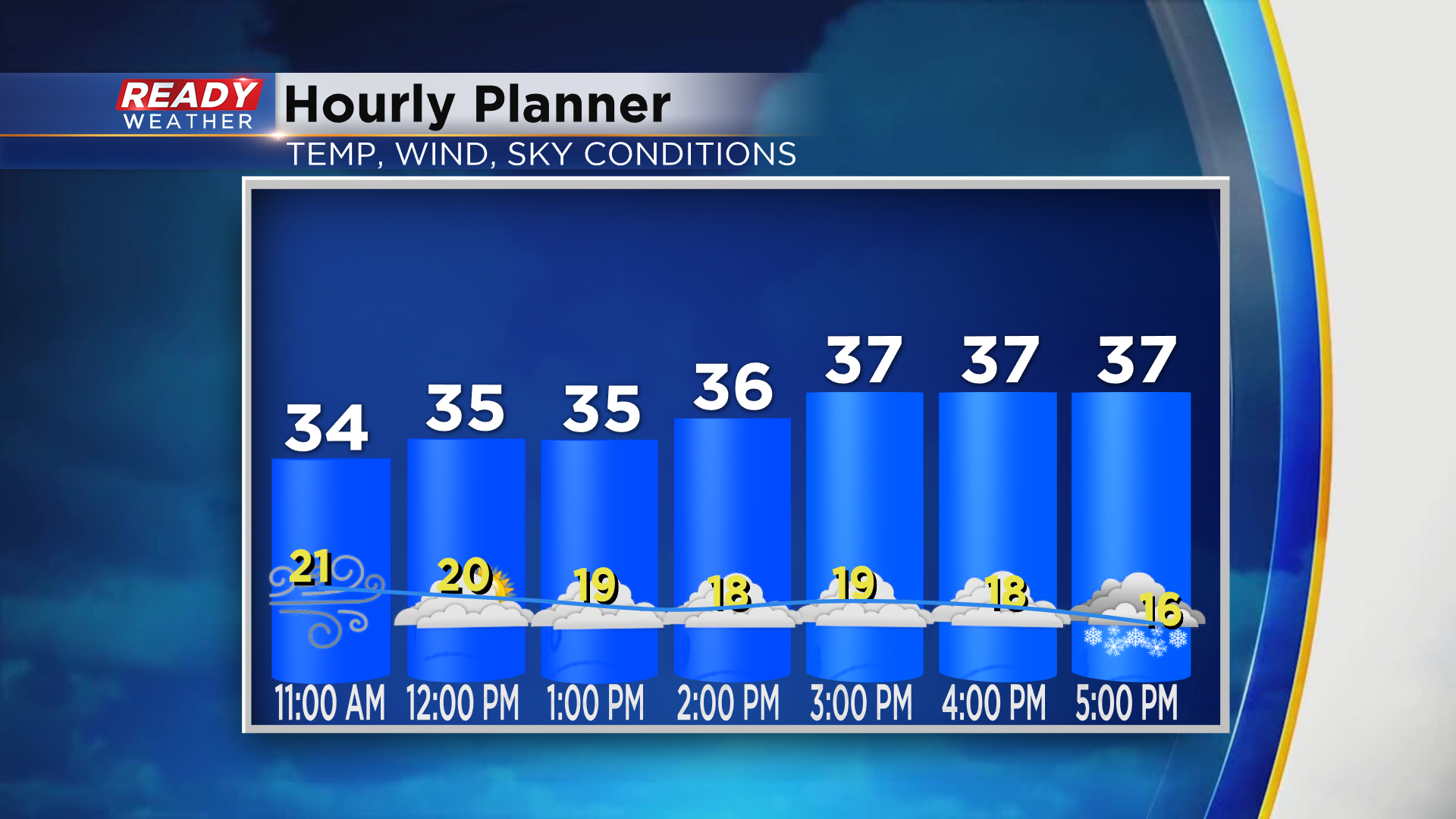
Cloudy and windy, but dry over the noon hour. Wind will be a major impact to this storm as snow slowly works in late day. Wind gusts have already been over 30mph in many locations across the viewing area. I've seen winds gusts to about 45mph in places just to our southwest as moderate snow is in progress there. Be prepared for quickly dropping visibilities as snow works in later today.
The timing of the snow will vary depending on your location. As it rolls up from the south, places like the greater Milwaukee area can expect it overhead by 5 p.m.
Updated: 11:00 a.m. March 15, 2021
Updated: 9:05 a.m. March 15, 2021
The morning was dry and just fine and many woke up to a beautiful sunrise. The clouds have now swallowed up the sun and we don't see much of it the rest of the week. The evening commute will be a different story with at least wet and slushy roads expected for the early evening commute becoming snow covered and slipper by the late evening commute.
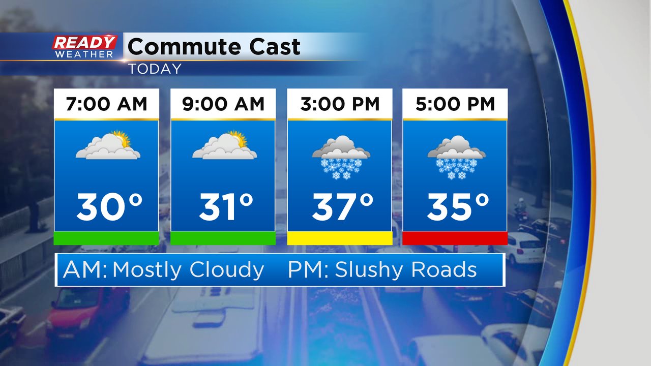
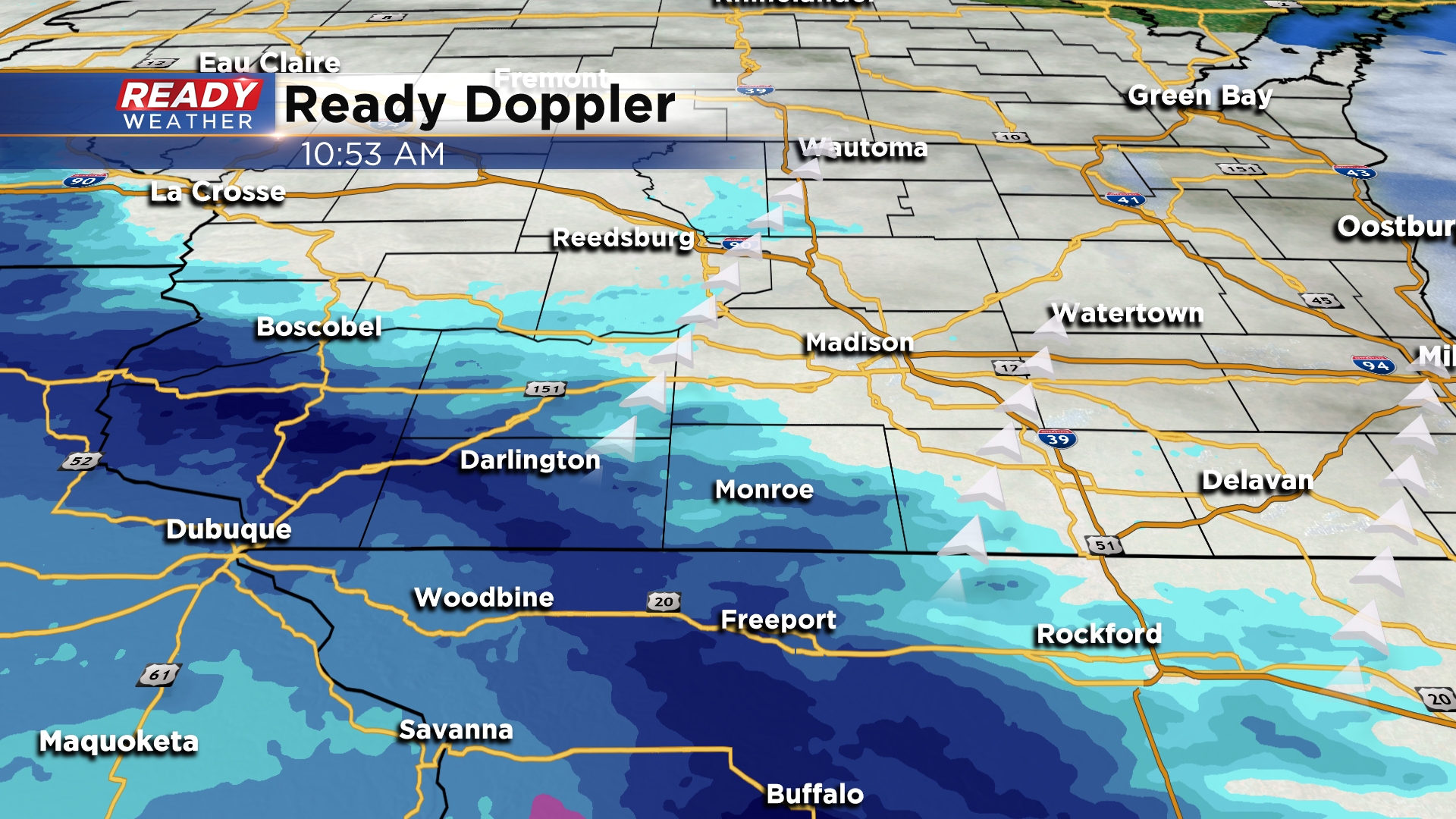
Currently snow is falling in southwest Wisconsin and NW Illinois but still has to overcome some dry air before it starts coming down in our local areas. Jefferson, Walworth, Racine and Kenosha Counties will be the first to see the snow start shortly after lunch time with most everyone seeing steady snow by the late afternoon.
------
Posted: 5:33 a.m. March 15, 2021
It's been over three weeks since we've had any measurable snow in southeast Wisconsin! Milwaukee has not had any precipitation (either rain or snow) in 20 days. But that all changes Monday with a large storm system moving across the country that brings some wet, slushy snow to southeast Wisconsin Monday afternoon and evening. The snow will start around 3 p.m. in our SW areas then move into the metro area for the evening commute and continue through the late evening.
A few lingering snow showers will be possible through late tonight into tomorrow morning. A touch of wintry mix with some freezing drizzle may be possible once the bulk of the heavy snow is done. The snow will come down fairly heavy at times and roads will likely be slushy by the evening commute and slick and snow covered through the evening. The wind will be strong most of the day with gusts to 30 mph.
No winter weather advisories have been issued for southeast Wisconsin but one has been issued just to our west in south central and southwest Wisconsin from 10 a.m. Monday morning through 7 p.m.
The snow will have to battle some dry air this morning which delays the start time when most of us will see flakes fly until the early afternoon. Some of the snow may melt, especially on the roads, when it first starts to fall. Accumulating snow will still be likely from late afternoon through the evening with 1-3" for most. A few spots may see just a touch more than 3".
Download the CBs 58 Ready Weather app top track the snow with the interactive radar.