Winter storm system rides in late this week, arctic air follows
A storm system will affect portions of the Badger State and the viewing area from Thursday into Saturday morning. There will likely be two rounds with this major system, with some uncertainties.
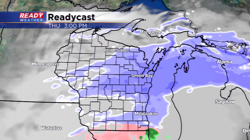
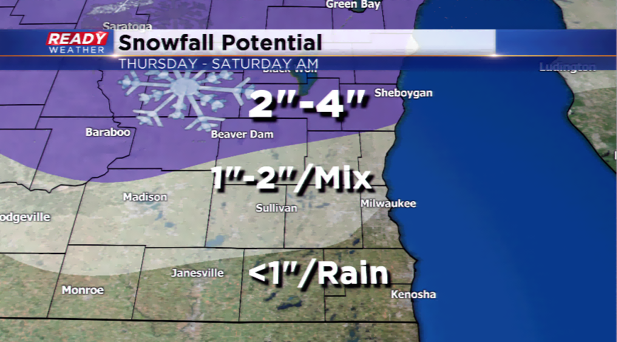
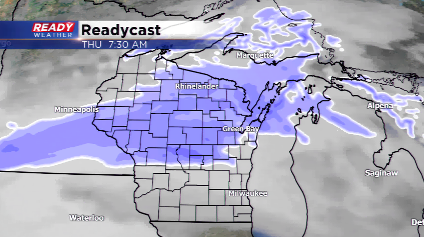
The first round of winter weather rolls in by Thursday morning bringing drizzle, rain, or light snow to the viewing area. This will spread from north to south – as it fills in, the northern parts of the area have the best chance to see all snow, while the rest will see a mix as times. This activity will be at its peak during the evening commute. The precipitation starts to end by Friday morning with slippery conditions and slight chances of light snow the rest of the day.
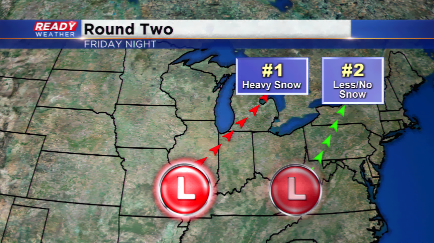
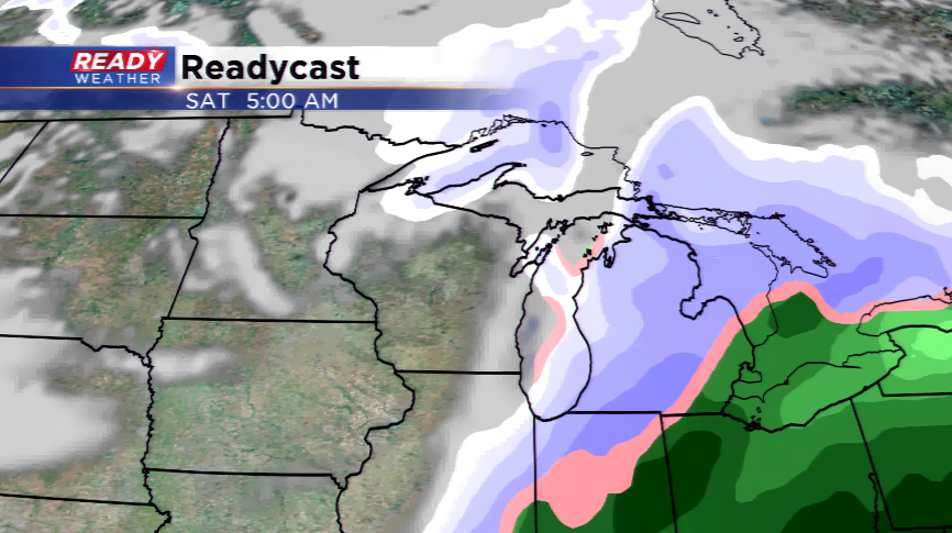
There’s not a lot of confidence in the second round of precipitation for Friday night. The track, as always, will be absolutely crucial to what the region receives for weather. If the low pressure system takes a westerly track, this could be a major winter storm with several inches of snow. At this time, most of the computer models are taking an easterly track which means very little additional snow or precipitation from this system. With the way the models are wobbling back and forth, it’s something we will be watching very closely to see if things do change.
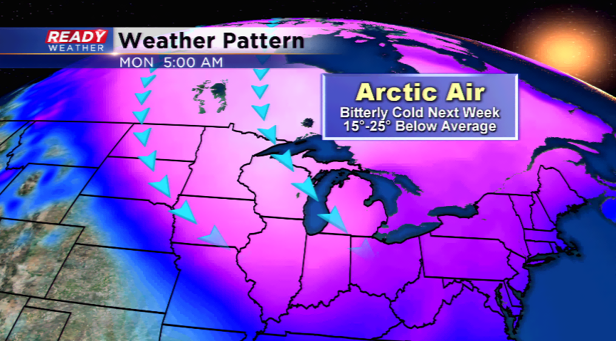
We have very high confidence of an Arctic blast behind this cluster of systems. The coldest air of the season will sink south from the north. Bitterly cold temperatures will send the highs down into the single digits and teens by late this weekend and early next week. This also means lows will drop below zero, and wind chills with wind will be WELL below zero.