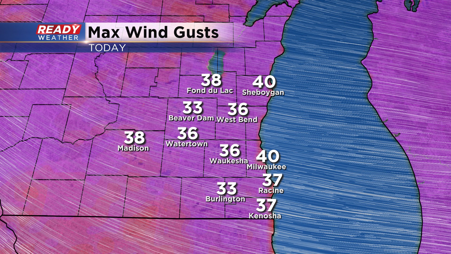
The week is starting off on a windy note! Wind gusts have been as high as 40mph. Check out the top gusts so far today:
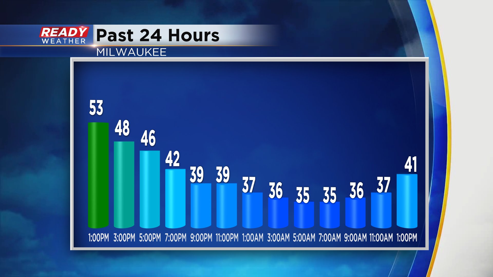
Even the sustained wind is running around 20mph this afternoon. All this is felt in the wake of a powerful low pressure system moving across the state yesterday. It brought snow to parts of the state, with many areas picking up over 6" of the white stuff. In the swirl of the low pressure system was also a wedge of dry air wrapping into it. That provided a southerly wind and a fairly dry daylight period here for our Sunday. That helped to bring us into the 50s out ahead of the center of the storm. Now behind it, we are feeling the northwest wind and chilly air. Have a look:
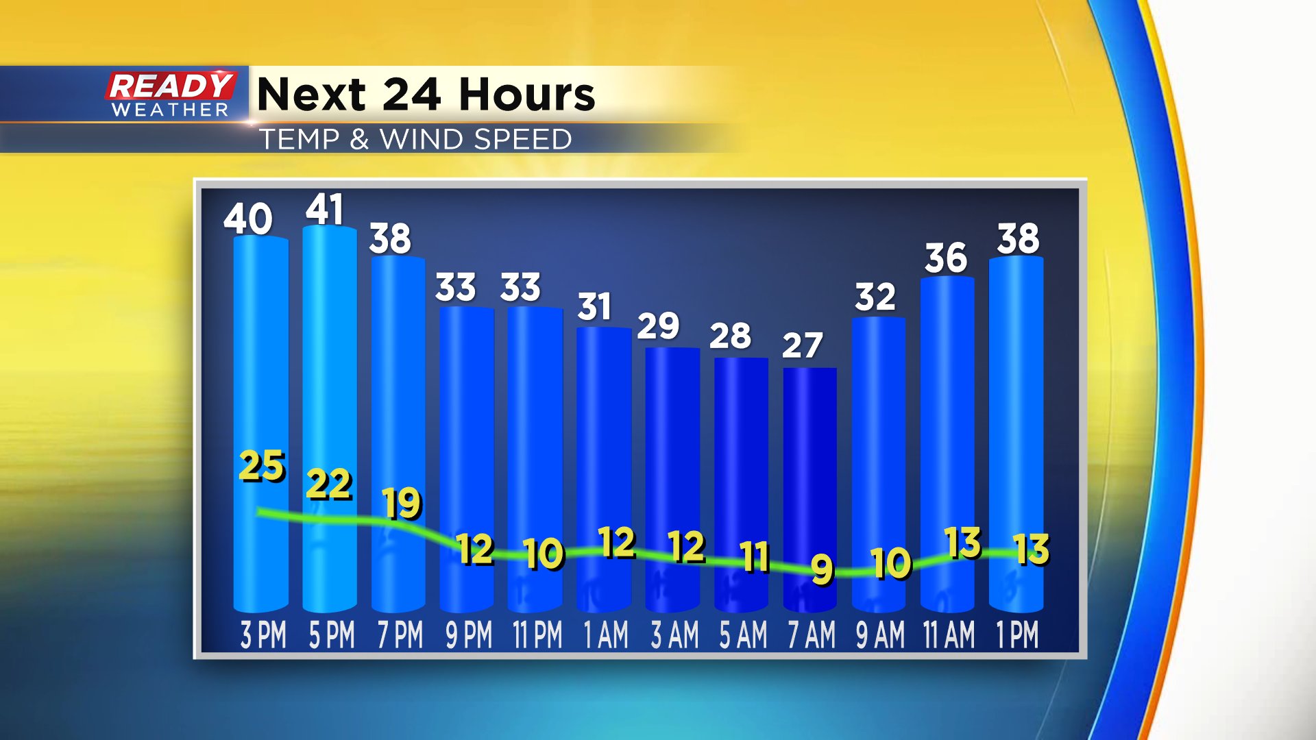
While spots are struggling to reach the 40s, tomorrow may be even colder! Even though average highs are in the mid 50s at this point in April, tomorrow may hold up in the 30s.
And that got me thinking, boy, could we see a new record Low Max? What is that you ask? That's the coldest high temperature ever recorded on a particular date. And the answer for tomorrow is no. The Low Max for April 14th is 32 degrees set back in 1907. But we won't be that far away from it with highs in the upper 30s for most! As I looked back through records I saw record Low Max temps were as cold as the 20s through the 17th of the month with 30s possible for highs, per the records, through the rest of the month.
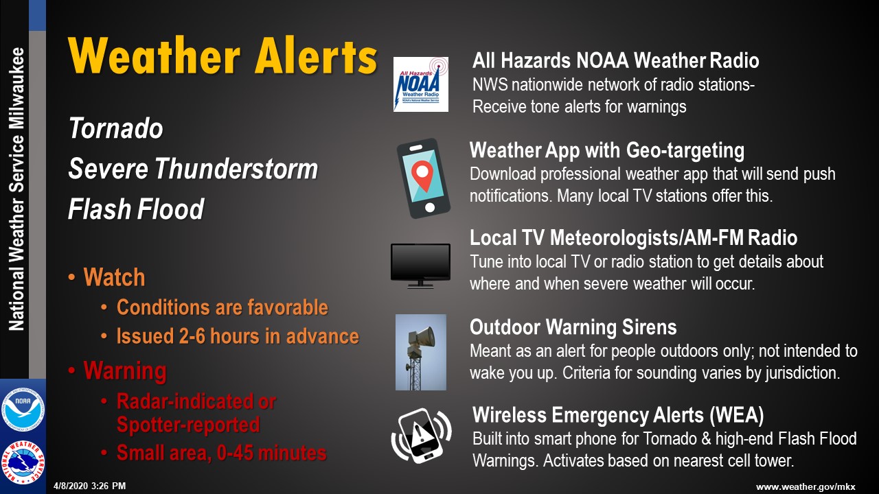
Ironically this is Tornado and Severe Weather Awareness week in Wisconsin. While we contend with cold, we think ahead and prepare for our summer weather storm season. Today's topic is Alerts and Warnings. Here's a nice page on what you need to know from our local National Weather Service office in Sullivan.
I'll be talking more about this today coming up on the CBS58 news at 4pm. Tune in!
I'm meteorologist Rebecca Schuld