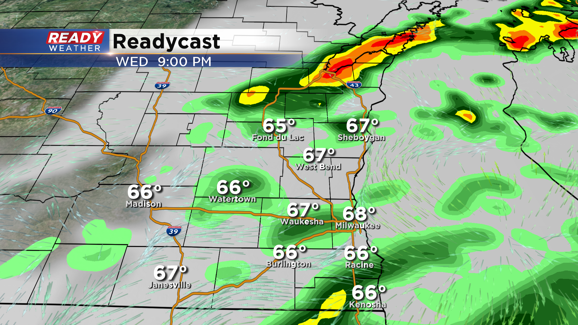
5 PM Update: Widespread rain and storms to continue into this evening


Updated: 5:00 pm July 15, 2020:
Moderate to heavy rain is falling in storms across parts of Milwaukee, Ozaukee, Dodge, and Fond du Lac counties.
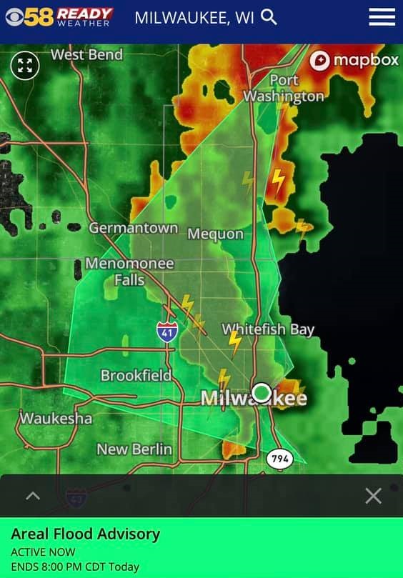
Parts of Milwaukee, Waukesha, Washington, and Ozaukee counties are under an Areal Flood Advisory through 8pm as 1.5-2" of rain has fallen from these storms, with an additional inch possible. Some flooding on area roads or in low lying spots will be possible.
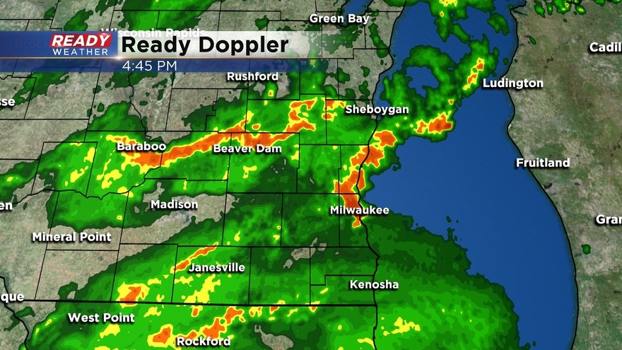
Lighter, more widespread rain is moving into southern Wisconsin. This will continue to push northward across the area through this evening.
--------------------------------------------------------------------------------------------
Updated: 3:00 pm July 15, 2020:
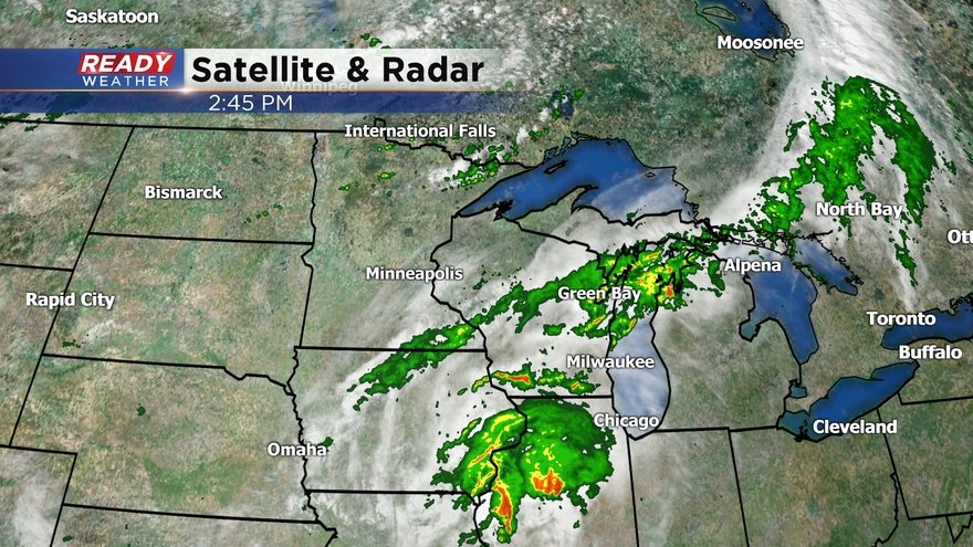
Scattered thunderstorms have moved into southern Wisconsin at mid afternoon, with the most prominent cell sitting over Whitewater.
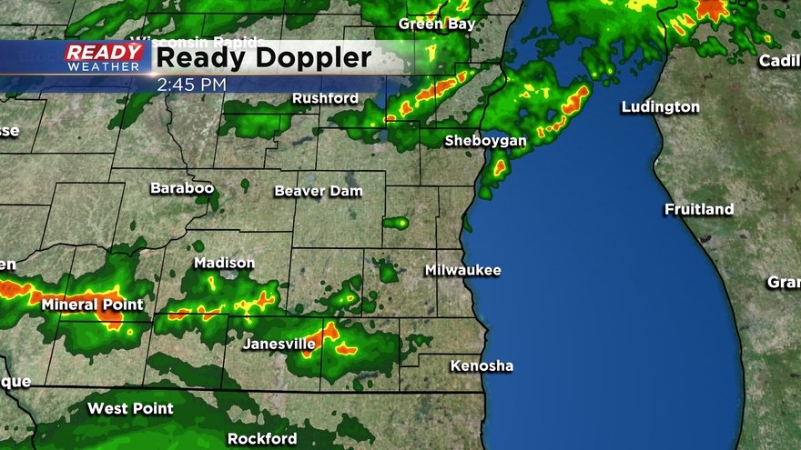
We'll be watching for additional thunderstorms to develop in northern Illinois over the next 1-2 hours ahead of the main area of rain pushing in from the south. This will be our best chance at any stronger storms, however the cloud cover we've had overhead all day has really limited our severe potential.
Expect heavy rain with any thunderstorms that do develop, and any stronger storms could produce gusty winds or hail.
--------------------------------------------------------------------------------------------------
Updated: 1:00 pm July 15, 2020:
Scattered thunderstorms developed and tracked along the stalled front around midday, dropping heavy rain in spots, but most of those storms have fizzled out.
The main wave of low pressure is still to our southwest. As it moves closer this afternoon, more scattered storms are expected to develop, especially south of the area that saw the showers and storms around midday.
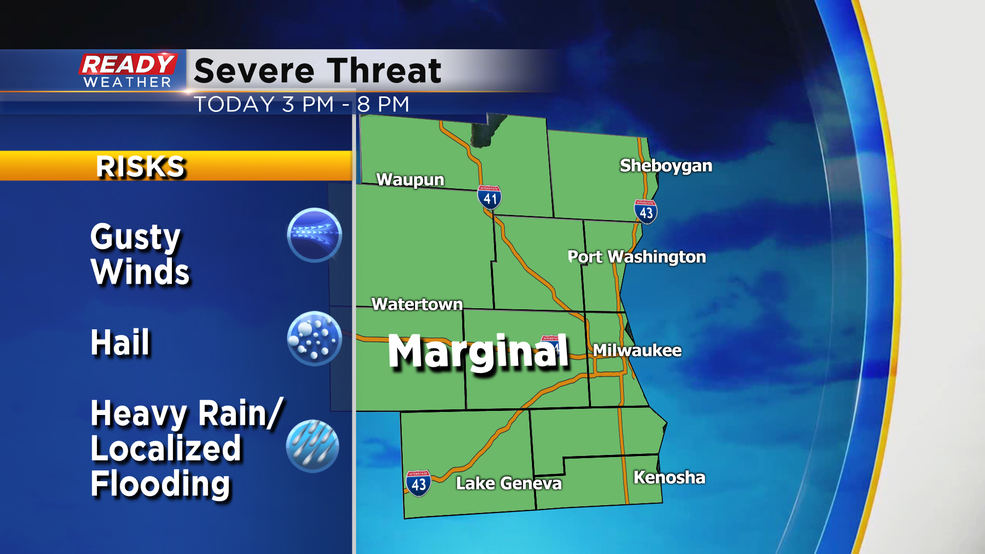
Expect scattered storms to become more numerous after 4 pm, and a few could be on the strong to severe side.
Main threats with these storms will be gusty winds, hail, and heavy downpours. Since we haven't seen much in the way of any clearing so far today, the intensity of these storms should remain limited. All of southeast Wisconsin remains under a level 1, Marginal Risk for severe storms.
Rain will start to taper off after 9 pm, with a fairly small window for stronger storms.
-------------------------------------------------------------------------------
Updated: 11:00 am July 15, 2020:
A majority of southeast Wisconsin has been able to dry out over the last few hours, but a couple of isolated storms have popped up late this morning along a stalled cold front that's draped across southeast Wisconsin.
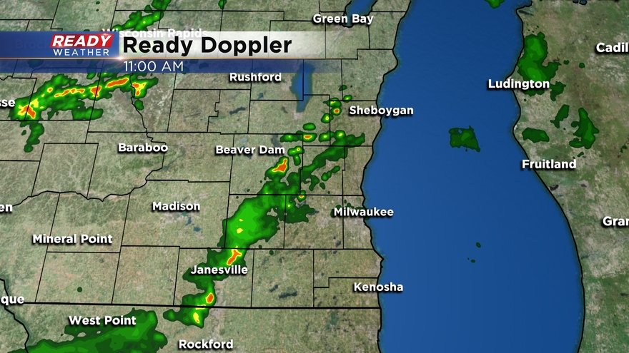
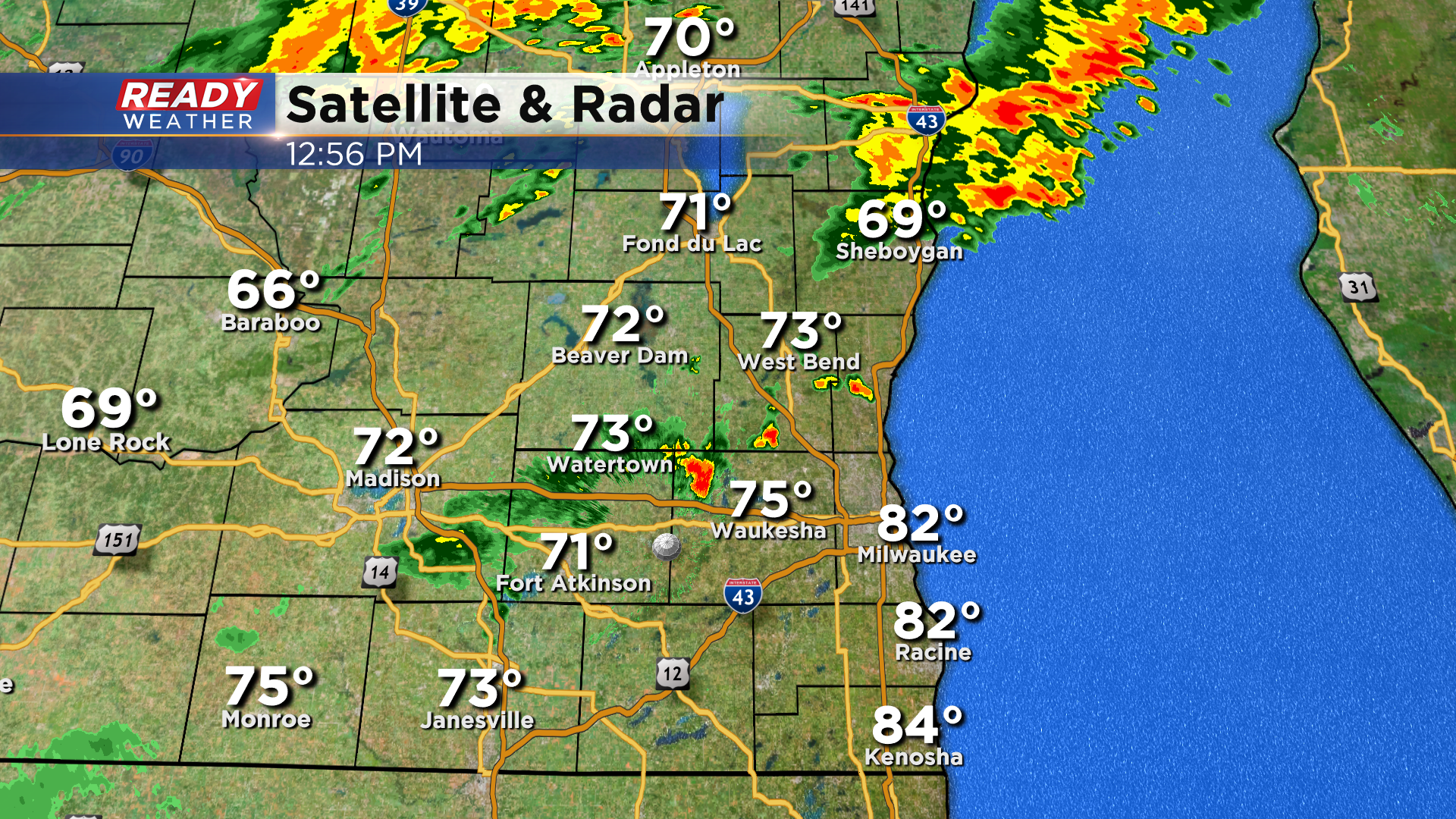
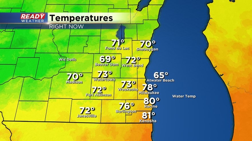
Temps ahead of this front are in the upper 70s to low 80s and only in the upper 60s to low 70s along and behind it.
Hit or miss storms will continue to pop up at times through early afternoon before becoming more numerous after 4 pm. Some of these storms could be on the stronger side with gusty winds and hail, along with heavy downpours. The best chance for strong storms will be in spots that see the most filtered sunshine through mid afternoon.
----------------------------------------------------------------------------------------------------------
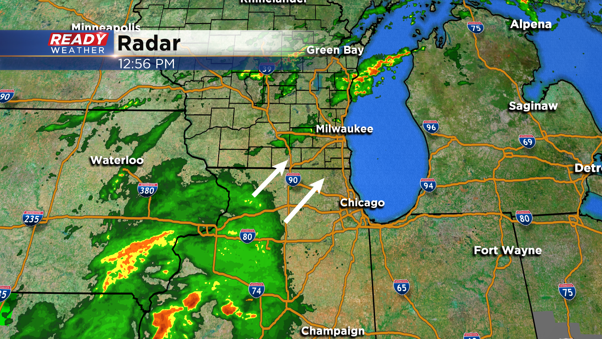
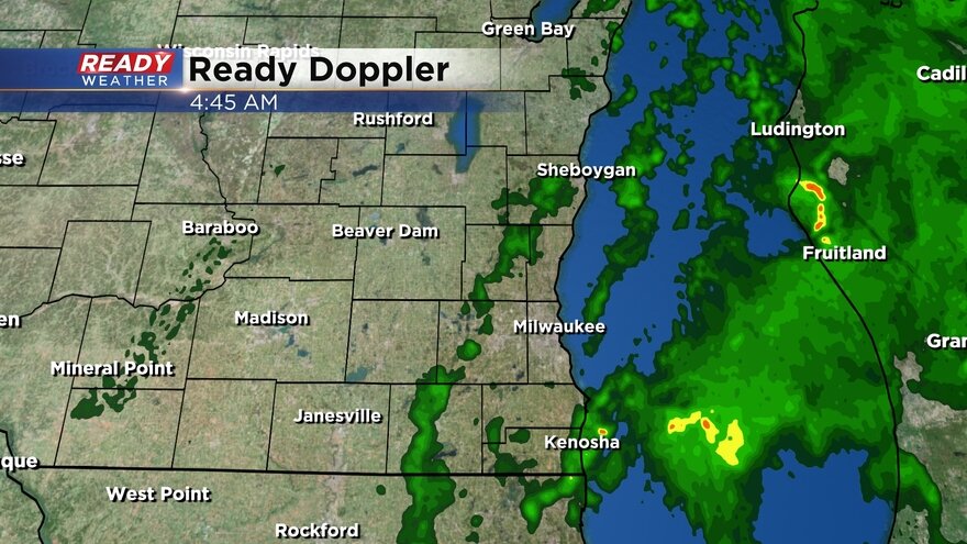
A few thunderstorms and rain showers rolled through southeast Wisconsin Tuesday night and continued Wednesday morning. Some heavy downpours and gusty wind to 40 mph has been reported locally but no severe weather. Here's a look at the current radar that will update with time:
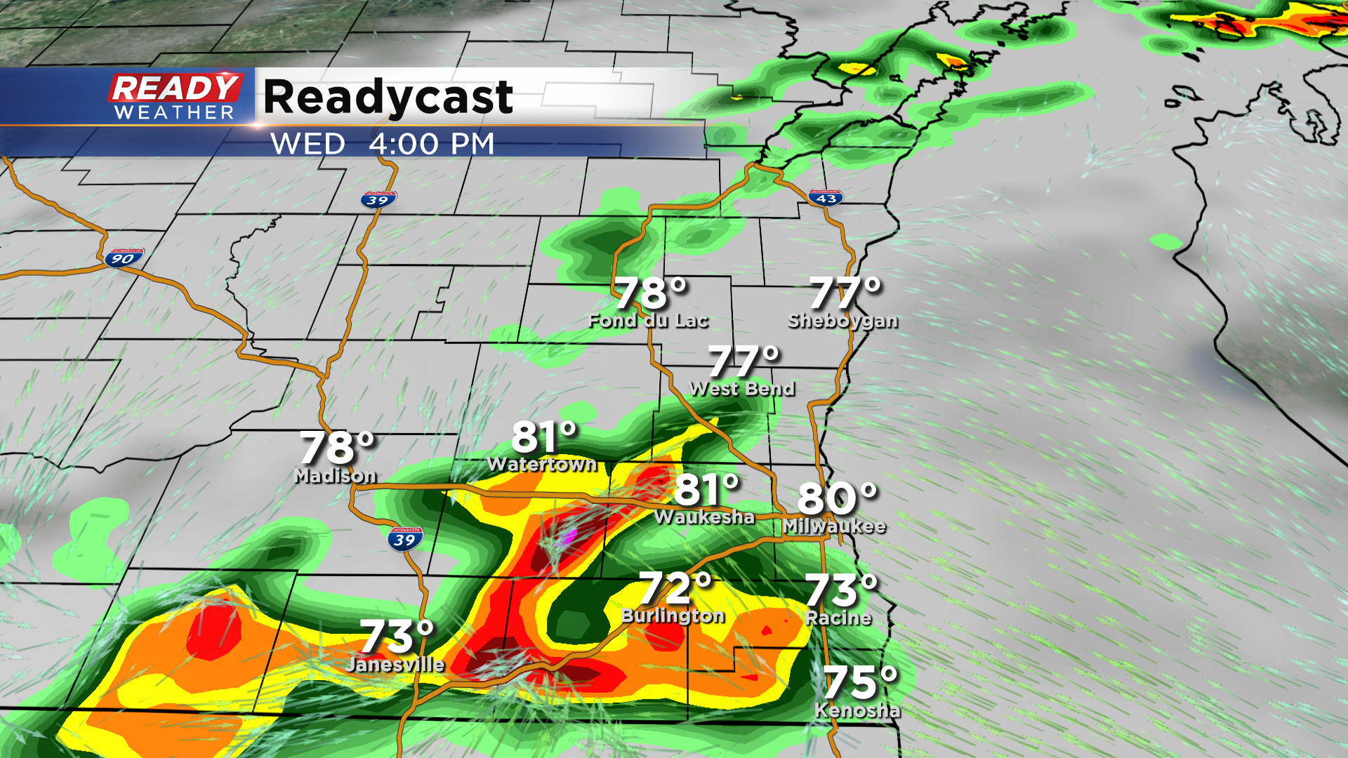
It is looking more likely that scattered showers and storms will continue throughout the day but there will likely be dry time. The best chance for heavy rain will be in the late afternoon and evening.

Although our chance for widespread severe weather is very low we could see a few stronger thunderstorms. All of southeast Wisconsin is in the marginal risk for severe weather which is the lowest risk level. The better chance for severe storms will be well to our south around St. Louis.

Rain totals Wednesday will be heavily dependent on who sees the strongest thunderstorms. Most of southeast Wisconsin have the chance to see up to 1" of rain but those that see thunderstorms could easily get 2" or more.

The rain will wrap up around or just after midnight. We will wake up to clouds Thursday morning with increasing sunshine throughout the day. Download the CBS 58 Ready Weather app to track Wednesday's rain and storms and get alerts if any severe thunderstorm warnings are issued.